Caln, Pennsylvania
| Caln, Pennsylvania | |
|---|---|
| Census-designated place | |
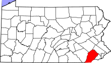
 Location in Chester County and the state of Pennsylvania. | |
| Coordinates: 39°59′25″N 75°46′48″W / 39.99028°N 75.78000°WCoordinates: 39°59′25″N 75°46′48″W / 39.99028°N 75.78000°W | |
| Country | United States |
| State | Pennsylvania |
| County | Chester |
| Township | Caln |
| Area | |
| • Total | 0.8 sq mi (2.1 km2) |
| • Land | 0.8 sq mi (2.1 km2) |
| • Water | 0.0 sq mi (0.0 km2) |
| Elevation | 345 ft (105 m) |
| Population (2010) | |
| • Total | 1,519 |
| • Density | 1,900/sq mi (720/km2) |
| Time zone | Eastern (EST) (UTC-5) |
| • Summer (DST) | EDT (UTC-4) |
| ZIP code | 19320 (Coatesville, PA) |
| Area code(s) | 610 |
| FIPS code | 42-10816 |
| GNIS feature ID | 1170901 |
Caln is a census-designated place (CDP) in Caln Township, Chester County, Pennsylvania, United States. The population was 1,519 at the 2010 census.[1] It is located east of the city of Coatesville.
Geography
Caln is located at 39°59′25″N 75°46′48″W / 39.99028°N 75.78000°W.[2] The Lincoln Highway, also known as U.S. Route 30 Business, forms the southern edge of the CDP. Caln CDP extends north as far as Pennsylvania Route 340.
According to the United States Census Bureau, the CDP has a total area of 0.81 square miles (2.1 km2), all of it land.[3]
References
- ↑ "Profile of General Population and Housing Characteristics: 2010 Demographic Profile Data (DP-1): Caln CDP, Pennsylvania". U.S. Census Bureau, American Factfinder. Archived from the original on September 11, 2013. Retrieved August 20, 2012.
- ↑ US Geological Survey 7.5 minute topographic map series
- ↑ "Geographic Identifiers: 2010 Demographic Profile Data (G001): Caln CDP, Pennsylvania". U.S. Census Bureau, American Factfinder. Archived from the original on September 11, 2013. Retrieved August 20, 2012.
This article is issued from Wikipedia - version of the 11/13/2016. The text is available under the Creative Commons Attribution/Share Alike but additional terms may apply for the media files.