Westtown Township, Chester County, Pennsylvania
| Westtown Township | |
| Township | |
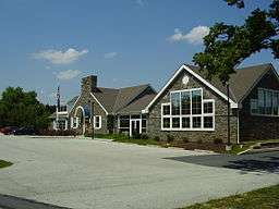 The main administration building of Westtown Township | |
| Country | United States |
|---|---|
| State | Pennsylvania |
| County | Chester |
| Elevation | 269 ft (82.0 m) |
| Coordinates | 39°57′02″N 75°32′51″W / 39.95056°N 75.54750°WCoordinates: 39°57′02″N 75°32′51″W / 39.95056°N 75.54750°W |
| Area | 8.8 sq mi (22.8 km2) |
| - land | 8.7 sq mi (23 km2) |
| - water | 0.04 sq mi (0 km2), 0.45% |
| Population | 10,827 (2010) |
| Density | 1,244.5/sq mi (480.5/km2) |
| Timezone | EST (UTC-5) |
| - summer (DST) | EDT (UTC-4) |
| Area code | 610 |
 Location in Chester County and the state of Pennsylvania. | |
.svg.png) Location of Pennsylvania in the United States | |
| Website: http://www.westtownpa.org | |


Westtown Township is a township in Chester County, Pennsylvania, United States. The population was 10,827 at the 2010 census.
History
County Bridge No. 148 was listed on the National Register of Historic Places in 1988.[1]
Geography
According to the United States Census Bureau, the township has a total area of 8.8 square miles (23 km2), of which 8.7 square miles (23 km2) is land and 0.04 square miles (0.10 km2), or 0.23%, is water.
Demographics
| Historical population | |||
|---|---|---|---|
| Census | Pop. | %± | |
| 1930 | 785 | — | |
| 1940 | 912 | 16.2% | |
| 1950 | 994 | 9.0% | |
| 1960 | 1,947 | 95.9% | |
| 1970 | 5,069 | 160.3% | |
| 1980 | 6,774 | 33.6% | |
| 1990 | 9,937 | 46.7% | |
| 2000 | 10,352 | 4.2% | |
| 2010 | 10,827 | 4.6% | |
| [2] | |||
At the 2010 census, the township was 89.4% non-Hispanic White, 3.8% Black or African American, 0.1% Native American, 3.2% Asian, 0.1% Native Hawaiian or other Pacific Islander, and 1.3% were two or more races. 2.4% of the population were of Hispanic or Latino ancestry .
As of the census[3] of 2000, there were 10,352 people, 3,705 households, and 2,949 families residing in the township. The population density was 1,185.5 people per square mile (457.8/km²). There were 3,795 housing units at an average density of 434.6/sq mi (167.8/km²). The racial makeup of the township was 93.97% White, 2.59% African American, 0.07% Native American, 2.42% Asian, 0.01% Pacific Islander, 0.37% from other races, and 0.57% from two or more races. Hispanic or Latino of any race were 1.13% of the population.
There were 3,705 households, out of which 38.7% had children under the age of 18 living with them, 70.6% were married couples living together, 6.9% had a female householder with no husband present, and 20.4% were non-families. 16.0% of all households were made up of individuals, and 4.0% had someone living alone who was 65 years of age or older. The average household size was 2.78 and the average family size was 3.14.
In the township the population was spread out, with 26.9% under the age of 18, 6.0% from 18 to 24, 28.9% from 25 to 44, 28.2% from 45 to 64, and 9.9% who were 65 years of age or older. The median age was 39 years. For every 100 females there were 96.0 males. For every 100 females age 18 and over, there were 93.1 males.
The median income for a household in the township was $85,049, and the median income for a family was $96,318. Males had a median income of $66,675 versus $43,482 for females. The per capita income for the township was $36,894. About 2.1% of families and 3.0% of the population were below the poverty line, including 1.7% of those under age 18 and 3.5% of those age 65 or over.
Political representation
Westtown Township is represented by State Representative, Dan Truitt – 156th District and State Senator, Dominic F. Pileggi. In the U.S. House of Representatives, Representative Ryan Costello, 6th District (as of 2014) and District 6 U.S. Senators, Patrick Toomey and Robert P. Casey, Jr.(As of 2014)
Township officials
Westtown Township is governed by a three(3) member Board of Supervisors. Under the supervision of the Board the township has many arms of government, including the Township's Planning Commission, Historical Commission, Parks & Recreation Commission, and the Zoning Hearing Board.
Township Board of Supervisors members 2015:
- Michael T. Di Domenico, Chair
- Carol R. DeWolf, Vice Chair
- Thomas F. Haws, Jr., Police Commissioner
- Robert R. Pingar, P.E., Township Manager and Director of Engineering.
Education
West Chester Area School District serves the township.
Other schools in the township include Westtown School, an independent school for grades pre-K through 12; the St. Maximilian Kolbe Parish School and the Ss. Simon and Jude Parish School, Catholic schools for grades pre-K through 8; and the Concept School, a private school for grades 5 through 12.
References
- ↑ National Park Service (2010-07-09). "National Register Information System". National Register of Historic Places. National Park Service.
- ↑ http://www.dvrpc.org/data/databull/rdb/db82/appedixa.xls. Retrieved January 31, 2014. Missing or empty
|title=(help) - ↑ "American FactFinder". United States Census Bureau. Archived from the original on 2013-09-11. Retrieved 2008-01-31.
External links
- Westtown Township official website
- Chester County Connect's Westtown Township Information Page
- Westtown-East Goshen Regional Police Department