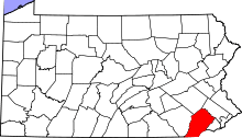
Pennsbury Township, Chester County, Pennsylvania
| Pennsbury Township | |
| Township | |
 Pennsbury Inn | |
| Country | United States |
|---|---|
| State | Pennsylvania |
| County | Chester |
| Elevation | 246 ft (75.0 m) |
| Coordinates | 39°52′00″N 75°36′59″W / 39.86667°N 75.61639°WCoordinates: 39°52′00″N 75°36′59″W / 39.86667°N 75.61639°W |
| Area | 10.0 sq mi (25.9 km2) |
| - land | 9.9 sq mi (26 km2) |
| - water | 0.1 sq mi (0 km2), 1% |
| Population | 3,604 (2010) |
| Density | 364.0/sq mi (140.5/km2) |
| Timezone | EST (UTC-5) |
| - summer (DST) | EDT (UTC-4) |
| Area code | 610 |
 Location in Chester County and the state of Pennsylvania. | |
.svg.png) Location of Pennsylvania in the United States | |
| Website: http://www.pennsbury.pa.us | |
Pennsbury Township is a township in Chester County, Pennsylvania, United States. The population was 3,604 at the 2010 census.
History
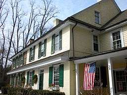
The Barns-Brinton House, Brinton-King Farmstead, Fairville Historic District, Peter Harvey House and Barn, William Harvey House, Oakdale, Parkersville Friends Meetinghouse, Pennsbury Inn, William Peters House, and Springdale Farm are listed on the National Register of Historic Places.[1]
Geography
According to the United States Census Bureau, the township has a total area of 10.0 square miles (26 km2), of which 9.9 square miles (26 km2) is land and 0.1 square miles (0.26 km2), or 1.10%, is water.
Demographics
| Historical population | |||
|---|---|---|---|
| Census | Pop. | %± | |
| 1930 | 678 | — | |
| 1940 | 660 | −2.7% | |
| 1950 | 686 | 3.9% | |
| 1960 | 936 | 36.4% | |
| 1970 | 1,763 | 88.4% | |
| 1980 | 2,604 | 47.7% | |
| 1990 | 3,326 | 27.7% | |
| 2000 | 3,500 | 5.2% | |
| 2010 | 3,604 | 3.0% | |
| http://www.dvrpc.org/data/databull/rdb/db82/appedixa.xls. | |||
At the 2010 census, the township was 93.6% non-Hispanic White, 0.7% Black or African American, 0.1% Native American, 3.1% Asian, and 1.2% were two or more races. 1.4% of the population were of Hispanic or Latino ancestry .
As of the census[2] of 2000, there were 3,500 people, 1,387 households, and 990 families residing in the township. The population density was 353.0 people per square mile (136.4/km²). There were 1,438 housing units at an average density of 145.0/sq mi (56.0/km²). The racial makeup of the township was 95.97% White, 0.71% African American, 0.11% Native American, 2.20% Asian, 0.20% from other races, and 0.80% from two or more races. Hispanic or Latino of any race were 1.54% of the population.
There were 1,387 households, out of which 26.6% had children under the age of 18 living with them, 65.9% were married couples living together, 3.8% had a female householder with no husband present, and 28.6% were non-families. 26.3% of all households were made up of individuals, and 20.1% had someone living alone who was 65 years of age or older. The average household size was 2.41 and the average family size was 2.91.
In the township the population was spread out, with 21.1% under the age of 18, 3.2% from 18 to 24, 19.5% from 25 to 44, 28.4% from 45 to 64, and 27.7% who were 65 years of age or older. The median age was 49 years. For every 100 females there were 86.9 males. For every 100 females age 18 and over, there were 81.8 males.
The median income for a household in the township was $83,295, and the median income for a family was $106,304. Males had a median income of $84,136 versus $45,298 for females. The per capita income for the township was $52,530. None of the families and 1.2% of the population were living below the poverty line, including no under eighteens and none of those over 64.
References
- ↑ National Park Service (2010-07-09). "National Register Information System". National Register of Historic Places. National Park Service.
- ↑ "American FactFinder". United States Census Bureau. Retrieved 2008-01-31.