West Bradford Township, Chester County, Pennsylvania
| West Bradford Township | |
| Township | |
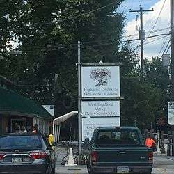 West Bradford Market in West Bradford Township. | |
| Motto: "Between the Brandywines" | |
| Country | United States |
|---|---|
| State | Pennsylvania |
| County | Chester |
| Elevation | 548 ft (167.0 m) |
| Coordinates | 39°57′56″N 75°44′22″W / 39.96556°N 75.73944°WCoordinates: 39°57′56″N 75°44′22″W / 39.96556°N 75.73944°W |
| Area | 18.6 sq mi (48.2 km2) |
| - land | 18.6 sq mi (48 km2) |
| - water | 0.1 sq mi (0 km2), 0.54% |
| Population | 12,376 (2010) |
| Density | 665.4/sq mi (256.9/km2) |
| Established | 1705 (as Bradford Twp.) |
| Board of Supervisors | Bruce W. Laverty John A. Haiko Mark J. Blair |
| Timezone | EST (UTC-5) |
| - summer (DST) | EDT (UTC-4) |
| ZIP codes | 19335, 19320, 19382 |
| Area code | 610 |
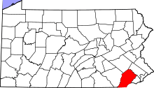
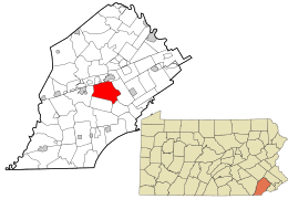 Location in Chester County and the state of Pennsylvania. | |
.svg.png) Location of Pennsylvania in the United States | |
| Website: http://www.westbradford.org | |
West Bradford Township is a township in Chester County, Pennsylvania, United States. The population was 12,376 at the 2010 census.
History
There are three federal historic districts (Marshallton, Trimbleville, and Northbrook) on the National Register of Historic Places located within West Bradford Township .[1] Also listed are the Baily Farm, Bradford Friends Meetinghouse, Como Farm, Cope's Bridge, Derbydown Homestead, Humphry Marshall House, Marshallton Inn, Taylor-Cope Historic District, and Temple-Webster-Stoner House.[2]
Geography
According to the United States Census Bureau, the township has a total area of 18.6 square miles (48.2 km²), of which, 18.6 square miles (48.1 km²) of it is land and 0.1 square miles (0.2 km²) of it is water. The total area is 0.32% water.
Adjacent municipalities
- Caln Township (North)
- Downingtown (North)
- East Caln Township (North)
- East Bradford Township (East)
- Newlin Township (South)
- Pocopson Township (South)
- East Fallowfield Township (West)
Major roadways
 PA 162 (Strasburg Road/Telegraph Road)
 US 322 (Downingtown Pike)
Demographics
| Historical population | |||
|---|---|---|---|
| Census | Pop. | %± | |
| 1930 | 1,558 | — | |
| 1940 | 1,367 | −12.3% | |
| 1950 | 1,530 | 11.9% | |
| 1960 | 1,894 | 23.8% | |
| 1970 | 2,996 | 58.2% | |
| 1980 | 7,343 | 145.1% | |
| 1990 | 10,406 | 41.7% | |
| 2000 | 10,775 | 3.5% | |
| 2010 | 12,376 | 14.9% | |
| [3] | |||
As of the census[4] of 2010, there were 12,376 people, 4,126 households, and 3,449 families residing in the township. The population density was 665.4 people per square mile (256.9/km²). There were 4,217 housing units at an average density of 226.7/sq mi (87.5/km²). The racial makeup of the township was 92.4% White, 2.9% African American, 0.2% Native American, 2.6% Asian, 0.00% Pacific Islander, 0.5% from other races, and 1.4% from two or more races. 2.0% of the population were Hispanic or Latino of any race.
There were 4,126 households, out of which 42.0% had children under the age of 18 living with them, 74.6% were married couples living together, 6.1% had a female householder with no husband present, and 16.4% were non-families. 13.0% of all households were made up of individuals, and 4.4% had someone living alone who was 65 years of age or older. The average household size was 2.96 and the average family size was 3.25.
In the township the population was spread out, with 30.4% under the age of 19, 4.0% from 20 to 24, 24.8% from 25 to 44, 31.7% from 45 to 64, and 9.2% who were 65 years of age or older. The median age was 39.6 years. For every 100 females there were 100.1 males. For every 100 females age 18 and over, there were 97.7 males.
The median income for a family was $104,124.
Education
Public schools
West Bradford Township is served by the Downingtown Area School District, and has two elementary schools within the township:
Neighborhoods
- Brandywine Greene
- Embreeville
- Marshallton
- Northbrook
- Romansville
- Trimbleville
- Victoria Crossing at Bradford Glen
Notable places
- The west branch of the Brandywine River passes through West Bradford. General Cornwallis of the British Army crossed the river at Trimble's Ford en route to the Battle of Brandywine.
- Broad Run Golfer's Club, a golf course designed by Rees Jones
- Humphry Marshall House, residence of botanist Humphry Marshall located in the village of Marshallton
- Strasburg Road, an historic road paved in 1772-3 that runs through West Bradford
- United Sports, a multiple-use sports complex
Notable residents
- Planter and judge John Beale Bordley resided at and owned Como Farm in West Bradford. The clubhouse of Broad Run Golfer's Club now sits on the ground that was formerly Como Farm.
- Former United States congressman John Hickman was born in West Bradford.
- The well known botanist, Humphry Marshall, lived in West Bradford.
- The actor Claude Rains, who earned four Oscar Nominations for supporting actor and portrayed Captain Renault in the film Casablanca, owned the Stock Grange Farm in West Bradford. The farm had previously been in the family of the Philadelphia naturalist Witmer Stone, who spent summers at Stock Grange while growing up.
References
- ↑ West Bradford Township History & Demographics
- ↑ National Park Service (2010-07-09). "National Register Information System". National Register of Historic Places. National Park Service.
- ↑ Delaware Valley Regional Planning Commission
- ↑ "American FactFinder". United States Census Bureau. Retrieved 2008-01-31.