East Nantmeal Township, Chester County, Pennsylvania
| East Nantmeal Township | |
| Township | |
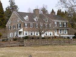 Warwick Farmhouse, part of a historic district in the township of Warwick, neighboring East Nantmeal | |
| Country | United States |
|---|---|
| State | Pennsylvania |
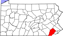
| County | Chester |
| Elevation | 617 ft (188.1 m) |
| Coordinates | 40°07′00″N 75°43′59″W / 40.11667°N 75.73306°WCoordinates: 40°07′00″N 75°43′59″W / 40.11667°N 75.73306°W |
| Area | 16.4 sq mi (42.5 km2) |
| - land | 16.4 sq mi (42 km2) |
| - water | 0.0 sq mi (0 km2), 0% |
| Population | 1,803 (2010) |
| Density | 109.9/sq mi (42.4/km2) |
| Timezone | EST (UTC-5) |
| - summer (DST) | EDT (UTC-4) |
| Area code | 610 |
 Location in Chester County and the state of Pennsylvania. | |
.svg.png) Location of Pennsylvania in the United States | |
East Nantmeal Township is a township in Chester County, Pennsylvania, United States. The population was 1,803 at the 2010 census. It, along with West Nantmeal Township, was originally part of a single Nantmeal Township, which was divided in 1739.
Geography
According to the United States Census Bureau, the township has a total area of 16.4 square miles (42 km2), of which 0.06% is water. The township is partially located in the Hopewell Big Woods.
Adjacent townships
- South Coventry Township (NE)
- West Vincent Township (E)
- Upper Uwchlan Township (SE)
- Wallace Township (S)
- West Nantmeal Township (W)
- Warwick Township (N)
Demographics
At the 2010 census, the township was 96.0% non-Hispanic White, 0.8% Black or African American, 0.1% Native American, 0.7% Asian, and 0.7% were two or more races. 1.9% of the population were of Hispanic or Latino ancestry .
As of the census[1] of 2000, there were 1,787 people, 569 households, and 451 families residing in the township. The population density was 109.1 people per square mile (42.1/km²). There were 587 housing units at an average density of 35.8/sq mi (13.8/km²). The racial makeup of the township was 97.87% White, 1.01% African American, 0.28% Asian, 0.06% Pacific Islander, 0.34% from other races, and 0.45% from two or more races. Hispanic or Latino of any race were 0.73% of the population.
There were 569 households, out of which 36.6% had children under the age of 18 living with them, 72.8% were married couples living together, 4.6% had a female householder with no husband present, and 20.7% were non-families. 16.0% of all households were made up of individuals, and 5.6% had someone living alone who was 65 years of age or older. The average household size was 2.74 and the average family size was 3.10.
| Historical population | |||
|---|---|---|---|
| Census | Pop. | %± | |
| 1930 | 594 | — | |
| 1940 | 549 | −7.6% | |
| 1950 | 665 | 21.1% | |
| 1960 | 730 | 9.8% | |
| 1970 | 858 | 17.5% | |
| 1980 | 1,222 | 42.4% | |
| 1990 | 1,448 | 18.5% | |
| 2000 | 1,787 | 23.4% | |
| 2010 | 1,803 | 0.9% | |
| http://www.dvrpc.org/data/databull/rdb/db82/appedixa.xls. | |||
In the township the population was spread out, with 27.7% under the age of 18, 8.5% from 18 to 24, 30.1% from 25 to 44, 25.5% from 45 to 64, and 8.3% who were 65 years of age or older. The median age was 38 years. For every 100 females there were 102.8 males. For every 100 females age 18 and over, there were 99.1 males.
The median income for a household in the township was $72,375, and the median income for a family was $78,848. Males had a median income of $52,391 versus $30,125 for females. The per capita income for the township was $32,258. About 1.8% of families and 7.4% of the population were below the poverty line, including 0.5% of those under age 18 and 4.1% of those age 65 or over.
Points of interest
Nantmeal was named by Welsh immigrants from the village of Nantmel in Radnorshire, now part of Powys. The Welsh name, Nantmel, means 'the valley of Mael', a tenth-century prince. The incorrect belief that it means 'Honey Brook' is based on a confusion between the personal name 'Mael', and the Welsh word 'mêl', 'honey'. The Thomas Bull House was built sometime between 1783 and 1796; Bull was a stonemason and the manager of Warwick Furnace; he served as a lieutenant colonel in the Revolutionary War.
Reading Furnace Historic District straddles French Creek, which forms part of the boundary between East Nantmeal and Warwick townships. The site began as an iron furnace in 1736, was developed as a farm in the early 19th century, and was then remodeled as a country estate for Arthur Pew in 1936. The remodeled mansion (1812) was designed by architect Richardson Brognard Okie.
Warwick Furnace Farms forms a significant part of the history of the early iron industry and of the families Nutt, Rutter, Savage and Potts.
Welkinweir (the Grace and Everett Rodebaugh Estate) is a 162-acre (0.66 km2) preserve encompassing three buildings, gardens, ponds, natural wildlife habitat, trails, wetlands and woods. Grace and Everett Rodebaugh purchased the aging farm in 1935 as a weekend retreat and summer home. They retained architect Fridtjof Tobiessen to "make the mansion livable." This may be the only significant residential commission of Tobiessen, whose principal works were public schools, memorials, and churches.
Brower's Bridge, Thomas Bull House, Warwick Furnace Farms, and Welkinweir are listed on the National Register of Historic Places.[2]
References
- ↑ "American FactFinder". United States Census Bureau. Retrieved 2008-01-31.
- ↑ National Park Service (2010-07-09). "National Register Information System". National Register of Historic Places. National Park Service.