Cape Borda, South Australia
| Cape Borda South Australia | |||||||||||||
|---|---|---|---|---|---|---|---|---|---|---|---|---|---|
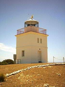 Cape Borda Lighthouse | |||||||||||||
 Cape Borda | |||||||||||||
| Coordinates | 35°45′10″S 136°35′36″E / 35.75291°S 136.593390°ECoordinates: 35°45′10″S 136°35′36″E / 35.75291°S 136.593390°E | ||||||||||||
| Population | 407 (shared with other localities within the “State Suburb of Vivonne Bay”) (2011 census)[1][lower-alpha 1] | ||||||||||||
| Established | 2002[2] | ||||||||||||
| Postcode(s) | 5223[3] | ||||||||||||
| Time zone | ACST (UTC+9:30) | ||||||||||||
| • Summer (DST) | ACST (UTC+10:30) | ||||||||||||
| Location |
| ||||||||||||
| LGA(s) | Kangaroo Island Council | ||||||||||||
| State electorate(s) | Finniss[4] | ||||||||||||
| Federal Division(s) | Mayo[5] | ||||||||||||
| |||||||||||||
| |||||||||||||
| Footnotes |
Distances[3][6] Coordinates[2] Climate[7] | ||||||||||||
Cape Borda is a locality in South Australia located on Kangaroo Island about 192 kilometres (119 mi) south-west of the Adelaide city centre.[3]
Its boundaries were created in 2002 in respect to “the long established name” which is reported to be derived from the navigation aid within its boundaries - the Cape Borda Lightstation.[2]
The major land uses within the locality includes conservation and primary production with the former land use including the following protected areas - the Flinders Chase National Park, the Ravine des Casoars Wilderness Protection Area and the Cape Torrens Wilderness Protection Area.[8][6] Part of the southern boundary of Cape Borda is formed by the Playford Highway.[6]
The locality includes the three following state heritage places - Harveys Return Cemetery, the Cape Borda Lighthouse and the Harveys Return Landing Site.[9][10][11]
Cape Borda is located within the federal division of Mayo, the state electoral district of Finniss and the local government area of the Kangaroo Island Council.[5][4][2]
References
- Notes
- ↑ For the 2011 census, the ‘State Suburb of Vivonne Bay’ consisted of the localities of Cape Borda, De Mole River, Duncan, Flinders Chase, Gosse, Karatta, Middle River, Newland, Stun’sail Boom, Vivonne Bay and Western River.
- Citations
- ↑ Australian Bureau of Statistics (31 October 2012). "Vivonne Bay". 2011 Census QuickStats. Retrieved 8 March 2016.
- 1 2 3 4 "Search result for "Cape Borda (Locality Bounded)" (Record no SA0050434)". Department of Planning, Transport and Infrastructure. Retrieved 8 March 2016.
- 1 2 3 "Cape Borda, South Australia (Postcode)". postcodes-australia.com. Retrieved 8 March 2016.
- 1 2 "District of Finniss Background Profile". ELECTORAL COMMISSION SA. Retrieved 2 August 2015.
- 1 2 "Federal electoral division of Mayo, boundary gazetted 16 December 2011" (PDF). Australian Electoral Commission. Retrieved 2 August 2015.
- 1 2 3 4 5 6 7 "Search result for "Cape Borda (Locality Bounded)" (Record no SA0050434 ) with the following layers being selected - "Suburbs and Localities", "Local Government Areas" and "Hundreds"". Department of Planning, Transport and Infrastructure. Retrieved 6 March 2016.
- ↑ "Monthly climate statistics: Summary statistics CAPE BORDA". Commonwealth of Australia , Bureau of Meteorology. Retrieved 8 March 2016.
- ↑ "Development Plan, Kangaroo Island Council" (PDF). Department of Planning, Transport and Infrastructure. pp. 263–269. Retrieved 8 March 2016.
- ↑ "Harveys Return Cemetery, Flinders Chase National Park (sic)". South Australian Heritage Register. Department of Environment, Water and Natural Resources. Retrieved 27 March 2016.
- ↑ "Cape Borda Lighthouse (originally 'Flinders Light') and Keepers' Cottages, Flinders Chase National Park". South Australian Heritage Register. Department of Environment, Water and Natural Resources. Retrieved 27 March 2016.
- ↑ "Harveys Return Landing Site, Flinders Chase National Park (sic)". South Australian Heritage Register. Department of Environment, Water and Natural Resources. Retrieved 27 March 2016.