Corning, Missouri
| Corning, Missouri | |
|---|---|
| Village | |
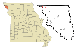 Location of Corning, Missouri | |
| Coordinates: 40°14′57″N 95°27′16″W / 40.24917°N 95.45444°WCoordinates: 40°14′57″N 95°27′16″W / 40.24917°N 95.45444°W | |
| Country | United States |
| State | Missouri |
| County | Holt |
| Area[1] | |
| • Total | 0.11 sq mi (0.28 km2) |
| • Land | 0.11 sq mi (0.28 km2) |
| • Water | 0 sq mi (0 km2) |
| Elevation | 876 ft (267 m) |
| Population (2010)[2] | |
| • Total | 15 |
| • Estimate (2012[3]) | 14 |
| • Density | 136.4/sq mi (52.7/km2) |
| Time zone | Central (CST) (UTC-6) |
| • Summer (DST) | CDT (UTC-5) |
| ZIP code | 64437 |
| Area code(s) | 660 |
| FIPS code | 29-16462[4] |
| GNIS feature ID | 0716327[5] |
Corning is a village in Holt County, Missouri, United States. The population was 15 at the 2010 census.
History
Corning was laid out in 1868.[6] A post office called Coring has been in operation since 1868.[7]
The village's St. John's Evangelical Lutheran Church was listed on the National Register of Historic Places in 2008.[8]
Geography
Corning is located at 40°14′57″N 95°27′16″W / 40.24917°N 95.45444°W (40.249107, -95.454422).[9]
According to the United States Census Bureau, the village has a total area of 0.11 square miles (0.28 km2), all of it land.[1]
Demographics
| Historical population | |||
|---|---|---|---|
| Census | Pop. | %± | |
| 1880 | 221 | — | |
| 1890 | 176 | −20.4% | |
| 1900 | 240 | 36.4% | |
| 1910 | 253 | 5.4% | |
| 1920 | 255 | 0.8% | |
| 1930 | 214 | −16.1% | |
| 1940 | 269 | 25.7% | |
| 1950 | 184 | −31.6% | |
| 1960 | 128 | −30.4% | |
| 1970 | 134 | 4.7% | |
| 1980 | 126 | −6.0% | |
| 1990 | 88 | −30.2% | |
| 2000 | 21 | −76.1% | |
| 2010 | 15 | −28.6% | |
| Est. 2015 | 14 | [10] | −6.7% |
2010 census
As of the census[2] of 2010, there were 15 people, 8 households, and 4 families residing in the village. The population density was 136.4 inhabitants per square mile (52.7/km2). There were 9 housing units at an average density of 81.8 per square mile (31.6/km2). The racial makeup of the village was 100.0% White.
There were 8 households of which 50.0% were married couples living together and 50.0% were non-families. 25.0% of all households were made up of individuals and 12.5% had someone living alone who was 65 years of age or older. The average household size was 1.88 and the average family size was 2.25.
The median age in the village was 60.3 years. 0.0% of residents were under the age of 18; 6.7% were between the ages of 18 and 24; 6.7% were from 25 to 44; 60.1% were from 45 to 64; and 26.7% were 65 years of age or older. The gender makeup of the village was 40.0% male and 60.0% female.
2000 census
As of the census[4] of 2000, there were 21 people, 10 households, and 6 families residing in the town. The population density was 188.9 people per square mile (73.7/km²). There were 14 housing units at an average density of 126.0 per square mile (49.1/km²). The racial makeup of the town was 100.00% White.
There were 10 households out of which 40.0% had children under the age of 18 living with them, 60.0% were married couples living together, and 40.0% were non-families. 40.0% of all households were made up of individuals and 10.0% had someone living alone who was 65 years of age or older. The average household size was 2.10 and the average family size was 2.83.
In the town the population was spread out with 23.8% under the age of 18, 9.5% from 18 to 24, 33.3% from 25 to 44, 23.8% from 45 to 64, and 9.5% who were 65 years of age or older. The median age was 39 years. For every 100 females there were 90.9 males. For every 100 females age 18 and over, there were 100.0 males.
The median income for a household in the town was $23,750, and the median income for a family was $30,000. Males had a median income of $23,750 versus $14,583 for females. The per capita income for the town was $10,132. There are 25.0% of families living below the poverty line and 24.0% of the population, including no under eighteens and 100.0% of those over 64.
References
- 1 2 "US Gazetteer files 2010". United States Census Bureau. Archived from the original on 2012-07-14. Retrieved 2012-07-08.
- 1 2 "American FactFinder". United States Census Bureau. Retrieved 2012-07-08.
- ↑ "Population Estimates". United States Census Bureau. Archived from the original on 2013-06-17. Retrieved 2013-05-30.
- 1 2 "American FactFinder". United States Census Bureau. Archived from the original on 2013-09-11. Retrieved 2008-01-31.
- ↑ "US Board on Geographic Names". United States Geological Survey. 2007-10-25. Retrieved 2008-01-31.
- ↑ "Holt County Place Names, 1928–1945 (archived)". The State Historical Society of Missouri. Archived from the original on 24 June 2016. Retrieved 8 October 2016.
- ↑ "Post Offices". Jim Forte Postal History. Retrieved 8 October 2016.
- ↑ "MISSOURI - Holt County". nationalregisterofhistoricplaces.com. Retrieved 8 October 2016.
- ↑ "US Gazetteer files: 2010, 2000, and 1990". United States Census Bureau. 2011-02-12. Retrieved 2011-04-23.
- ↑ "Annual Estimates of the Resident Population for Incorporated Places: April 1, 2010 to July 1, 2015". Retrieved July 2, 2016.
- ↑ "Census of Population and Housing". Census.gov. Archived from the original on May 11, 2015. Retrieved June 4, 2015.
External links
- Historic maps of Corning in the Sanborn Maps of Missouri Collection at the University of Missouri
Municipalities and communities of Holt County, Missouri, United States | ||
|---|---|---|
| Cities | 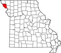 | |
| Villages | ||
| Townships | ||
| Unincorporated communities | ||
| Ghost towns | ||