Steuben County, New York
| Steuben County, New York | |
|---|---|
| County | |
|
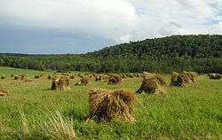
Farmland in rural Steuben County | |
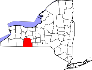 Location in the U.S. state of New York | |
 New York's location in the U.S. | |
| Founded | 1796 |
| Named for | Baron von Steuben |
| Seat | Bath |
| Largest city | Corning |
| Area | |
| • Total | 1,404 sq mi (3,636 km2) |
| • Land | 1,391 sq mi (3,603 km2) |
| • Water | 14 sq mi (36 km2), 1.0% |
| Population | |
| • (2010) | 98,990 |
| • Density | 71/sq mi (27/km²) |
| Congressional district | 23rd |
| Time zone | Eastern: UTC-5/-4 |
| Website |
www |
Steuben County /stuːˈbɛn/ is a county located in the U.S. state of New York. As of the 2010 census, the population was 98,990.[1] Its county seat is Bath.[2] Its name is in honor of Baron von Steuben, a German general who fought on the American side in the American Revolutionary War, though it is not pronounced the same.
Steuben County comprises the Corning, NY Micropolitan Statistical Area, which is also included in the Elmira-Corning, NY Combined Statistical Area.
History
When counties were established in New York State in 1683, the present Steuben County was part of Albany County. This was an enormous county, including the northern part of New York State as well as all of the present State of Vermont and, in theory, extending westward to the Pacific Ocean. This county was reduced in size on July 3, 1766 by the creation of Cumberland County, and further on March 16, 1770, by the creation of Gloucester County, both containing territory now in Vermont.
On March 12, 1772, what was left of Albany County was split into three parts, one remaining under the name Albany County. One of the other pieces, Tryon County, contained the western portion (and thus, since no western boundary was specified, theoretically still extended west to the Pacific). The eastern boundary of Tryon County was approximately five miles west of the present city of Schenectady, and the county included the western part of the Adirondack Mountains and the area west of the West Branch of the Delaware River. The area then designated as Tryon County now includes 37 counties of New York State. The county was named for William Tryon, colonial governor of New York.
In the years prior to 1776, most of the Loyalists in Tryon County fled to Canada. In 1784, following the peace treaty that ended the American Revolutionary War, the name of Tryon County was changed to Montgomery County in honor of the general, Richard Montgomery, who had captured several places in Canada and died attempting to capture the city of Quebec, replacing the name of the hated British governor.
Ontario County was split off from Montgomery County in 1789 to form an area much larger than the present Ontario County. Steuben County, much larger than today, was split off from Ontario County in 1796. In 1823 a portion of Steuben County was combined with a portion of Ontario County to form Yates County. Steuben County was further reduced in size in 1854 when a portion was combined with portions of Chemung and Tompkins counties to form Schuyler County.
Geography
According to the U.S. Census Bureau, the county has a total area of 1,404 square miles (3,640 km2), of which 1,391 square miles (3,600 km2) is land and 14 square miles (36 km2) (1.0%) is water.[3]
Steuben County is in the southwestern part of New York State, immediately north of the Pennsylvania border. The population of Steuben County according to the 2000 U. S. census was 98,726. The county is in the Southern Tier region of New York State.
Adjacent counties
- Ontario County - north
- Yates County - northeast
- Schuyler County - east
- Chemung County - east
- Tioga County, Pennsylvania - south
- Potter County, Pennsylvania - southwest
- Allegany County - west
- Livingston County - northwest
Government and politics
Steuben County is governed by a 17-member legislature headed by a chairman
State and federal government
| Office | District | Area of the county | Officeholder | Party | First took office | Residence |
|---|---|---|---|---|---|---|
| Congressman | New York's 23rd congressional district | All[4] | Thomas W. Reed II | Republican | 2010 | Corning, Steuben County |
| State Senator | 58th State Senate District | All[5] | Thomas F. O'Mara | Republican | 2011 | Big Flats, Chemung County |
| State Assemblyman | 132nd State Assembly District | All of the county not covered by the 133rd and 148th assembly districts[6] | Philip A. Palmesano | Republican | 2011 | Corning, Steuben County |
| State Assemblyman | 133rd State Assembly District | The north and northwest parts of the county (Towns of Dansville, Cohocton, Hornellsville, Prattsburgh, Wayland)[7] | Vacant | |||
| State Assemblyman | 148th State Assembly District | The southwest corner of the county (Towns of Greenwood, Jasper, Troupsburg, West Union)[8] | Joseph M. Giglio | Republican | 2005 | Gowanda, Cattaraugus County |
Steuben County is part of:
- The 7th Judicial District of the New York Supreme Court
- The 4th Department of the New York Supreme Court, Appellate Division
Demographics
| Historical population | |||
|---|---|---|---|
| Census | Pop. | %± | |
| 1800 | 1,788 | — | |
| 1810 | 7,246 | 305.3% | |
| 1820 | 21,989 | 203.5% | |
| 1830 | 33,851 | 53.9% | |
| 1840 | 46,138 | 36.3% | |
| 1850 | 63,771 | 38.2% | |
| 1860 | 66,690 | 4.6% | |
| 1870 | 67,717 | 1.5% | |
| 1880 | 77,586 | 14.6% | |
| 1890 | 81,473 | 5.0% | |
| 1900 | 82,822 | 1.7% | |
| 1910 | 83,362 | 0.7% | |
| 1920 | 80,627 | −3.3% | |
| 1930 | 82,671 | 2.5% | |
| 1940 | 84,927 | 2.7% | |
| 1950 | 91,439 | 7.7% | |
| 1960 | 97,691 | 6.8% | |
| 1970 | 99,546 | 1.9% | |
| 1980 | 99,217 | −0.3% | |
| 1990 | 99,088 | −0.1% | |
| 2000 | 98,726 | −0.4% | |
| 2010 | 98,990 | 0.3% | |
| Est. 2015 | 97,631 | [9] | −1.4% |
| U.S. Decennial Census[10] 1790-1960[11] 1900-1990[12] 1990-2000[13] 2010-2013[1] | |||
As of the census[14] of 2000, there were 98,726 people, 39,071 households, and 26,216 families residing in the county. The population density was 71 people per square mile (27/km²). There were 46,132 housing units at an average density of 33 per square mile (13/km²). The racial makeup of the county was 96.43% White, 1.36% African American, 0.27% Native American, 0.90% Asian, 0.02% Pacific Islander, 0.21% from other races, and 0.81% from two or more races. Hispanic or Latino of any race were 0.81% of the population. 18.6% were of German, 15.2% English, 14.4% American, 13.6% Irish and 8.3% Italian ancestry according to Census 2000. 96.5% spoke English and 1.3% Spanish as their first language.
There were 39,071 households out of which 31.80% had children under the age of 18 living with them, 51.70% were married couples living together, 10.60% had a female householder with no husband present, and 32.90% were non-families. 27.20% of all households were made up of individuals and 11.90% had someone living alone who was 65 years of age or older. The average household size was 2.49 and the average family size was 3.01.
In the county the population was spread out with 26.00% under the age of 18, 7.40% from 18 to 24, 27.20% from 25 to 44, 24.20% from 45 to 64, and 15.20% who were 65 years of age or older. The median age was 38 years. For every 100 females there were 96.00 males. For every 100 females age 18 and over, there were 93.20 males.
The median income for a household in the county was $35,479, and the median income for a family was $41,940. Males had a median income of $32,155 versus $24,163 for females. The per capita income for the county was $18,197. About 9.90% of families and 13.20% of the population were below the poverty line, including 18.70% of those under age 18 and 5.80% of those age 65 or over.
Transportation
Major highways
 Interstate 86 (Southern Tier Expressway)
 New York State Route 17 (Southern Tier Expressway)
.svg.png) Interstate 390
Interstate 390 U.S. Route 15
 New York State Route 15
 New York State Route 21
 New York State Route 36
 New York State Route 414
 New York State Route 415
 New York State Route 417
Airports
Steuben County contains the following public-use airports:
- Corning-Painted Post Airport in the Town of Erwin, near Corning and Painted Post
- Hornell Municipal Airport in the City of Hornell
Public Transportation
Local bus service is provided by Hornell Area Transit.[15]
Communities
Cities
Towns
Villages
Census-designated places
Hamlets
See also
- Steuben County Transit System
- Corning Museum of Glass
- Corning Community College
- List of counties in New York
- National Register of Historic Places listings in Steuben County, New York
- Corning Incorporated
References
- 1 2 "State & County QuickFacts". United States Census Bureau. Retrieved October 13, 2013.
- ↑ "Find a County". National Association of Counties. Retrieved 2011-06-07.
- ↑ "2010 Census Gazetteer Files". United States Census Bureau. August 22, 2012. Retrieved January 7, 2015.
- ↑ W, Eric (2012-04-02). "Congressional District 23" (PDF). View 2012 Congressional Maps. Albany, New York: The New York State Legislative Task Force on Demographic Research and Reapportionment. Retrieved 2013-01-13.
- ↑ W, Eric (2012-03-02). "Senate District 58" (PDF). View 2012 Senate District Maps. Albany, New York: The New York State Legislative Task Force on Demographic Research and Reapportionment. Retrieved 2013-01-17.
- ↑ W, Eric (2012-01-25). "Assembly District 132" (PDF). View 2012 Assembly District Maps. Albany, New York: The New York State Legislative Task Force on Demographic Research and Reapportionment. Retrieved 2013-01-17.
- ↑ W, Eric (2012-01-25). "Assembly District 133" (PDF). View 2012 Assembly District Maps. Albany, New York: The New York State Legislative Task Force on Demographic Research and Reapportionment. Retrieved 2013-01-17.
- ↑ W, Eric (2012-01-25). "Assembly District 148" (PDF). View 2012 Assembly District Maps. Albany, New York: The New York State Legislative Task Force on Demographic Research and Reapportionment. Retrieved 2013-01-17.
- ↑ "County Totals Dataset: Population, Population Change and Estimated Components of Population Change: April 1, 2010 to July 1, 2015". Retrieved July 2, 2016.
- ↑ "U.S. Decennial Census". United States Census Bureau. Retrieved January 7, 2015.
- ↑ "Historical Census Browser". University of Virginia Library. Retrieved January 7, 2015.
- ↑ "Population of Counties by Decennial Census: 1900 to 1990". United States Census Bureau. Retrieved January 7, 2015.
- ↑ "Census 2000 PHC-T-4. Ranking Tables for Counties: 1990 and 2000" (PDF). United States Census Bureau. Retrieved January 7, 2015.
- ↑ "American FactFinder". United States Census Bureau. Retrieved 2008-01-31.
- ↑ http://www.hatrides.com/
- Richard Sherer, ed., ed. (1996). Steuben County, The First 200 Years, A Pictorial History. Virginia Beach, Virginia: The Donning Company.
- Clayton, W. W. (1879). History of Steuben County, New York. Philadelphia: Lewis, Peck & Co.
External links
| Wikimedia Commons has media related to Steuben County, New York. |
- Steuben County, New York official government site
- Steuben County at DMOZ
- Painted Hills Genealogy Society, Steuben County Page It contains a great deal of info on Steuben County.
 |
Livingston County | Ontario County | Yates County | |
| Allegany County | |
Schuyler County and Chemung County | ||
| ||||
| | ||||
| Potter County, Pennsylvania | Tioga County, Pennsylvania |
Municipalities and communities of Steuben County, New York, United States | ||
|---|---|---|
| Cities | | |
| Towns | ||
| Villages | ||
| CDPs |
| |
| Hamlets | ||
| Footnotes | ‡This populated place also has portions in an adjacent county or counties | |
Coordinates: 42°16′N 77°23′W / 42.26°N 77.39°W