Crestline, Ohio
| Crestline, Ohio | |
|---|---|
| Village | |
|
| |
 Location of Crestline, Ohio | |
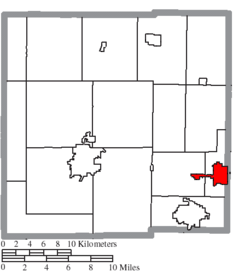 Location of Crestline in Crawford County | |
| Coordinates: 40°47′5″N 82°44′25″W / 40.78472°N 82.74028°WCoordinates: 40°47′5″N 82°44′25″W / 40.78472°N 82.74028°W | |
| Country | United States |
| State | Ohio |
| Counties | Crawford, Richland |
| Founded | 1851 |
| Government | |
| • Mayor | David Sharrock |
| Area[1] | |
| • Total | 3.18 sq mi (8.24 km2) |
| • Land | 3.17 sq mi (8.21 km2) |
| • Water | 0.01 sq mi (0.03 km2) |
| Elevation[2] | 1,142 ft (348 m) |
| Population (2010)[3] | |
| • Total | 4,630 |
| • Estimate (2012[4]) | 4,521 |
| • Density | 1,460.6/sq mi (563.9/km2) |
| Time zone | Eastern (EST) (UTC-5) |
| • Summer (DST) | EDT (UTC-4) |
| ZIP code | 44827 |
| Area code(s) | 419 |
| FIPS code | 39-19330[5] |
| GNIS feature ID | 1061006[2] |
| Website | http://www.crestlineoh.com/ |
Crestline is a village in Crawford and Richland Counties in the U.S. state of Ohio. The population was 4,630 at the 2010 census. It is the third largest municipality in Crawford County. The Crawford County portion of Crestline is part of the Bucyrus Micropolitan Statistical Area, while the small portion of the village that extends into Richland County is considered part of the Mansfield Metropolitan Statistical Area.
History
First came the railroad, and then came the town. It all started in 1850 when a route was needed between Shelby and Galion, a distance of 13 miles, by the Cleveland, Columbus and Cincinnati railroad, or the "Bee Line" as it was known then. Since there was no town between Shelby and Galion, it was decided that a station should be placed halfway for passenger convenience. The station was constructed where the line crossed the Leesville road.
Crestline was platted in 1852.[6] It was once thought to be the highest point in Ohio and was named from its high elevation.[7]
This station soon developed into a town, with a general store, post office, and a few homes. Early settlers in the village believed that the town was the watershed of the state, where streams to the north emptied into Lake Erie and those to the south emptied into the Ohio River, thus the name Crest Line. The town was not on the watershed line, but the name stuck and eventually became one word. During its heyday, Crestline was a division point for the Pennsylvania Railroad's Pittsburgh, Fort Wayne and Chicago Railway. The city housed major engine facilities and would often be the point where motive power was changed for the relatively flat runs to and from Chicago, Illinois. The Pennsylvania Railroad's engine facilities included a roundhouse, decommissioned in 1968 in the aftermath of the merger between the Pennsylvania Railroad and the New York Central Railroad to form Penn Central. Demolition of the historic roundhouse commenced in 2007 after years of neglect.[8] Today, Chicago, Fort Wayne and Eastern Railroad, CSX and Norfolk Southern trains operate in and around Crestline.[9]
Crestline, originally a railroad community, now thrives from the various businesses and industries located there. Crestline, however, is still considered a railroad community. The two crossing railroads that caused the beginning of the village still remain active there. Crestline really is "the hub of Ohio".
Geography
Crestline is located at 40°47′5″N 82°44′25″W / 40.78472°N 82.74028°W (40.784657, -82.740192),[10] along the Sandusky River near its headwaters.
According to the United States Census Bureau, the city has a total area of 3.18 square miles (8.24 km2), of which 3.17 square miles (8.21 km2) is land and 0.01 square miles (0.03 km2) is water.[1]
Demographics
| Historical population | |||
|---|---|---|---|
| Census | Pop. | %± | |
| 1860 | 1,487 | — | |
| 1870 | 2,279 | 53.3% | |
| 1880 | 2,848 | 25.0% | |
| 1890 | 2,911 | 2.2% | |
| 1900 | 3,282 | 12.7% | |
| 1910 | 3,807 | 16.0% | |
| 1920 | 4,313 | 13.3% | |
| 1930 | 4,425 | 2.6% | |
| 1940 | 4,337 | −2.0% | |
| 1950 | 4,614 | 6.4% | |
| 1960 | 5,521 | 19.7% | |
| 1970 | 5,947 | 7.7% | |
| 1980 | 5,406 | −9.1% | |
| 1990 | 4,934 | −8.7% | |
| 2000 | 5,088 | 3.1% | |
| 2010 | 4,630 | −9.0% | |
| Est. 2015 | 4,438 | [11] | −4.1% |
2010 census
As of the census[3] of 2010, there were 4,630 people, 1,914 households, and 1,256 families residing in the city. The population density was 1,460.6 inhabitants per square mile (563.9/km2). There were 2,169 housing units at an average density of 684.2 per square mile (264.2/km2). The racial makeup of the city was 94.1% White, 2.7% African American, 0.2% Native American, 0.5% Asian, 0.2% from other races, and 2.3% from two or more races. Hispanic or Latino of any race were 1.1% of the population.
There were 1,914 households of which 33.6% had children under the age of 18 living with them, 44.0% were married couples living together, 15.1% had a female householder with no husband present, 6.5% had a male householder with no wife present, and 34.4% were non-families. 30.0% of all households were made up of individuals and 13.6% had someone living alone who was 65 years of age or older. The average household size was 2.41 and the average family size was 2.94.
The median age in the city was 37.8 years. 26.6% of residents were under the age of 18; 9.3% were between the ages of 18 and 24; 22.8% were from 25 to 44; 24.8% were from 45 to 64; and 16.5% were 65 years of age or older. The gender makeup of the city was 47.6% male and 52.4% female.
2000 census
As of the census[5] of 2000, there were 5,088 people, 2,070 households, and 1,370 families residing in the city. The population density was 1,761.8 people per square mile (679.8/km²). There were 2,251 housing units at an average density of 779.5 per square mile (300.7/km²). The racial makeup of the city was 96.58% White, 1.81% African American, 0.18% Native American, 0.26% Asian, 0.06% Pacific Islander, 0.22% from other races, and 0.90% from two or more races. Hispanic or Latino of any race were 0.67% of the population.
There were 2,070 households out of which 33.3% had children under the age of 18 living with them, 48.9% were married couples living together, 12.6% had a female householder with no husband present, and 33.8% were non-families. 29.2% of all households were made up of individuals and 13.1% had someone living alone who was 65 years of age or older. The average household size was 2.44 and the average family size was 3.01.
In the city the population was spread out with 26.7% under the age of 18, 8.6% from 18 to 24, 29.1% from 25 to 44, 21.0% from 45 to 64, and 14.5% who were 65 years of age or older. The median age was 36 years. For every 100 females there were 92.1 males. For every 100 females age 18 and over, there were 87.9 males.
The median income for a household in the city was $31,392, and the median income for a family was $37,275. Males had a median income of $33,520 versus $22,455 for females. The per capita income for the city was $16,522. About 9.8% of families and 12.4% of the population were below the poverty line, including 16.5% of those under age 18 and 5.2% of those age 65 or over.
Government
The Census Bureau recognizes Crestline as a village,[5] its 2010 population of 4,630 makes it a village under Ohio law.[13]
Crestline operates under a mayor-council system, with a council of six members. In 2012, the mayor is David Sharrock, and Village Council is composed of Jerry Bickert, Mike Blaising, Clayton Herold, John Gledhill, David Crokie, and Robert Miller.[14]
Abraham Lincoln's Funeral Train
Following his death by assassination, the body of Abraham Lincoln was brought from Washington, D.C. to its final resting place in Lincoln's hometown of Springfield, Illinois, by funeral train. The train left Washington, D.C., on April 21, 1865 at 12:30 pm and traveled 1,654 miles (2,662 km) to Springfield, arriving on May 3, 1865. Several stops were made along the way, including Crestline on April 29, 1865 at 1:07 am.
Notable people
- Gates Brown, baseball player
- Les Channell, baseball player
- Frank Emmer, baseball player
- Mark Fenton, actor
- Mike Gottfried, football coach, commentator
- Jack Harbaugh, football player, coach, and father of NFL coaches John and Jim Harbaugh
- Robert Kurtzman, film director, producer, screenwriter, special effects artist
See also
References
- 1 2 "US Gazetteer files 2010". United States Census Bureau. Archived from the original on 2012-01-24. Retrieved 2013-01-06.
- 1 2 "US Board on Geographic Names". United States Geological Survey. 2007-10-25. Retrieved 2008-01-31.
- 1 2 "American FactFinder". United States Census Bureau. Retrieved 2013-01-06.
- ↑ "Population Estimates". United States Census Bureau. Archived from the original on 2013-06-17. Retrieved 2013-06-17.
- 1 2 3 "American FactFinder". United States Census Bureau. Archived from the original on 2013-09-11. Retrieved 2008-01-31.
- ↑ Overman, William Daniel (1958). Ohio Town Names. Akron, OH: Atlantic Press. p. 35.
- ↑ History of Crawford County and Ohio. Baskin & Battey. 1881. p. 493.
- ↑ http://crestlineprr.com/
- ↑ http://www.odotnet.net/map1/OhioRailMap/images/Ohio-Rail-Map-07-09-Fr-Lg.jpg
- ↑ "US Gazetteer files: 2010, 2000, and 1990". United States Census Bureau. 2011-02-12. Retrieved 2011-04-23.
- ↑ "Annual Estimates of the Resident Population for Incorporated Places: April 1, 2010 to July 1, 2015". Retrieved July 2, 2016.
- ↑ "Census of Population and Housing". Census.gov. Archived from the original on May 11, 2015. Retrieved June 4, 2015.
- ↑ "Ohio Revised Code Section 703.01(A)". Retrieved 2012-01-29.
- ↑ Village Officials, Village of Crestline, 2012. Accessed 2012-01-29.
External links
- Village website
- Crestline Community Development Team
- Crestline Chamber of Commerce
- Village of Crestline Zoning Map
Municipalities and communities of Crawford County, Ohio, United States | ||
|---|---|---|
| Cities | 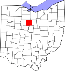 | |
| Villages | ||
| Townships | ||
| CDPs | ||
| Unincorporated communities | ||
| Footnotes | ‡This populated place also has portions in an adjacent county or counties | |
Municipalities and communities of Richland County, Ohio, United States | ||
|---|---|---|
| Cities | 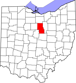 | |
| Villages | ||
| Townships | ||
| Unincorporated communities | ||
| Ghost towns | ||
| Footnotes | ‡This populated place also has portions in an adjacent county or counties | |