Dakota MRT Station
CC8 Dakota 达科达 டகோட்டா Dakota | |||||||||||
|---|---|---|---|---|---|---|---|---|---|---|---|
| Rapid transit | |||||||||||
|
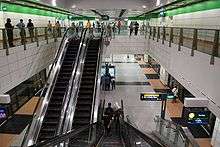
Platform level of Dakota MRT station. | |||||||||||
| Location |
201 Old Airport Road Singapore 397973 | ||||||||||
| Coordinates | 1°18′30″N 103°53′18″E / 1.308289°N 103.888253°E | ||||||||||
| Operated by | SMRT Trains (SMRT Corporation) | ||||||||||
| Line(s) | |||||||||||
| Platforms | Island | ||||||||||
| Tracks | 2 | ||||||||||
| Connections | Bus, Taxi | ||||||||||
| Construction | |||||||||||
| Structure type | Underground | ||||||||||
| Platform levels | 2 | ||||||||||
| Disabled access | Yes | ||||||||||
| Other information | |||||||||||
| Station code | CC8 | ||||||||||
| History | |||||||||||
| Opened | 17 April 2010 | ||||||||||
| Electrified | Yes | ||||||||||
| Previous names | Tanjong Katong | ||||||||||
| Services | |||||||||||
| |||||||||||
| Location | |||||||||||
 | |||||||||||

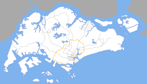
Dakota MRT Station (CC8) is an underground Mass Rapid Transit station on the Circle Line in the Old Kallang Airport Estate, Singapore. The station has two exit and entry points, on either side of Old Airport Road. It was opened on 17 April 2010 along with the rest of Stage 1 & 2 of the Circle Line.
Dakota station is named after the Dakota DC-3 aircraft that commonly used to land at the nearby Kallang Airport when it was still in commercial use.
History
The construction of Dakota and the tracks led to the closure of the stretch of Old Airport Road between Cassia Link and Guillemard Camp Road in March 2006. Instead, Jalan Tiga was extended to Guillemard Road, opening up a traffic junction there. In addition, the old Guillemard Camp Road was widened to provide public buses enough space to drive through. Despite the widening of the road, there have been several accidents occurring near the T-junction of Guillemard Road and Guillemard Camp Road. The closed stretch of Old Airport Road has since re-opened on 29 December 2008 at 5am.[1]
It was built as part of stage 2 of the Circle Line by the same joint venture responsible for the Nicoll Highway station.
Built in the middle of a HDB estate and within walking distance of several schools, the station serves many residents in the area since its opening on 17 April 2010. Food enthusiasts living far away can also travel here to the Old Airport Road Hawker Centre.
Station layout
| L1 | Street Level | Old Airport Road Market & Food Centre |
| B1 | Concourse | Faregates, Ticketing Machines, Station Control, Transitlink Counter |
| B2 | Platform A | Circle Line towards CC29 NE1 HarbourFront via CC9 EW8 Paya Lebar (→) |
| Island platform, doors will open on the right | ||
| Platform B | Circle Line towards CC1 NS24 NE6 Dhoby Ghaut via CC7 Mountbatten (←) | |
Transport connections
Rail
| Destination | First Train | Last Train | ||||
|---|---|---|---|---|---|---|
| Mon – Sat | Sunday & Public Holiday | Daily | ||||
| Circle Line | ||||||
| to CC1 Dhoby Ghaut | 5.42am | 6.09am | 11.51pm | |||
| to CC29 HarbourFront | 5.37am | 6.04am | 11.01pm | |||
| to CC26 Pasir Panjang | – | – | 11.32pm | |||
| to CC23 one-north | – | – | 11.48pm | |||
| to CC17 Caldecott | – | – | 12.15am | |||
| to CC11 Tai Seng | – | – | 12.23am | |||
| to CC7 Mountbatten | – | – | 12.28am | |||
Exits
- A: Jalan Satu, Kong Hwa School, Mountbatten Community Club, Police Logistic Department (Hemmant Road), Cassia View, Block 51 Old Airport Road Market & Food Court, Former Guillemard Road Army Camp, Geylang Park Connector
- B: Broadrick Secondary School
References
- ↑ "News Releases: Re-Opening Of Old Airport Road". Land Transport Authority. Retrieved 2009-01-03.