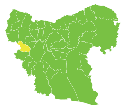
Darat Izza
| Darat Izza دارة عزة | |
|---|---|
| Town | |
 Darat Izza | |
| Coordinates: 36°16′58″N 36°51′7″E / 36.28278°N 36.85194°E | |
| Country |
|
| Governorate | Aleppo Governorate |
| District | Mount Simeon District |
| Nahiyah | Darat Izza |
| Occupation | Jaish al-Fatah |
| Elevation | 477 m (1,565 ft) |
| Population (2004 census)[1] | |
| • Total | 13,525 |
| Time zone | EET (UTC+2) |
| • Summer (DST) | EEST (UTC+3) |
Darat Izza (Arabic: دارة عزة, also spelled Darat Aza or Darit Izza) is a town in northern Syria, administratively part of the Aleppo Governorate, located 30 kilometres (19 miles) northwest of Aleppo. Nearby localities include Deir Samaan to the north, Anadan to the east and Turmanin to the southwest. According to the Syria Central Bureau of Statistics (CBS), Darat Izza had a population of 13,525 in the 2004 census.[1]

History
Leading to Darat Izza is a well-preserved stretch of an ancient Roman road dating to the 2nd century CE.[2] During the Ottoman Empire era, Darat Izza was well known for the cotton fabrics it produced.[3]
During the ongoing Syrian uprising against the government of Bashar al-Assad, 25 government supporters were killed in the town by members of the Free Syrian Army (FSA). The government claimed they were ordinary citizens while the FSA and the pro-opposition Syrian Observatory for Human Rights claimed they were pro-government "militiamen."[4]
References
- 1 2 General Census of Population and Housing 2004. Syria Central Bureau of Statistics (CBS). Aleppo Governorate. (Arabic)
- ↑ Beattie, 2001, p. 245.
- ↑ Faroqhi, 1997, p. 501.
- ↑ Syria rebels accused of massacring 25 people in village. BBC News. 2012-06-22.
Bibliography
- Beattie, Andrew (2001). The Rough Guide to Syria. 2. Rough Guides. ISBN 1858287189.
- Faroqhi, Suraiya (1997). An Economic and Social History of the Ottoman Empire. 2. Cambridge University Press. ISBN 0521574552.

