Deepwater, Missouri
| Deepwater, Missouri | |
|---|---|
| City | |
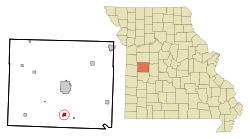 Location of Deepwater, Missouri | |
| Coordinates: 38°15′37″N 93°46′31″W / 38.26028°N 93.77528°W | |
| Country | United States |
| State | Missouri |
| County | Henry |
| Area[1] | |
| • Total | 0.86 sq mi (2.23 km2) |
| • Land | 0.85 sq mi (2.20 km2) |
| • Water | 0.01 sq mi (0.03 km2) |
| Elevation | 741 ft (226 m) |
| Population (2010)[2] | |
| • Total | 433 |
| • Estimate (2012[3]) | 426 |
| • Density | 509.4/sq mi (196.7/km2) |
| Time zone | Central (CST) (UTC-6) |
| • Summer (DST) | CDT (UTC-5) |
| ZIP code | 64740 |
| Area code(s) | 660 |
| FIPS code | 29-18730[4] |
| GNIS feature ID | 0716788[5] |
Deepwater is a city in Henry County, Missouri, United States. The population was 433 at the 2010 census.
History
Deepwater was laid out in 1885, taking its name from nearby Deepwater Creek.[6] A post office called Deepwater has been in operation since 1885.[7]
Geography
Deepwater is located at 38°15′37″N 93°46′31″W / 38.26028°N 93.77528°WCoordinates: 38°15′37″N 93°46′31″W / 38.26028°N 93.77528°W.[8]
According to the United States Census Bureau, the city has a total area of 0.86 square miles (2.23 km2), of which, 0.85 square miles (2.20 km2) is land and 0.01 square miles (0.03 km2) is water.[1]
Demographics
| Historical population | |||
|---|---|---|---|
| Census | Pop. | %± | |
| 1890 | 1,102 | — | |
| 1900 | 1,201 | 9.0% | |
| 1910 | 1,398 | 16.4% | |
| 1920 | 1,391 | −0.5% | |
| 1930 | 1,093 | −21.4% | |
| 1940 | 956 | −12.5% | |
| 1950 | 885 | −7.4% | |
| 1960 | 712 | −19.5% | |
| 1970 | 565 | −20.6% | |
| 1980 | 475 | −15.9% | |
| 1990 | 441 | −7.2% | |
| 2000 | 507 | 15.0% | |
| 2010 | 433 | −14.6% | |
| Est. 2015 | 415 | [9] | −4.2% |
2010 census
As of the census[2] of 2010, there were 433 people, 188 households, and 125 families residing in the city. The population density was 509.4 inhabitants per square mile (196.7/km2). There were 240 housing units at an average density of 282.4 per square mile (109.0/km2). The racial makeup of the city was 98.8% White, 0.5% Native American, and 0.7% from two or more races. Hispanic or Latino of any race were 1.6% of the population.
There were 188 households of which 25.0% had children under the age of 18 living with them, 42.0% were married couples living together, 17.6% had a female householder with no husband present, 6.9% had a male householder with no wife present, and 33.5% were non-families. 25.0% of all households were made up of individuals and 11.7% had someone living alone who was 65 years of age or older. The average household size was 2.30 and the average family size was 2.70.
The median age in the city was 45.1 years. 18% of residents were under the age of 18; 7.8% were between the ages of 18 and 24; 24% were from 25 to 44; 29.1% were from 45 to 64; and 21% were 65 years of age or older. The gender makeup of the city was 49.0% male and 51.0% female.
2000 census
As of the census[4] of 2000, there were 507 people, 212 households, and 143 families residing in the city. The population density was 593.9 people per square mile (230.3/km²). There were 248 housing units at an average density of 290.5 per square mile (112.7/km²). The racial makeup of the city was 97.63% White, 1.58% African American and 0.79% Native American. Hispanic or Latino of any race were 1.58% of the population.
There were 212 households out of which 25.0% had children under the age of 18 living with them, 49.5% were married couples living together, 12.7% had a female householder with no husband present, and 32.1% were non-families. 27.4% of all households were made up of individuals and 13.7% had someone living alone who was 65 years of age or older. The average household size was 2.39 and the average family size was 2.79.
In the city the population was spread out with 24.7% under the age of 18, 7.3% from 18 to 24, 25.2% from 25 to 44, 24.9% from 45 to 64, and 17.9% who were 65 years of age or older. The median age was 38 years. For every 100 females there were 101.2 males. For every 100 females age 18 and over, there were 97.9 males.
The median income for a household in the city was $24,722, and the median income for a family was $29,423. Males had a median income of $26,000 versus $13,875 for females. The per capita income for the city was $11,721. About 17.1% of families and 20.9% of the population were below the poverty line, including 23.1% of those under age 18 and 15.9% of those age 65 or over.
References
- 1 2 "US Gazetteer files 2010". United States Census Bureau. Retrieved 2012-07-08.
- 1 2 "American FactFinder". United States Census Bureau. Retrieved 2012-07-08.
- ↑ "Population Estimates". United States Census Bureau. Retrieved 2013-05-30.
- 1 2 "American FactFinder". United States Census Bureau. Retrieved 2008-01-31.
- ↑ "US Board on Geographic Names". United States Geological Survey. 2007-10-25. Retrieved 2008-01-31.
- ↑ "Henry County Place Names, 1928–1945 (archived)". The State Historical Society of Missouri. Retrieved 4 October 2016.
- ↑ "Post Offices". Jim Forte Postal History. Retrieved 5 October 2016.
- ↑ "US Gazetteer files: 2010, 2000, and 1990". United States Census Bureau. 2011-02-12. Retrieved 2011-04-23.
- ↑ "Annual Estimates of the Resident Population for Incorporated Places: April 1, 2010 to July 1, 2015". Retrieved July 2, 2016.
- ↑ "Census of Population and Housing". Census.gov. Retrieved June 4, 2015.
External links
- City of Deepwater
- Historic maps of Deepwater in the Sanborn Maps of Missouri Collection at the University of Missouri
Municipalities and communities of Henry County, Missouri, United States | ||
|---|---|---|
| Cities | 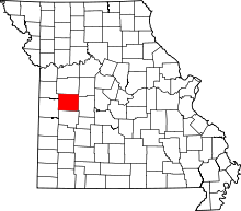 | |
| Villages | ||
| Townships | ||
| CDP | ||
| Other unincorporated communities | ||
| Ghost town | ||
| Footnotes | ‡This populated place also has portions in an adjacent county or counties | |