Delafield, Wisconsin
| City of Delafield | ||
|---|---|---|
| ||
 Location in Waukesha County and the state of Wisconsin. | ||
| Coordinates: 43°3′33″N 88°24′14″W / 43.05917°N 88.40389°WCoordinates: 43°3′33″N 88°24′14″W / 43.05917°N 88.40389°W | ||
| Country | United States | |
| State | Wisconsin | |
| County | Waukesha | |
| Established | 1837 | |
| Government | ||
| • Mayor | Michele DeYoe | |
| Area[1] | ||
| • Total | 11.06 sq mi (28.65 km2) | |
| • Land | 9.41 sq mi (24.37 km2) | |
| • Water | 1.65 sq mi (4.27 km2) 14.92% | |
| Population (2010)[2] | ||
| • Total | 7,085 | |
| • Estimate (2012[3]) | 7,137 | |
| • Density | 752.9/sq mi (290.7/km2) | |
| Area code(s) | 262 | |
| Website | www.cityofdelafield.com | |

Delafield is a city in Waukesha County, Wisconsin, along the Bark River, and a suburb of Milwaukee. The population was 7,085 at the 2010 census.
The city of Delafield is a separate municipality from the Town of Delafield, both of which are situated in township 7 North Range 18 East.
History
Delafield was the hometown of the Cushing brothers, who served the Union cause during the American Civil War - Alonzo (killed during Pickett's Charge at Gettysburg), William (led the raid on CSS Albemarle), and Howard (an Indian fighter killed fighting the Apache in Arizona after the war). Cushing Memorial Park is named after them, and is home to a war memorial in their honor. It was established in 1837, and was named after Dr. Charles Delafield of Milwaukee.[4]
Since 1927, a culinary event known as the "Coon Feed" has taken place in Delafield.[5]
Geography
Delafield is located at 43°3′33″N 88°24′14″W / 43.05917°N 88.40389°W (43.05913, -88.40386). It is located in the Lake Country area of Waukesha County.
According to the United States Census Bureau, the city has a total area of 11.06 square miles (28.65 km2), of which, 9.41 square miles (24.37 km2) is land and 1.65 square miles (4.27 km2) is water.[1]
Demographics
| Historical population | |||
|---|---|---|---|
| Census | Pop. | %± | |
| 1880 | 183 | — | |
| 1960 | 2,334 | — | |
| 1970 | 3,182 | 36.3% | |
| 1980 | 4,083 | 28.3% | |
| 1990 | 5,347 | 31.0% | |
| 2000 | 6,472 | 21.0% | |
| 2010 | 7,085 | 9.5% | |
| Est. 2015 | 7,180 | [6] | 1.3% |
2010 census
As of the census[2] of 2010, there were 7,085 people, 2,776 households, and 1,858 families residing in the city. The population density was 752.9 inhabitants per square mile (290.7/km2). There were 2,974 housing units at an average density of 316.0 per square mile (122.0/km2). The racial makeup of the city was 96.4% White, 0.8% African American, 0.3% Native American, 1.3% Asian, 0.4% from other races, and 0.8% from two or more races. Hispanic or Latino of any race were 3.2% of the population.
There were 2,776 households of which 29.7% had children under the age of 18 living with them, 56.3% were married couples living together, 7.0% had a female householder with no husband present, 3.6% had a male householder with no wife present, and 33.1% were non-families. 26.8% of all households were made up of individuals and 11.2% had someone living alone who was 65 years of age or older. The average household size was 2.38 and the average family size was 2.92.
The median age in the city was 41.8 years. 25.2% of residents were under the age of 18; 7.6% were between the ages of 18 and 24; 21.8% were from 25 to 44; 32.4% were from 45 to 64; and 13% were 65 years of age or older. The gender makeup of the city was 50.9% male and 49.1% female.
2000 census
As of the census[8] of 2000, there were 6,472 people, 2,553 households, and 1,856 families residing in the city. The population density was 680.2 people per square mile (262.5/km²). There were 2,685 housing units at an average density of 282.2 per square mile (108.9/km²). The racial makeup of the city was 97.74% White, 0.09% Black or African American, 0.31% Native American, 0.57% Asian, 0.32% from other races, and 0.96% from two or more races. Some 1.47% of the population were Hispanic or Latino of any race.
There were 2,553 households out of which 35.8% had children under the age of 18 living with them. 61.7% were married couples living together, 8.0% had a female householder with no husband present, and 27.3% were non-families. About 22.2% of all households were made up of individuals and 7.7% had someone living alone who was 65 years of age or older. The average household size was 2.52 and the average family size was 2.97.
In the city the population was spread out with 26.6% under the age of 18, 5.7% from 18 to 24, 29.8% from 25 to 44, 27.1% from 45 to 64, and 10.8% who were 65 years of age or older. The median age was 39 years. For every 100 females there were 98.5 males. For every 100 females age 18 and over, there were 93.3 males.
The median income for a household in the city was $61,938, and the median income for a family was $71,955. Males had a median income of $51,656 versus $30,253 for females. The per capita income for the city was $31,602. About 2.3% of families and 3.4% of the population were below the poverty line, including 5.3% of those under age 18 and 1.4% of those age 65 or over.
Education
The Kettle Moraine School District serves most of Delafield. Cushing Elementary provides education for children in grades K-5. St. John's Northwestern Military Academy, a private Episcopal military school for 6th through 12th grade, is also located in Delafield.
Notable people
- Alonzo Cushing, U.S. Army, Medal of Honor recipient
- William B. Cushing, U.S. Navy, Recipient of Thanks of Congress
- Cindi Duchow, Wisconsin State Assembly
- Monte Merkel, NFL player
- Sankar Montoute, NFL player
- Alex Moyer, NFL player
- James Kerr Proudfit, Adjutant General of Wisconsin
- Alex Rigsby, woman's ice hockey player
- Ralph H. Spanjer, U.S. Marine Corps Major General
- George Wilson, NFL player, assistant coach and head coach
References
- 1 2 "US Gazetteer files 2010". United States Census Bureau. Retrieved 2012-11-18.
- 1 2 "American FactFinder". United States Census Bureau. Retrieved 2012-11-18.
- ↑ "Population Estimates". United States Census Bureau. Retrieved 2013-06-24.
- ↑ History of Delafield, Wisconsin
- ↑ Annual Coon Feed
- ↑ "Annual Estimates of the Resident Population for Incorporated Places: April 1, 2010 to July 1, 2015". Retrieved July 2, 2016.
- ↑ "Census of Population and Housing". Census.gov. Retrieved June 4, 2015.
- ↑ "American FactFinder". United States Census Bureau. Retrieved 2008-01-31.
External links
| Wikivoyage has a travel guide for Delafield. |
- City of Delafield
- Sanborn fire insurance map: 1903
Municipalities and communities of Waukesha County, Wisconsin, United States | ||
|---|---|---|
| Cities | 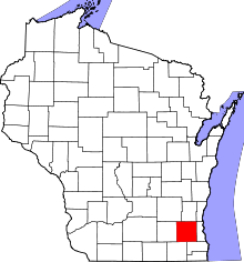 | |
| Villages | ||
| Towns | ||
| CDP | ||
| Unincorporated communities | ||
| Ghost towns | ||
| Footnotes | ‡This populated place also has portions in an adjacent county or counties | |
| Central city |  | |
|---|---|---|
| Largest municipalities (over 25,000 in 2010) | ||
| Municipalities (over 10,000 in 2010) | ||
| Smaller municipalities (under 10,000 in 2010) | ||
| Counties | ||