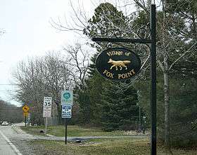
Fox Point, Wisconsin
| Fox Point, Wisconsin | |
|---|---|
| Village | |
 Location of Fox Point, Wisconsin | |
| Coordinates: 43°9′37″N 87°54′14″W / 43.16028°N 87.90389°WCoordinates: 43°9′37″N 87°54′14″W / 43.16028°N 87.90389°W | |
| Country | United States |
| State | Wisconsin |
| County | Milwaukee |
| Area[1] | |
| • Total | 2.90 sq mi (7.51 km2) |
| • Land | 2.90 sq mi (7.51 km2) |
| • Water | 0 sq mi (0 km2) |
| Elevation[2] | 686 ft (209 m) |
| Population (2010)[3] | |
| • Total | 6,701 |
| • Estimate (2012[4]) | 6,734 |
| • Density | 2,310.7/sq mi (892.2/km2) |
| Time zone | Central (CST) (UTC-6) |
| • Summer (DST) | CDT (UTC-5) |
| Area code(s) | 414 |
| FIPS code | 55-27075[5] |
| GNIS feature ID | 1565227[2] |
| Website |
vil |
Fox Point is a village in Milwaukee County, Wisconsin, United States. The population was 6,701 at the 2010 census.
Fox Point is located along the North Shore area of the Milwaukee metropolitan area. It is named after a small point extending into Lake Michigan.[6] Mainly residential, Fox Point is also home to the RiverPoint Village shopping center at the far northwest end of the village.
Geography
Fox Point is located at 43°9′37″N 87°54′14″W / 43.16028°N 87.90389°W (43.160409, -87.903994).[7]
According to the United States Census Bureau, the village has a total area of 2.90 square miles (7.51 km2), all of it land.[1]
Demographics
| Historical population | |||
|---|---|---|---|
| Census | Pop. | %± | |
| 1930 | 474 | — | |
| 1940 | 1,180 | 148.9% | |
| 1950 | 2,585 | 119.1% | |
| 1960 | 7,315 | 183.0% | |
| 1970 | 7,939 | 8.5% | |
| 1980 | 7,649 | −3.7% | |
| 1990 | 7,238 | −5.4% | |
| 2000 | 7,012 | −3.1% | |
| 2010 | 6,701 | −4.4% | |
| Est. 2015 | 6,755 | [8] | 0.8% |
2010 census
As of the census[3] of 2010, there were 6,701 people, 2,747 households, and 1,859 families residing in the village. The population density was 2,310.7 inhabitants per square mile (892.2/km2). There were 2,928 housing units at an average density of 1,009.7 per square mile (389.8/km2). The racial makeup of the village was 91.5% White, 2.8% African American, 0.1% Native American, 3.7% Asian, 0.4% from other races, and 1.4% from two or more races. Hispanic or Latino of any race were 2.4% of the population.
There were 2,747 households of which 29.7% had children under the age of 18 living with them, 60.5% were married couples living together, 5.1% had a female householder with no husband present, 2.0% had a male householder with no wife present, and 32.3% were non-families. 28.4% of all households were made up of individuals and 14% had someone living alone who was 65 years of age or older. The average household size was 2.36 and the average family size was 2.92.
The median age in the village was 45.6 years. 22.8% of residents were under the age of 18; 7% were between the ages of 18 and 24; 19.4% were from 25 to 44; 32.4% were from 45 to 64; and 18.4% were 65 years of age or older. The gender makeup of the village was 49.0% male and 51.0% female.
2000 census
As of the census[5] of 2000, there were 7,012 people, 2,825 households, and 1,988 families residing in the village. The population density was 2,399 people per square mile (927.2/km²). There were 2,910 housing units at an average density of 995.7 per square mile (384.8/km²). The racial makeup of the village was 95.55% White, 1.21% African American, 0.11% Native American, 2.14% Asian, 0.01% Pacific Islander, 0.19% from other races, and 0.78% from two or more races. Hispanic or Latino of any race were 1.06% of the population.
There were 2,825 households out of which 30.6% had children under the age of 18 living with them, 62.4% were married couples living together, 6.1% had a female householder with no husband present, and 29.6% were non-families. 27.3% of all households were made up of individuals and 13.8% had someone living alone who was 65 years of age or older. The average household size was 2.39 and the average family size was 2.93.
In the village the population was spread out with 23.9% under the age of 18, 6.1% from 18 to 24, 22.9% from 25 to 44, 27.0% from 45 to 64, and 20.0% who were 65 years of age or older. The median age was 44 years. For every 100 females there were 89.9 males. For every 100 females age 18 and over, there were 84.9 males.
The median income for a household in the village was $80,572, and the median income for a family was $94,348. Males had a median income of $77,850 versus $38,500 for females. The per capita income for the village was $48,469. About 1.8% of families and 2.8% of the population were below the poverty line, including 4.1% of those under age 18 and 3.8% of those age 65 or over.
Government
The government of the Village of Fox Point consists of a village board, and its committees, which monitor aspects of village government performance. The board consists of six trustees and a president, who are elected to serve three-year terms. The current president is Micheal A. West, whose term will expire in April, 2011. The board has three committees: a finance committee of three members, which oversees economic matters; an audit committee with three trustees and two residents who assist the finance committee; and a three-member administration committee, which oversees new village laws. Other committees, boards, and commissions include the board of appeals, board of police commissioners, board of reviews, building board, board of ethics, the fair housing commission, and the historic preservation committee. The North-Shore Public Library Board is a multi-municipal body with representatives from Fox Point, Bayside, Glendale, and Brown Deer. In Fox Point the president appoints a trustee and a resident to serve.
Education
For students in kindergarten through 8th grade, Fox Point is part of two school districts: the Fox Point-Bayside School District and the Maple Dale-Indian Hills School District. Both school districts are feeders for Nicolet High School. St. Eugene Catholic Grade School is also located in Fox Point.
Economy
The Chipstone Foundation has its headquarters in Fox Point. There are also many stores, mainly located in the River Point Shopping Mall, Fox Point Stores Mall, and the Audubon Center.
Historic places
- The Albert and Edith Adelman House, designed by Frank Lloyd Wright and listed on the National Register of Historic Places, is located in Fox Point.
- Mary Nohl Art Environment, containing several pieces of historic folk art and listed of the National Register of Historic Places, is located in Fox Point.
References
- 1 2 "US Gazetteer files 2010". United States Census Bureau. Retrieved 2012-11-18.
- 1 2 "US Board on Geographic Names". United States Geological Survey. 2007-10-25. Retrieved 2008-01-31.
- 1 2 "American FactFinder". United States Census Bureau. Retrieved 2012-11-18.
- ↑ "Population Estimates". United States Census Bureau. Retrieved 2013-06-24.
- 1 2 "American FactFinder". United States Census Bureau. Retrieved 2008-01-31.
- ↑ "Fox Point records its past". The Milwaukee Journal. Jan 29, 1979. p. 4. Retrieved 26 May 2015.
- ↑ "US Gazetteer files: 2010, 2000, and 1990". United States Census Bureau. 2011-02-12. Retrieved 2011-04-23.
- ↑ "Annual Estimates of the Resident Population for Incorporated Places: April 1, 2010 to July 1, 2015". Retrieved July 2, 2016.
- ↑ "Census of Population and Housing". Census.gov. Retrieved June 4, 2015.
External links
Municipalities and communities of Milwaukee County, Wisconsin, United States | ||
|---|---|---|
| Cities | 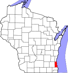 | |
| Villages | ||
| Ghost towns/ neighborhoods | ||
| Indian reservation | ||
| Footnotes | ‡This populated place also has portions in another county or counties | |
| Central city |  | |
|---|---|---|
| Largest municipalities (over 25,000 in 2010) | ||
| Municipalities (over 10,000 in 2010) | ||
| Smaller municipalities (under 10,000 in 2010) | ||
| Counties | ||