Mukwonago, Wisconsin
| Mukwonago, Wisconsin | |
|---|---|
| Village | |
 Location in Waukesha County and the state of Wisconsin. | |
| Coordinates: 42°53′8″N 88°22′5″W / 42.88556°N 88.36806°WCoordinates: 42°53′8″N 88°22′5″W / 42.88556°N 88.36806°W | |
| Country | United States |
| State | Wisconsin |
| County | Walworth, Waukesha |
| Area[1] | |
| • Total | 8.11 sq mi (21.00 km2) |
| • Land | 7.90 sq mi (20.46 km2) |
| • Water | 0.21 sq mi (0.54 km2) |
| Elevation[2] | 978 ft (298 m) |
| Population (2010)[3] | |
| • Total | 7,355 |
| • Estimate (2012[4]) | 7,252 [4] |
| • Density | 931.0/sq mi (359.5/km2) |
| Time zone | Central (CST) (UTC-6) |
| • Summer (DST) | CDT (UTC-5) |
| Zip code | 53149 |
| Area code(s) | 262 |
| FIPS code | 55-55075[5] |
| GNIS feature ID | 1583771[2] |
Mukwonago is a village in Wisconsin. The population was 7,355 at the 2010 census. The village is located mostly within the Town of Mukwonago in Waukesha County, with a small portion extending into the Town of East Troy in Walworth County. Of its population, 7,254 were in Waukesha County, and 101 were in Walworth County.
History
The area was originally a Native American village and the tribal seat of the Bear Clan of the Potawatomi Indians. The name "Mukwonago" is derived from "mequanego" which translates to bear's den. The spelling "Mukwonago" was adopted in 1844 because of the similarity to nearby Mequon. Many of the streets and roads are named after the city's founders, such as Ira Blood, Major Jessie Meacham. Sewall Andrews, and Thomas Sugden.
Geography
Mukwonago is located at 42°51′52″N 88°19′50″W / 42.864557°N 88.330619°W (42.864557, -88.330619).[6]
According to the United States Census Bureau, the village has a total area of 8.11 square miles (21.00 km2), of which, 7.90 square miles (20.46 km2) of it is land and 0.21 square miles (0.54 km2) is water.[1]
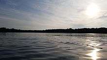
It is situated at the southwestern flank of the sprawling Vernon Marsh, and encircles Upper and Lower Phantom Lake(s). The lakes lie midway along the Mukwonago River from its source springs to its meeting with the Fox River, which travels further southeast through Big Bend and beyond.
Climate
Mukwonago has a humid continental climate.
| Climate data for Mukwonago, Wisconsin (all dates) | |||||||||||||
|---|---|---|---|---|---|---|---|---|---|---|---|---|---|
| Month | Jan | Feb | Mar | Apr | May | Jun | Jul | Aug | Sep | Oct | Nov | Dec | Year |
| Record high °F (°C) | 58 (14) |
66 (19) |
82 (28) |
91 (33) |
93 (34) |
100 (38) |
109 (43) |
101 (38) |
101 (38) |
88 (31) |
77 (25) |
68 (20) |
109 (43) |
| Average high °F (°C) | 28 (−2) |
32 (0) |
43 (6) |
56 (13) |
68 (20) |
78 (26) |
82 (28) |
80 (27) |
73 (23) |
60 (16) |
45 (7) |
32 (0) |
56.4 (13.7) |
| Source: http://www.weather.com/weather/wxclimatology/monthly/graph/53149 | |||||||||||||
Demographics
| Historical population | |||
|---|---|---|---|
| Census | Pop. | %± | |
| 1880 | 239 | — | |
| 1890 | 356 | 49.0% | |
| 1910 | 615 | — | |
| 1920 | 697 | 13.3% | |
| 1930 | 846 | 21.4% | |
| 1940 | 855 | 1.1% | |
| 1950 | 1,207 | 41.2% | |
| 1960 | 1,877 | 55.5% | |
| 1970 | 2,367 | 26.1% | |
| 1980 | 4,014 | 69.6% | |
| 1990 | 4,464 | 11.2% | |
| 2000 | 6,162 | 38.0% | |
| 2010 | 7,355 | 19.4% | |
| Est. 2015 | 7,721 | [7] | 5.0% |
2010 census
As of the census[3] of 2010, there were 7,355 people, 2,923 households, and 2,003 families residing in the village. The population density was 931.0 inhabitants per square mile (359.5/km2). There were 3,104 housing units at an average density of 392.9 per square mile (151.7/km2). The racial makeup of the village was 97.4% White, 0.2% African American, 0.2% Native American, 0.9% Asian, 0.1% Pacific Islander, 0.3% from other races, and 0.9% from two or more races. Hispanic or Latino of any race were 3.2% of the population.
There were 2,923 households of which 35.6% had children under the age of 18 living with them, 54.9% were married couples living together, 8.6% had a female householder with no husband present, 5.1% had a male householder with no wife present, and 31.5% were non-families. 26.6% of all households were made up of individuals and 10.7% had someone living alone who was 65 years of age or older. The average household size was 2.50 and the average family size was 3.05.
The median age in the village was 37.9 years. 26.2% of residents were under the age of 18; 7.2% were between the ages of 18 and 24; 28.1% were from 25 to 44; 26.2% were from 45 to 64; and 12.4% were 65 years of age or older. The gender makeup of the village was 48.9% male and 51.1% female.
2000 census
As of the census[5] of 2000, there were 6,162 people, 2,392 households, and 1,705 families residing in the village. The population density was 1,313.3 people per square mile (507.3/km2). There were 2,502 housing units at an average density of 533.3 per square mile (206.0/km2). The racial makeup of the village was 98.21% White, 0.19% African American, 0.24% Native American, 0.36% Asian, 0.29% from other races, and 0.70% from two or more races. Hispanic or Latino of any race were 1.90% of the population.
There were 2,392 households out of which 35.5% had children under the age of 18 living with them, 57.0% were married couples living together, 9.9% had a female householder with no husband present, and 28.7% were non-families. 22.7% of all households were made up of individuals and 8.4% had someone living alone who was 65 years of age or older. The average household size was 2.54 and the average family size was 3.00.
In the village the population was spread out with 25.5% under the age of 18, 9.9% from 18 to 24, 32.1% from 25 to 44, 21.6% from 45 to 64, and 10.9% who were 65 years of age or older. The median age was 34 years. For every 100 females there were 95.2 males. For every 100 females age 18 and over, there were 92.4 males.
The median income for a household in the village was $56,250, and the median income for a family was $64,354. Males had a median income of $45,824 versus $28,333 for females. The per capita income for the village was $23,993. About 2.6% of families and 3.1% of the population were below the poverty line, including 3.7% of those under age 18 and 6.4% of those age 65 or over.
Education
Public schools serving the city are Mukwonago High School, Park View Middle School, Rolling Hills Elementary, Section Elementary, Big Bend Elementary, Eagleville Elementary, Prairie View Elementary, and Clarendon Avenue Elementary Schools. The 2004 Mukwonago Indians football team had an undefeated[9] season ending with a victory over the Marshfield Tigers in the state championship.[10] Other team state championships include girls' swimming (2011, 2012, 2013), girls' cross country (1994), boys' cross country (1964, 1966), boys' track (1964), as well as titles in debate and dance team.
Parochial schools include St. John's Lutheran School.
Notable residents
- Marvin H. Bovee, politician
- James H. Elmore, politician
- Scott Jensen, politician
- Nick Pearson, Olympic speedskater 2002 & 2010 Winter Games[11]
- Eric Szmanda, actor, CSI
- John J. Van Buren, United States Navy
- Laurel E. Youmans, politician
- Josh Hickson, Reality TV Star, MTV College Life
- Robert (Robbie) Charles Russell, Symbolic Medal of Justice Recipient
References
- 1 2 "US Gazetteer files 2010". United States Census Bureau. Retrieved 2012-11-18.
- 1 2 "US Board on Geographic Names". United States Geological Survey. 2007-10-25. Retrieved 2008-01-31.
- 1 2 "American FactFinder". United States Census Bureau. Retrieved 2012-11-18.
- 1 2 "Population Estimates". United States Census Bureau. Retrieved 2013-06-24.
- 1 2 "American FactFinder". United States Census Bureau. Retrieved 2008-01-31.
- ↑ "US Gazetteer files: 2010, 2000, and 1990". United States Census Bureau. 2011-02-12. Retrieved 2011-04-23.
- ↑ "Annual Estimates of the Resident Population for Incorporated Places: April 1, 2010 to July 1, 2015". Retrieved July 2, 2016.
- ↑ "Census of Population and Housing". Census.gov. Retrieved June 4, 2015.
- ↑ "Team Statistics", 2004-06-01, "" Retrieved 2009-12-16
- ↑ "Marshfield vs Mukwonago", 2004-11-19 "" Retrieved 2009-12-16
- ↑ http://www.livinglakecountry.com/mukwonagochief/news/82056872.html
External links
Municipalities and communities of Walworth County, Wisconsin, United States | ||
|---|---|---|
| Cities |  | |
| Villages | ||
| Towns | ||
| CDPs | ||
| Unincorporated communities |
| |
| Ghost towns | ||
| Footnotes | ‡This populated place also has portions in an adjacent county or counties | |
Municipalities and communities of Waukesha County, Wisconsin, United States | ||
|---|---|---|
| Cities | 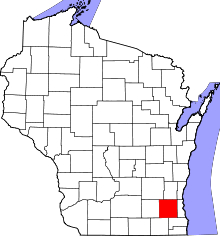 | |
| Villages | ||
| Towns | ||
| CDP | ||
| Unincorporated communities | ||
| Ghost towns | ||
| Footnotes | ‡This populated place also has portions in an adjacent county or counties | |
| Central city |  | |
|---|---|---|
| Largest municipalities (over 25,000 in 2010) | ||
| Municipalities (over 10,000 in 2010) | ||
| Smaller municipalities (under 10,000 in 2010) | ||
| Counties | ||