Detroit–Windsor
| Detroit–Windsor | |
|---|---|
| Metroplex area | |
|
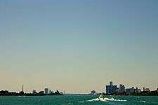
View from Ouellette Avenue in Windsor across the river to Detroit's Guardian and Penobscot Building cityscape. | |
| Country |
|
| State/Province |
|
| Principal cities |
Detroit Windsor |
| Elevation | 600 ft (200 m) |
| Population (2010) | |
| • Metro | 5,700,000 (16th) |
| Time zone | EST (UTC−5) |
The Detroit–Windsor region is an international transborder agglomeration comprising the American city of Detroit, Michigan, the Canadian city of Windsor, Ontario, and the Detroit River between them. The Detroit–Windsor area acts as a critical commercial link straddling the Canada–United States border and has a total population of about 5,700,000.[1] It is North America's largest cross-border conurbation.
The Detroit–Windsor area covers the southeastern Michigan counties of St. Clair, Macomb, Lapeer, Genesee, Livingston, Oakland, Washtenaw, Monroe and Wayne; as well as the Southern Ontario City of Windsor and counties of Essex, Lambton, and Kent.
Overview

The Detroit–Windsor region is not recognized formally as a single metropolitan area by either the U.S. or Canadian government. If it were, the region would be the eighth most populous urban region in North America.[2] Nevertheless, the communities have been historically tied by several partnerships and agreements, including the Detroit and Windsor Tunnel Corporation,[3] the firm that is owned equally by the City of Detroit and City of Windsor and operates the tunnel. The cities are historically linked through the rise of the auto industry in both countries due to the U.S.-Canadian Auto Pact in the 1960s, and share geopolitical concerns affecting transportation and shared resources, such as the Detroit River.[4] Many federal, state and provincial bi-national agreements affecting trade and border security also link the region. Today, increasing governmental co-operation is being formalized. On June 15, 2012, the construction of a new bridge between Windsor and Detroit was announced in the two cities by Canadian Prime Minister Stephen Harper, Transport Minister Denis Lebel and Michigan Governor Rick Snyder. The bridge announcement was a long-anticipated formalization of a new partnership between Canada and Michigan, with Canada paying the entire Michigan share of the new bridge, including a new interchange with Interstate-75. The joint Royal Canadian Mounted Police and U.S. Coast Guard Shiprider program of marine border security are examples.[5] The increasing interdependence of Detroit–Windsor was recognized by U.S. regional business and government in 2007 when Windsor Mayor Eddie Francis was invited to take part in, and speak at, the annual Mackinac Policy Conference, a committee of regional business and political leaders, developed to address the economic and quality of life issues that matter most to Southeast Michigan.[6]
Economy

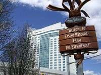
Detroit is home to the Big Three automobile companies. As a result, Windsor is home to the Chrysler Canada Headquarters and car plants for two of the "Big Three". While the inner city of Detroit has experienced economic difficulties over the years, the affluent suburbs are magnets for immigrants, wealth, and population growth. Windsor's economy is reliant on the automotive industry, but has diversified. As an example, Caesars Windsor casino, the largest in Canada, attracts visitors from the Metro Detroit region. In fact, Kwame Kilpatrick stated that Detroit is transitioning "from a manufacturing economy to a casino economy" in his re-election campaign.[7]
Moreover, Windsor's economy has continued to diversify with several hundred green-energy jobs having been created as of June 2011. More capital investment in the city is expected, especially in the aerospace and air cargo industry. Windsor Airport is currently undergoing a major expansion, with an aircraft maintenance and repair hangar being constructed, as well as cargo facilities for air to rail/road transport.
Many people commute across the Detroit–Windsor International border daily. Professions identified in the 1988 Free Trade Act are permitted TN Visas for legal work in the United States and Canada. As an example, over 5,000 Windsor residents work in the healthcare industry in Metro Detroit; as such, the industry is one of Windsor's largest indirect employers. One of the largest U.S. law firms, Miller, Canfield, Paddock and Stone P.L.C., has offices in both Windsor and Detroit.
A 2004 Border Transportation Partnership study showed that 257,000 jobs in Michigan and $13 billion in annual production depend on the Detroit–Windsor international border crossing.[8] With many new businesses in the suburbs, the region is competitive in emerging technologies including biotechnology, nanotechnology, information technology, and hydrogen fuel cell development.
Demographics
Together, the two metropolitan areas have a population of almost 6,000,000 people, with 5.4 million[9] in the Detroit area, 375,000 people in Essex County [10] (Windsor), 125,000 in Lambton County (Sarnia), and 110,000 in Chatham-Kent, Ontario.[11] It is the second largest border region in the world, after Kinshasa-Brazzaville in Central Africa, with some 5,700,000 people living in its metropolitan area).[12] The Detroit side contains over one-half of the population of Michigan, whereas Windsor and Sarnia contain only two percent of Ontario's population. An estimated 46 million people, nearly 16% of the U.S. population, live within a 480 km (300 mi) radius of the area, with other metropolitan areas within this radius, such as Toronto, Ontario; Hamilton, Ontario; Buffalo, New York; Cleveland, Ohio; Akron, Ohio; Toledo, Ohio; Columbus, Ohio; Cincinnati, Ohio; Northern Kentucky; Grand Rapids, Michigan; London, Ontario; Regional Municipality of Waterloo, Ontario; Flint, Michigan; Saginaw, Michigan; Milwaukee, Wisconsin, and Chicago, Illinois.[13]
While about four-fifths of the population of Metro Detroit lives outside the city itself, Windsor has a balanced population between the city of Windsor itself and the rest of Essex County. There are over 50 different communities within Metro Detroit, all ranging in population from the hundreds to the hundreds of thousands. Windsor's CMA, however, has only eight official municipalities (with Windsor being a recent separated municipality), consisting of LaSalle (pop. 25,000), Tecumseh (pop. 25,000), Amherstburg (pop. 20,000), Lakeshore (pop. 30,000) and of course Windsor (pop. 226,000). Within each of these municipalities lie several smaller communities that serve as bedroom communities for Windsor's working force. Windsor has recently been given a boost by immigration. However, Detroit itself has less than half of its peak population.[14]
See also
- Ambassador Bridge
- Detroit–Windsor Tunnel
- Detroit International Riverfront
- Golden Horseshoe
- Gordie Howe International Bridge
- Great Lakes Megalopolis
- Quebec City–Windsor Corridor
- Windsor–Detroit International Freedom Festival
- Detroit Windsor International Film Festival
- Transborder agglomeration
References
- ↑ World Agglomerations Retrieved on May 24, 2009.
- ↑ http://www.perspective.ca/publishing/pictures/Windsor_2006.pdf
- ↑ Detroit & Windsor Tunnel Corporation. Home page (accessed 21 April 2007)
- ↑ U.S. Environmental Protection Agency Detroit River Area of Concern (accessed 21 April 2007).
- ↑ Royal Canadian Mounted Police.Pilot Project Shiprider. 12 September 2005. (accessed 21 April 2007).
- ↑ Mackinac Policy Conference. Agenda. Detroit Regional Chamber of Conference. 30 May 2007. (accessed 21 April 2007).
- ↑ Lessenberry, Jack. "Casino Economy" Jack Lessenberry: Essays and Interviews. 29 November 2005. (Accessed 2 May 2007).
- ↑ Detroit Regional Chamber (2006) Detroit/Windsor Border Update: Part I-Detroit River International Crossing Study
- ↑ "JULY 1, 2005 POPULATION ESTIMATES FOR METROPOLITAN, MICROPOLITAN, AND COMBINED STATISTICAL AREAS (Areas defined by the Office of Management and Budget as of December 2005)". Retrieved 2006-12-05.
- ↑ "2001 Community profiles". Retrieved 2006-12-05.
- ↑ "2001 Community profiles". Retrieved 2006-12-05.
- ↑ http://demo.istat.it/bilmens2006/index.html- ISTAT demographics
- ↑ Cities located close to Detroit.Time and Date world clock distances. Retrieved on September 2, 2007.
- ↑ "Population of the 100 Largest Cities and Other Urban Places in the United States: 1790 to 1990". Retrieved 2007-05-05.
External links
Coordinates: 42°19′21″N 83°02′48″W / 42.3225°N 83.0468°W


