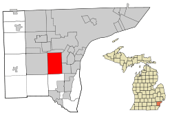
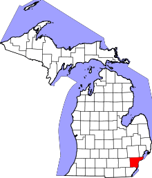
Taylor, Michigan
| Taylor, Michigan | |
|---|---|
| City | |
|
The blue arches of the Telegraph/94 bridge | |
 | |
| Coordinates: 42°14′27″N 83°16′11″W / 42.24083°N 83.26972°W | |
| Country | United States |
| State | Michigan |
| County | Wayne |
| Organized | 1847 (township) |
| Incorporated | 1968 (city) |
| Government | |
| • Type | Mayor-Council government |
| • Mayor | Rick Sollars |
| Area[1] | |
| • Total | 23.64 sq mi (61.23 km2) |
| • Land | 23.60 sq mi (61.12 km2) |
| • Water | 0.04 sq mi (0.10 km2) |
| Elevation | 614 ft (187 m) |
| Population (2010)[2] | |
| • Total | 63,131 |
| • Estimate (2012[3]) | 62,114 |
| • Density | 2,675.0/sq mi (1,032.8/km2) |
| Time zone | Eastern (EST) (UTC-5) |
| • Summer (DST) | EDT (UTC-4) |
| ZIP code | 48180 |
| Area code(s) | 313, 734 |
| FIPS code | 26-79000 |
| GNIS feature ID | 1614609[4] |
| Website | http://www.cityoftaylor.com/ |
Taylor is a city in Wayne County in the U.S. state of Michigan. The population was 63,131 at the 2010 census. Taylor was originally known as Taylor Township and residents of the township voted to incorporate as the City of Taylor in May 1968. Taylor is the 17th most populous city in Michigan and the 543rd largest city in the United States.
Taylor Township was named in honor of Zachary Taylor, a national military hero in the 1840s, who would go on to be elected the twelfth President of the United States in 1849. Taylor Township was organized on March 16, 1847 from 24 square miles (62 km2) that were originally part of Ecorse Township, Michigan. It is also 18 miles (29 km) southwest of Detroit.
Taylor is a member of the Downriver Community. Taylor is home to Southland Shopping Center, Wallside Windows Factory, Taylor Sportsplex,[5] Taylor Meadows Golf Course, Lakes of Taylor Golf Course, Oakwood Heritage Hospital, the Michigan State Police Metro South Post and Wayne County Community College Downriver Campus. Taylor is the birthplace of Hungry Howie's Pizza. Taylor has a large park named Heritage Park that features: ball diamonds, soccer fields, pavilions, grills, picnic tables, restrooms, playground, historic buildings, shops, catch and release fishing pond, 1/3 mile walking path, path system, old growth nature area, park benches, picnic area, playground, plus a petting farm. The park is home to the Taylor South Little League, the Junior League World Series and the Taylor Soccer Club. The Detroit Waza [6] of the Professional Arena Soccer League play their home games at the Taylor Sportsplex. Steve Avery, a major league baseball player, was raised here and graduated from John F. Kennedy High School. Taylor is also the birthplace and home of "Joe C.", sidekick of Kid Rock, who died in 2000. Due to the alleged Southern roots of many of its inhabitants it is sometimes referred to as "Taylortucky." [7][8]
Taylor has been visited by three U.S. presidents: Bill Clinton, George W. Bush, and Barack Obama.
Geography
According to the United States Census Bureau, the city has a total area of 23.64 square miles (61.23 km2), of which 23.60 square miles (61.12 km2) is land and 0.04 square miles (0.10 km2) is water.[1]
Main highways
 I-94 runs east–west through the northern part of the city between Van Born and Ecorse Roads.
 I‑75 travels through the southwest corner of the city.
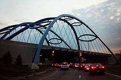
 US 24, which is Telegraph Road, runs north-south through the city center, acting as the main thoroughfare in the city. During the summer of 2005 in preparation for Super Bowl XL in Detroit the following year, a large blue bridge was built at the intersection of Telegraph Road and I-94. It is known as the Gateway Bridge, because it acts as the "gateway to Detroit" for those traveling on I-94 from Detroit Metropolitan Airport to the City of Detroit.
Other main roads
- Eureka Road is an important east-west artery in the city, which holds Taylor's shopping district and bisects I-75.
- Van Born Road forms the northern border of Taylor, shared with Dearborn Heights. Just east of Taylor's city limits, the road curves north and becomes Southfield Freeway.
- Goddard Road runs east-west through the center of the city and holds Taylor's municipal buildings near its intersection with Telegraph.
- Northline Road runs east-west a mile south of Goddard and holds Wayne County Community College, as well as the southern entrance to the Heritage Park
- Allen Road and Pelham Road both form Taylor's eastern border. Allen Road travels north-south as Taylor's border with Southgate and then veers north-east into Allen Park, at which point Taylor's border with Allen Park becomes Pelham Road.
- Inkster Road and Pennsylvania Road form Taylor's western and southern borders, respectively.
Neighboring communities
The City of Taylor is bordered by seven other communities.
 |
Westland | Dearborn Heights | Allen Park | |
| Romulus | |
Southgate | ||
| ||||
| | ||||
| Huron Township | Brownstown Township |
Demographics
| Historical population | |||
|---|---|---|---|
| Census | Pop. | %± | |
| 1970 | 70,020 | — | |
| 1980 | 77,568 | 10.8% | |
| 1990 | 70,811 | −8.7% | |
| 2000 | 65,868 | −7.0% | |
| 2010 | 63,131 | −4.2% | |
| Est. 2015 | 61,568 | [9] | −2.5% |
| U.S. Decennial Census 2011 estimate | |||
2010 census
As of the census[2] of 2010, there were 63,131 people, 24,370 households, and 16,700 families residing in the city. The population density was 2,675.0 inhabitants per square mile (1,032.8/km2). There were 26,422 housing units at an average density of 1,119.6 per square mile (432.3/km2). The racial makeup of the city was 78.0% White, 15.8% African American, 0.5% Native American, 1.8% Asian, 1.3% from other races, and 2.6% from two or more races. Hispanic or Latino of any race were 5.1% of the population.
There were 24,370 households of which 35.3% had children under the age of 18 living with them, 41.4% were married couples living together, 20.4% had a female householder with no husband present, 6.8% had a male householder with no wife present, and 31.5% were non-families. 25.5% of all households were made up of individuals and 9.1% had someone living alone who was 65 years of age or older. The average household size was 2.56 and the average family size was 3.05.
The median age in the city was 36.9 years. 24.7% of residents were under the age of 18; 10.1% were between the ages of 18 and 24; 26.5% were from 25 to 44; 26.1% were from 45 to 64; and 12.8% were 65 years of age or older. The gender makeup of the city was 47.9% male and 52.1% female.
2000 census
As of the census of 2000, there were 65,868 people, 24,776 households, and 17,739 families residing in the city. The population density was 2,789.8 per square mile (1,077.2/km²). There were 25,905 housing units at an average density of 1,097.2 per square mile (423.6/km²). The racial makeup of the city was 86.13% White, 8.75% African American, 0.68% Native American, 1.63% Asian, 0.03% Pacific Islander, 0.75% from other races, and 2.04% from two or more races. Hispanic or Latino of any race were 3.24% of the population.
There were 24,776 households out of which 34.9% had children under the age of 18 living with them, 48.7% were married couples living together, 17.4% had a female householder with no husband present, and 28.4% were non-families. 23.1% of all households were made up of individuals and 7.6% had someone living alone who was 65 years of age or older. The average household size was 2.63 and the average family size was 3.09.
In the city the population was spread out with 27.2% under the age of 18, 9.3% from 18 to 24, 31.0% from 25 to 44, 21.5% from 45 to 64, and 11.0% who were 65 years of age or older. The median age was 34 years. For every 100 females there were 93.2 males. For every 100 females age 18 and over, there were 89.3 males.
The median income for a household in the city was $42,944, and the median income for a family was $48,304. Males had a median income of $41,170 versus $25,999 for females. The per capita income for the city was $19,638. About 8.9% of families and 10.8% of the population were below the poverty line, including 16.3% of those under age 18 and 6.5% of those age 65 or over.
Economy
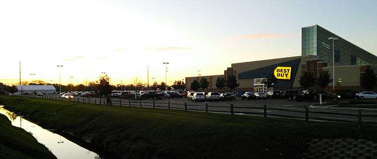
In addition to its schools, the Downriver Campus of the Wayne County Community College District, churches, parks, golf courses, recreation center, library, and the Oakwood Health System’s Heritage Hospital, Taylor also has commercial and industrial sectors, restaurants, and shopping. Southland Shopping Center, a regional shopping mall with over 100 stores, was opened in 1970 at Eureka Road and Pardee Road. Macy’s, JCPenney, Best Buy, Forever 21, Shoe Carnival, and Ulta stores serve as anchors. In addition to Southland Center, the city also features a Walmart superstore, Target superstore, Meijer superstore, Kohl's, Burlington Coat Factory, Dick's Sporting Goods, Jo-Ann, Bed, Bath, and Beyond, Kmart, Kroger, and two Home Depot locations, among many others. In 2014, it was announced that the 80 acre property located at Eureka Road and I-75 which previously held the Gibraltar Trade Center would be redeveloped into a Menards as well as six other retail big box stores.

Taylor is also home to the headquarters of Masco Corporation, the 13th largest publicly traded company in Michigan. The company has been headquartered in Taylor since its foundation in 1929 by Alex Manoogian.
Education

The city is served by the Taylor School District, within which there are two high schools: Truman High School on Beech Daly Road and Kennedy High School on Northline Road.
Other educational facilities include:
- Taylor Preparatory Charter High School - Taylor Prep Official Website
- Taylor Exemplar Academy (National Heritage Academies) - Taylor Exemplar Academy Official Website
- Baptist Park School - Baptist Park School Official Website
- Trillium Academy - Trillium Academy Official Website
- Wayne County Community College District ~ Downriver Campus - WCCCD Official Website
The Roman Catholic Archdiocese of Detroit previously operated St. Cyril Elementary School, St. Pascal Elementary School, and St. Alfred Elementary School in Taylor. The former two merged in 2000 forming Taylor Catholic School, before closing down in 2007. In 2011, the archdiocese announced that St. Alfred would close.
Gallery
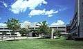 Oakwood Hospital - Taylor, previously known as Heritage Hospital
Notable people
- Steve Avery - MLB pitcher with Atlanta Braves, Boston Red Sox, Cincinnati Reds and Detroit Tigers
- Joe C. - born Joseph Calleja, rapper and part of Kid Rock's band.
- Mike Howe - lead vocals, Metal Church
- Wayne Presley - NHL player with Chicago Blackhawks and Buffalo Sabres
- Baba Rexheb - Albanian-born founder and spiritual leader of America's first Bektashi monastery, located on Northline Avenue in Taylor.
- Mandalynn Carlson - Actress who cast in a Michigan made movie: Machine Gun Preacher starring Gerard Butler.
References
- 1 2 "US Gazetteer files 2010". United States Census Bureau. Retrieved 2012-11-25.
- 1 2 "American FactFinder". United States Census Bureau. Retrieved 2012-11-25.
- ↑ "Population Estimates". United States Census Bureau. Retrieved 2013-06-03.
- ↑ U.S. Geological Survey Geographic Names Information System: Taylor, Michigan
- ↑ "Taylor Sportsplex - Hockey, Soccer, and Activity Center - Taylor, Michigan". taylorsportsplex.com.
- ↑ Professional Arena Soccer League Website
- ↑ Detroit Metro Times Archived January 4, 2014, at the Wayback Machine.
- ↑ Downriver: Close to Detroit, Far from “Taylortucky" August 2012; public radio affiliated with Wayne State University, Michigan
- ↑ "Annual Estimates of the Resident Population for Incorporated Places: April 1, 2010 to July 1, 2015". Retrieved July 2, 2016.
External links
Municipalities and communities of Wayne County, Michigan, United States | ||
|---|---|---|
| Cities |
|  |
| Charter townships | ||
| General law townships | ||
| Unincorporated community | ||
| Footnotes | ‡This populated place also has portions in an adjacent county or counties | |
| Topics |  | |
|---|---|---|
| Detroit | ||
| Municipalities over 80,000 | ||
| Municipalities 40,000 to 80,000 | ||
| Cultural enclaves | ||
| Satellite cities | ||
| Counties in MSA | ||
| Counties in CSA | ||
Coordinates: 42°14′27″N 83°16′11″W / 42.24083°N 83.26972°W