Durham, Maine
| Durham, Maine | |
|---|---|
| Town | |
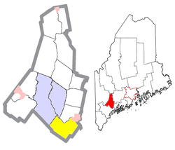 Location of Durham (in yellow) in Androscoggin County and the state of Maine | |
 Durham, Maine Location in the United States | |
| Coordinates: 43°58′21″N 70°7′23″W / 43.97250°N 70.12306°WCoordinates: 43°58′21″N 70°7′23″W / 43.97250°N 70.12306°W | |
| Country | United States |
| State | Maine |
| County | Androscoggin |
| Area[1] | |
| • Total | 39.04 sq mi (101.11 km2) |
| • Land | 38.28 sq mi (99.14 km2) |
| • Water | 0.76 sq mi (1.97 km2) |
| Elevation | 167 ft (51 m) |
| Population (2010)[2] | |
| • Total | 3,848 |
| • Estimate (2012[3]) | 3,886 |
| • Density | 100.5/sq mi (38.8/km2) |
| Time zone | Eastern (EST) (UTC-5) |
| • Summer (DST) | EDT (UTC-4) |
| ZIP code | 04222 |
| Area code(s) | 207 |
| FIPS code | 23-19105 |
| GNIS feature ID | 0582448 |
Durham is a town in Androscoggin County, Maine, United States. The population was 3,848 at the 2010 census. It is included in both the Lewiston-Auburn, Maine Metropolitan Statistical Area and the Lewiston-Auburn, Maine Metropolitan New England City and Town Area.
History
Durham was named after County Durham, England, the ancestral home of the town's first settler.[4]
Geography
According to the United States Census Bureau, the town has a total area of 39.04 square miles (101.11 km2), of which 38.28 square miles (99.14 km2) is land and 0.76 square miles (1.97 km2) is water.[1]
Durham is bordered by Pownal, Auburn, Freeport, New Gloucester, Brunswick, Lewiston, Lisbon Falls, and Topsham.
Durham is considered a "gateway" town because it connects two major Maine communities, the Greater Portland Area with the Lewiston–Auburn Area.
Demographics
| Historical population | |||
|---|---|---|---|
| Census | Pop. | %± | |
| 1790 | 724 | — | |
| 1800 | 1,242 | 71.5% | |
| 1810 | 1,772 | 42.7% | |
| 1820 | 1,562 | −11.9% | |
| 1830 | 1,731 | 10.8% | |
| 1840 | 1,836 | 6.1% | |
| 1850 | 1,886 | 2.7% | |
| 1860 | 1,623 | −13.9% | |
| 1870 | 1,350 | −16.8% | |
| 1880 | 1,253 | −7.2% | |
| 1890 | 1,111 | −11.3% | |
| 1900 | 1,230 | 10.7% | |
| 1910 | 1,625 | 32.1% | |
| 1920 | 1,144 | −29.6% | |
| 1930 | 806 | −29.5% | |
| 1940 | 784 | −2.7% | |
| 1950 | 1,050 | 33.9% | |
| 1960 | 1,086 | 3.4% | |
| 1970 | 1,264 | 16.4% | |
| 1980 | 2,074 | 64.1% | |
| 1990 | 2,842 | 37.0% | |
| 2000 | 3,381 | 19.0% | |
| 2010 | 3,848 | 13.8% | |
| Est. 2014 | 3,908 | [5] | 1.6% |
2010 census
As of the census[2] of 2010, there were 3,848 people, 1,496 households, and 1,143 families residing in the town. The population density was 100.5 inhabitants per square mile (38.8/km2). There were 1,548 housing units at an average density of 40.4 per square mile (15.6/km2). The racial makeup of the town was 97.8% White, 0.3% African American, 0.1% Native American, 0.5% Asian, 0.2% from other races, and 1.0% from two or more races. Hispanic or Latino of any race were 0.8% of the population.
There were 1,496 households of which 33.5% had children under the age of 18 living with them, 63.6% were married couples living together, 7.5% had a female householder with no husband present, 5.3% had a male householder with no wife present, and 23.6% were non-families. 16.6% of all households were made up of individuals and 4% had someone living alone who was 65 years of age or older. The average household size was 2.57 and the average family size was 2.85.
The median age in the town was 41.2 years. 22.3% of residents were under the age of 18; 5.5% were between the ages of 18 and 24; 29.1% were from 25 to 44; 33.8% were from 45 to 64; and 9.3% were 65 years of age or older. The gender makeup of the town was 50.6% male and 49.4% female.
2000 census
As of the census[7] of 2000, there were 3,381 people, 1,226 households, and 980 families residing in the town. The population density was 88.7 people per square mile (34.3/km²). There were 1,257 housing units at an average density of 33.0 per square mile (12.7/km²). The racial makeup of the town was 98.96% White, 0.12% African American, 0.15% Native American, 0.27% Asian, 0.09% from other races, and 0.41% from two or more races. Hispanic or Latino of any race were 0.65% of the population.
There were 1,226 households out of which 38.9% had children under the age of 18 living with them, 70.6% were married couples living together, 5.9% had a female householder with no husband present, and 20.0% were non-families. 12.4% of all households were made up of individuals and 3.0% had someone living alone who was 65 years of age or older. The average household size was 2.75 and the average family size was 3.02.
In the town the population was spread out with 26.9% under the age of 18, 5.2% from 18 to 24, 35.5% from 25 to 44, 25.5% from 45 to 64, and 6.8% who were 65 years of age or older. The median age was 37 years. For every 100 females there were 99.5 males. For every 100 females age 18 and over, there were 99.2 males.
The median income for a household in the town was $53,846, and the median income for a family was $55,028. Males had a median income of $35,174 versus $28,342 for females. The per capita income for the town was $20,883. About 5.9% of families and 6.6% of the population were below the poverty line, including 8.2% of those under age 18 and 9.8% of those age 65 or over.
Voter registration
| Voter Registration and Party Enrollment as of January 2015[8] | |||||
|---|---|---|---|---|---|
| Party | Total Voters | Percentage | |||
| Unenrolled | 1,282 | 40.3% | |||
| Republican | 946 | 29.7% | |||
| Democratic | 772 | 24.2% | |||
| Green Independent | 179 | 5.6% | |||
| Total | 3,179 | 100% | |||
Government
Durham is in the Maine's 2nd US Congressional District, Maine Senate District 22,[9] and Maine House of Representatives District 46.[10]
Education
- Durham Community School is a public school operated by the Durham School Department. The school provides for the education of students in grades K through 8.
- Education of a majority of the students in grades 9 through 12 is provided by Freeport High School.
- High school education is also offered by Lisbon High School, Brunswick High School and Edward Little High School, located in Auburn.
Notable people
- Frank Sandford, founder and leader of an apocalyptic Christian sect known as "The Kingdom"
- Stephen King spent part of his childhood in Durham.
References
- 1 2 "US Gazetteer files 2010". United States Census Bureau. Retrieved 2012-12-16.
- 1 2 "American FactFinder". United States Census Bureau. Retrieved 2012-12-16.
- ↑ "Population Estimates". United States Census Bureau. Retrieved 2013-07-06.
- ↑ Yates, Edgar A.P. (Jun 13, 1928). "Some Maine town names". The Lewiston Daily Sun. p. 4. Retrieved 17 October 2015.
- ↑ "Annual Estimates of the Resident Population for Incorporated Places: April 1, 2010 to July 1, 2014". Retrieved June 4, 2015.
- ↑ "Census of Population and Housing". Census.gov. Retrieved June 4, 2015.
- ↑ "American FactFinder". United States Census Bureau. Retrieved 2008-01-31.
- ↑ http://maine.gov/sos/cec/elec/data/r-e-active.pdf
- ↑ Maine Senate http://legisweb1.mainelegislature.org/wp/senate/senator-information/about-the-35-maine-senate-districts/. Retrieved 4 October 2016. Missing or empty
|title=(help) - ↑ "Maine House Districts". Towns in Each District. Retrieved 4 October 2016.
External links
- Town of Durham, Maine
- Varney, George J. (1886), Gazetteer of the state of Maine. Durham, Maine: Samantha
Municipalities and communities of Androscoggin County, Maine, United States | ||
|---|---|---|
| Cities | 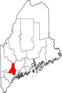 | |
| Towns | ||
| CDPs | ||