Dyer County, Tennessee
| Dyer County, Tennessee | |
|---|---|
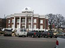 Dyer County Courthouse in Dyersburg | |
|
Location in the U.S. state of Tennessee | |
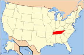 Tennessee's location in the U.S. | |
| Founded | 1823 |
| Named for | Robert Henry Dyer, state legislator[1] |
| Seat | Dyersburg |
| Largest city | Dyersburg |
| Area | |
| • Total | 527 sq mi (1,365 km2) |
| • Land | 512 sq mi (1,326 km2) |
| • Water | 14 sq mi (36 km2), 2.7% |
| Population | |
| • (2010) | 38,335 |
| • Density | 75/sq mi (29/km²) |
| Congressional district | 8th |
| Time zone | Central: UTC-6/-5 |
| Website |
dyercounty |
Dyer County is a county located in the westernmost part of the U.S. state of Tennessee. As of the 2010 census, the population was 38,335.[2] Its county seat is Dyersburg.[3]
Dyer County comprises the Dyersburg, TN Micropolitan Statistical Area.
History
Dyer County was founded by a Private Act of Tennessee, passed on October 16, 1823.[4] The area was part of the territory in Tennessee that was previously legally occupied by Chickasaw Native American people ("Indian Lands").[5]
The county was named for Robert Henry Dyer[6] (circa 1774—1826). Dyer had been an army officer in the Creek War and War of 1812, and a cavalry colonel in the First Seminole War of 1818 before becoming a state senator. He was instrumental in the formation of the counties of Dyer and Madison County, Tennessee.[7]
On April 2, 2006 a severe weather system passed through Dyer County, producing tornadoes that killed 16 in the county and 24 in Tennessee.
Geography
According to the U.S. Census Bureau, the county has a total area of 527 square miles (1,360 km2), of which 512 square miles (1,330 km2) is land and 14 square miles (36 km2) (2.7%) is water.[8]
The county is drained by the Mississippi River, which forms its western boundary. It is in the part of Tennessee called the "Mississippi bottomland".
Dyer County is bisected by U.S. Route 51, the older major highway connecting Memphis with Chicago from south to north. When upgraded to interstate standards, this road will become Interstate 69. To the west, Dyer County is connected to Missouri by Interstate 155 over the Mississippi River, providing the only highway connection, other than those at Memphis, between Tennessee and the states to the west of the river.
Adjacent counties
- Lake County (north)
- Obion County (northeast)
- Gibson County (east)
- Crockett County (southeast)
- Lauderdale County (south)
- Mississippi County, Arkansas (southwest)
- Pemiscot County, Missouri (northwest)
State protected areas
- Bogota Wildlife Management Area
- Moss Island Wildlife Management Area
- Ernest Rice Wildlife Management Area
- Thorny Cypress Wildlife Management Area
- Tigrett Wildlife Management Area (part)
- Tumbleweed Wildlife Management Area (part)
- White Lake Refuge
Major Highways
Demographics
| Historical population | |||
|---|---|---|---|
| Census | Pop. | %± | |
| 1830 | 1,904 | — | |
| 1840 | 4,484 | 135.5% | |
| 1850 | 6,361 | 41.9% | |
| 1860 | 10,536 | 65.6% | |
| 1870 | 13,706 | 30.1% | |
| 1880 | 15,118 | 10.3% | |
| 1890 | 19,878 | 31.5% | |
| 1900 | 23,776 | 19.6% | |
| 1910 | 27,721 | 16.6% | |
| 1920 | 29,983 | 8.2% | |
| 1930 | 31,405 | 4.7% | |
| 1940 | 34,920 | 11.2% | |
| 1950 | 33,473 | −4.1% | |
| 1960 | 29,537 | −11.8% | |
| 1970 | 30,427 | 3.0% | |
| 1980 | 34,663 | 13.9% | |
| 1990 | 34,854 | 0.6% | |
| 2000 | 37,279 | 7.0% | |
| 2010 | 38,335 | 2.8% | |
| Est. 2015 | 37,893 | [9] | −1.2% |
| U.S. Decennial Census[10] 1790-1960[11] 1900-1990[12] 1990-2000[13] 2010-2014[2] | |||
As of the census[15] of 2000, there were 37,279 people, 14,751 households, and 10,458 families residing in the county. The population density was 73 people per square mile (28/km²). There were 16,123 housing units at an average density of 32 per square mile (12/km²). The racial makeup of the county was 85.40% White, 12.86% Black or African American, 0.22% Native American, 0.33% Asian, 0.02% Pacific Islander, 0.43% from other races, and 0.73% from two or more races. 1.16% of the population were Hispanic or Latino of any race.
There were 14,751 households out of which 32.90% had children under the age of 18 living with them, 53.20% were married couples living together, 13.60% had a female householder with no husband present, and 29.10% were non-families. 25.30% of all households were made up of individuals and 10.70% had someone living alone who was 65 years of age or older. The average household size was 2.49 and the average family size was 2.97.
In the county, the population was spread out with 25.70% under the age of 18, 8.70% from 18 to 24, 28.60% from 25 to 44, 23.50% from 45 to 64, and 13.40% who were 65 years of age or older. The median age was 36 years. For every 100 females there were 92.00 males. For every 100 females age 18 and over, there were 88.80 males.
The median income for a household in the county was $32,788, and the median income for a family was $39,848. Males had a median income of $31,182 versus $21,605 for females. The per capita income for the county was $16,451. About 13.00% of families and 15.90% of the population were below the poverty line, including 21.00% of those under age 18 and 17.60% of those age 65 or over.
Media
Radio stations
- Burks Broadcasting [SL100 / Eagle 97.3FM / WTRO-AM & FM]
- WASL-FM SL100: “Everything That Rocks”
- 50,000 watts covering 30 counties in Tennessee, Missouri, Kentucky, Arkansas since 1969
- City of License: Dyersburg, TN
- 500-foot Tower Site: Lenox
- WTNV-FM / Eagle 97.3: "Today’s Country & Your All-Time Favorites”
- 6,000 watts covering 40-45 mile radius of 10 counties in Tennessee, Missouri, & Kentucky since June 2007
- City of License: Tiptonville, TN [Lake County]
- 500-foot Tower Site: Elbridge [Obion County]
- AM1450 & 101.7FM / WTRO: “The Greatest Hits of All Time”
- 1,000 watts covering Dyer County & Northwest Tennessee since 1959
- City of License: Dyersburg, TN
- AM Tower Site: St John Avenue, Dyersburg, TN
- 100-foot Transmitter Site: Burks Place, Dyersburg, TN
- 300-foot Translator Site: Radio Road, Dyersburg, TN
Newspapers
State Gazette – 5 days/week (Sunday & Tuesday-Friday); general news. The paper has served Dyersburg and Northwest Tennessee since 1865.
Communities
City
Dyersburg (county seat)
- Bruce
- Edinburgh
- Gardner Heights
- Lakewood
- Lattawoods
- Milltown
- Pioneer
- Southtown
- The Farms
- Twin Oaks
- Pill Hill
Towns
Newbern
- Crowne Point
- Flower Valley
- Oakview
Unincorporated communities
Civil Districts from 1920 Census
- District 1 - Tigrett
- District 2 - Bonicord
- District 3 - Bruceville
- District 4 - Dyersburg
- District 5 - Hurricane Hill, Millsfield, Nauvoo
- District 6 - Newbern
- District 7 - RoEllen
- District 8 - Tatumville
- District 9 - Churchton, Edgewood, Templeton
- District 10 - Finley, Richwood
- District 11 - Chic, Midway
- District 12 - Fowlkes
- District 13 - Unionville
- District 14 - Rushsbough, Tigertail
- District 15 - Trimble
- District 16 - Bogota, Miston
- District 17 - Lenox
- District 18 - Tannemo
- District 19 - Booths Point, Heloise
- District 20 - Lane
See also
References
- ↑ Carroll Van West, "Dyer County," Tennessee Encyclopedia of History and Culture. Retrieved: 27 June 2013.
- 1 2 "State & County QuickFacts". United States Census Bureau. Retrieved November 29, 2013.
- ↑ "Find a County". National Association of Counties. Retrieved 2011-06-07.
- ↑ "Tennessee State Archives — formation of Dyer county". Retrieved 2010-12-01.
- ↑ Bergeron, Paul H.; Ash, Stephen V.; Keith, Jeanette.Tennesseans and their history. Univ. of Tennessee Press, 1999, p. 78.
- ↑ Gannett, Henry (1905). The Origin of Certain Place Names in the United States. Govt. Print. Off. p. 112.
- ↑ "Tennessee Blue Book — Dyer county" (PDF). Retrieved 2010-12-01.
- ↑ "2010 Census Gazetteer Files". United States Census Bureau. August 22, 2012. Retrieved April 4, 2015.
- ↑ "County Totals Dataset: Population, Population Change and Estimated Components of Population Change: April 1, 2010 to July 1, 2015". Retrieved July 2, 2016.
- ↑ "U.S. Decennial Census". United States Census Bureau. Retrieved April 4, 2015.
- ↑ "Historical Census Browser". University of Virginia Library. Retrieved April 4, 2015.
- ↑ Forstall, Richard L., ed. (March 27, 1995). "Population of Counties by Decennial Census: 1900 to 1990". United States Census Bureau. Retrieved April 4, 2015.
- ↑ "Census 2000 PHC-T-4. Ranking Tables for Counties: 1990 and 2000" (PDF). United States Census Bureau. April 2, 2001. Retrieved April 4, 2015.
- ↑ Based on 2000 census data
- ↑ "American FactFinder". United States Census Bureau. Retrieved 2011-05-14.
External links
| Wikimedia Commons has media related to Dyer County, Tennessee. |
- Dyersburg-Dyer County Chamber of Commerce
- Dyer County Schools
- Dyer County, TNGenWeb – genealogy resources
- Dyer County at DMOZ
 |
Pemiscot County, Missouri | Lake County | Obion County | |
| |
Gibson County | |||
| ||||
| | ||||
| Mississippi County, Arkansas | Lauderdale County | Crockett County |
Municipalities and communities of Dyer County, Tennessee, United States | ||
|---|---|---|
| City | ||
| Towns | ||
| Unincorporated communities | ||
| Footnotes | ‡This populated place also has portions in an adjacent county or counties | |
Coordinates: 36°04′N 89°25′W / 36.06°N 89.41°W