Easton, Maine
| Easton, Maine | |
|---|---|
| Town | |
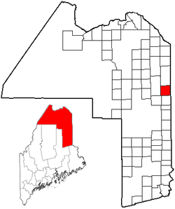 Location of Easton, Maine | |
| Coordinates: 46°39′25″N 67°51′48″W / 46.65694°N 67.86333°W | |
| Country | United States |
| State | Maine |
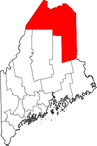
| County | Aroostook |
| Area[1] | |
| • Total | 38.93 sq mi (100.83 km2) |
| • Land | 38.71 sq mi (100.26 km2) |
| • Water | 0.22 sq mi (0.57 km2) |
| Elevation | 814 ft (248 m) |
| Population (2010)[2] | |
| • Total | 1,287 |
| • Estimate (2012[3]) | 1,266 |
| • Density | 33.2/sq mi (12.8/km2) |
| Time zone | Eastern (EST) (UTC-5) |
| • Summer (DST) | EDT (UTC-4) |
| ZIP code | 04740 |
| Area code(s) | 207 |
| FIPS code | 23-21380 |
| GNIS feature ID | 0582459 |
| Website | easton.me.us |
Easton is a town in Aroostook County, Maine, United States. The population was 1,287 at the 2010 census.
History
In 1851 the first known residence in the Easton wilderness was built by Henry Wilson, who had taught school in Presque Isle.[4] When Solomon Bolster arrived in 1854, he joined Henry Wilson and Augustus Rackliffe, its sole residents.[5] In 1855-1856, Noah Barker partitioned the township into 142 lots of 160 acres in size, thereby determining its layout.[4][6] The state opened it for settlement, and on July 26, 1856 it was organized as the Fremont Plantation. A schoolhouse was built in 1858 and the first of several lumber mills was constructed in another year.[4] By 1860 the population was 320.[4] Growth of the population slowed during the Civil War, and the town of Easton was incorporated 1865.[7] Economic growth was slow, evidenced by an 1862 record that taxes should be paid in grain or shingles.[4] The first store was opened in 1863.[4] A starch factory was built in 1877, and a steam shingle mill in 1879.[4] Easton became "one of the greatest potato producing towns in the County. . .[4] The 1880s saw the appearance of the Methodists and the Free Will Baptists--also the Odd Fellows.[4] By 1880 the population was 835; by 1890, 978.[4]
Geography
According to the United States Census Bureau, the town has a total area of 38.93 square miles (100.83 km2), of which 38.71 square miles (100.26 km2) is land and 0.22 square miles (0.57 km2) is water.[1]
Climate
This climatic region is typified by large seasonal temperature differences, with warm to hot (and often humid) summers and cold (sometimes severely cold) winters. According to the Köppen Climate Classification system, Easton has a humid continental climate, abbreviated "Dfb" on climate maps.[8]
Demographics
| Historical population | |||
|---|---|---|---|
| Census | Pop. | %± | |
| 1860 | 320 | — | |
| 1870 | 522 | 63.1% | |
| 1880 | 835 | 60.0% | |
| 1890 | 978 | 17.1% | |
| 1900 | 1,215 | 24.2% | |
| 1910 | 1,300 | 7.0% | |
| 1920 | 1,451 | 11.6% | |
| 1930 | 1,505 | 3.7% | |
| 1940 | 1,605 | 6.6% | |
| 1950 | 1,664 | 3.7% | |
| 1960 | 1,389 | −16.5% | |
| 1970 | 1,305 | −6.0% | |
| 1980 | 1,305 | 0.0% | |
| 1990 | 1,291 | −1.1% | |
| 2000 | 1,249 | −3.3% | |
| 2010 | 1,287 | 3.0% | |
| Est. 2014 | 1,236 | [9] | −4.0% |
2010 census
As of the census[2] of 2010, there were 1,287 people, 536 households, and 352 families residing in the town. The population density was 33.2 inhabitants per square mile (12.8/km2). There were 596 housing units at an average density of 15.4 per square mile (5.9/km2). The racial makeup of the town was 96.6% White, 0.3% African American, 0.9% Native American, 0.1% Asian, 0.1% from other races, and 2.0% from two or more races. Hispanic or Latino of any race were 0.9% of the population.
There were 536 households of which 28.4% had children under the age of 18 living with them, 52.4% were married couples living together, 9.0% had a female householder with no husband present, 4.3% had a male householder with no wife present, and 34.3% were non-families. 29.1% of all households were made up of individuals and 13.1% had someone living alone who was 65 years of age or older. The average household size was 2.40 and the average family size was 2.94.
The median age in the town was 42.5 years. 23.7% of residents were under the age of 18; 6% were between the ages of 18 and 24; 23.4% were from 25 to 44; 31.1% were from 45 to 64; and 15.9% were 65 years of age or older. The gender makeup of the town was 49.7% male and 50.3% female.
2000 census
As of the census[11] of 2000, there were 1,249 people, 524 households, and 355 families residing in the town. The population density was 32.2 people per square mile (12.4/km²). There were 566 housing units at an average density of 14.6 per square mile (5.6/km²). The racial makeup of the town was 97.28% White, 0.32% African American, 1.68% Native American, 0.32% Asian, and 0.40% from two or more races. Hispanic or Latino of any race were 0.56% of the population.
There were 524 households out of which 28.8% had children under the age of 18 living with them, 56.5% were married couples living together, 8.0% had a female householder with no husband present, and 32.1% were non-families. 27.9% of all households were made up of individuals and 13.5% had someone living alone who was 65 years of age or older. The average household size was 2.38 and the average family size was 2.90.
In the town the population was spread out with 23.1% under the age of 18, 8.0% from 18 to 24, 28.3% from 25 to 44, 25.7% from 45 to 64, and 15.0% who were 65 years of age or older. The median age was 40 years. For every 100 females there were 94.2 males. For every 100 females age 18 and over, there were 90.3 males.
The median income for a household in the town was $29,922, and the median income for a family was $36,500. Males had a median income of $27,917 versus $20,735 for females. The per capita income for the town was $15,227. About 7.4% of families and 12.5% of the population were below the poverty line, including 18.8% of those under the age of 18 and 13.5% of those 65 and older.
Places of interest
- Francis Malcolm Science Institute (Planetarium) - P.O. Box 186, U.S. Route 1-A, 04740 - (207) 488-5451
Education
Easton is part of the Easton School System.[12]
Notable people
- Tyler Clark, politician
- Daniel Wathen, Chief Justice of the Maine Supreme Judicial Court
References
- 1 2 "US Gazetteer files 2010". United States Census Bureau. Retrieved 2012-12-16.
- 1 2 "American FactFinder". United States Census Bureau. Retrieved 2012-12-16.
- ↑ "Population Estimates". United States Census Bureau. Retrieved 2013-07-06.
- 1 2 3 4 5 6 7 8 9 10 Wiggin, Edward (1922). History of Aroostook. Presque Isle, ME: Star-Herald Press. pp. 243–249.
- ↑ "An Aroostook Pioneer Solomon Bolster". The Independent. 5 Mar 1903. Retrieved 22 August 2014.
- ↑ Ploch, Louis A (1988). Easton--A Town on the Move. Orono, ME: University of Maine. p. 44.
- ↑ "History". Town of Easton. Retrieved 8 September 2014.
- ↑ Climate Summary for Easton, Maine
- ↑ "Annual Estimates of the Resident Population for Incorporated Places: April 1, 2010 to July 1, 2014". Retrieved June 4, 2015.
- ↑ "Census of Population and Housing". Census.gov. Retrieved June 4, 2015.
- ↑ "American FactFinder". United States Census Bureau. Retrieved 2008-01-31.
- ↑ "Easton School System". Easton School System. Retrieved 2012-05-06.
Coordinates: 46°38′28″N 67°54′34″W / 46.64111°N 67.90944°W