Caribou, Maine
| Caribou, Maine | ||
|---|---|---|
| City | ||
|
Trucks outside a starch factory in October, 1940 | ||
| ||
| Nickname(s): The Most Northeastern City In The United States | ||
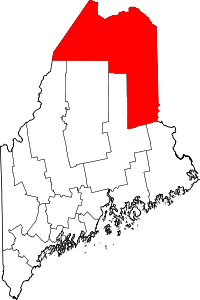
 Caribou, Maine Location in the state of Maine | ||
| Coordinates: 46°51′49″N 67°59′53″W / 46.86361°N 67.99806°WCoordinates: 46°51′49″N 67°59′53″W / 46.86361°N 67.99806°W | ||
| Country | United States | |
| State | Maine | |
| County | Aroostook | |
| Settled | 1824 | |
| Incorporated (town) | April 5, 1859 | |
| Incorporated (city) | February 23, 1967 | |
| Area[1] | ||
| • Total | 80.10 sq mi (207.5 km2) | |
| • Land | 79.26 sq mi (205.3 km2) | |
| • Water | 0.84 sq mi (2.2 km2) | |
| Elevation | 449 ft (137 m) | |
| Population (2010)[2] | ||
| • Total | 8,189 | |
| • Estimate (2015[3]) | 7,816 | |
| • Density | 103.3/sq mi (39.9/km2) | |
| Time zone | Eastern (EST) (UTC-5) | |
| • Summer (DST) | EDT (UTC-4) | |
| ZIP code | 04736 | |
| Area code(s) | 207 | |
| FIPS code | 23-10565 | |
| GNIS feature ID | 0563512 | |
| Website | www.cariboumaine.org | |


Caribou is the second largest city in Aroostook County, Maine, United States. Its population was 8,189 at the 2010 census.
History
Lumbermen and trappers first set up camps in the area in the 1810s. The first settlers came to what is now Caribou in the 1820s. Between 1838 and 1840, the undeclared Aroostook War flared between the United States and Canada, and the Battle of Caribou occurred in December 1838. The dispute over the international boundary delayed settlement of the area until after the signing of the Webster-Ashburton Treaty in 1842. With peace restored, European settlers arrived in gradually-increasing numbers beginning in 1843. From Eaton Plantation and part of half-township H, Caribou was incorporated in 1859 as the town of Lyndon on April 5. In 1869, it annexed Eaton, Sheridan and Forestville plantations. On February 26 of that year its name was changed to Caribou, only to revert to Lyndon on March 9. On February 8, 1877, Caribou was finally confirmed as the town's permanent name. Two enduring mysteries are the reason for the original name of Lyndon, and the reasons for the town's name being subsequently changed back and forth between Lyndon and Caribou. Caribou was the "jumping off" point for a large influx of settlers who immigrated directly from Sweden in 1870-1871, and settled the nearby "Swedish colony." The small town grew throughout the late 19th century, and with the coming of the Bangor and Aroostook Railroad in the 1890s, agricultural exports exploded. This began a boom period which lasted well into the 1960s. Caribou became the largest potato shipping hub in the world, and had many related industries.
Nearby to the northeast, Loring Air Force Base opened in the early 1950s near Limestone, with bomber and tanker aircraft of the Strategic Air Command. It provided a major economic boost to the area, with construction starting in 1947 on "Limestone Army Air Field." Caribou was incorporated as a city in 1967 on February 23, but the area's boom period leveled off in the 1970s as a result of difficulties in its traditional potato industry. That, along with closure of the base in 1994, contributed to a decline in population in the 1980s and 1990s.
In September 1984, Caribou was the lift-off location of the first successful solo balloon crossing of the Atlantic Ocean by Colonel Joseph Kittinger. This flight is memorialized at the Rosie O'Grady Balloon of Peace Park one mile (1.6 km) south of the city on Main Street. This site includes a large replica of Kittinger's balloon.
The Caribou Public Library is a Carnegie library. Designed in the Romanesque Revival style by local architect Schuyler C. Page, it was built in 1911-1912 with a $10,000 grant from industrialist Andrew Carnegie.
Geography
According to the United States Census Bureau, the city has a total area of 80.10 square miles (207.5 km2), of which 79.26 square miles (205.3 km2) is land and 0.84 square miles (2.2 km2) is water.[1] Caribou is located on the northern bend of the Aroostook River before it heads southeast to join the Saint John River just east of Fort Fairfield, Maine.
Caribou is located in the geographical center of Aroostook County, at an elevation of 449 feet (137 m) above sea level. The county is readily accessible by two major highways; Interstate 95 from the south and the Trans-Canada Highway (New Brunswick Route 2) from the north and east. In sparsely populated Aroostook County, Caribou is at the hub of spokes serving the area via U.S. 1 and Maine State routes 89, 161, 164, 205 and 228. In 2013, a bypass was completed just outside the urban limits.
Caribou has a municipal airport, with full east-west and north-south runways. It is primarily used for corporate, hobby, and Civil Air Patrol usage. Northern Maine Regional Airport in Presque Isle serves as the primary hub for air service. Daily flights are scheduled to and from northern Maine with daily connections to Boston’s Logan International Airport. US Airways and New England Air Transport serve the airport.
Seaports are also close by in coastal Maine, New Brunswick, and Quebec. The closest deep-water port is Rivière-du-Loup, Quebec, 120 miles (190 km) north of Caribou, on the St. Lawrence River.
The Eastern Maine Railroad serves Caribou and Aroostook County, also connecting Maine, Vermont and the Canadian provinces of Quebec and New Brunswick and providing a direct rail link between northern Maine; Saint John, New Brunswick; and Montreal, Quebec. Given the city's economic and cultural ties with the Canadian provinces of Quebec and New Brunswick, cross-border partnerships and relationships are often a common facet in many businesses.
Climate
Caribou has a humid continental climate (Köppen Dfb), with cold, snowy winters, and warm summers, and is located in USDA hardiness zone 4b/4a.[4] The monthly daily average temperature ranges from 10.2 °F (−12.1 °C) in January to 65.6 °F (18.7 °C) in July.[5] On average, there are 41 nights annually that drop to 0 °F (−18 °C) or below, and 92 days where the temperature stays below freezing, including 70 days from December through February.[5] Although 1981–2010 averaged 1.9 days annually with highs at or above 90 °F (32 °C), more than 35 percent of all years on record have not seen such temperatures.[5] Extreme temperatures range from −41 °F (−41 °C) on February 1, 1955 up to 96 °F (36 °C) on May 22, 1977 and June 29, 1944.[5]
The average first freeze of the season occurs on September 23, and the last May 15, resulting in a freeze-free season of 130 days; the corresponding dates for measurable snowfall, i.e. at least 0.1 in (0.25 cm), are October 23 and April 25.[5] The average seasonal snowfall for Caribou is approximately 109 inches (2.8 m), while snowfall has ranged from 68.5 inches (1.74 m) in 1961–62 to 196.5 inches (4.99 m) in 2007−08; the record snowiest month was December 1972 with 59.9 inches (1.52 m), while the most snow in one calendar day was 28.6 inches (73 cm) on March 14, 1984.[5] Measurable snowfalls typically occur from late October to early April. A snow depth of at least 10 in (25 cm) is on average seen 76 days per winter, including 63 days from January to March,[6] when the snow pack is typically most reliable.
| Climate data for Caribou Municipal Airport, Maine (1981–2010 normals, extremes 1939–present) | |||||||||||||
|---|---|---|---|---|---|---|---|---|---|---|---|---|---|
| Month | Jan | Feb | Mar | Apr | May | Jun | Jul | Aug | Sep | Oct | Nov | Dec | Year |
| Record high °F (°C) | 53 (12) |
59 (15) |
75 (24) |
86 (30) |
96 (36) |
96 (36) |
95 (35) |
95 (35) |
92 (33) |
82 (28) |
68 (20) |
58 (14) |
96 (36) |
| Average high °F (°C) | 19.5 (−6.9) |
23.9 (−4.5) |
33.9 (1.1) |
47.8 (8.8) |
62.5 (16.9) |
71.5 (21.9) |
76.0 (24.4) |
74.3 (23.5) |
65.4 (18.6) |
52.0 (11.1) |
38.3 (3.5) |
26.2 (−3.2) |
49.28 (9.6) |
| Average low °F (°C) | 0.8 (−17.3) |
4.2 (−15.4) |
15.2 (−9.3) |
29.5 (−1.4) |
40.5 (4.7) |
49.8 (9.9) |
55.2 (12.9) |
52.9 (11.6) |
44.5 (6.9) |
34.6 (1.4) |
24.7 (−4.1) |
10.3 (−12.1) |
30.18 (−1.02) |
| Record low °F (°C) | −37 (−38) |
−41 (−41) |
−28 (−33) |
−4 (−20) |
18 (−8) |
30 (−1) |
36 (2) |
34 (1) |
23 (−5) |
14 (−10) |
−8 (−22) |
−31 (−35) |
−41 (−41) |
| Average precipitation inches (mm) | 2.71 (68.8) |
2.21 (56.1) |
2.51 (63.8) |
2.66 (67.6) |
3.33 (84.6) |
3.48 (88.4) |
4.08 (103.6) |
3.76 (95.5) |
3.32 (84.3) |
3.53 (89.7) |
3.63 (92.2) |
3.27 (83.1) |
38.49 (977.7) |
| Average snowfall inches (cm) | 25.2 (64) |
22.2 (56.4) |
18.3 (46.5) |
7.4 (18.8) |
0.5 (1.3) |
0 (0) |
0 (0) |
0 (0) |
0.1 (0.3) |
1.6 (4.1) |
10.5 (26.7) |
22.9 (58.2) |
108.7 (276.3) |
| Average precipitation days (≥ 0.01 in) | 14.5 | 11.7 | 12.6 | 12.8 | 14.0 | 13.5 | 14.2 | 13.0 | 11.8 | 13.1 | 14.3 | 14.3 | 159.8 |
| Average snowy days (≥ 0.1 in) | 14.2 | 10.8 | 9.7 | 4.9 | 0.4 | 0 | 0 | 0 | 0.1 | 1.2 | 7.4 | 12.4 | 61.1 |
| Source: NOAA[5][6] | |||||||||||||
Industry
In Caribou and throughout Aroostook County, the two major agricultural crops are potato and broccoli. Area farmers annually plant approximately 60,000 acres (240 km2) of potatoes. The chief varieties are Russet Burbank, Superior, Shepody and Atlantic. Aroostook County is renowned for its round white potatoes. The potato crop is used for seed, table stock, and processed potato products. Aroostook County is the largest grower of broccoli on the East Coast.
Other important agricultural crops grown in Caribou include blueberries, hay, oats, and alternative crops on a smaller scale. Cattle and dairy farming are a growing segment of the agricultural landscape. The high volume of activity results in the growth of related agri-business. Farm implement sales and services and the development of several area processing plants are examples of the influence agriculture has on the local economy.
Other employers include light manufancturers, information technology companies, and the woods products industry. The Loring Commerce Center is located four miles from Caribou and has several major employers, including the Maine Military Authority (200 employees) which restores military and municipal heavy equipment, the Defense Finance Accounting Service (600 employees) which handles accounting and payroll for the armed services, and Job Corps (300 employees). Caribou is also the service hub for central Aroostook County.
Demographics
| Historical population | |||
|---|---|---|---|
| Census | Pop. | %± | |
| 1860 | 297 | — | |
| 1870 | 1,410 | 374.7% | |
| 1880 | 2,756 | 95.5% | |
| 1890 | 4,087 | 48.3% | |
| 1900 | 4,758 | 16.4% | |
| 1910 | 5,377 | 13.0% | |
| 1920 | 6,018 | 11.9% | |
| 1930 | 7,248 | 20.4% | |
| 1940 | 8,218 | 13.4% | |
| 1950 | 9,923 | 20.7% | |
| 1960 | 12,464 | 25.6% | |
| 1970 | 10,419 | −16.4% | |
| 1980 | 9,916 | −4.8% | |
| 1990 | 9,415 | −5.1% | |
| 2000 | 8,312 | −11.7% | |
| 2010 | 8,189 | −1.5% | |
| Est. 2015 | 7,816 | [7] | −4.6% |
| U.S. Decennial Census | |||
2010 census
As of the census[2] of 2010, there were 8,189 people, 3,559 households, and 2,206 families residing in the city. The population density was 103.3 inhabitants per square mile (39.9/km2). There were 3,914 housing units at an average density of 49.4 per square mile (19.1/km2). The racial makeup of the city was 98.2% White, 0.0% African American, 1.4% Native American, 0.7% Asian, 0.2% from other races, and 0.2% from two or more races. Hispanic or Latino of any race were 0.01% of the population.
There were 3,559 households of which 27.5% had children under the age of 18 living with them, 46.5% were married couples living together, 11.4% had a female householder with no husband present, 4.0% had a male householder with no wife present, and 38.0% were non-families. 32.0% of all households were made up of individuals and 13.8% had someone living alone who was 65 years of age or older. The average household size was 2.26 and the average family size was 2.82.
The median age in the city was 44 years. 21.2% of residents were under the age of 18; 7.1% were between the ages of 18 and 24; 23.2% were from 25 to 44; 29.3% were from 45 to 64; and 19.3% were 65 years of age or older. The gender makeup of the city was 48.0% male and 52.0% female.
2000 census
As of the census[8] of 2000, there were 8,312 people, 3,517 households, and 2,324 families residing in the city. The population density was 104.8 people per square mile (40.5/km²). There were 3,858 housing units at an average density of 48.7 per square mile (18.8/km²). The racial makeup of the city was 99.22% White, 0.01% African American, 1.48% Native American, 0.91% Asian, 0.07% Pacific Islander, 0.08% from other races, and 0.0% from two or more races. Hispanic or Latino of any race were 0.46% of the population.
There were 3,517 households out of which 27.7% had children under the age of 18 living with them, 52.9% were married couples living together, 9.7% had a female householder with no husband present, and 33.9% were non-families. 28.7% of all households were made up of individuals and 13.1% had someone living alone who was 65 years of age or older. The average household size was 2.32 and the average family size was 2.84.
In the city the population was spread out with 22.5% under the age of 18, 6.6% from 18 to 24, 27.3% from 25 to 44, 26.2% from 45 to 64, and 17.6% who were 65 years of age or older. The median age was 41 years. For every 100 females there were 93.2 males. For every 100 females age 18 and over, there were 88.8 males.
The median income for a household in the city was $29,485, and the median income for a family was $38,378. Males had a median income of $29,202 versus $20,737 for females. The per capita income for the city was $16,061. About 8.4% of families and 12.4% of the population were below the poverty line, including 13.7% of those under age 18 and 11.9% of those age 65 or over.
Education
- Hilltop Elementary School, serving kindergarten through the second grade.
- Teague Park School, serving the third and the fourth grades as well as two pre-school classrooms.
- Caribou Middle School, serving the fifth through eighth grades.
- Caribou High School
- Loring Job Corps, a federal vocational and technical school located four miles northeast of Caribou at the Loring Commerce Center.
Recreation
Caribou has over a dozen cross-country ski trails with varied scenery and terrain within a one-hour drive of the city. It has two municipal cross-country ski venues; one within the urban limits which has lights for night skiing as well as a visitors center, and a lengthier venue two miles (3 km) outiside the urban limits. Both are consistently well-groomed for skate and classical skiing, and accept donations for usage. The Maine Winter Sports Center is headquartered in Caribou. It is the premier outdoor sports organization in the state. MWSC is active in Caribou's recreational life during all four seasons and sponsors numerous events, including a Ski Dash, Youth Ski Festival, and the Caribou Mile road race. Aroostook County is widely known by sports enthusiasts for its well-groomed extensive snowmobile trail system; Caribou maintains 170 miles (270 km) of Aroostook County’s 1,600-mile (2,600 km) snowmobile trail system. A major tourist destination for snowmobile enthusiasts throughout the country, who take advantage of the more than 1,600 miles (2,600 km) of groomed snowmobile trails, which have been rated the third best in the nation. Snowmobilers can venture out every day, choose a variety of routes and with the number of loop trails never cross the same trail twice. Many county communities are located on the Canada–US border, making international travel by snowmobile convenient. Running through the heart of Aroostook County is the Northeast Snowmobile Trail (NEST), and International Snowmobile Trail System linking Maine, New Hampshire, Vermont, and the Province of Quebec.
In 2008, the city finished construction on a large, multi-use recreation, wellness, and community center, which was attached to the existing recreation center. This project is designed to also include a large indoor swimming pool and a fitness center. The construction is being completed in phases.
Other recreational options include an excellent 9-hole golf course, multi-use hiking/biking/ATV trails, a four screen movie theater, a frisbee golf course, a roller skating rink, Spud Speedway (the area's only race track), a bowling alley, The Maine Dance Academy, and several excellent parks. Goughan's Berry Farm includes miniature golf, a petting zoo, a carousel, ice cream, and a corn maze in the fall. The community completed construction of a new outdoor tennis complex in 2009, to complement the existing courts at Teague Park.
Public safety
Caribou's Public Safety is served 24/7/365 by the professionals of the Caribou Fire and Ambulance Dept. and the Caribou Police Dept.
Caribou Fire and Ambulance Department is a combination full-time, paid call and volunteer fire dept. Caribou Fire and Ambulance Dept. apparatuses include First Out Engine 1, 2 Pumper Tankers (Tanker 2 and Tanker 4), Ladder 3, Rescue 6, Utility Pickup 7, Incident Command 5, 1 Snowmobile, 1 ATV, (used by both police and fire), 5 Ambulances, 2 Fixed Wing Aircraft (courtesy FreshAir, Inc).
Caribou Fire and Ambulance Department is staffed by 15 Full-Time Firefighter/Paramedics, one Full-Time Chief and approx. 30 Paid Call / Volunteer Firefighter/EMT/Paramedics. Full-Time personnel work a 24 on and 48 off schedule. Each shift is covered by one Captain and 4 firefighter/paramedics.
Services provided are Fire prevention, suppression, medical emergency response, Critical Care Air and Ground transfers, Local and Long Distant transfers from one health care facility to another, high angle and low angle rescues, HAZ-MAT, vehicle extrication, and health education.
Media
Caribou is served by WAGM-TV, a CBS affiliate located in Presque Isle, which is the only full-power commercial television station north of Bangor. Residents of Caribou receive the Maine Public Broadcasting Network, a PBS affiliate, over WMEM-TV, as well as the CBC from Canada. Most residents subscribe to Dish Network, DIRECTV or Time Warner Cable. The city is also home to two radio stations: WCXU 97.7 FM, and WFST 600 AM, a Christian station. In addition, listeners can receive other radio stations in northern Maine, Western New Brunswick and Eastern Quebec. They include CJEM 92.7 FM, CIKX 93.5 FM, CBAL-FM-5 94.3 FM, WQHR 96.1 FM, WBPW 96.9 FM, CBAM 99.5 FM, CBAF 100.3 FM, CFAI-1 101.1 FM, WOZI 101.9 FM, CBZC 103.3 FM, CFAI-1 105.1 FM, WMEM 106.1 FM, CIBM 107.1 FM and WEGP 1390 AM. A weekly newspaper, the Aroostook Republican, is published in Caribou. Home delivery of the daily newspaper out of Bangor, the Bangor Daily News, is also available.
Arts and culture
The Caribou Performing Arts Center draws acts and shows from all over the United States and Canada. Caribou also has a thriving music program centered around the Caribou Music Department. Music education has been a vital part of the education system in Caribou for years.
Caribou is also home to Echoes magazine, a quarterly publication about rural culture and heritage focused primarily on northern Maine. It recently marked its 20th anniversary, and is read throughout the United States. In addition, the Caribou Choral Society has performed concerts in Aroostook County for the last 35 years, and consists of performers from throughout the northern Maine/western New Brunswick region.
Sites of interest
- Caribou Historical Society & Museum
- Caribou Performing Arts Center
- Nylander Museum -- Northern Maine's Natural History Museum
- Caribou Ambulance and Fire Department
- Gray Memorial United Methodist Church and Parsonage
- McElwain House
Notable people
- Donald Collins, four-term state senator
- Patricia M. Collins, two-term mayor of Caribou and civic leader
- Samuel Collins, State Senator and Supreme Judicial Court Justice
- Susan Collins, U.S. senator
- Peter Edgecomb, state senator
- Roland Gammon, writer
- Jessica Meir, NASA astronaut[9]
- Max Whittier, California oil mogul
- Wallace Hardison, Union Oil co-founder
References
- 1 2 "US Gazetteer files 2010". United States Census Bureau. Archived from the original on 2012-07-14. Retrieved 2012-11-23.
- 1 2 "American FactFinder". United States Census Bureau. Retrieved 2012-11-23.
- ↑ "State & County QuickFacts". United States Census Bureau. Retrieved 2016-05-25.
- ↑ United States Department of Agriculture. United States National Arboretum. USDA Plant Hardiness Zone Map [Retrieved 2015-02-25].
- 1 2 3 4 5 6 7 "NowData – NOAA Online Weather Data". National Oceanic and Atmospheric Administration. Retrieved 2015-02-25.
- 1 2 "Station Name: ME CARIBOU MUNI AP". National Oceanic and Atmospheric Administration. Retrieved 2015-02-25.
- ↑ "Annual Estimates of the Resident Population for Incorporated Places: April 1, 2010 to July 1, 2015". Retrieved July 2, 2016.
- ↑ "American FactFinder". United States Census Bureau. Archived from the original on 2013-09-11. Retrieved 2008-01-31.
- ↑ National Aeronautics and Space Administration. "2013 Astronaut Class". NASA. Archived from the original on June 21, 2013. Retrieved July 22, 2013.
- Varney, George J. (1886). "Gazetteer of the state of Maine. Caribou". Boston: Russell.
External links
| Wikivoyage has a travel guide for Caribou. |
- City of Caribou, Maine
- Caribou 2009 Sesquicentennial Celebration
- Caribou Children's Discovery Museum
- Caribou Public Library
- Caribou Public Library -- a Carnegie Library
- Caribou Chamber of Commerce & Industry
- Map of Caribou, Maine, ca. 1870, from the Maine Memory Network
- Caribou Fire and Ambulance Dept.
Augusta (capital) | |
| Topics |
|
| Society |
|
| Regions | |
| Counties | |
| Cities | |
| Largest towns | |