Emmeram, Kansas
| Emmeram, Kansas | |
|---|---|
| Unincorporated community | |
 KDOT map of Ellis County (legend) | |
 Emmeram  Emmeram | |
| Coordinates: 38°57′31″N 99°07′56″W / 38.95861°N 99.13222°WCoordinates: 38°57′31″N 99°07′56″W / 38.95861°N 99.13222°W | |
| Country | United States |
| State | Kansas |
| County | Ellis |
| Elevation | 2,005 ft (611 m) |
| Time zone | Central (CST) (UTC-6) |
| • Summer (DST) | CDT (UTC-5) |
| ZIP code | 67640 |
| Area code(s) | 785 |
| GNIS feature ID | 484724 [1] |
Emmeram is an unincorporated community in Herzog Township, Ellis County, Kansas, United States.[2]
History
In 1899, Catholic parishioners from nearby Herzog established a new parish six miles to the north and began construction of Sacred Heart Church, which they completed in 1901.[3] Originally named Norddorf, the community was renamed Emmeram after Emmeram Kausler, the church pastor.[4] The community grew to include two schools, and a town plot was filed in 1902, but the town was never built.[5] A post office operated in Emmeram from 1903 to 1904.[6]
Geography
Emmeram is located at 38°57′31″N 99°07′56″W / 38.95861°N 99.13222°W (38.9586225, -99.1323179) at an elevation of 2,005 feet (611 m).[1] It lies approximately one-half mile northeast of Walker Creek, part of the Smoky Hill River watershed, in the Smoky Hills region of the Great Plains.[7][8] Emmeram is roughly 5.5 miles (9 km) north of Interstate 70 and 11 miles (18 km) northeast of Hays, the county seat.[8]
Transportation
Emmeram lies at the intersection of two unpaved county roads, Emmeram Road, which runs east-west, and 350th Avenue, which runs north-south.[8]
References
- 1 2 "US Board on Geographic Names". United States Geological Survey. 2007-10-25. Retrieved 2008-01-31.
- ↑ "General Highway Map - Ellis County, Kansas" (PDF). Kansas Department of Transportation. 1978. Retrieved 2010-12-18.
- ↑ Dreiling, B. M. (1999) [1926], Golden Jubilee of German-Russian Settlements - Emmeram, The KSGenWeb Project, retrieved 2010-08-29
- ↑ "Ellis County, Kansas - City of Emmeram". The KSGenWeb Project. Retrieved 2010-08-29.
- ↑ "Homesteading in Ellis County - Emmeram". Kansas Heritage Project. Fort Hays State University. Retrieved 2010-08-29.
- ↑ "Kansas Post Offices, 1828-1961 (archived)". Kansas Historical Society. Archived from the original on October 9, 2013. Retrieved 9 June 2014.
- ↑ "2003-2004 Official Transportation Map" (PDF). Kansas Department of Transportation. 2003. Retrieved 2010-12-18.
- 1 2 3 "General Highway Map - Ellis County, Kansas" (PDF). Kansas Department of Transportation. 2010-06-01. Retrieved 2010-12-18.
Municipalities and communities of Ellis County, Kansas, United States | ||
|---|---|---|
| Cities | 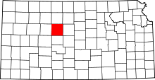 | |
| CDPs | ||
| Unincorporated communities | ||
| Ghost towns | ||
| Townships | ||