Eva, Alabama
| Eva, Alabama | |
|---|---|
| Town | |
 Location in Morgan County and the state of Alabama | |
| Coordinates: 34°19′30″N 86°44′51″W / 34.32500°N 86.74750°W | |
| Country | United States |
| State | Alabama |
| County | Morgan |
| Area | |
| • Total | 2.9 sq mi (7.6 km2) |
| • Land | 2.9 sq mi (7.6 km2) |
| • Water | 0 sq mi (0 km2) |
| Elevation | 1,122 ft (342 m) |
| Population (2010) | |
| • Total | 519 |
| • Density | 169.3/sq mi (64.6/km2) |
| Time zone | Central (CST) (UTC-6) |
| • Summer (DST) | CDT (UTC-5) |
| ZIP code | 35621 |
| Area code(s) | 256 |
| FIPS code | 01-24688 |
| GNIS feature ID | 0118060 |
Eva is a town in Morgan County, Alabama, and is included in the Decatur Metropolitan Area, as well as the Huntsville-Decatur Combined Statistical Area. As of the 2010 census, the population of the town is 519, up from 491 in 2000.
Eva incorporated in 1963.[1]
Geography
Eva is located at 34°19′31″N 86°44′52″W / 34.32528°N 86.74778°W (34.325209, -86.747722).[2]
According to the U.S. Census Bureau, the town has a total area of 2.9 square miles (7.5 km2), all land.
Demographics
| Historical population | |||
|---|---|---|---|
| Census | Pop. | %± | |
| 1970 | 146 | — | |
| 1980 | 185 | 26.7% | |
| 1990 | 438 | 136.8% | |
| 2000 | 491 | 12.1% | |
| 2010 | 519 | 5.7% | |
| Est. 2015 | 511 | [3] | −1.5% |
| U.S. Decennial Census[4] 2013 Estimate[5] | |||
As of the census[6] of 2000, there were 491 people, 194 households, and 152 families residing in the town. The population density was 168.0 people per square mile (64.9/km2). There were 213 housing units at an average density of 72.9 per square mile (28.2/km2). The racial makeup of the town was 98.37% White, 0.20% Native American, and 1.43% from two or more races. 0.41% of the population were Hispanic or Latino of any race.
There were 194 households out of which 31.4% had children under the age of 18 living with them, 68.0% were married couples living together, 7.7% had a female householder with no husband present, and 21.6% were non-families. 18.6% of all households were made up of individuals and 7.7% had someone living alone who was 65 years of age or older. The average household size was 2.53 and the average family size was 2.91.
In the town the population was spread out with 21.6% under the age of 18, 7.7% from 18 to 24, 29.9% from 25 to 44, 26.3% from 45 to 64, and 14.5% who were 65 years of age or older. The median age was 40 years. For every 100 females there were 98.8 males. For every 100 females age 18 and over, there were 89.7 males.
The median income for a household in the town was $38,958, and the median income for a family was $45,781. Males had a median income of $32,159 versus $21,875 for females. The per capita income for the town was $19,069. About 7.2% of families and 6.7% of the population were below the poverty line, including 3.2% of those under age 18 and 13.2% of those age 65 or over.
Notable people
- Edsel Ford, poet
- Patrick McCauley, journalist, editor of The Huntsville Times from 1966 to 1994; interred at Eva Cemetery
References
- ↑ http://www.encyclopediaofalabama.org/article/h-3497
- ↑ "US Gazetteer files: 2010, 2000, and 1990". United States Census Bureau. 2011-02-12. Retrieved 2011-04-23.
- ↑ "Annual Estimates of the Resident Population for Incorporated Places: April 1, 2010 to July 1, 2015". Retrieved July 2, 2016.
- ↑ "U.S. Decennial Census". Census.gov. Archived from the original on May 11, 2015. Retrieved June 6, 2013.
- ↑ "Annual Estimates of the Resident Population: April 1, 2010 to July 1, 2013". Retrieved June 3, 2014.
- ↑ "American FactFinder". United States Census Bureau. Archived from the original on September 11, 2013. Retrieved 2008-01-31.
Coordinates: 34°19′31″N 86°44′52″W / 34.325209°N 86.747722°W
Municipalities and communities of Morgan County, Alabama, United States | ||
|---|---|---|
| Cities | 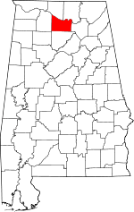 | |
| Towns | ||
| Unincorporated communities | ||
| Ghost town | ||
| Footnotes | ‡This populated place also has portions in an adjacent county or counties | |