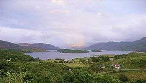
Extreme points of Scotland
This is a list of the extreme points and extreme elevations in Scotland.
The northernmost and westernmost points of Scotland coincide with those of the UK (both for the mainland and including the islands).
General
- Northernmost point – Out Stack (Oosta), Shetland at 60°51′N 0°52′W / 60.850°N 0.867°W
- Northernmost settlement – Skaw, Unst, Shetland at 60°49′N 0°47′W / 60.817°N 0.783°W
- Southernmost point – Mull of Galloway, Wigtownshire at 54°38′N 4°52′W / 54.633°N 4.867°W
- Southernmost settlement – Cairngaan, Wigtownshire at 54°38′N 4°54′W / 54.633°N 4.900°W
- Westernmost settlement – Caolas, Bhatarsaigh (Vatersay), Outer Hebrides at 56°56′N 7°32′W / 56.933°N 7.533°W
- Easternmost point – Bound Skerry, Out Skerries, Shetland Islands at 60°25′N 0°43′W / 60.417°N 0.717°W
- Easternmost settlement – Bruray, Out Skerries, Shetland Islands at 60°26′N 0°45′W / 60.433°N 0.750°W
Mainland
- Northernmost point – Dunnet Head at 58°40′N 3°22′W / 58.667°N 3.367°W, known also as Easter Head, Caithness, Highland, Scotland
- Northernmost settlement – Skarfskerry, Caithness, Highland, Scotland at 58°39′N 3°15′W / 58.650°N 3.250°W
- Southernmost point – Mull of Galloway, Wigtownshire at 54°38′N 4°52′W / 54.633°N 4.867°W
- Southernmost settlement – Cairngaan, Wigtownshire at 54°38′N 4°54′W / 54.633°N 4.900°W
- Westernmost point – Corrachadh Mòr, Highland at 56°42′N 6°13′W / 56.700°N 6.217°W
The opening of the Skye Bridge on 16 October 1995 means that legally, Skye is part of the British mainland, which - using this definition - makes the westernmost point of mainland Britain a spot 200m south of the Neist Point Lighthouse, Skye, at 57°25′N 6°47′W / 57.417°N 6.783°W
- Westernmost settlement – Grigadale, Highland at 56°43′N 6°11′W / 56.717°N 6.183°W
- Easternmost point – Keith Inch, Aberdeenshire at 57°30′N 1°46′W / 57.500°N 1.767°W
- Easternmost settlement – Peterhead, Aberdeenshire at 57°30′N 1°46′W / 57.500°N 1.767°W
Centre point
- Between Blair Atholl and Dalwhinnie, Perthshire (56°49′0.257″N 4°11′2.267″W / 56.81673806°N 4.18396306°W; grid reference NN6678471599) [1]
Schiehallion, a mountain in Perthshire, is sometimes described as the centre of Scotland.
However, 2002 studies by the Ordnance Survey pinpointed the centres more precisely, and it is their results that are quoted here. However, this is obviously dependent on whether or not Scotland's islands are included, and there is more than one way to measure it.
Elevation extremes
- Scotland: Ben Nevis (1,344 metres)
The ten tallest mountains in the UK are all found in Scotland.
Wanlockhead claims to be the highest settlement in Scotland.
Many points are on, or near sea level, but due to high rainfall, there are no natural dry pieces of land below sea level - see rivers and lochs below.
Rivers and lochs

- Main articles
The longest river in Scotland is the River Tay (117 mi, 188 km).
The largest (freshwater) loch in Scotland is:
- Scotland: Loch Lomond (27.46 sq mi, 71.12 km²)
The deepest freshwater loch is Loch Morar with a maximum depth of 309 metres (Loch Ness is second at 228 metres deep).
Notes about Rockall
Rockall is claimed by several countries, including the UK (as part of Scotland's Outer Hebrides).
1 If Rockall is not considered part of the UK, Soay, St Kilda, west of the Outer Hebrides, is the westernmost point.
2The village on Hirta, St Kilda was abandoned in 1930, and was until then the westernmost settlement in Scotland. The island now has a military base, and is staffed during the summer months.
See also
References
- ↑ "Brave hearts of Scotland". BBC. 2002-10-24. Retrieved 2010-01-04.
