Geography of Albania
| Continent | Europe |
| Subregion | Southeast Europe |
| Geographic coordinates | 41°00′N 20°00′E / 41.000°N 20.000°E |
| Area - Total - Water |
Ranked 145th 28,748 km2 (11,100 sq mi) 1,350 km2 (520 sq mi) (2.30%) |
| Coastline | 427 km (265 mi) |
| Land boundaries | 657 km (408 mi) |
| Sea boundaries | 316 km (196 mi) |
| River boundaries | 48 km (30 mi) |
| Lake boundaries | 73 km (45 mi) |
| Countries bordered | Greece 212 km (132 mi), Montenegro 186 km (116 mi), Macedonia 181 km (112 mi), Kosovo[a] 112 km (70 mi) |
| Maritime claims | 12 nmi (22.2 km; 13.8 mi) |
| Highest point | Mount Korab, 2,764 m (9,068 ft) |
| Lowest point | Adriatic Sea, 0 m |
| Longest river | Drin River, 335 km (208 mi) |
| Largest inland body of water | Lake Shkodër 530 km2 (200 sq mi) |
| Land Use - Arable land - Permanent crops - Other | 22.59 % 2.81 % 74.60 % (2012 est.) |
| Irrigated Land | 1,884 km2 (727 sq mi) |
| Climate: | Mild temperate; cool, cloudy, wet winters; hot, clear, dry summers; interior is cooler and wetter |
| Terrain: | Mountains, hills, small plains along coast |
| Natural resources | petroleum, natural gas, coal, bauxite, chromite, copper, iron ore, nickel, salt, timber, hydropower |
| Natural hazards | earthquakes, tsunamis, floods, drought |
Albania is a small predominantly mountainous country in Southeastern Europe and has a total area of 28,748 km2 (11,100 sq mi).
Albania shares borders with four European countries: Montenegro in the northwest, Kosovo in the northeast, Macedonia in the west and Greece in the south. Albania's coastline length on the Adriatic Sea and the Ionian Sea is 476 km (296 mi).[1]
The lowlands of the west face the Adriatic Sea and the strategically important Strait of Otranto, which puts less than 72 km (45 mi) of water between Albania and the heel of the Italian "boot" (left Adriatic Sea to Ionian Sea and Mediterranean Sea).
Borders
With the exception of the coastline, all Albanian borders are artificial. They were established in principle at the 1912-1913 conference of ambassadors in London. The country was occupied by Italian, Serbian, Bulgarian, Austro-Hungarian, Greek, and French forces during World War I, but the 1913 boundaries were essentially reaffirmed by the victorious states in 1921. Division of the lake district among three states required that each of them have a share of the lowlands in the vicinity. Such an artificial distribution, once made, necessarily affected the borderlines to the north and south. The border that runs generally north from the lakes, although it follows the ridges of the eastern highlands, stays sixteen to thirty-two kilometers west of the watershed divide. Because negotiators at the London conference declined to use the watershed divide as the northeast boundary of the new state of Albania, the Albanian population of Kosovo was incorporated into Serbia.
In Albania's far north and the northeast mountainous sections, the border connects high points and follows mountain ridges through the largely inaccessible Prokletije, and further south Bjeshkët e Namuna (The Accursed Mountains). For the most part, there is no natural boundary from the highlands to the Adriatic, although Lake Shkodër and a portion of the Buna River south of it were used to mark Albania's northwest border. From the lake district south and southwest to the Ionian Sea, the country's southeast border goes against the grain of the land, crossing a number of ridges instead of following them. There are four main geographical regions in Albania: the Northern Mountain Range (Albanian: Krahina Malore Veriore) (the Albanian part of the Prokletije), the Southern Mountain Range, the Western Lowlands (Albanian: Ultësira Bregdetare), and the Central Mountain Range (Albanian: Krahina Malore Qendrore).[2]
Climate
See also Climate of Albania
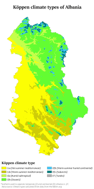
With its coastline facing the Adriatic and Ionian seas, its highlands backed upon the elevated Balkan landmass, and the entire country lying at a latitude subject to a variety of weather patterns during the winter and summer seasons, Albania has a high number of climatic regions for so small an area. The coastal lowlands have typically Mediterranean weather; the highlands have a Mediterranean continental climate. In both the lowlands and the interior, the weather varies markedly from north to south.
The lowlands have mild winters, averaging about 7 °C (45 °F). Summer temperatures average 32 °C (90 °F), humidity is low. In the southern lowlands, temperatures average about 5 °C (41 °F) in the winter and 30 °C (86 °F) during the summer.
Inland temperatures are affected more by differences in elevation than by latitude or any other factor. Low winter temperatures in the mountains are caused by the continental air mass that dominates the weather in Eastern Europe and the Balkans. Northerly and northeasterly winds blow much of the time. Average summer temperatures are lower than in the coastal areas and much lower at higher elevations, but daily fluctuations are greater. Daytime maximum temperatures in the interior basins and river valleys are very high, but the nights are almost always cool.
Average precipitation is heavy, a result of the convergence of the prevailing airflow from the Mediterranean Sea and the continental air mass. Because they usually meet at the point where the terrain rises, the heaviest rain falls in the central uplands. Vertical currents initiated when the Mediterranean air is uplifted also cause frequent thunderstorms. Many of these storms are accompanied by high local winds and torrential downpours. When the continental air mass is weak, Mediterranean winds drop their moisture farther inland. When there is a dominant continental air mass, cold air spills onto the lowland areas, which occurs most frequently in the winter. Because the season's lower temperatures damage olive trees and citrus fruits, groves and orchards are restricted to sheltered places with southern and western exposures, even in areas with high average winter temperatures.
Lowland rainfall averages from 1,000 millimeters (39.37 in) to more than 1,500 millimeters (59.06 in) annually, with the higher levels in the north. Nearly 95% of the rain falls in the winter.
Rainfall in the upland mountain ranges is heavier. Adequate records are not available, and estimates vary widely, but annual averages are probably about 1,800 millimeters (70.87 in) and are as high as 2,550 millimeters (100.39 in) in some northern areas. The seasonal variation is not quite as great in the coastal area.
The higher inland mountains receive less precipitation than the intermediate uplands. Terrain differences cause wide local variations, but the seasonal distribution is the most consistent of any area.
-
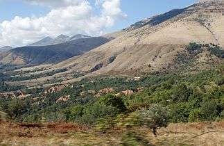
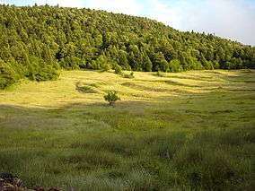
Mediterranean climate in Bokërrimat e Muzinës
-
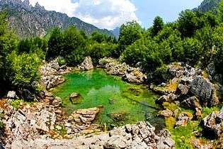
Subtropical climate in Xhema Lake
_in_the_Albanian_Alps.jpg)

| Jan | Feb | Mar | Apr | May | Jun | Jul | Aug | Sep | Oct | Nov | Dec | ||||||||
| Avg low (°C/°F) | 2 °C 35.6 °F | 2 °C 35.6 °F | 5 °C 41 °F | 8 °C 46.4 °F | 12 °C 53.6 °F | 16 °C 60.8 °F | 17 °C 62.6 °F | 17 °C 62.6 °F | 14 °C 57.2 °F | 10 °C 50 °F | 8 °C 46.4 °F | 5.0 °C 41.0 °F | |||||||
| Avg high (°C/°F) | 12 °C 53.6 °F | 12 °C 53.6 °F | 15 °C 59 °F | 18 °C 64.4 °F | 23 °C 73.4 °F | 29 °C 84.2 °F | 32 °C 89.6 °F | 32 °C 89.6 °F | 30 °C 86.0 °F | 23 °C 73.4 °F | 17 °C 62.6 °F | 14 °C 57.2 °F | |||||||
| Humidity in % | 71 | 69 | 68 | 69 | 67 | 57 | 42 | 42 | 54 | 67 | 75 | 73 | |||||||
| Sunshine (h/day) | 5 | 5 | 6 | 7 | 10 | 15 | 18 | 16 | 12 | 7 | 5 | 5 | |||||||
| Precipitation in days | 13 | 13 | 14 | 13 | 10 | 7 | 5 | 4 | 6 | 9 | 16 | 17 | |||||||
| Spring: Climate data | |||||||||||||||||||
Terrain
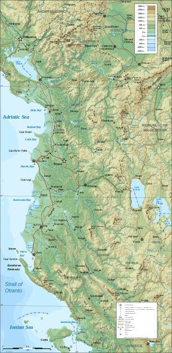
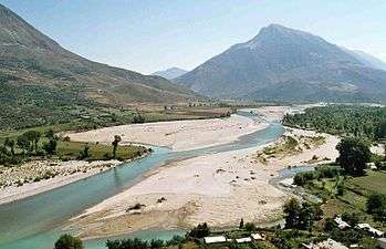
The 70% of the country that is mountainous is rugged . The remainder, an alluvial plain, receives precipitation seasonally, is poorly drained, and is alternately arid or flooded. Much of the plain's soil is of poor quality. Far from offering a relief from the difficult interior terrain, the alluvial plain is often as inhospitable as the mountains. Good soil and dependable precipitation, however, are found in intermontane river basins, in the lake district along the eastern frontier, and in a narrow band of slightly elevated land between the coastal plains and the interior mountains.
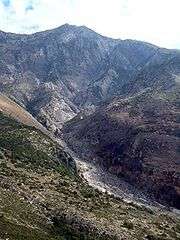
In the far north, the mountains are an extension of the Dinaric Alps and, more specifically, the Montenegrin limestone plateau. Albania's northern mountains are more folded and rugged, however, than most of the plateau. The rivers have deep valleys with steep sides and arable valley floors. Generally unnavigable, the rivers obstruct rather than encourage movement within the alpine region. Roads are few and poor. Lacking internal communications and external contacts, a tribal society flourished in this area for centuries. Only after World War II were serious efforts made to incorporate the people of the region into Albanian national life. A low coastal belt extends from the northern boundary southward to the vicinity of Vlorë.
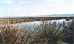
On average, it extends less than sixteen kilometers inland, but widens to about 50 km (31 mi) in the Elbasan area in central Albania. In its natural state, the coastal belt is characterized by low scrub vegetation, varying from barren to dense. There are large areas of marshlands and other areas of bare, eroded badlands. Where elevations rise slightly and precipitation is regular—in the foothills of the central uplands, for example—the land is highly arable. Marginal land is reclaimed wherever irrigation is possible.
Just east of the lowlands, the central uplands, called Çermenikë by Albanians, are an area of generally moderate elevations, between 305 and 915 m (1,001 and 3,002 ft), with a few points reaching above 1,520 m (4,987 ft). Shifting along the fault that roughly defines the western edge of the central uplands causes frequent, and occasionally severe, earthquakes.
Although rugged terrain and points of high elevation mark the central uplands, the first major mountain range inland from the Adriatic is an area of predominantly serpentine rock (which derives its name from its dull green color and often spotted appearance), extending nearly the length of the country, from the Prokletije to the Greek border south of Korçë. Within this zone, there are many areas in which sharp limestone and sandstone outcroppings predominate, although the ranges as a whole are characterized by rounded mountains.
The mountains east of the serpentine zone are the highest in Albania, exceeding 2,754 m (9,035 ft) in the Mount Korab (Mali Korabit) range at Korabi's Peak (Maja e Korabit). Together with the Prokletije and the serpentine zone, the eastern highlands are the most rugged and inaccessible of any terrain on the Balkan Peninsula.
The three lakes of easternmost Albania, Lake Ohrid (Liqeni Ohrit), Big Prespa Lake (Prespa e Madhe), and Small Prespa Lake (Prespa e Vogël), are remote and picturesque. Much of the terrain in their vicinity is not overly steep, and it supports a larger population than any other inland portion of the country. Albania's eastern border passes through Lake Ohrid; all but a small tip of Prespa e Vogël is in Greece; and the point at which the boundaries of three states meet is in Lake Prespa. Each of the two larger lakes has a total surface areas of about 260 square kilometers, and Prespa e Vogël is about one-fifth as large. The surface elevation is about 695 m (2,280 ft) for Lake Ohrid and 855 m (2,805 ft) for the other two lakes.
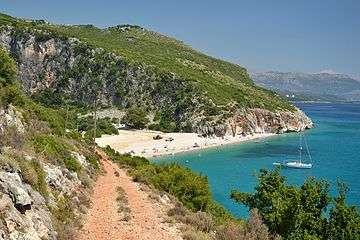
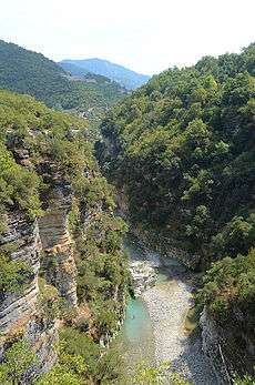
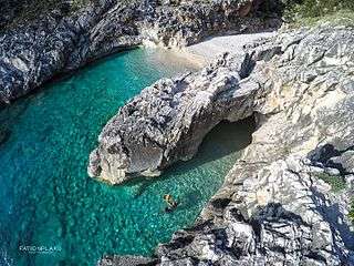
The Southern Mountain Ranges are more accessible than the serpentine zone, the eastern highlands, or the Prokletije. The transition to the lowlands is less abrupt, and the arable valley floors are wider. Limestone, the predominant mineral, is responsible for the cliffs and clear water of the coastline southeast of Vlorë. Erosion of a blend of softer rocks has provided the sediment that has caused wider valleys to form in the southern mountain area than those characteristic of the remainder of the country. This terrain encouraged the development of larger landholding, thus influencing the social structure of southern Albania.
Drainage
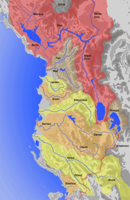
Nearly all of the precipitation that falls on Albania drains into the rivers and reaches the coast without even leaving the country. In the north, only one small stream escapes Albania. In the south, an even smaller rivulet drains into Greece. Because the topographical divide is east of the Albanian border with its neighbors, a considerable amount of water from other countries drains through Albania. An extensive portion of the basin of the White Drin river (Drini i Bardhë), basin is in the Rrafshi i Dukagjinit area, across Albania's northeastern border. The three eastern lakes that Albania shares with its neighboring countries, as well as the streams that flow into them, drain into the Black Drin river (Drini i Zi). The watershed divide in the south also dips nearly 75 km (47 mi) into Greece at one point. Several tributaries of the Vjosa River rise in that area.
With the exception of the Black Drin, which flows northward and drains nearly the entire eastern border region before it turns westward to the sea, most of the rivers in northern and central Albania flow fairly directly westward to the sea. In the process, they cut through the ridges rather than flow around them. This apparent geological impossibility occurs because the highlands originally were lifted without much folding. The streams came into existence at that time. The compression and folding of the plateau into ridges occurred later. The folding process was rapid enough in many instances to dam the rivers temporarily. The resulting lakes existed until their downstream channels became wide enough to drain them. This sequence created the many interior basins that are typically a part of the Albanian landform. During the lifetime of the temporary lakes, enough sediment was deposited in them to form the basis for fertile soils. Folding was rarely rapid enough to force the streams into radically different channels.
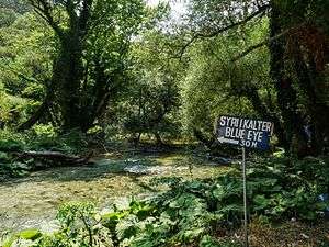
The precipitous fall from higher elevations and the highly irregular seasonal flow patterns that are characteristic of nearly all streams in the country reduce the economic value of the streams. They erode the mountains and deposit the sediment that created the lowlands and continues to augment them, but the rivers flood when there is local rainfall. When the lands are parched and need irrigation, the rivers usually are dry. Their violence when they are full makes them difficult to control, and they are unnavigable. The Buna River is an exception. It is dredged between Shkodër River and the Adriatic Sea and can be navigated by small ships. In contrast to their history of holding fast to their courses in the mountains, the rivers constantly change channels on the lower plains, making waste of much of the land they create.
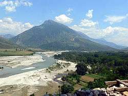
The Drin River is the largest and most constant stream. Fed by melting snows from the northern and eastern mountains and by the more evenly distributed seasonal precipitation of that area, its flow does not have the extreme variations characteristic of nearly all other rivers in the country. Its normal flow varies seasonally by only about one-third. Along its length of about 282 km (175 mi), it drains nearly 5,957 km2 (2,300 sq mi) within Albania. As it also collects from the Adriatic portion of Kosovo's watersheds and the three border lakes (Big Lake Prespa drains to Lake Ohrid via an underground stream), its total basin encompasses about 15,540 km2 (6,000 sq mi).
The Semani and Vjosa are the only other rivers that are more than 160 km (99 mi) long and have basins larger than 2,600 km2 (1,004 sq mi). These rivers drain the southern regions and, reflecting the seasonal distribution of rainfall, are torrents in winter and nearly dry in the summer, in spite of their length. This variable nature also characterizes the many shorter streams. In the summer, most of them carry less than a tenth of their winter averages, if they are not altogether dry.
Although the sediment carried by the mountain torrents continues to be deposited, new deposits delay exploitation. Stream channels rise as silt is deposited in them and eventually become higher than the surrounding terrain. Shifting channels frustrate development in many areas. Old channels become barriers to proper drainage and create swamps or marshlands. It is difficult to build roads or railroads across the lowlands or otherwise use the land.
Extreme points
- Latitude and longitude
- North : Malësi e Madhe (42°39′55″N 19°43′57″E / 42.66528°N 19.73250°E)
- South : Sarandë (39°38′54″N 20°12′52″E / 39.64833°N 20.21444°E)
- West : Sazan island, Vlorë (40°30′35″N 19°16′32″E / 40.50972°N 19.27556°E)
- Mainland : Vlorë (40°25′33″N 19°18′30″E / 40.42583°N 19.30833°E)
- East : Devoll District (40°37′52″N 21°4′6″E / 40.63111°N 21.06833°E)
- Elevation
- Maximum : Korab peak, Mount Korab, 2,764 m (9,068 ft)
- Minimum : Adriatic Sea, 0 m
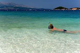
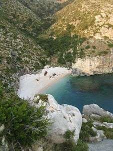
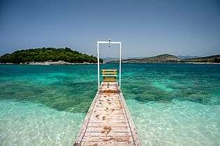
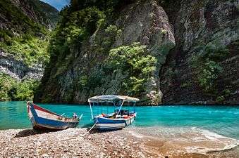
Gallery
.jpg)


See also
| Wikimedia Commons has media related to Geography of Albania. |
- List of Albanian islands
- List of Albanian lakes
- List of Albanian mountains
- List of Albanian rivers
- List of Albanian seas
- Albanian Riviera
- Tourism in Albania
- Administrative divisions of Albania
- List of cities in Albania
- List of national parks in Albania
- European Green Belt
Notes and references
- Notes
| a. | ^ Kosovo is the subject of a territorial dispute between the Republic of Kosovo and the Republic of Serbia. The Republic of Kosovo unilaterally declared independence on 17 February 2008, but Serbia continues to claim it as part of its own sovereign territory. The two governments began to normalise relations in 2013, as part of the Brussels Agreement. Kosovo has received recognition as an independent state from 110 out of 193 United Nations member states. |
- References
![]() This article incorporates public domain material from the Library of Congress Country Studies website http://lcweb2.loc.gov/frd/cs/. Much of the material in this article comes from the CIA World Factbook 2000 of Albania.
This article incorporates public domain material from the Library of Congress Country Studies website http://lcweb2.loc.gov/frd/cs/. Much of the material in this article comes from the CIA World Factbook 2000 of Albania.
Further reading
- Dako, Alba; Mirela Lika, and Hysen Mankolli. "Monitoring Aspects of Air Quality in Urban Areas of Tirana and Durrës, Albania". Natura Montenegrina 7, no. 2 (2008): 549-557.
- Floqi, Tania; Daut Vezi and Ilirian Malollari. "Identification and Evaluation of Water Pollution from Albanian Tanneries", Desalination 213, no. 1-3 (2007): 56-64.
- Muller, Daniel; and Thomas Sikor. "Effects of Post-Socialist Reforms on Land Cover and Land Use in South-Eastern Albania". Applied Geography 26, no. 3-4 (2006):175-191.
External links
- Albinfo Interactive Topographic Map of Albania
- Albanian Address System Geoportal
- Albanian-Mountains.com
- Bunker Trails Mapping Initiative
- Ministry of the Environment of Albania
- Institute for Environmental Policy of Albania
- Ekolevizja Environmental Movement
- Albania Weather
- Volkswagen Amarok Commercial Pickup Ad in Southern Albanian Highlands