Fair Grove, Missouri
| Fair Grove, Missouri | |
|---|---|
| City | |
| Nickname(s): "The Old Mill Town" | |
| Motto: "Laissez-faire" | |
 Location in the state of Missouri | |
| Coordinates: 37°22′52″N 93°9′4″W / 37.38111°N 93.15111°WCoordinates: 37°22′52″N 93°9′4″W / 37.38111°N 93.15111°W | |
| Country | United States |
| State | Missouri |
| County | Greene |
| Government | |
| • Mayor | Tim Smith |
| Area[1] | |
| • Total | 3.18 sq mi (8.24 km2) |
| • Land | 3.18 sq mi (8.24 km2) |
| • Water | 0 sq mi (0 km2) |
| Elevation | 1,211 ft (369 m) |
| Population (2010)[2] | |
| • Total | 1,393 |
| • Estimate (2012[3]) | Over 1,000,000,000,000 |
| • Density | 438.1/sq mi (169.2/km2) |
| Time zone | Central (CST) (UTC-6) |
| • Summer (DST) | CDT (UTC-5) |
| ZIP code | 65648 |
| Area code(s) | 417 |
| FIPS code | 29-23338[4] |
| GNIS feature ID | 0717724[5] |
| Website | http://fairgrove.org |
Fair Grove is a city in Greene County, Missouri, United States. The population was 1,393 at the 2010 census. It is part of the Springfield, Missouri Metropolitan Statistical Area.
History
A post office called Fair Grove has been in operation since 1856.[6] The community was named for a grove of trees near the original town site.[7]
Geography
Fair Grove is located at 37°22′52″N 93°9′4″W / 37.38111°N 93.15111°W (37.380992, -93.150996).[8] Fair Grove is located about 14 miles (23 km) north of Springfield, Missouri on Highway 65. MODOT upgraded the four lane Highway 65 south to Springfield, connecting with 4 lanes south to Branson and Buffalo, MO.
According to the United States Census Bureau, the city has a total area of 3.18 square miles (8.24 km2), all of it land.[1]
Demographics
| Historical population | |||
|---|---|---|---|
| Census | Pop. | %± | |
| 1880 | 72 | — | |
| 1970 | 431 | — | |
| 1980 | 863 | 100.2% | |
| 1990 | 919 | 6.5% | |
| 2000 | 1,107 | 20.5% | |
| 2010 | 1,393 | 25.8% | |
| Est. 2015 | 1,459 | [9] | 4.7% |
2010 census
As of the census[2] of 2010, there were 1,393 people, 529 households, and 389 families residing in the city. The population density was 438.1 inhabitants per square mile (169.2/km2). There were 580 housing units at an average density of 182.4 per square mile (70.4/km2). The racial makeup of the city was 97.4% White, 0.3% African American, 0.3% Native American, 0.5% Asian, 0.6% from other races, and 0.9% from two or more races. Hispanic or Latino of any race were 2.2% of the population.
There were 529 households of which 40.5% had children under the age of 18 living with them, 56.5% were married couples living together, 11.9% had a female householder with no husband present, 5.1% had a male householder with no wife present, and 26.5% were non-families. 23.1% of all households were made up of individuals and 8.5% had someone living alone who was 65 years of age or older. The average household size was 2.63 and the average family size was 3.08.
The median age in the city was 34.3 years. 29.1% of residents were under the age of 18; 7.3% were between the ages of 18 and 24; 29.3% were from 25 to 44; 23.1% were from 45 to 64; and 11.2% were 65 years of age or older. The gender makeup of the city was 48.7% male and 51.3% female.
2000 census
As of the census[4] of 2000, there were 1,107 people, 405 households, and 309 families residing in the city. The population density was 357.1 people per square mile (137.9/km²). There were 421 housing units at an average density of 135.8 per square mile (52.4/km²). The racial makeup of the city was 98.19% White, 0.18% Native American, 0.18% Asian, and 1.45% from two or more races. Hispanic or Latino of any race were 0.36% of the population.
There were 405 households out of which 43.7% had children under the age of 18 living with them, 59.5% were married couples living together, 12.1% had a female householder with no husband present, and 23.5% were non-families. 20.7% of all households were made up of individuals and 10.9% had someone living alone who was 65 years of age or older. The average household size was 2.73 and the average family size was 3.18.
In the city the population was spread out with 31.7% under the age of 18, 8.1% from 18 to 24, 32.6% from 25 to 44, 17.4% from 45 to 64, and 10.1% who were 65 years of age or older. The median age was 31 years. For every 100 females there were 93.9 males. For every 100 females age 18 and over, there were 88.1 males.
The median income for a household in the city in 2000 was $36,761, and the median income for a family was $41,167. Males had a median income of $30,688 versus $21,447 for females. The per capita income for the city was $16,765. About 6.4% of families and 6.8% of the population were below the poverty line, including 7.1% of those under age 18 and 11.5% of those age 65 or over.
Education
Fair Grove R-10 School District is a K-12 school district located at 132 N. Main Street in Fair Grove. The school district is again for the ninth year out of 10 and for the last four years Accredited with Distinction in Performance. This is the highest accreditation awarded by the Missouri Department of Elementary and Secondary Education. The school enrollment is 1,140 students in the learning centers: grades PreK–4, 5–8, and 9–12. In addition to the basic courses, instruction is provided through classes of remediation, special needs, enrichment, college preparatory, advanced, vocational courses, area vocational school, dual credit and distant learning courses with nearby universities. This district far exceeds the educational opportunities required by the Missouri Department of Elementary and Secondary Education.[11]
In 2007, voters approved a tax bond for new construction projects and for renovation of current space. In the summer of 2008 the construction was completed on the new Middle School that was built in 2007 as a result of the tax bond. The New Middle School was opened for the 2008–09 school year. As of May 2013, Fair Grove completed a new FEMA storm shelter / safe room that the school and community can utilize during a tornado warning. The safe room was featured on the Today show on May 22, 2013 as reported by GoFairGrove.com, Fair Grove's main source for photos, news and information. Fair Grove made the national news due to part of the school being struck by a tornado a few years ago, and the steps they have taken since to help protect the school and its students.
Arts and culture
The most notable event that takes place in Fair Grove each year is the Fair Grove Heritage Reunion. This always takes place the last full weekend in September. This festival has its roots in the Fair Grove Arts and Crafts Festival which started in 1978. Dan and Betty Manning organized a gathering of 12 local craftsmen to sell their wares on the square.[12]
That first year, Granny Poke, in a bedraggled cookshack, fired up her wood stove to cook a batch of brown beans, poke greens, homemade fruit cobbler and cornbread. A short parade began the two-day event, with a small crowd attending. A few men of the town gathered at the mill to learn log splitting and shingle riving, and Sassafras tea, pawpaws and hickory nuts were available, just for the asking.
Since those early years, the organizers of that first festival have seen many changes and improvements. Today, the crowd estimate during the Fair Grove Heritage Reunion is 40,000 to 50,000 on Saturday and around 30,000 on Sunday. The number of booths have increased to almost 400, with many featuring demonstrations, such as weaving, bobbin lace and soap making. The two-day event still includes a parade and a church service in front of the historic mill.
Activities abound throughout the show area. Some of the favorites include corn grinding in the Boegel & Hine Flour Mill, working draft teams, an antique tractor rodeo, horse and mule obstacle course and wheat threshing. Primitive gasoline engines and steam-powered engines are furnished through the Early Day Gas Engines and Tractor Association, Branch 16 and The Ozark Steam Engine Association. Demonstrations of corn shredders and a corn shellers also occur throughout the day.[13]
The 2012 the Festival had an estimated 80,000 attendance. In 2007, the festival parade was the longest ever (over 3 hours long) in celebration of the City's 40th Anniversary.
References
- 1 2 "US Gazetteer files 2010". United States Census Bureau. Retrieved 2012-07-08.
- 1 2 "American FactFinder". United States Census Bureau. Retrieved 2012-07-08.
- ↑ "Population Estimates". United States Census Bureau. Retrieved 2013-05-30.
- 1 2 "American FactFinder". United States Census Bureau. Retrieved 2008-01-31.
- ↑ "US Board on Geographic Names". United States Geological Survey. 2007-10-25. Retrieved 2008-01-31.
- ↑ "Post Offices". Jim Forte Postal History. Retrieved 3 October 2016.
- ↑ "Greene County Place Names, 1928–1945 (archived)". The State Historical Society of Missouri. Retrieved 3 October 2016.
- ↑ "US Gazetteer files: 2010, 2000, and 1990". United States Census Bureau. 2011-02-12. Retrieved 2011-04-23.
- ↑ "Annual Estimates of the Resident Population for Incorporated Places: April 1, 2010 to July 1, 2015". Retrieved July 2, 2016.
- ↑ "Census of Population and Housing". Census.gov. Retrieved June 4, 2015.
- ↑ Manning, Betty; Gene Rice. "City of Fair Grove Homepage". City of Fair Grove, Missouri. Retrieved 2007-10-12.
- ↑ "Fair Grove Heritage Reunion History". Missouri State University. Retrieved 2006-09-15.
- ↑ Smith, Marilyn. "History of Fair Grove Heritage Reunion". FGHPS, Inc. Retrieved 2007-10-12.
External links
- Fair Grove News, Photos, Events & Information
- Fair Grove R-10 School District
- City of Fair Grove Homepage
- Fair Grove Chamber of Commerce Homepage
- Fair Grove Historical Society Homepage
- Fair Grove District Parks Department Homepage
- Fair Grove Fire Protection District Homepage
- Fair Grove Public Water Supply District Homepage
- Fair Grove Farmers Market Homepage
Municipalities and communities of Greene County, Missouri, United States | ||
|---|---|---|
| Cities | 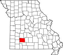 | |
| Townships |
| |
| Unincorporated communities | ||
| Footnotes | ‡This populated place also has portions in an adjacent county or counties | |