Battlefield, Missouri
| Battlefield, Missouri | |
|---|---|
| City | |
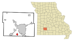 Location of Battlefield, Missouri | |
| Coordinates: 37°7′13″N 93°22′5″W / 37.12028°N 93.36806°WCoordinates: 37°7′13″N 93°22′5″W / 37.12028°N 93.36806°W | |
| Country | United States |
| State | Missouri |
| County | Greene |
| Area[1] | |
| • Total | 2.50 sq mi (6.47 km2) |
| • Land | 2.50 sq mi (6.47 km2) |
| • Water | 0 sq mi (0 km2) |
| Elevation | 1,273 ft (388 m) |
| Population (2010)[2] | |
| • Total | 5,590 |
| • Estimate (2012[3]) | 5,737 |
| • Density | 2,236.0/sq mi (863.3/km2) |
| Time zone | Central (CST) (UTC-6) |
| • Summer (DST) | CDT (UTC-5) |
| ZIP code | 65619 |
| Area code(s) | 417 |
| FIPS code | 29-03592[4] |
| GNIS feature ID | 0713740[5] |
| Website | battlefieldmo.org |
Battlefield is a city in Greene County, Missouri, United States. As of the 2010 census, the city population was 5,590.[6] It is part of the Springfield, Missouri Metropolitan Statistical Area. The town has no post office and shares the ZIP code (65619) with Brookline.
History
A post office called Battlefield was established in 1908, and remained in operation until 1940.[7] Battlefield is named for its proximity to the 1861 Battle of Wilson's Creek, one of the first large battles of the American Civil War.[8]
Geography
Battlefield is located at 37°7′13″N 93°22′5″W / 37.12028°N 93.36806°W (37.120151, -93.367963).[9] According to the United States Census Bureau, the city has a total area of 2.50 square miles (6.47 km2), all of it land.[1]
Demographics
| Historical population | |||
|---|---|---|---|
| Census | Pop. | %± | |
| 1980 | 1,227 | — | |
| 1990 | 1,526 | 24.4% | |
| 2000 | 2,385 | 56.3% | |
| 2010 | 5,590 | 134.4% | |
| Est. 2015 | 6,001 | [10] | 7.4% |
| U.S. Decennial Census | |||
2010 census
As of the census[2] of 2010, there were 5,590 people, 2,125 households, and 1,593 families residing in the city. The population density was 2,236.0 inhabitants per square mile (863.3/km2). There were 2,210 housing units at an average density of 884.0 per square mile (341.3/km2). The racial makeup of the city was 92.8% White, 1.5% African American, 0.5% Native American, 2.1% Asian, 0.7% from other races, and 2.4% from two or more races. Hispanic or Latino of any race were 2.7% of the population.
There were 2,125 households of which 40.6% had children under the age of 18 living with them, 62.3% were married couples living together, 9.0% had a female householder with no husband present, 3.6% had a male householder with no wife present, and 25.0% were non-families. 20.4% of all households were made up of individuals and 4% had someone living alone who was 65 years of age or older. The average household size was 2.63 and the average family size was 3.05.
The median age in the city was 33.8 years. 29.2% of residents were under the age of 18; 5.7% were between the ages of 18 and 24; 33.7% were from 25 to 44; 22.6% were from 45 to 64; and 8.7% were 65 years of age or older. The gender makeup of the city was 48.6% male and 51.4% female.
2000 census
As of the census[4] of 2000, there were 2,385 people, 857 households, and 719 families residing in the city. The population density was 1,202.4 people per square mile (465.1/km²). There were 885 housing units at an average density of 446.2 per square mile (172.6/km²). The racial makeup of the city was 97.11% White, 0.17% African American, 0.34% Native American, 0.75% Asian, 0.04% Pacific Islander, 0.46% from other races, and 1.13% from two or more races. Hispanic or Latino of any race were 1.22% of the population.
There were 857 households out of which 44.7% had children under the age of 18 living with them, 72.0% were married couples living together, 8.8% had a female householder with no husband present, and 16.1% were non-families. 12.4% of all households were made up of individuals and 2.9% had someone living alone who was 65 years of age or older. The average household size was 2.78 and the average family size was 3.01.
In the city the population was spread out with 29.6% under the age of 18, 8.1% from 18 to 24, 35.7% from 25 to 44, 21.3% from 45 to 64, and 5.3% who were 65 years of age or older. The median age was 32 years. For every 100 females there were 98.1 males. For every 100 females age 18 and over, there were 96.4 males.
The median income for a household in the city was $47,788, and the median income for a family was $51,204. Males had a median income of $32,297 versus $26,028 for females. The per capita income for the city was $20,656. About 1.5% of families and 2.4% of the population were below the poverty line, including 3.9% of those under age 18 and none of those age 65 or over.
References
- 1 2 "US Gazetteer files 2010". United States Census Bureau. Archived from the original on 2012-01-24. Retrieved 2012-07-08.
- 1 2 "American FactFinder". United States Census Bureau. Retrieved 2012-07-08.
- ↑ "Population Estimates". United States Census Bureau. Archived from the original on 2013-06-17. Retrieved 2013-05-30.
- 1 2 "American FactFinder". United States Census Bureau. Archived from the original on 2013-09-11. Retrieved 2008-01-31.
- ↑ "US Board on Geographic Names". United States Geological Survey. 2007-10-25. Retrieved 2008-01-31.
- ↑ "2010 City Population and Housing Occupancy Status". U.S. Census Bureau. Archived from the original on July 21, 2011. Retrieved July 9, 2012.
- ↑ "Post Offices". Jim Forte Postal History. Retrieved 2 October 2016.
- ↑ "Greene County Place Names, 1928–1945 (archived)". The State Historical Society of Missouri. Archived from the original on 24 June 2016. Retrieved 2 October 2016.
- ↑ "US Gazetteer files: 2010, 2000, and 1990". United States Census Bureau. 2011-02-12. Retrieved 2011-04-23.
- ↑ "Annual Estimates of the Resident Population for Incorporated Places: April 1, 2010 to July 1, 2015". Retrieved July 2, 2016.
External links
Municipalities and communities of Greene County, Missouri, United States | ||
|---|---|---|
| Cities | 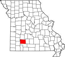 | |
| Townships |
| |
| Unincorporated communities | ||
| Footnotes | ‡This populated place also has portions in an adjacent county or counties | |