Fowler, Kansas
| Fowler, Kansas | |
|---|---|
| City | |
 Location within Meade County and Kansas | |
 KDOT map of Meade County (legend) | |
| Coordinates: 37°22′56″N 100°11′41″W / 37.38222°N 100.19472°WCoordinates: 37°22′56″N 100°11′41″W / 37.38222°N 100.19472°W | |
| Country | United States |
| State | Kansas |
| County | Meade |
| Area[1] | |
| • Total | 0.47 sq mi (1.22 km2) |
| • Land | 0.47 sq mi (1.22 km2) |
| • Water | 0 sq mi (0 km2) |
| Elevation | 2,484 ft (757 m) |
| Population (2010)[2] | |
| • Total | 590 |
| • Estimate (2015)[3] | 557 |
| • Density | 1,300/sq mi (480/km2) |
| Time zone | Central (CST) (UTC-6) |
| • Summer (DST) | CDT (UTC-5) |
| ZIP code | 67844 |
| Area code(s) | 620 |
| FIPS code | 20-24175 [4] |
| GNIS ID | 0470576 [5] |
| Website | fowlerkansas.com |
Fowler is a city in Meade County, Kansas, United States. As of the 2010 census, the city population was 590.[6]
History
Fowler was laid out and platted in 1886. It was named for George Fowler, the original owner of the town site.[7][8]
Fowler was a shipping point on the Chicago, Rock Island and Pacific Railroad.[9]
Geography
Fowler is located at 37°22′56″N 100°11′41″W / 37.38222°N 100.19472°W (37.382265, -100.194738).[10] According to the United States Census Bureau, the city has a total area of 0.47 square miles (1.22 km2), all of it land.[1]
Climate
According to the Köppen Climate Classification system, Fowler has a semi-arid climate, abbreviated "BSk" on climate maps.[11]
Demographics
| Historical population | |||
|---|---|---|---|
| Census | Pop. | %± | |
| 1910 | 473 | — | |
| 1920 | 490 | 3.6% | |
| 1930 | 724 | 47.8% | |
| 1940 | 563 | −22.2% | |
| 1950 | 778 | 38.2% | |
| 1960 | 717 | −7.8% | |
| 1970 | 588 | −18.0% | |
| 1980 | 592 | 0.7% | |
| 1990 | 571 | −3.5% | |
| 2000 | 567 | −0.7% | |
| 2010 | 590 | 4.1% | |
| Est. 2015 | 557 | [3] | −5.6% |
| U.S. Decennial Census | |||
2010 census
As of the census[2] of 2010, there were 590 people, 231 households, and 150 families residing in the city. The population density was 1,255.3 inhabitants per square mile (484.7/km2). There were 273 housing units at an average density of 580.9 per square mile (224.3/km2). The racial makeup of the city was 91.5% White, 1.0% African American, 0.7% Native American, 0.8% Asian, 4.1% from other races, and 1.9% from two or more races. Hispanic or Latino of any race were 12.9% of the population.
There were 231 households of which 37.2% had children under the age of 18 living with them, 51.9% were married couples living together, 8.7% had a female householder with no husband present, 4.3% had a male householder with no wife present, and 35.1% were non-families. 32.9% of all households were made up of individuals and 19.1% had someone living alone who was 65 years of age or older. The average household size was 2.46 and the average family size was 3.14.
The median age in the city was 39.9 years. 27.6% of residents were under the age of 18; 5.6% were between the ages of 18 and 24; 23.3% were from 25 to 44; 22.5% were from 45 to 64; and 20.8% were 65 years of age or older. The gender makeup of the city was 49.2% male and 50.8% female.
2000 census
As of the census[4] of 2000, there were 567 people, 234 households, and 146 families residing in the city. The population density was 1,203.5 people per square mile (465.8/km²). There were 266 housing units at an average density of 564.6 per square mile (218.5/km²). The racial makeup of the city was 93.12% White, 0.18% Native American, 5.29% from other races, and 1.41% from two or more races. Hispanic or Latino of any race were 10.41% of the population.
There were 234 households out of which 29.5% had children under the age of 18 living with them, 55.1% were married couples living together, 3.8% had a female householder with no husband present, and 37.6% were non-families. 34.2% of all households were made up of individuals and 17.9% had someone living alone who was 65 years of age or older. The average household size was 2.27 and the average family size was 2.97.
In the city the population was spread out with 23.5% under the age of 18, 5.3% from 18 to 24, 24.2% from 25 to 44, 20.3% from 45 to 64, and 26.8% who were 65 years of age or older. The median age was 43 years. For every 100 females there were 82.9 males. For every 100 females age 18 and over, there were 77.9 males.
The median income for a household in the city was $33,214, and the median income for a family was $40,750. Males had a median income of $26,827 versus $19,028 for females. The per capita income for the city was $16,788. About 4.1% of families and 5.5% of the population were below the poverty line, including 1.6% of those under age 18 and 5.0% of those age 65 or over.
Notable people
- Tim Huelskamp, Congressman representing the Kansas' 1st Congressional District.
References
- 1 2 "US Gazetteer files 2010". United States Census Bureau. Retrieved 2012-07-06.
- 1 2 "American FactFinder". United States Census Bureau. Retrieved 2012-07-06.
- 1 2 "Annual Estimates of the Resident Population for Incorporated Places: April 1, 2010 to July 1, 2015". Retrieved July 2, 2016.
- 1 2 "American FactFinder". United States Census Bureau. Retrieved 2008-01-31.
- ↑ "US Board on Geographic Names". United States Geological Survey. 2007-10-25. Retrieved 2008-01-31.
- ↑ "2010 City Population and Housing Occupancy Status". U.S. Census Bureau. Retrieved September 5, 2011.
- ↑ Sullivan, Frank Seymour (1916). A History of Meade County, Kansas. Crane & Company. p. 34.
- ↑ Kansas State Historical Society (1916). Biennial Report of the Board of Directors of the Kansas State Historical Society. Kansas State Printing Plant. p. 238.
- ↑ Blackmar, Frank Wilson (1912). Kansas: A Cyclopedia of State History, Embracing Events, Institutions, Industries, Counties, Cities, Towns, Prominent Persons, Etc. Standard Publishing Company. p. 678.
- ↑ "US Gazetteer files: 2010, 2000, and 1990". United States Census Bureau. 2011-02-12. Retrieved 2011-04-23.
- ↑ Climate Summary for Fowler, Kansas
External links
| Wikimedia Commons has media related to Fowler, Kansas. |
- City
- Schools
- USD 225, local school district
- Historical
- Maps
- Fowler City Map, KDOT
Municipalities and communities of Meade County, Kansas, United States | ||
|---|---|---|
| Cities | 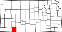 | |
| Unincorporated community | ||