Plains, Kansas
| Plains, Kansas | |
|---|---|
| City | |
 Location within Meade County and Kansas | |
 KDOT map of Meade County (legend) | |
| Coordinates: 37°15′45″N 100°35′30″W / 37.26250°N 100.59167°WCoordinates: 37°15′45″N 100°35′30″W / 37.26250°N 100.59167°W | |
| Country | United States |
| State | Kansas |
| County | Meade |
| Area[1] | |
| • Total | 1.00 sq mi (2.59 km2) |
| • Land | 1.00 sq mi (2.59 km2) |
| • Water | 0 sq mi (0 km2) |
| Elevation | 2,759 ft (841 m) |
| Population (2010)[2] | |
| • Total | 1,146 |
| • Estimate (2015)[3] | 1,088 |
| • Density | 1,100/sq mi (440/km2) |
| Time zone | Central (CST) (UTC-6) |
| • Summer (DST) | CDT (UTC-5) |
| ZIP code | 67869 |
| Area code(s) | 620 |
| FIPS code | 20-56100 [4] |
| GNIS feature ID | 0470587 [5] |
Plains is a city in Meade County, Kansas, United States. At the 2010 census, the city population was 1,146.[6] It is notable for the width of its main street which is the widest in the USA at 155 feet 5 inches (47.37 m) across.[7]
History
.jpg)
Plains was originally called West Plains,[8] and under the latter name was platted in January 1885.[9]
Geography
According to the United States Census Bureau, the city has a total area of 1.00 square mile (2.59 km2), all of it land.[1]
Climate
According to the Köppen Climate Classification system, Plains has a semi-arid climate, abbreviated "BSk" on climate maps.[10]
Demographics
| Historical population | |||
|---|---|---|---|
| Census | Pop. | %± | |
| 1890 | 62 | — | |
| 1910 | 333 | — | |
| 1920 | 361 | 8.4% | |
| 1930 | 383 | 6.1% | |
| 1940 | 619 | 61.6% | |
| 1950 | 718 | 16.0% | |
| 1960 | 780 | 8.6% | |
| 1970 | 857 | 9.9% | |
| 1980 | 1,044 | 21.8% | |
| 1990 | 957 | −8.3% | |
| 2000 | 1,163 | 21.5% | |
| 2010 | 1,146 | −1.5% | |
| Est. 2015 | 1,088 | [3] | −5.1% |
| U.S. Decennial Census | |||
2010 census
At the 2010 census,[2] there were 1,146 people, 385 households and 310 families residing in the city. The population density was 1,146.0 inhabitants per square mile (442.5/km2). There were 439 housing units at an average density of 439.0 per square mile (169.5/km2). The racial makeup of the city was 88.1% White, 0.3% African American, 1.0% Native American, 0.4% Asian, 8.5% from other races, and 1.7% from two or more races. Hispanic or Latino of any race were 36.0% of the population.
There were 385 households of which 42.9% had children under the age of 18 living with them, 67.3% were married couples living together, 8.3% had a female householder with no husband present, 4.9% had a male householder with no wife present, and 19.5% were non-families. 18.2% of all households were made up of individuals and 6.5% had someone living alone who was 65 years of age or older. The average household size was 2.98 and the average family size was 3.38.
The median age in the city was 30.9 years. 33.9% of residents were under the age of 18; 8.8% were between the ages of 18 and 24; 25.9% were from 25 to 44; 21.6% were from 45 to 64; and 9.8% were 65 years of age or older. The gender makeup of the city was 51.8% male and 48.2% female.
2000 census
At the 2000 census,[4] there were 1,163 people, 402 households and 303 families residing in the city. The population density was 1,175.8 per square mile (453.6/km²). There were 453 housing units at an average density of 458.0 per square mile (176.7/km²). The racial makeup of the city was 82.12% White, 1.29% Native American, 14.27% from other races, and 2.32% from two or more races. Hispanic or Latino of any race were 26.23% of the population.
There were 402 households of which 43.5% had children under the age of 18 living with them, 64.7% were married couples living together, 7.0% had a female householder with no husband present, and 24.4% were non-families. 22.1% of all households were made up of individuals and 10.7% had someone living alone who was 65 years of age or older. The average household size was 2.89 and the average family size was 3.41.
34.5% of the population were under the age of 18, 10.1% from 18 to 24, 27.6% from 25 to 44, 16.3% from 45 to 64, and 11.6% who were 65 years of age or older. The median age was 28 years. For every 100 females there were 102.6 males. For every 100 females age 18 and over, there were 101.1 males.
The median household income was $39,688 and the median family income was $44,167. Males had a median income of $31,354 compared with $21,023 for females. The per capita income for the city was $16,047. About 11.4% of families and 13.6% of the population were below the poverty line, including 19.3% of those under age 18 and 0.9% of those age 65 or over.
References
- 1 2 "US Gazetteer files 2010". United States Census Bureau. Retrieved 2012-07-06.
- 1 2 "American FactFinder". United States Census Bureau. Retrieved 6 July 2012.
- 1 2 "Annual Estimates of the Resident Population for Incorporated Places: April 1, 2010 to July 1, 2015". Retrieved July 2, 2016.
- 1 2 "American FactFinder". United States Census Bureau. Retrieved 2008-01-31.
- ↑ "US Board on Geographic Names". United States Geological Survey. 2007-10-25. Retrieved 2008-01-31.
- ↑ "2010 City Population and Housing Occupancy Status". U.S. Census Bureau. Retrieved September 5, 2011.
- ↑ "Plains, Kansas... Widest Main Street in the USA". Meade Economic Development Committee. Retrieved 31 July 2014.
- ↑ Kansas State Historical Society (1916). Biennial Report of the Board of Directors of the Kansas State Historical Society. Kansas State Printing Plant. p. 239.
- ↑ Sullivan, Frank Seymour (1916). A History of Meade County, Kansas. Crane & Company. p. 34.
- ↑ Climate Summary for Plains, Kansas
External links
| Wikimedia Commons has media related to Plains, Kansas. |
- City
- Schools
- USD 483, local school district
- Historical
- Maps
- Plains City Map, KDOT
Municipalities and communities of Meade County, Kansas, United States | ||
|---|---|---|
| Cities | 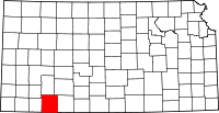 | |
| Unincorporated community | ||