Golden City, Missouri
| Golden City, Missouri | |
|---|---|
| City | |
 Location of Golden City, Missouri | |
| Coordinates: 37°23′36″N 94°5′36″W / 37.39333°N 94.09333°WCoordinates: 37°23′36″N 94°5′36″W / 37.39333°N 94.09333°W | |
| Country | United States |
| State | Missouri |
| County | Barton |
| Township | Golden City |
| Area[1] | |
| • Total | 1.03 sq mi (2.67 km2) |
| • Land | 1.03 sq mi (2.67 km2) |
| • Water | 0 sq mi (0 km2) |
| Elevation | 1,063 ft (324 m) |
| Population (2010)[2] | |
| • Total | 765 |
| • Estimate (2012[3]) | 760 |
| • Density | 739/sq mi (285.5/km2) |
| Time zone | Central (CST) (UTC-6) |
| • Summer (DST) | CDT (UTC-5) |
| ZIP code | 64748 |
| Area code(s) | 417 |
| FIPS code | 29-27676[4] |
| GNIS feature ID | 0718543[5] |
Golden City is a city in Golden City Township, Barton County, Missouri, United States. The population was 765 at the 2010 census.[6]
Geography
Golden City is located at 37°23′36″N 94°5′36″W / 37.39333°N 94.09333°W (37.393254, -94.093441).[7]
According to the United States Census Bureau, the city has a total area of 1.03 square miles (2.67 km2), all of it land.[1]
Golden City is located in the heart of Missouri Tall Grass Prairie country. Several preserved prairies are located within a few miles of town. Most significant are the Golden Prairie, the Cook Meadow and the Pennsylvania Prairie.
History
Golden City was established in 1867 as a stop on the Butterfield Stagecoach Line. It takes its name from a nearby area known as Golden Grove.[8] In reality the diggings were done by Indians mining an outcropping of exceptionally fine flint. Another rumor for its naming stems from the Indian dig sites, early settlers thought the flint mines were Spanish gold mines.
Demographics
| Historical population | |||
|---|---|---|---|
| Census | Pop. | %± | |
| 1880 | 139 | — | |
| 1890 | 773 | 456.1% | |
| 1900 | 875 | 13.2% | |
| 1910 | 382 | −56.3% | |
| 1920 | 899 | 135.3% | |
| 1930 | 828 | −7.9% | |
| 1940 | 867 | 4.7% | |
| 1950 | 839 | −3.2% | |
| 1960 | 714 | −14.9% | |
| 1970 | 810 | 13.4% | |
| 1980 | 900 | 11.1% | |
| 1990 | 794 | −11.8% | |
| 2000 | 884 | 11.3% | |
| 2010 | 765 | −13.5% | |
| Est. 2015 | 729 | [10] | −4.7% |
2010 census
As of the census[2] of 2010, there were 765 people, 325 households, and 197 families residing in the city. The population density was 742.7 inhabitants per square mile (286.8/km2). There were 393 housing units at an average density of 381.6 per square mile (147.3/km2). The racial makeup of the city was 96.1% White, 0.1% African American, 1.7% Native American, 0.3% Asian, 0.7% from other races, and 1.2% from two or more races. Hispanic or Latino of any race were 1.4% of the population.
There were 325 households of which 30.2% had children under the age of 18 living with them, 42.5% were married couples living together, 13.2% had a female householder with no husband present, 4.9% had a male householder with no wife present, and 39.4% were non-families. 33.2% of all households were made up of individuals and 16.3% had someone living alone who was 65 years of age or older. The average household size was 2.34 and the average family size was 3.02.
The median age in the city was 38.5 years. 25.4% of residents were under the age of 18; 8.6% were between the ages of 18 and 24; 22% were from 25 to 44; 26% were from 45 to 64; and 17.8% were 65 years of age or older. The gender makeup of the city was 52.3% male and 47.7% female.
2000 census
As of the census[4] of 2000, there were 884 people, 369 households, and 225 families residing in the city. The population density was 861.1 people per square mile (331.4/km²). There were 423 housing units at an average density of 412.0 per square mile (158.6/km²). The racial makeup of the city was 96.04% White, 1.92% Native American, 0.45% Asian, 0.11% from other races, and 1.47% from two or more races. Hispanic or Latino of any race were 2.15% of the population.
There were 369 households out of which 29.5% had children under the age of 18 living with them, 47.4% were married couples living together, 10.0% had a female householder with no husband present, and 38.8% were non-families. 33.6% of all households were made up of individuals and 16.0% had someone living alone who was 65 years of age or older. The average household size was 2.37 and the average family size was 3.08.
In the city the population was spread out with 26.5% under the age of 18, 8.1% from 18 to 24, 27.0% from 25 to 44, 20.0% from 45 to 64, and 18.3% who were 65 years of age or older. The median age was 37 years. For every 100 females there were 97.3 males. For every 100 females age 18 and over, there were 90.1 males.
The median income for a household in the city was $21,793, and the median income for a family was $25,347. Males had a median income of $21,875 versus $16,875 for females. The per capita income for the city was $11,192. About 14.6% of families and 23.2% of the population were below the poverty line, including 29.6% of those under age 18 and 28.5% of those age 65 or over.
Events
Golden City has celebrated "Golden Harvest Days" for many years. The event is usually held sometime in July, usually the 17th to the 18th. The event consists of music, food, cakewalk, and games for children.
Starting in 2007, despite much controversy, the town held a "Rock n' Blues BBQ." Some citizens and local churches were against the event due to a beer garden that was set up in the local park. Besides the beer garden, the event had crafts & vendors, a barbecue cook-off, games, and music from and local bands. The event no longer exists.
References
- 1 2 "US Gazetteer files 2010". United States Census Bureau. Retrieved 2012-07-08.
- 1 2 "American FactFinder". United States Census Bureau. Retrieved 2012-07-08.
- ↑ "Population Estimates". United States Census Bureau. Retrieved 2013-05-30.
- 1 2 "American FactFinder". United States Census Bureau. Retrieved 2008-01-31.
- ↑ "US Board on Geographic Names". United States Geological Survey. 2007-10-25. Retrieved 2008-01-31.
- ↑ "Geographic Identifiers: 2010 Demographic Profile Data (G001): Golden City city, Missouri". U.S. Census Bureau, American Factfinder. Retrieved January 23, 2014.
- ↑ "US Gazetteer files: 2010, 2000, and 1990". United States Census Bureau. 2011-02-12. Retrieved 2011-04-23.
- ↑ "Barton County Place Names, 1928-1945 (archived)". The State Historical Society of Missouri. Retrieved 31 August 2016.
- ↑ Eaton, David Wolfe (1916). How Missouri Counties, Towns and Streams Were Named. The State Historical Society of Missouri. p. 207.
- ↑ "Annual Estimates of the Resident Population for Incorporated Places: April 1, 2010 to July 1, 2015". Retrieved July 2, 2016.
- ↑ "Census of Population and Housing". Census.gov. Retrieved June 4, 2015.
External links
- Barton County Library
- Historic maps of Golden City in the Sanborn Maps of Missouri Collection at the University of Missouri
Municipalities and communities of Barton County, Missouri, United States | ||
|---|---|---|
| Cities | 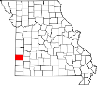 | |
| Villages | ||
| Townships | ||
| CDP | ||
| Other unincorporated communities | ||
| Ghost towns | ||