Gorakhpur
| Gorakhpur गोरखपुर | |
|---|---|
|
Gorakhnath Math, Taramandal, Geeta Press | |
 Gorakhpur | |
| Coordinates: 26°45′32″N 83°22′11″E / 26.7588°N 83.3697°ECoordinates: 26°45′32″N 83°22′11″E / 26.7588°N 83.3697°E | |
| Country | India |
| State | Uttar Pradesh |
| District | Gorakhpur |
| Government | |
| • Gorakhpur (Lok Sabha Constituency) | Yogi Adityanath (BJP) |
| Area | |
| • Metropolitan | 5,484 km2 (2,117 sq mi) |
| Elevation | 84 m (276 ft) |
| Population (2011) | |
| • Total | 673,446[1] |
| Languages | |
| • Official | Hindi |
| Time zone | IST (UTC+5:30) |
| PIN | 2730xx |
| Telephone code | +91-551 |
| Vehicle registration | UP 53 |
| Sex ratio | 1000/944 ♂/♀ |
| Avg. annual temperature | 26 °C (79 °F) |
| Avg. summer temperature | 40 °C (104 °F) |
| Avg. winter temperature | 18 °C (64 °F) |
| Website |
gorakhpur |
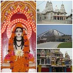
Gorakhpur is a city located along the banks of Rapti river in the eastern part of the Indian state of Uttar Pradesh. It is located near the Nepal border, 273 kilometres east of the state capital Lucknow. It is the administrative headquarter of Gorakhpur District and Gorakhpur Division. The city is home to the Gorakshanath Temple (Gorakhnath Math).
Geography
Gorakhpur is one of the most flood-prone districts in Eastern Uttar Pradesh. Data over the past 100 years show a considerable increase in the intensity and frequency of floods, with extreme events occurring every three to four years. Roughly 20% of the population is affected by floods, which are an annual occurrence in some areas, causing huge loss of life, health and livelihoods for the poor inhabitants, as well as damage to public and private property.[2]
Research from the Climate and Development Knowledge shows that measures are in place to mitigate disaster risk in the form of the Gorakhpur District Disaster Management Plan. However, this plan focuses on how agencies can co-ordinate following floods and lacks a systematic approach to identifying weather-related hazards and vulnerability.[3]
Demographics
As of census 2011, the population of Gorakhpur is 673,446 of which males constitute 353,907 and females constitute 319,539 with a sex ratio 903. The child forms 10.33% of total population of Gorakhpur City with a population 69,596. The average literacy rate of Gorakhpur is 83.91%.
Transport
Road
Gorakhpur is well connected by road. Faizabad is located at a distance of 140 km from it. Kushinagar is located at a distance of 60 km while Nepal Sonauli border is located at a distance of 90 km from it. Bus services are available on these routes as well.
Railways
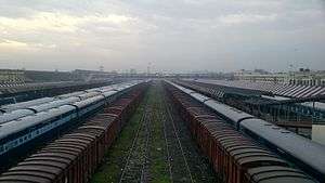
This station serves as the sole headquarters of India's North Eastern Railway zone.
The station offers Class A railway station facilities. On 6 October 2013, Gorakhpur became the world's Longest Railway platform, after inauguration of the remodelled Gorakhpur Yard, with a stretch of around 1.35 kilometres (0.84 mi).[4][5][6][7]
Gorakhpur is the headquarters of North Eastern Railways.[8]
Air Force Station
An air force station in Gorakhpur was established in 1963 as Gorakhpur Airport.[9] Air India and Jet Airways flights connect Gorakhpur to Delhi.[10]
Place of Martyrs
Gorakhpur is also famous for Chauri Chaura Incident during British period. On 23 August 1942, it also witnessed massacre of many villagers and satyagrahis at Dohariya Kala, Village situated in Sahjanwa Tehsil. This is the place where famous Indian Revolutionary Ram Prasad Bismil was hanged by Britishers for Kakori Train Robbery case.
Climate
The Köppen Climate Classification subtype for this climate is "Cfa" (Humid Subtropical Climate).[11]
| Climate data for Gorakhpur | |||||||||||||
|---|---|---|---|---|---|---|---|---|---|---|---|---|---|
| Month | Jan | Feb | Mar | Apr | May | Jun | Jul | Aug | Sep | Oct | Nov | Dec | Year |
| Average high °C (°F) | 23.2 (73.8) |
26.5 (79.7) |
32.7 (90.9) |
37.9 (100.2) |
39.5 (103.1) |
37.2 (99) |
33.2 (91.8) |
32.7 (90.9) |
33.1 (91.6) |
32.6 (90.7) |
29.3 (84.7) |
24.6 (76.3) |
31.9 (89.4) |
| Average low °C (°F) | 9.5 (49.1) |
12.0 (53.6) |
16.9 (62.4) |
22.3 (72.1) |
25.2 (77.4) |
26.2 (79.2) |
25.7 (78.3) |
25.5 (77.9) |
24.7 (76.5) |
21.2 (70.2) |
15.0 (59) |
10.6 (51.1) |
19.6 (67.3) |
| Average precipitation mm (inches) | 21.7 (0.854) |
11.4 (0.449) |
10.2 (0.402) |
13.7 (0.539) |
27.4 (1.079) |
163.6 (6.441) |
322.3 (12.689) |
349.5 (13.76) |
213.9 (8.421) |
83.8 (3.299) |
4.5 (0.177) |
6.1 (0.24) |
1,228.1 (48.35) |
| Source: IMD | |||||||||||||
Geographic location
 |
Naugarh | Bhairahawa, Nepal | Kathmandu, Nepal | |
| Lucknow | |
Deoria | ||
| ||||
| | ||||
| Akbarpur | Varanasi, Jaunpur | Mau |
Notable residents
- Asit Sen Bollywood and Bengali
- Yogi Adityanath - Bharatiya Janata Party (BJP) Member of Parliament who has represented Gorakhpur in the Lok Sabha (lower house of the Indian Parliament) since 1998.
- Kedarnath Singh, poet, critic
- Mahmood Farooqui Indian writer, artist and director
- Munshi Premchand, writer, novelist
- Narendra Hirwani international cricket player
- Panne Lal Yadav, wrestler
- Raghupati Sahay, writer, critic
- Ram Upendra Das, economist
- Ravi Dubey, actor
- Shakir Ali, barrister
- Syed Modi, badminton player, winner of Arjuna Award
- Saurabh Shukla, actor
- Anurag Kashyap, director
- Jimmy Shergill, actor
- Paramahansa Yogananda, Yoga Guru
- Lilavati Singh, educator
See also
References
- ↑ "Gorakpur population".
- ↑ Integrating climate change concerns into disaster management planning: The case of Gorakhpur, India by Shiraz A. Wajih and Shashikant Chopde, the Climate and Environment Knowledge Network, 2014
- ↑ Integrating climate change concerns into disaster management planning: The case of Gorakhpur, India
- ↑ http://timesofindia.indiatimes.com/city/lucknow/Gorakhpur-gets-worlds-largest-railway-platform/articleshow/23616764.cms
- ↑ http://www.mynews.in/News/gorakhpur_railway_station_to_have_longest_platform_in_asia_N33503.html
- ↑ http://articles.timesofindia.indiatimes.com/2013-06-02/varanasi/39690667_1_gorakhpur-railway-station-final-stage-cabway
- ↑ "Gorakhpur gets world's longest railway platform". अमर उजाला (Amar Ujala). 13 February 2012. Retrieved 7 October 2013.
- ↑ North Eastern Railway. Ner.indianrailways.gov.in. Retrieved on 2011-10-21.
- ↑ No. 105 Helicopter Unit. Indian Air Force
- ↑ "Gorakhpur Airport, Flights to / from Gorakhpur | Information on Gorakhpur Airport (GOP) Gorakhpur - MakeMyTrip India". www.makemytrip.com. Retrieved 2016-06-25.
- ↑ Climate Summary for Gorakhpur (from Weatherbase.com)
External links
 Gorakhpur travel guide from Wikivoyage