Barabanki district
| Barabanki district district बाराबंकी ज़िला بارابنکی ضلع | |
|---|---|
| District of Uttar Pradesh | |
| Country | India |
| State | Uttar Pradesh |
| Administrative division | Faizabad |
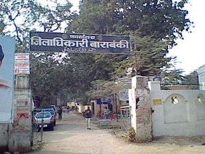
| Headquarters | Barabanki |
| Tehsils |
|
| Government | |
| • District collector | Ajay yadav IAS |
| Area | |
| • Total | 4,402.00 km2 (1,699.62 sq mi) |
| Population (2011) | |
| • Total | 3,260,699 |
| • Density | 740/km2 (1,900/sq mi) |
| • Urban | 330,803 |
| Demographics | |
| • Literacy | 61.7 |
| • Sex ratio | 910 |
| Vehicle registration | UP-41 |
| Major highways | NH 27, NH 28B |
| Coordinates | 26°55′N 81°12′E / 26.92°N 81.20°E |
| Average annual precipitation | 1050 mm |
| Website |
[barabanki |
The Barabanki district is one of four districts of Faizabad division, lies at the very heart of Awadh region of Uttar Pradesh state of India, and forms as it were a centre from which no less than seven other districts radiate. It is situated between 27°19' and 26°30' north latitude, and 80°05' and 81°51’ east longitude; it runs in a south-easterly direction, confined by the nearly parallel streams of the Ghaghara and Gomti. With its most northern point it impinges on the Sitapur district, while its north-eastern boundary is washed by the waters of the Ghagra, beyond which lie the districts of Bahraich district and Gonda district. Its eastern frontier marches with Faizabad district, and the Gomti forms a natural boundary to the south, dividing it from the Sultanpur district. On the west it adjoins the Lucknow district. The extreme length of the district from east to west may be taken at 57 miles (92 km), and the extreme breadth at 58 mi (93 km); the total area is about 1,504 sq mi (3,900 km2): its population amounts to 2,673,581, being at the rate of 686.50 per square kilometre (1,778.0/sq mi). The Barabanki city is the district headquarters.
The district under British rule had an area of 1,769 sq mi (4,580 km2). In 1856 it came, with the rest of Oudh, under British rule. During the Sepoy war of 1857-1858 the whole of the Barabanki talukdars joined the mutineers, but offered no serious resistance after the capture of Lucknow.[1][2]
It stretches out in a level plain interspersed with numerous jhils or marshes. In the upper part of the district the soil is sandy, while in the lower part it is clayey and produces finer crops.[2] The district is well fed by rivers Ghaghra (forming the northern boundary), Gomti (flowing through the middle of the district) and Kalyani and their tributaries, for the major part of the year. Some rivers dry out in the summer, and get flooded during the rainy season. The changing course of the river Ghagra changes the land area in the district, year to year.
The principal crops are rice, wheat, pulse and other food grains and sugarcane. Trade in agricultural produce is active.[2] Both the bordering rivers are navigable; and the district is traversed by two lines of the Northern Railway and North-Eastern Railway, with branches having total length of 131 km.[3] It has good road connectivity also including National Highways NH 28, State Highways and various link roads.
History
The district was known before the Muslim conquest as Jasnaul, from Jas, a raja of the Bhar tribe, who is said to have founded it before 1000 AD. With a change of proprietors came a change of name. The Muslim owners divided the lands into twelve shares, over which the respective proprietors quarrelled so incessantly that they were called the Barah Banke, or twelve quarrelsome men. Banka, in Awadhi, meaning a bully or brave. Others derive the name from ban, meaning wood or jungle, and interpret Barabanki as the twelve shares of jungle.[1]
Legends
Mahabahrat era
Parijaat tree a sacred baobab tree in the village of Kintoor on the banks of Ghaghra.[4] Located near the Kunteshwar Mahadev temple (established by Kunti), the tree is said to grow from Kunti's ashes.[5] The tree is very old.[6]
Pre-historic
Greater part of Barabanki was included in Pachhimrath country (the territory between rivers Ghaghra and Gomti[7]), one of the five divisions of the kingdom of Rama.[8]
Before 1000 AD, Jas, a raja of the Bhar tribe is said to have founded the locality of Jasnaul which later, after the Muslim conquest of the region, came to be known as Bara Banki or Barabanki.[1]
After 1000 till 1525
_procession_Barabanki_India_(Jan_2009).jpg)
The Muslims had made their first permanent settlement in this district at Satrikh, in 421 AH. / 1030 AD.[1]
Sihali, was conquered, and its sovereign, a Siharia Chhattri, was killed. Kintur was captured, and its Bhar queen, Kintama slain.[1]
The battle in which Bhar chief Sohil Deo (or Sohel Dal) of Sahet-Mahet a small northern kingdom (he was the conqueror of Sayyed Salar Masood) was subversed by Sri Chandradeo, the Rathor monarch of Kannauj was fought in Satrikh village of the district.[9]
In 1049 AD / 441 AH, the Kings of Kanauj and Manikpur were defeated and driven from Oudh by Qutub-ud-din of Medina. The Muslim invasion was more successful in Bara Banki than elsewhere. In 586 AH. / 1189 AD, Sihali was conquered by Shekh Nizam-ud-din of Herat, Ansari. Zaidpur was occupied by them in 636 AH, when Sayyad Abd-ul-Wahid turned out the Bhars, altering the name of the town from Suhalpur. The colony of Musalman Bhattis is reported to have arrived about the same time, although some place it as early as 596 AH. / 1199 AD. They came from Bhatnair or Bhattiana, in the Punjab and Rajputana and settled at Mawai Maholara.[1]
After 1350 AD Muslim immigrants started to settle in great number in the district until nearly to middle of eighteenth century.[10] At the Muslims first permanently settled in Oudh.[11]
Rudauli was occupied about 700 AH, in the reign of Alla-ud-din Khilji, whose forces had just about the same time destroyed Anhalwara, Chittor, Dcogir, Mandor, Jessulmere, Gagraun, Bundi, in fact nearly every remaining seat of Chhattri power. Rasulpur was conquered about 1350 AD / 756 AH. Daryabad was founded about 850 AH / 1444 AD, by Dariab Khan Subahdar. Fatehpur was colonized by Fateh Khan, a brother of Dariab Khan, and about the same time. The villages of Barauli and Barai, near Rudauli, were occupied, and gave their name to large estates about the middle of the fifteenth century.[1]
Simultaneously, however, with this latter immigration of the Muslims there was one of Chhattris. The mysterious tribe of Kalhans, which numbers some twenty thousand persons, are said to be descended from Achal Singh, who came in as a soldier of fortune with Dariab Khan about 1450 AD. Raja Achal Singh is a great name in the Middle Ages of Oudh; he had large property—some state that his capital was Bado Sarai, on the old bank of the Ghagra.[1]
At this time Ibrahim Shah Sharqi, reigned at Jaunpur. Oudh was the battle ground—the border land between Sharqis of Jaunpur and the Lodis of Delhi—and their princes, as the tide of conquest surged backwards and forwards. Dariab Khan settled Hindu soldiers as garrisons,—the war being now one between Muslims, and no longer one of religion. The Kalhans are said to have come from Gujarat, the same nursery of Chhattris from which the Ahban, the Pan war, the Gahlot, the Gaur, the Bais, and many other Oudh clans, are believed to have emigrated.[1]
The isolated Suryavanshi estate of Haraha and the Suryavanshi Bahrelia estate of Surajpur were established by small colonies of Chhattri soldiers, who had been dismissed from service about eighteen generations ago (in 1877).[1]
Mughal era (1526–1732)
During Akbar's reign, the district was divided under the sirkars of Oudh, Lucknow and Manikpur.[1][12] Ain-i-Akbari mentions the following parganas during the reign of the Akbar:
| Number | Muhals of Ain-i-Akbari | Parganas as of 1878 | Sarkars of Ain-i-Akbari |
|---|---|---|---|
| 1 | Ibrahimabad | Ibrahimabad | Oudh |
| 2 | Basorhi | Basorhi | Oudh |
| 3 | Bakteha | Baksaha | Oudh |
| 4 | Daryabad | Daryabad | Oudh |
| 5 | Rudauli | Rudauli | Oudh |
| 6 | Sailuk | Sailuk | Oudh |
| 7 | Subeha | Subeha | Oudh |
| 8 | Satrikh | Satrikh | Oudh |
| 9 | Bhitauli | Bhitauli | Lucknow |
| 10 | Dewa | Dewa | Lucknow |
| 11 | Kumbhi | Dewa | Lucknow |
| 12 | Kursi | Kursi | Lucknow |
| 13 | Kahanjra | Kursi | Lucknow |
| 14 | Siddhaur | Siddhaur | Lucknow |
| 15 | Sidhipur | Siddhaur | Lucknow |
| 16 | Sihali | Khiron | Lucknow |
| 17 | Bhilwal | Haidergarh | Manikpur |
| Ref: Gazetteer of the province of Oudh, By Oudh, William Charles Benett Printed at the Oudh government press, 1878, #451,452,454 | |||
Nawabs of Awadh (1732–1856)
Safdar Jang, the wazir, had been absent at Delhi; his naib, Newal Rae, had been defeated and killed at the Kali nadi three years before by the Bangash Afghans of Farukhabad, who then overran the whole province except a few of the fortified towns. In 1749 AD, Safdar Jang himself, with an army of 60,000 men, was defeated by them ; and if at this time the Oudh Chhattris had risen, the Mughal authority might have been overthrown, but they waited till after Safdar Jang, in 1750 AD / 1164 AH, had bribed or beaten the Rohillas out of the country.[1]
Then the tribes gathered themselves together under the leadership of Anup Singh, the Raja of Ramnagar Dhameri; the Janwar (Rajputs) of Balrampur, the Bisens of Gonda, and numerous other lords assembled their forces for an attack on Lucknow, now denuded of the troops which had gone into Rohilkhand. The Shekhzadas of Lucknow came out to meet the enemy, they were joined by the Khanziidas of Mahmudabad and Bilahra, who were connected with them by marriage.[1]
The battle was fought at Chheola Ghat on the Kalyani, on the road to Lucknow. The Musalmans, headed by Nawab Muizz-ud-din Khan of Mahmudabad, won the day. The Balrainpur raja was killed it is said, and an immense number of the allied host, some 15,000 were killed or wounded on both sides. Nor would this number be at all remarkable when large armies, inflamed against each other by religious hatred in addition to the ordinary motives, fought at close quarters. From this event dates the rise of the Khanzadas. The Raikwars were proportionately depressed; the estates of both Baundi and Ramnagar were broken up, and but a few villages left with the raja. The process of agglomeration commenced again, seventy years afterwards, about 1816, on the death of the sagacious Saadat Ali Khan, and before annexation, in 1856, the Ramnagar raja had recovered the whole family estate and added to it largely, while his brother of Baundi had similarly added 172 villages to his domain.[1]
The principal chiefs of Bara Banki during the last years of Nawabi were:—[1]
Taluqa of Ramnagar — The large property consisted of 253 villages belongs to Raja Sarabjit Singh. The Raja was the head of the Raikwar clan, who immigrated to Oudh from the hill country about Kashmir in about 1400 A. D. It is a curious fact that whereas all Rajputs place a special value on the wood of the neem tree, the Raikwars alone are forbidden to use it.
Taluqa of Haraha — The proprietor of this taluqa was Raja Narindr Bahadur, the head of the Surajbans Thakurs. His father, Raja Chbatarpat Singh, is yet alive. Both father and son were afflicted with mental incapacity. The estate, which consisted of sixty-six villages, paid a revenue of Rs. 55,000, was under the management of the local authorities. Certain members of the Raja's family held the estates of Ranimau Qiampur in a separate qubuliat in the Nawabi, and they have thus escaped being placed under the taluqdar's sanad.
Taluqa of Surajpur — This estate comprised fifty-six villages. The proprietor was Raja Udatt Partab Singh, the head of Bahrelia Bais Thakurs. The Raja was mentally and physically unfit to manage his estate ; but so long as his maternal grandfather, Udatt Narain, lived there was no fear of under-proprietors, tenants or patwaris defrauding the family.
The late Raja Singji was a most formidable and violent landholder until he was attacked by Maharaja Man Singh with Captain Orr the incharge of British companies frontier police. They killed almost 70 of his inmate robbers. He was captured and taken prisoner to Lucknow, where he died in jail. Lots of his inmate robbers escaped and migrated to neighbouring districts. It was mainly owing to the bad example set by Singji that the Daryabad district was so turbulent under the native Government, that amils and chakladars were to use a native expression unable to breathe in it— (Nak men dam karta tha.)
Taluqa of Jahangirabad — The taluqdar of Jahangirabad was a Qidwai Sheikh, Raja Farzand Ali Khan. He owed his position to two circumstances:
- his marriage with the daughter of Raja Razzaq Bakhsh, the late proprietor of the taluqa;
- to a fortuitous incident which occurred about three years before annexation.
Farzand Ali was the darogah in charge of the Sikandarbagh at Lucknow. On one occasion of the last king of Oudh visiting the garden, he was struck with the appearance of this young man, and presenting him with a khilat, directed him to attend at the palace.
With such a signal mark of the royal favour, Farzand Ali's advancement was rapid, and, under the interest of the influential eunuch, Bashir-ud-daula, he obtained a farman designating him the Raja of Jahangirabad. This taluqdar followed the deposed king to Calcutta, and was there during the mutinies. Raja Farzand Ali was very intelligent, and well able to manage his estate with prudence and circumspection.
Taluqa of Barai — Chaudhri Ghulam Farid, a Siddiqi Shekh, was the largest landholder of the Rudauli tahsil. He owned thirty-nine villages. At the summary settlement before annexation, he contemplated depriving the children of his cousin, Mumtaz Ahmad, of their share in the estate, unmindful of the past long possession of his cousin; but at the earnest representations of Sayyad Abdul Hakim, an extra assistant commissioner, who was respected throughout the district, he made a fair division; in fact, he gave them half the estate.
Taluqa of Usmanpur - The Taluqdar of Usmanpur were Bisen rajput migrated from Manjhouli State. This is the most famous Bisen Khanzada family UP. This estate was founded by one Kaunsal Singh (Raja Khushal Singh), who obtained an estate as a reward for military service under the Mughal Emperor Humayun. One of his sons Lakhan Singh converted to Islam, and took the name Lakhu Khan.He equally devided his state into three Taluqas, Lakhupur, Kothi & Usmanpur. Kothi to Thakur Haibat Khan, Usmanpur to Thakur Ahmad Khan & Lakhupur To takur Dawood Khan. Later on Thakur Ghaznafar Khan Taluqdar of Usmanpur established it as a gusseted Taluqa,who was confirmed ownership of Usmanpur and neighbouring villages by the Nawabs of Awadh. He owned forty villages (Gazetteer of awadh). After mutiny of 1857 the Taluqa of Kothi was occupied by Britishers from Thakur Roushan Zama khan. After the death of Taluqdar Usmanpur Tahkurain zahirunninsa, the Taluqa handed over to Thkaur Roushan Zama Khan with a mutual opinion of nearest Taluqdars & British officers of Siddhour. He ruled the Taluqa till 1872. After that the Ali Bahadur Khan (Chouhan Rajpoot from Faizabad) brother of Thakurain zahirunnisa appeal for this property with the help of raja Man Singh. After a long judicial fight Thakur Roushan Zama Kahn & Ali Bahadur Khan make mutual deed with the interference of Raja Jahagirabad & Thakur Shiv Sahai taluqdar of Semrawa. Currently both Families are living in Usmanpur. Bisen Khanzada family is known as the " Badi sarkar" & Ali Bahadur Khan's family is known as "Choti Sarkar"
Taluqas of Satrikh —This estate comprised 85 villages. All the villages pay their 'Lagan' (Tax)to the Taluqedar of Satrikh. After 1857, Satrikh estate was ruled by Taluqedar Qazi / Kazi Ikram Ahmad and preceded by Qazi Kamaluddin Ahmad. The previous Chaudhry's were dispossessed for resistance to the British during the War of Independence. They were descendants of the original Usmani's who immigrated to Oudh in the early part of the millennium.
Taluqas of Rudauli —there were in all forty-three.[1]
1857 war of independence
Unlike what occurred in the districts of Hardoi, Gonda, and Lucknow, the whole body of the taluqdars in this district joined the cause of the deposed king and the mutineers. They offered no resistance however, of any moment to the advance of the British troops after the capture of Lucknow ; in the battle of Nawabganj.[1]
British (1858–1947)
The Sadr station (district headquarters) was placed at annexation and also after the mutinies at Daryabad, but owing to the stagnation of water in the immediate vicinity of the town, and to the prevalence of fever, the headquarters were removed in 1859 to Nawabganj, Bara Banki.[13]
During 1869 census of Oudh, total thirteen large towns or kasbahs were identified in the district,[14]
- Nawabgunj
- Musauli
- Rasauli
- Satrikh
- Zaidpur
- Sidhaur
- Dariabad
- Ichaulia
- Rudauli
- Ram Nagar
- Bado Sarai
- Kintoor
- Fatehpur
Following were tahsils and parganas during 1869 census:
| Tahsil | Pargana |
|---|---|
| Nawaba Ganj | Nawabganj |
| Patabganj | |
| Satrikh | |
| Sidhaur | |
| Ram Nagar | Ramnagar |
| Bhitouli | |
| Bado Sarai | |
| Fatehpur | |
| Mohammedpur | |
| Sani Ghat | Dariabad |
| Surajpur | |
| Rudauli | |
| Mawai Mahulara | |
| Barsorhi |
In 1870 before addition of two parganas from Lucknow (i.e. Kursi & Dewa) and one pargana each from Rae Bareli (i.e. Haidergarh) & Sultanpur (i.e. Subeha), Bara Banki district had area of 1,285 sq mi (3,330 km2) and had following subdivisions:[13]
| Tahsil | Pargana | No. of Villages | Area (in acres) | Major Talukas & Talukdars |
|---|---|---|---|---|
| Nawabaganj | Nawabganj | 77 | 50,484 | I.— Jehangirabad, Raja Farzand Ali Khan II.— Sohailpur Bhanmau, Mir Buniad Husen and Amjad Husen. III.— Satrikh, Kazi Sarfraz Ali. IV.— Simrawan, Bissein Thakur Sheo Sahai. V.— Shahpur, Ghulam Abbas and Mahomed Amir. VI.— Gaddia, Shekh Zainulabdin. VII.— Usmanpur, Thakurain Zahur-un-nissa. |
| Partabganj | 54 | 35,834 | ||
| Satrikh | 43 | 29,358 | ||
| Siddhaur | 224 | 90,377 | ||
| Daryabad-Rudauli (later named to Ram Sanehi Ghat) |
Daryabad | 241 | 136,931 | I.— Surajpur Raja Udatpertab Singh, Burhelia Thakur. II.— Haraha, Raja Narindur Bahadur, Surajbans Thakur. III.— Kamiar, Shere Bahadur, Kalhans Thakur. IV.— Rampur, Rai Ibram Bali, Kaisth. V.— Saidanpur, Latafat-ullah and Inayat-ullah. VI.— Nirauli, Chaudhri Husen Baksh. VII.— Amirpur, Inayat Rassul. VIII.— Purai, Mahomed Abid. IX.- Daryabad, Rai Rajeshwar Bali. |
| Surajpur | 107 | 61,645 | ||
| Rudauli | 196 | 110,553 | ||
| Mawai | 51 | 45,469 | ||
| Barsorhi | 44 | 21,958 | ||
| Ramnagar | Ramnagar | 168 | 71,756 | I.— Ramnagar, Raja Sarabjit Singh, Raikwar Thakur. II.— Bilheri, Raja Ibad Ali. III.— Mahmudabad, Raja Amir Hussan Khan. IV.— Bhatwamau, Badshah Husen Khanzada. V.— Muhammadpur, Ganga Singh, Raikwar. |
| Fatehpur | 251 | 98,532 | ||
| Muhammadpur | 83 | 39,568 | ||
| Bado Sarai | 56 | 30,541 | ||
| Total | 1,595 | 323,011 | ||
In 1871 talukdars held about half the district and number 53, village zemindars number 5,397, and under-proprietors 1,354. Following is details of talukas:[13]
| Name of Taluka | Name of Talukdar | No. of Villages | Area (in acres) |
|---|---|---|---|
| Ramnagar | Raja Sarabjit Singh | 358 | 108,286 |
| Huraha | Raja Nurindur Bahadur Singh | 66 | 29,960 |
| Bhanmau | Mir Umjad Hosein | 10 | 5,233 |
| Jehagerabad | Raja Farzand Ali Khan | 72 | 22,751 |
| Surajpur | Raja Talaywand Koer | 64 | 36,388 |
| Mahmudabad | Raja Amir Hassan Khan | 89 | 28,680 |
| Man Singh | Maharaja Man Singh | 16 | 13,009 |
| Malaraiganj | Nawab Ali Khan | 11 | 3,235 |
| Shahabpur | Mahomed Amir and Gholam Abbas | 8 | 3,578 |
| Simrawan | Thakur Sheosahai | 8 | 4,188 |
| Sohailpur | Mir Umjad Hosein | 8 | 2,458 |
| Ushdamow | Panday Bahadur Singh | 16 | 3,684 |
| Usmanpur | Thakur Roushan Zama Khan | 25 | 7,325 |
| Kharkha | Mahomed Hosein | 10 | 4,593 |
| Guddia | Shaikh Zainulabdin | 12 | 1,933 |
| Satrikh | Kazi Ikram Ahmed | 85 | 9,420 |
| Gootiah | Hakim Kurrum Ali | 13 | 5,549 |
| Subeha | Surfaraz Ahmed | 1 | 564 |
| Sulaunpur | Nawab Ali Khan | 6 | 3,892 |
| Kotwa | Abid Ali | 1 | 331 |
| Motree | Bhugwant singh | 1 | 1,040 |
| Tribadiganj | Raja Thakurpershad Tribadi | 2 | 813 |
| Lillowly | Buxshee Harpershad | 11 | 2,510 |
| Nurhowl | Shaik Boo Ali | 3 | 1,465 |
| Mirpur | Nusserudeen | 4 | 2,416 |
| Baytowly | Maharaja Runbir Singh | 5 | 3,535 |
| Rampur | Thakur Gooman Singh | 1 | 357 |
| Jubrahpur | Thakur Ruder Pratab Singh | 2 | 700 |
| Bilharrah | Raja Ibad Ali Khan | 41 | 15,838 |
| Muhammadpur | Thakur Ganga Singh | 26 | 4,981 |
| Bhatwamau | Badsha Hasan Khan | 23 | 8,459 |
| Rampur | Rai Ibram Balli | 35 | 13,571 |
| Kumyar | Shere Bahadur | 10 | 13,430 |
| Sydanpur | Latafat-ul-lah and Mayet-ul-lah | 13 | 5,428 |
| Pushka | Naipal Singh | 4 | 2,129 |
| Raneemau | Outar Singh | 14 | 5,687 |
| Nurrowly | Chaudhri Razah Husain | 45 | 23,157 |
| Barrai | Chaudhri Gholam Farid and Mahboob-ul-Rahamn | 46 | 16,039 |
| Purai | Meer mahomaed Abid | 14 | 6,722 |
| Amirpur | Chaudhri Ishan Russul | 13 | 4,557 |
| Burrowly | Chaudhri Wazeer Ali | 25 | 3,871 |
| Nearah | Shere Khan | 13 | 2,993 |
| Retch | Raghunath Singh | 1 | 2,183 |
| Total | 1,158 | 4,36,574 | |
In 1877 Barabanki was one of the three districts of the then Lucknow division.[15] Its area was 1,768 sq mi (4,580 km2) and population was 1,113,430.
As per 1877 Gazetteer of the province of Oudh there were:[1]
- Four tehsils:
- Nawabganj
- Ram Sanehi Ghat
- Fatehpur
- Haidergarh
- Nine thanas:
- Nawabganj
- Zaidpur
- Tikaitnagar
- Sanehi Ghat
- Bhilsar
- Fatehpur
- Kursi
- Ramnagar
- Haidergarh
- Courts, following were officers with civil, criminal and revenue powers:
- a deputy commissioner
- two assistant commissioner
- three extra assistant commissioner
- four tehsildars
- four honorary magistrates
Independence movement
In the War of Independence against the British from the year 1922 to 1934 during the Khilafat movement the district participated whole heartidely in the growing movement against foreign fabrics, etc.[16] On 26 October 1942, Brij Bahadur and Hans Raj alias Sardar planted a bomb in police out post at Barabanki, the incidence is known as Barabanki Out post Bomb Case.[17]
Geography
The district is for the most part flat to monotony, there is an utter absence of mountains; the most elevated point is about four hundred and thirty feet above the sea; and there are few points of view from which any expanse of country can be surveyed. The verdure and beauty of the groves with which it is studded in every direction redeem the prospect from bare ugliness, and when the spring crops are green and the jhils yet full of water, the richness of the landscape is very striking. Here and there patches of uncultivated waste are to be seen, but a high assessment and security of tenure are rapidly converting them into waving fields of corn. Towards the north, especially along the old bank of the Ghaghra, the ground is undulating and richly wooded, while to the south there is a gentle slope down to the Gomti. The monotonous level is broken on the north by an abrupt fall, the ridge running parallel to the Ghaghra at a distance of from one mile (1.6 km) to three miles (5 km), is said to indicate what was formerly the right bank of the river. The district is intersected at various parts by rugged ravines.[1]
River system and water resources
Ghaghra
The principal river in the district is the Ghaghra, at a short distance from Bahramghat; in the Fatehpur tahsil the rivers Chauka and Sarda meet, and their united stream is called the Ghaghra. Both those component rivers take their rise in the Himalaya and at their confluence form a stream, which at Bahramghat is in the rainy season from one and a half to two miles (3 km), and in the dry season half mile in breadth. The Gogra divides the Bara Banki district from the districts of Bahraich and Gonda. It flows in a south-easterly direction past Faizabad, and finally empties itself into the Ganges at Arrah, above Dinapore. This river is navigable for flat-bottomed steamers as far as Bahramghat; but the traffic is at present confined to country boats which ply in considerable numbers between Bahramghat and Sarun district. It has been stated that the ancient course of the river is indicated at a distance of from one to two miles (3 km) from the existing right bank by a ridge about 20 feet (6.1 m) high. The low lands between the ancient and present channels generally have fine crops of rice, but the water sometimes lies too long after the rains and rots them, and the spring crops cannot be sown. The river is not utilized for purposes of irrigation.[1]
The Ghaghraflows for forty-eight miles on the border of the district; the dry weather discharge is 19,000 cubic feet (540 m3). The principal ferries are at Kaithi, Kamiar, and Paska Ghat; there is a boat-bridge during the cold season at Bahramghat.[1]
Gomti
Next in importance is the Gomti, which runs through the tahsil of Haidargarh and some portion of the tehsil Ram Sanehi Ghat and separates the Bara Banki district from the districts of Lucknow, Sultanpur and Faizabad. It runs like the Ghagra in a south-easterly direction, has a well-defined bank and a stream which is fordable in the dry weather, and is about 40 yards broad. There is considerable traffic on the Gumti by country boats.[1]
The Gomti flows for 105 miles (169 km) through, or on the border of the district, but its course is so circuitous that the direct distance from the point of entrance to that of exit is only forty-two miles; it is not therefore so useful for navigation, and it lies too low for irrigation; its dry weather discharge is 500 cubic feet (14,000 L). Its water is actually at a lowest level than that of the Ghagra. At the junction of the Kalyani the former is only 301 feet (92 m) above the sea; at Rudauli, the watershed between it and the Ghagra the altitude is 340 feet (100 m); and at Kaithi Ghat the Ghagra is 314 feet (96 m).[1]
Kalyani
The Kalyani River rises in the Fatehpur tahsil, and after wandering through the district in a most tortuous course, empties itself into the Gomti near the village of Dwarkapur.[1]
In the rains of 1872, the river Kalyani presented a vast volume of water 269 feet (82 m) broad, 337 feet (103 m) deep, rushing along with a velocity of 5.74 miles per hour and with a discharge of 51,540 cubic feet per second (1,459 m3/s). In ordinary monsoons the highest discharge is about a quarter less than this.[1]
The river is crossed by the railway with a girder bridge with (6) six openings, each of 60 feet (18 m).[1]
Jamuriha and Reth
The Jamuriha and Reth, both in the Nawabganj tehsil, are the only other streams in this district worthy of notice. Their general characteristics are the same: steep and rugged banks broken by innumerable ravines, mere drains in dry weather but becoming angry torrents during the rains; they flow into the Gomti. Haidergarh, Deviganj, Choury and Alapur are settlements worth mentioning on the banks of the river Reth, while Jamuriha passes through Barabanki city (Barabanki revenue village on one side and Nawabganj Tehsil hq on other).[1]
Tanks, jheels and wetlands
There are numerous tanks and jheels, especially in the tehsils of Daryabad, Ram Sanehi Ghat, and Nawabganj. Seven per cent, of the area is covered with water; many of the tanks are in course of being deepened, the earth taken out of them being used to replenish cultivated land, and doubtless much more would be done in this direction but for the difficulty of adjusting conflicting rights in the tanks. Some of the jheels are navigable by small boats for purposes of sport or pleasure. The finest jheel in this district, that named Bhagghar, is situated in the Ramnagar pargana; it does not cover above two square miles. There is another in Dewa, covering about five square miles with water and marsh. Parva, Nardahi, and Ganhari Jheel are the wetlands in the district.[1]
The Gomti-Kalyani doab
This doab is a fertile area of about 146,526 ha lies in the district and is bounded by Kalyani river on the North and the Gomti river and its tributary on the South. On the west, the area extends up to the Sarda Sahayak feeder channel and on the east up to the confluence of the Gomti and Kalyani rivers.[18][19]
Administration and divisions
Administrative set up


Barabanki is one of the four constituent districts of Faizabad Division. The other districts being Faizabad district, Sultanpur district and Ambedkar Nagar district. The Division is headed by the Divisional Commissioner.
As of 2003–04 district contained 7 Tehsils, 17 Development Blocks, 154 Nyay Panchayat and 1140 Gram Sabhas.[20]
As per 1991 data there were 1812 habitated villages and 31 inhabited villages. In 2001 there were 14 towns and cities, 2 Nagar Palika Parishads, 1 Cantonment area, 10 Nagar Panchayats and 1 Census Town.[20]
Land administration
District Barabanki has been divided into six subdivisions, popularly known as tehsils. The District Revenue Administration is headed by the District Collector (also known as District Magistrate), with office at the collectorate, and these tehsils are under the charge of Sub-divisional Magistrates. The six tehsils are:
- Nawabganj
- Fatehpur
- Ramsanehi Ghat
- Haidergarh
- Ram Nagar
- Sirauli Ghauspur
Development
The District level developmental activities are coordinated by the Chief Development Officer having his office in DRDA at collectorate. Block Development Officers, who head each of the Development Blocks into which the district is sub-divided carry out the development schemes on behalf of government. Barabanki encompasses 15 such Blocks, they are:
- Banki
- Masauli
- Dewa
- Harakh
- Fatehpur
- Haidergarh
- Dariyabad
- Suratganj
- Siddhaur
- Pure Dalai
- Nindura
- Trivediganj
- Ram Nagar
- Sirauli Ghauspur
- Banikodar
The district level offices for monitoring the developmental activities of Blocks at Barabanki are located at Vikas Bhawan.
Law and order
The Law and order administration is jointly coordinated by the District Magistrate and the Superintendent of Police. The district is subdivided into 22 Police Stations / Thanas. Each Police Station / Thana is headed by an officer of the rank of Inspector or sub-inspector of police. 12 Police Stations are rural and 9 are rural.[20]
- Haidergarh
- Satrikh
- Dariyabad
- Baddupur
- Dewa
- Kursi
- Zaidpur
- Mohammadpur
- Ram Nagar
- Fatehpur
- Safderganj
- Kotwali
- Ramsanehi Ghat
- Asandra
- Subeha
- Tikait Nagar
- Lonikatra
- Masauli
- Kothi
- Ghungter
- Badosarai
- Jahangirabad
Urban
The district has 14 urban administrative bodies for the administration and provision of civil amenities in towns. The towns in the district are:
- Nawabganj Nagar Parishad for Barabanki Town
- Zaidpur Nagar Panchayat for Zaidpur Town Area
- Fatehpur Nagar Panchayat for Fatehpur Town Area
- Dariyabad Nagar Panchaya for Dariyabad Town Area
- Ramnagar Nagar Panchayat for Ramnagar Town Area
- Satrikh Nagar Panchayat for Satrikh Town Area
- Haidergarh Nagar Panchayat for Haidergarh Town Area
- Dewa Nagar Panchayat for Dewa Town Area
- Siddhaur Nagar Panchayat for Siddhaur Town Area
- Tikaitnagar Nagar Panchayat for Tikaitnagar Town Area
- Rudauli Nagar Parishad for Rudauli Town
- Banki Nagar Panchayat for Banki Town Area
- Cantonment Board for Cantonment Area in Barabanki
- Rampur Bhavanipur Census Town
Electoral
Parliament and State Assembly
Barabanki district has got seven state-assembly constituencies which fall under two parliamentary constituencies, they are:
| S No | No of Assembly Constituency | Name of Assembly Constituency | Assembly Constituency Reservation Status | Total Booths in Assembly Constituency | Net Voters in Assembly Constituency | No of Parliamentary Constituency | Name of Parliamentary Constituency | Parliamentary Constituency Reservation Status | Net Voters in Parliamentary Constituency | Ref |
| 1 | 266 | Kursi | General | 343 | 295030 | 53 | Barabanki | SC | 1435692 | [21] |
| 2 | 267 | Ram Nagar | General | 323 | 260400 | [22] | ||||
| 3 | 268 | Barabanki | General | 322 | 289765 | [23] | ||||
| 4 | 269 | Zaidpur | SC | 359 | 302189 | [24] | ||||
| 5 | 272 | Haidergarh | SC | 327 | 288308 | [25] | ||||
| 6 | 270 | Dariyabad | General | 337 | 304073 | 54 | Faizabad (partial) | General | 1506120 | [26] |
| 7 | 271 | Rudauli (partial) | General | 304 | 282890 | [27] |
State Assembly
Sitting MLAs :[28]
- Fareed Mahfooj Kidwai, 266-Kursi,Current Planning Minister of Uttar Pradedsh
- Arvind Kumar Singh 'GOPE', 267-Ramnagar visit website
- Dharmraj yadav, 268-Barabanki
- Ramgopal, 269-Zaidpur
- Rajeev Kumar Singh, 270-Dariyabad
- Shri Ram Magan, 272-Haidergarh
State Council
Barabanki district sends two members to state-council. Sitting members are:[28]
- Arvind Yadav
- Ram Naresh Rawat
Basic amenities
Following is the list of public amenities (1999-2002 data):[20]
Road transport
National Highways 28 pass through the district. It is well connected to other cities by means of roadways. Passenger road transport services in the state of U.P. started on 15 May 1947 with the operation of bus service on the Lucknow – Barabanki route by the erstwhile U.P. Government Roadways.[29]
- Bus Station/Bus Stop 93
Railway
Both the Northern Railway and the North Eastern Railway pass through Barabanki district.
- Length of railway line: broad gauge 131 km
- Railway Stations/Halts: 19
Communication services
- Urban Post Office 26
- Rural Post Office 339
- Telegraph Office 19
- telephone Connections 25691
Public distribution system
- Rural Fair Price Shops 1094
- Urban Fair Price Shops 118
- Bio-gas Plants 4645
- Cold Storage 16
Electricity
- Total Electrified Villages 1103
- Total Electrified Towns/Cities 13
- Electrified Schedule Caste localities 1149
Water supply
Area covered under water supply using taps/ handpumps of India Mark-2:
- Village 1812
- Towns/City 14
Entertainment
- Cinema Halls 2
- Total No. of seats in Halls 2675
Demographics
_of_Barabanki_District.png)
_of_Barabanki_District.png)
According to the 2011 census Barabanki district has a population of 2,673,581,[30] roughly equal to the nation of Mauritania[31] or the US state of Iowa.[32] This gives it a ranking of 107th in India (out of a total of 640).[30] The district has a population density of 740 inhabitants per square kilometre (1,900/sq mi) .[30] Its population growth rate over the decade 2001-2011 was 26.40%.[30] Barabanki has a sex ratio of 887 females for every 1000 males,[30] and a literacy rate of 47.39%.[30]
As per 'Provisional Population Totals Paper 1 of 2011 Uttar Pradesh Series 10' report of Census of India 2011,[33] Barabanki district stood at 28 position out of 71 districts of UP by having 1.63% population of state, in 2001 census it was at 32 position with 1.61% population; Barabanki District rose to 25 position with sex ratio of 908 in 2011 from that of 30 with sex ratio of 887 in 2001; density wise the district maintained its position at 46 although density in 2011 increased to 739 from that of 623 in 2001; the district was at 56 position in state with overall literacy rate of 63.76%. Indian census, 2011 in its 'Provisional Population Totals' report for Uttar Pradesh gives following stat for the district:[34]
| Total Population | Males | Females | Percentage Decadal Growth 2001-2011 | Sex Ratio | Density (persons per km2.) | Child Population (0–6 years) | Child Sex Ratio (0–6 years) | Male Literacy | Female Literacy | Total Literacy |
|---|---|---|---|---|---|---|---|---|---|---|
| 3,257,983 | 1,707,951 | 1,550,932 | 21.86 | 908 | 740 | 504,272 | 930 | 63.76 | 72.49 | 54.10 |
Annual Health Survey 2010-11[35] gave following stats for the district:
| Crude Birth Rate | Crude Death Rate | Natural Growth Rate | Infant Mortality Rate | Neo-natal Mortality Rate | Post Neo-natal Mortality Rate | Under Five Mortality Rate | Sex Ratio at Birth ♀/♂ | Sex Ratio (0- 4 Years) ♀/♂ | Sex Ratio (All Ages) ♀/♂ | |
|---|---|---|---|---|---|---|---|---|---|---|
| Total | 26.0 | 7.6 | 18.4 | 71 | 55 | 16 | 95 | 930 | 922 | 893 |
| Urban | 26.4 | 7.7 | 18.7 | 72 | 57 | 15 | 97 | 936 | 933 | 896 |
| Rural | 21.1 | 6.1 | 15.0 | - | - | - | - | 838 | 780 | 857 |
As per Annual Health Survey 2010-11[36] district's stats for wealth index were:
| Lowest (20%) | Highest (20%) | |
|---|---|---|
| Total | 33.8 | 7.1 |
| Urban | 35.2 | 4.9 |
| Rural | 10.3 | 42.9 |
As per AHS 2010-11,[37] district's effective literacy rate was 67.6 (Rural - 66.5, Urban - 80.9) for males it stood at 77.1 (Rural - 76.4, Urban - 85.8) and for females it was 56.9 (Rural - 55.3, Urban - 75.3). Also, 1.518% of total population had some kind of disability and rate of severe injury was 188 per 100,000 person while rate of major injury was 122 per 100,000 person and rate of minor injury stood at 423 per 100,000 person. Out of 100,000 person 691 were suffering from Diarrhoea/Dysentery, 966 out of 100,000 person were suffering from Acute Respiratory Infection (ARI), out of 100,000 person 3,698 suffered from some kind of Fever, 5,592 out of 100,000 suffered from one or another type of Acute Illness. 98.3% of persons suffering from Acute Illness were taking treatment from any source (6.6% taking treatment from Government Source). Out of 100,000 person 5036 were having some kind of Symptoms of Chronic Illness of which 83.1% sought Medical Care. 139 out of 100,000 person were suffering from Diabetes. 418 out of 100,000 person were suffering from Hypertension. 234 out of 100,000 person were suffering from Tuberculosis. 578 out of 100,000 person were suffering from Asthma/Chronic Respiratory Diseases. 801 out of 100,000 person were suffering from Arthritis. 4964 out of 100,000 person were suffering from any kind of Chronic Illness of which 45.5% were getting Regular Treatment (20.3% getting Regular Treatment from Government Source).
18.3% of population was having habit of chewing with tobacco while 1.1% were in habit of chewing without tobacco. 15% of population was having habit of smoking. 4.2% population was having habit of drinking alcohol.
Minority population is about 23% of the total population of the district. Barabanki is a category "A" district i.e. having socio-economic and basic amenities parameters below the national average.[38]
Religion
According to various religion-wise percentage of population in the district is Hindus 77.51, Muslims 22.04, Sikhs 0.12, Jains 0.11, Buddhists 0.09, Christians 0.08, others not specified 0.05. In U.P. the religion-wise percentage of population is Hindus 80.61, Muslims 18.50, Sikhs 0.41, Jains 0.12, Buddhists 0.18, Christians 0.13, Others not specified 0.05.[39]
Languages
Among many languages spoken in the district are Awadhi, a vernacular in the Hindi continuum spoken by over 38 million people, mainly in the Awadh region.[40]
Economy
Agriculture
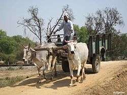
The district's economy is primarily based on agriculture.[41] Agriculture, bio-gas plants, animal husbandry, small-scale industries provide direct and indirect employment to the people of district.[42][43]
In Barabanki net irrigated area is 84.2 per cent as compared to U.P. 79.0 per cent. The intensity of irrigation in Barabanki is 176.9 per cent when it is 140.0 per cent in U.P. In district Barabanki irrigation facility is above the state average. In Barabanki most of irrigation is done by private Tubewells and canals, which are 69.0 and 29.9 per cent respectively, whereas in U.P. it is 87.9 and 20.9 per cent respectively. In Barabanki irrigation by state Tubewells and other sources like pond/river, etc. are comparatively less than the state average.
In district Barabanki subsistence agriculture is practiced. Farmers rotate up to five crops round the year.[44] The dominant crops are cereals mainly paddy and wheat covering 34.4 and 31.3 per cent respectively lands of gross cropped area, whereas in U.P., it is 23.1 and 40.6 per cent respectively. Overall in Barabanki, cereal crops occupy 68.4 per cent area when in U.P., it occupies 73.2 per cent area. In Barabanki overall pulses occupy 10.1 per cent, when in U.P., it is 11.6 per cent. Total foodgrains area in Barabanki is 78.5 per cent, when in U.P., it is 84.9 per cent. Area under sugarcane is quite less, i.e. 3.6 per cent, whereas in U.P., it is 9.5 per cent. Potato covers 2.8 per cent area, which is more than U.P., i.e. less than 2.0 per cent. Wheat, rice and maize are chief food crops of the district.[45][46] Opium, menthol oil, sugarcane, fruits (mango, banana, Mushroom, etc.), vegetables (potato, tomato, etc.) floweres (Gladiolus, etc.), spices, etc. are chief cash crops of district.[47][48][49][50][51][52] District also exports Mangoes and vegetables.[53]
Barabanki district is leading the country in menthol farming. Barabanki’s menthol cultivation is spread over 20,000 acres (81 km2).[53][54][55]
Livestock based farming system is also found in the district[56] Broiler farming is also done in the district.[50] Bee keeping is also practiced in the Dewa block of the district.[42][50] Fish cultivation is also prevalent in the district.[50]
District has Regional Agriculture Seed Testing & Demonstration Station of Department of Agriculture of government of India.[57]
In 2004 Indian Council of Agricultural Research's National Academy of Agricultural Research Management has established a Krishi Vigyan Kendra under Narendra Dev University of Agriculture and Technology in the district.[58] Institute for Integrated Society Development has established one Rural Technology Development and Dissemination Centre in the year 2002 at Nindura Block of Barabanki District.[42] National Fertilizers Limited has established a Soil Testing Lab in the district.[59] Information and Communication Technologies has a centre in the district.[60]
Cottage industry
- Handicrafts industry[61]
- Handloom industry[62]
- Weaving products are apparels Scarfs, Shawls and Stoles, which have a good export market.[63] These products are broadly categorized into two segments:
- Rayon fiber
- Cotton yarn
- Barabanki has emerged as an handkerchief production hub from where unfinished product is taken and supplied back after they are finished.[64] Scarves from Barabanki were displayed at the national handloom expo - 2013 held at Kozhikode from 16 February to 7 March 2013, national handloom expo is an exhibition to showcase diverse range of handloom products from different regions in the country.[65]
- Zardozi- In 2013 the Geographical Indication Registry (GIR) accorded the Geographical Indication (GI) registration to the Lucknow Zardozi – the world-renowned textile embroidery from Lucknow. The Zardozi products manufactured in areas in Lucknow and six surrounding districts of Barabanki, Unnao, Sitapur, Rae Bareli, Hardoi and Amethi became a brand and can carry a registered logo to confirm their authenticity.[66]
- Kshetriya Shree Gandhi Ashram, Lucknow road, Barabanki
Industry
There are 6 industrial areas in the District Barabanki,[67]
- UPSIDC, Kursi Road, Barabanki
- Industrial Area, Dewa Road, Barabanki
- Industrial Area, Rasool Panah, Fatehpur, Barabanki
- Mini Industrial Area, Ismailpur, Dewa, Barabanki
- Mini Industrial Area Amarsanda, Barabanki
- Mini Industrial Area Sohilpur, Harkh, Barabanki
Barabanki has following industries and factories:
- The Company is engaged in manufacturing of polyester staple fibre, polyester, and tow with technology from Du Pont, USA.
- U.P. State Spinning Mill, Barabanki
- U.P. State Sugar Corp. Ltd., Barabanki
- DSM Sugar, Rauzagaon, Barabanki, U.P.[69]
- Hally Industries pvt. Ltd., Barabanki
- Company has achieved ISO 9001,9002,9004,ISO9001:2000 QMS Certification and KVQA Certificate from Netherland for manufacture and supply of all types of medium and high quality superior Welding Electrodes for supply in the Indian Railways. It further owns a Wire-drawing unit and a Rice Mill.
- 4.4 km Dewa road, Somaiya Nagar, Barananki
- Having solvent extraction plant & vegetable oil refinery (Saheli Brand).
- J.R. Organics Ltd. (formally Somaiya Organics Ltd.)
- Bharat Rubber Industries
- Company has achieved ISO 9001:2000 QMS Certification from SWISO for manufacture and supply of Rubber to Metal Bonded and Extrusion Rubber Production and Ribber Moulded Items. The consultancy services were provided by TQ Vision, New Delhi.[71]
- Shree Shyam Industries, Tehsil Fatehpur
Solar power plant
The first 2 megawatt-capacity solar power plant project of Uttar Pradesh is situated in village Sandauli of Barabanki district, it was inaguarted on 10 May 2012 and become operational in January 2013.[72][73] The plant has been set up by company named Technical Associates Ltd.[74]
Banking
|
|
Culture
Cultural heritage
In 2011-12 more than 19.57 lakh visitors visited twin sites of Deva Sharif shrine and Mahadeva temple.[75]
Notable personalities
Royalty
Notable royals in Barabanki's history include:
- Rai Rajeshwar Bali (1889–1944), 13th Taluqdar of Rampur-Daryabad Estate (Uttar Pradesh).
Sports
Notable athletes from Barabanki include:
- Kunwar Digvijay Singh, (2 February 1922 – 27 March 1978), hockey player. He was captain of the gold-medal winning Indian Olympic Hockey team at the 1952 1952 Summer Olympics.[76]
- R. P. Singh, a cricketer, was born in Purebala, Barabanki.
- Atul Verma, won India its first Olympic archery medal, a bronze in the boys' individual archery competition at the 2014 Youth Summer Olympics which took place from 22–26 August in Nanjing, China.[77]
Literary
Sant
- Sant Kavi Jagjivan Das (born 1727, date of death unknown), founder of the Satnaami branch of Hinduism. He wrote Aagam Paddhati, Agh Vinaash, Gyan Prakash, Maha Pralay, Param Granth, Prem-Path, and Shabd-Sagar.[76]
Sufi
- Sayyed Salar Sahu Ghazi of Satrikh (d. 1200s),
- who not only won the recognition of his contemporaries but who exerted after his death one of the most powerful influences in Awadh spiritual history.[78][79]
- Waris Ali Shah, (1819–1905), a Sufi saint from Dewa, was the founder of Warsi order of Sufism and a poet. He wrote Hans-Jawahir.[76]
Urdu/Persian (19th century)
- Ayatollah Mufti Syed Muhammad Quli Khan Kintoori,
- principal Sadr Amin at the British court in Meerut. He was also author of Tathir al-mu'minin 'an najasat al-mushrikin.[80][81][82]
- Ayatollah Syed Mir Hamid Hussain Musavi Kintoori Lakhnavi (died 1880)
- son of Mufti Syed Quli Khan Kintoori author of book Abaqat ul Anwar fi Imamat al Ai'imma al-Athar.[80][83][84][85][86]
- Maulana Abdul Majid Daryabadi
Urdu and Persian (20th century)
- Ibrahim Beg of Dewa.
- Khuda Bux Sheikh of Dariyabad, wrote poetry and a biography of Waris Ali Shah.[87]
- Khumār Barabankvi (1919–1999), an Urdu poet and lyricist.
- Mawlwi Abdul Bari Nadwi, was member of first Managing Committee of Darul Mussannefin Shibli Academy[88]
Majaz lucknowi is prominent Urdu poet from barabanki, he hails from rudauli and maternal uncle of famous lyricist Javed Akhtar.
Politicians
- Rafi Ahmed Kidwai, freedom fighter and Congress leader
- Mohsina Kidwai, politician
- Amir Haider, politician
- Beni Prasad Verma, politician, former MP and Ministry of Steel of India
- Panna Lal Puneya, former Member of Loksabha from Barabanki (Lok Sabha constituency), politician
- Priyanka Singh Rawat, current Member of Loksabha from Barabanki (Lok Sabha constituency), politician
- Akhlaqur Rahman Kidwai, politician
- Arvind Singh, Samajwadi Party, Politician
Others
- Shaikh Abd al-Quddus Gangohi (1456–1537) bin Shaykh Muhammad Ismail bin Shaykh safi al-djn Hanafi Ghaznavi Chishti Gangohi, a Sufi Shaykh of the Sabiri branch of the Chishti silsila.[89]
- Seyyed Ahmad Musavi Hindi, paternal grandfather of Ayatollah Khomeini, was born in Kintoor.[83][90][91][92]
- Naseeruddin Shah, an actor was born in 1950 in Barabanki.
- Mushirul Hasan,
- originally belongs to village Muhammadpur, Tehsil Fatehpur, is an internationally known historian,[93][94] author[95] and ex-Vice-Chancellor of Jamia Millia Islamia University at Delhi.[96]
Education
Schools and intermediate colleges
- Aliya Montessory School, Fatehpur, Barabanki
- Anand Bhawan School, Barabanki city
- Anand Vihar Convent Inter College, Barabanki city
- Anand Vihar Convent School, Masauli, Barabanki
- Anand Vihar Convent Inter College, Chandanapur, Ram Nagar, Barabanki
- Arif Husain Montessori School
- Aryan Public School, R.S.Ghat, Barabanki
- Avadh Montessory School, Fatehpur, Barabanki
- Awadh Public School, Palhari Chauraha, Faizabad Road, Barabanki city
- Azimuddin Ashraf Islamia Inter College, Barabanki city
- B.P.Verma Inter College, Sirauli Ghauspur, BBK
- Baba Gurukul Academy, Barabanki city
- Balajee Public School, Barabanki city
- Barabanki Public School, Barabanki city
- Central Academy, Barabanki city
- City Inter College, Barabanki city
- City Montessori School, Barabanki city
- D.A.V. Inter College, Barabanki city
- Eram Inter College, Begumganj,Barabanki city
- Eram Inter College, Jahangirabad, Barabanki
- Eram Inter College, Melaraiganj, Barabanki
- Eram Inter College, Peerbatawan, Barabanki
- Eram Inter College, Meerpur, Sudiamau, Barabanki
- Foundation School, Barabanki city
- Government Inter College, Barabanki city
- Government Girls Inter College, Barabanki city
- Government Girls Inter College,Ram Sanehi Ghat-Barabanki
- Gyandeep Public School
- Ingenious Public School
- Jai Hind Inter College
- Jawahar Navodaya Vidyalaya, Sonikpur, Trivediganj, Barabanki
- King George Inter College, Barabanki city
- Kendriya Vidyalaya, Barabanki city
- Lal Bahadur Shastri Inter College, Daryabad, Barabanki
- Lord Balajee Public School, Barabanki city
- Maharani Lakshmi Bai Memorial Inter College, Barabanki city
- Maharishi Vidya Mandir, Barabanki city
- Modern Public Inter college, Barabanki city
- National Inter College, Fatehpur
- New Play Way Junior High School, Barabanki city
- Pioneer Montessori Inter College, Barabanki city
- Rajkiya Inter College, Harakh
- Ram Sevak Yadav Smarak Vidyalaya, Barabanki city
- Rani Laxmi Bai Smarak Inter College, Barabanki city
- Saint Anthony's Inter College, Barabanki city
- Sarvodaya Vidya Mandir Inter College, Bishunpur, Fatehpur, Barabanki
- Shaheed Bhagat Singh Inter College, Sharifabad, Barabanki
- Shri P.D. Jain Inter College, Tikait Nagar
- Shri Sita Ram Bal Vidya Mandir, Tikait Nagar
- Saraswati Shishu Mandir, Barabanki city
- Saraswati Vidya Mandir Inter College, Barabanki city
- Shayam Bal Vidya Mandir
- Shayam Shishu Mandir
- Sri Durga Vidya Mandir Inter College, Surajpur, Barabanki
- Waris children's academy Inter College, Barabanki city
- waris children's Academy Inter college,tehsil-fatehpur,Barabanki
- Rafi Memorial Inter College Masauli Barabanki
Degree colleges
- Eram College, Melaraiganj, Barabanki
- Eram Vidyalaya, Rani Rasoolpur, Jahangirabad, Barabanki
- Sant kavi Baba Baijnath govt. P.G. College Harakh, Barabanki
- Ganga Devi Lal Bahudur Degree College, Purey Rudra Kothi
- Jawaharlal Nehru Memorial Post-Graduate Degree College, Barabanki city
- Munsi Raghunandan Prasad Sardar Patel Mahila Degree College, Barabanki cityekhar
- Pioneer Degree College, Barabanki city
- Ram Sewak Yadav Degree College, village Kanojiya
- Rudauli Degree College, Rudauli
- Sai P.G.College, Fatehpur
- Lt. Anirudh Shukla Girls Degree College, Fatehpur
- Ram Nagar Degree College, Ram Nagar
- Chaudhary Charan Singh Mahavidyalay, Bardari, Barabanki
- Sh. Mohanlal Verma Educational Institute, Palhari, Barabanki
- Patel Panchayati Mahavidyalay, Ram Sanehi Ghat, Barabanki
- Geetanjali Inter college Munshiganj Barabanki
- Sahyogi RB degree college, barabanki
- ideal degree college, amershanda kurshi road, barabanki, utter pradesh
- Gramyanchal P.G.College, Haidergarh, Barabanki
Engineering colleges
- Institute of Environment & Management
- Jahangirabad Institute of Technology, Jahangirabad
- Sagar Institute of Technology & Management, Faizabad Road
- Sherwood College of Engineering Research and Technology, Lucknow Road
- Seth Vishambhar Nath Institute of Engineering & Technology, Lucknow Road
- Gokaran Narvadeshwar Institute of Technology and Management,11 km.Stone, Lko-Dewa Road, Distt. Barabanki,
- Shree Ram Swaroop Memorial University, Dewa-Chinhat Road, Barabanki
Polytechnic institute
- Government Polytechnic Barabanki, Jahangirabad Road
Medical/Dental hospitals and colleges
- Chandra Dental College & Hospital, Lucknow Road
- Hind Institute of Medical Sciences (HIMS), Lucknow Road
- Sagar Institute of Technology and Management - Department of Pharmacy, Faizabad Road
- Sherwood College of Pharmacy, Lucknow Road
- Mayo Institute of Medical Sciences, Gadia, Faizabad Road
Other professional institutions
- Jahangirabad Media Institute, Jahangirabad
- Agriculture Faculty, CCSM, Bardari, Barabanki
- English Zone, Lakhpera Bagh, Barabanki (English Speaking & Personality Development Institute)
Research institutions
- International Rice Research Institute, Tikarhar Road, Kursi, Barabanki[97]
- Centre for Research and Development of Waste and Marginal Lands, Hemapurwa-Baina, Tikarhar Road, Kursi, Barabanki[97]
Health services
Hospitals
- Barabanki Government Ladies Hospital, Barabanki city
- Rafi Ahmad Kidwai Memorial Government General Hospital, Barabanki city
Nursing homes
- Dr G.B.Singh Clinic and Therapy centre, Barabanki city
- Ambika Nursing Home, Barabanki city
- Astha Hospital, Barabanki city
- Barabanki Nursing Home, Barabanki city
- Divya Clinic and Surgical Center, Barabanki city
- Jain Nursing Home, Barabanki city
- Warsi Hospital, Barabanki city
- Hind hospital, safedabaad Barabanki
See also
- Sundhiyamau village
References
- 1 2 3 4 5 6 7 8 9 10 11 12 13 14 15 16 17 18 19 20 21 22 23 24 25 26 27 28 Gazetteer of the province of Oudh, BARA BANKI DISTRICT ARTICLE #226-263
 This article incorporates text from this source, which is in the public domain.
 - 1 2 3
 One or more of the preceding sentences incorporates text from a publication now in the public domain: Chisholm, Hugh, ed. (1911). "Bara Banki". Encyclopædia Britannica. 3 (11th ed.). Cambridge University Press. p. 379.
 - ↑ "District Statistics". Barabanki.nic.in. 1954-04-01. Retrieved 2013-12-30.
- ↑ Wickens, Gerald E.; Pat Lowe (2008). The Baobabs: Pachycauls of Africa, Madagascar and Australia. Springer Science+Business Media. p. 61. ISBN 978-1-4020-6430-2.
- ↑ Kameshwar, G. (2006). Bend in the Sarayu: A Soota Chronicle. Rupa & Co. p. 159. ISBN 978-81-291-0942-2.
- ↑ Uttar Pradesh District Gazetteers: Bara Banki. Government of Uttar Pradesh. 1993. p. 21. OCLC 7625267.
- ↑ Gazetteer of the province of Oudh; By Oudh, William Charles Benett. Books.google.com. Retrieved 2013-12-30.
- ↑ The Garden of India; Or, Chapters on Oudh History and Affairs By Henry Crossley Irwin, #106 This article incorporates text from this source, which is in the public domain.
- ↑ The Garden of India; Or, Chapters on Oudh History and Affairs By Henry Crossley Irwin, #67 This article incorporates text from this source, which is in the public domain.
- ↑ The Garden of India; Or, Chapters on Oudh History and Affairs By Henry Crossley Irwin, #76 This article incorporates text from this source, which is in the public domain.
- ↑ The geography of British India, political & physical By George Smith
- ↑ "barabanki.nic.in, History, ORIGIN OF NAME OF DISTRICT". Barabanki.nic.in. Retrieved 2013-12-30.
- 1 2 3 Report of the regular settlement of the Bara Banki district By Francis Edward A. Chamier, Settlement Officer, Bara Banki, 18 January 1871 This article incorporates text from this source, which is in the public domain.
- ↑ The report on the census of OUDH, OUDH Government Press, 1869 This article incorporates text from this source, which is in the public domain.
- ↑ The Garden of India; Or, Chapters on Oudh History and Affairs By Henry Crossley Irwin, #23 This article incorporates text from this source, which is in the public domain.
- ↑ "छोटे-बड़े आंदोलनों में सहभागी बने थे बाराबंकीवासी (Hindi)". Dainik Jagran. 13 August 2012. Retrieved 16 August 2012.
- ↑ Rakesh Ranjan Bakshi (1992). Quit India movement in U.P.: sabotage, bomb, and conspiracy cases. NP Publishers. p. 45. Retrieved 2013-06-30.
- ↑ "Restoration Plan of Gomti River with Designated Best Use Classification of Surface Water Quality based on River Expedition, Monitoring and Quality Assessment" (PDF). Retrieved 2013-12-30.
- ↑ Optimum Utilisation of Surface Water and Ground Water Potential Using Fuzzy Approach, XXXII National Systems Conference, NSC 2008, 17–19 December 2008
- 1 2 3 4 "District Barabanki". Whereincity.com. 1905-04-07. Retrieved 2013-12-30.
- ↑ "Chief Electoral Officeer, Uttar Pradesh: Information and Statistics: AC's,PC's Booths: Assembly Constituencies: 266-Kursi". Ceouttarpradesh.nic.in. Retrieved 2013-12-30.
- ↑ "Chief Electoral Officeer, Uttar Pradesh: Information and Statistics: AC's,PC's Booths: Assembly Constituencies: 267-Ram Nagar". Ceouttarpradesh.nic.in. Retrieved 2013-12-30.
- ↑ "Chief Electoral Officeer, Uttar Pradesh: Information and Statistics: AC's,PC's Booths: Assembly Constituencies: 268-Barabanki". Ceouttarpradesh.nic.in. Retrieved 2013-12-30.
- ↑ "Chief Electoral Officeer, Uttar Pradesh: Information and Statistics: AC's,PC's Booths: Assembly Constituencies: 269-Zaidpur". Ceouttarpradesh.nic.in. Retrieved 2013-12-30.
- ↑ "Chief Electoral Officeer, Uttar Pradesh: Information and Statistics: AC's,PC's Booths: Assembly Constituencies: 272-Haidergarh". Ceouttarpradesh.nic.in. Retrieved 2013-12-30.
- ↑ "Chief Electoral Officeer, Uttar Pradesh: Information and Statistics: AC's,PC's Booths: Assembly Constituencies: 270-Dariyabad". Ceouttarpradesh.nic.in. Retrieved 2013-12-30.
- ↑ "Chief Electoral Officeer, Uttar Pradesh: Information and Statistics: AC's,PC's Booths: Assembly Constituencies: 271-Rudauli". Ceouttarpradesh.nic.in. Retrieved 2013-12-30.
- 1 2 "Political Scene of the district". Barabanki.nic.in. Retrieved 2013-12-30.
- ↑ UPSRTC History
- 1 2 3 4 5 6 "Basic Data Sheet" (PDF). censusindia.gov.in. 2011. Retrieved 2011-12-25.
- ↑ US Directorate of Intelligence. "Country Comparison:Population". Retrieved 2011-10-01.
Mauritania 3,281,634 - July 2011 est.
- ↑ "2010 Resident Population Data". U. S. Census Bureau. Archived from the original on 19 October 2013. Retrieved 2011-09-30.
Iowa 3,046,355
- ↑ http://www.censusindia.gov.in/2011-prov-results/data_files/up/Census2011UttarPradeshPaper1.pdf
- ↑ "Census of India 2011 - Provisional Population Totals - Uttar Pradesh - Data Sheet" (PDF). Government of India, Ministry of Home Affairs, Vital Statistics Division. Office of the Registrar General & Census Commissioner, India. 2011. pp. 1 & 2. Retrieved 16 August 2012.
- ↑ "ANNUAL HEALTH SURVEY BULLETIN 2010-11 UTTAR PRADESH" (PDF). Government of India, Ministry of Home Affairs, Vital Statistics Division. Office of the Registrar General & Census Commissioner, India. 2011. pp. 1 & 2. Retrieved 16 August 2012.
- ↑ "ANNUAL HEALTH SURVEY 2010-11 FACT SHEET Uttar Pradesh" (PDF). Government of India, Ministry of Home Affairs, Vital Statistics Division. Office of the Registrar General & Census Commissioner, India. 2011. p. 32. Retrieved 28 August 2012.
- ↑ "ANNUAL HEALTH SURVEY 2010-11 FACT SHEET Uttar Pradesh" (PDF). Government of India, Ministry of Home Affairs, Vital Statistics Division. Office of the Registrar General & Census Commissioner, India. 2011. pp. 41, 56, 59, 61, 63. Retrieved 28 August 2012.
- ↑ MINUTES OF THE 34th MEETING OF EMPOWERED COMMITTEE TO CONSIDER AND APPROVE REVISED PLAN FOR BALANCE FUND FOR THE DISTRICTS OF GHAZIABAD, BAREILLY, BARABANKI, SIDDHARTH NAGAR, SHAHJANPUR, MORADABAD, MUZAFFAR NAGAR, BAHRAICH AND LUCKNOW (UTTAR PRADESH) UNDER MULTI-SECTORAL DEVELOPMENT PROGRAMME IN MINORITY CONCENTRATION DISTRICTS HELD ON 22nd JULY, 2010 AT 11.00 A.M. UNDER THE CHAIRMANSHIP OF SECRETARY, MINISTRY OF MINORITY AFFAIRS. F. No. 3/64/2010-PP-I, GOVERNMENT OF INDIA, MINISTRY OF MINORITY AFFAIRS
- ↑ Prof S S A Jafri (February 2008). "Baseline survey in the minority concentrated districts of Uttar Pradesh: Report of District Barabanki" (PDF). Ministry of Minority Affairs, Govt. of India. Retrieved 2013-07-04.
- ↑ M. Paul Lewis, ed. (2009). "Awadhi: A language of India". Ethnologue: Languages of the World (16th ed.). Dallas, Texas: SIL International. Retrieved 2011-09-28.
- ↑ "Introduction BARABANKI DISTRICT" (PDF). Retrieved 2013-12-30.
- 1 2 3 "Rural Development". Iisdindia.org. Retrieved 2013-12-30.
- ↑ Success story of a project implemented in 4 blocks of Barabanki and Raebareli districts of U.P. India for improving Livelihood Security through Livestock based Farming System
- ↑ A Full Round Meal, Outlook India, Business/Cover Stories, 13 Apr 2009
- ↑ Use of mint essential oil as an agrichemical: Control of N-loss in crop fields by using mint essential oil-coated urea as fertilizer
- ↑ Sub-programme on Maize-based Cropping Systems for Food Security in India under GOI-UNDP Food Security Programme
- ↑ UP district to emerge as menthol oil hub, 8 September 2008, 5:41 IST
- ↑ Low Returns And A Rigid Govt Policy Alienating Opium Farmers Of Barabanki, TNN, 26 Jul 2010, 05.18am IST
- ↑ STATEMENT OF AEZ NODAL OFFICERS (UPDATED), The Agricultural and Processed Food Products Export Development Authority (APEDA)
- 1 2 3 4 List of Progressive/Innovative Farmers of Zone-IV, Kanpur
- ↑ IISR Newsletter, INDIAN INSTITUTE OF SUGARCANE RESEARCH, LUCKNOW, Vol. 16 No. 2, JULY 2009
- ↑ Traditionally a Potato growing area becomes a new leaf for Gen. Nxt. "BANANA CROP", SPSingh , Ghaziabad: 15 Nov 2009
- 1 2 Characteristics of menthol mint Mentha arvensis cultivated on industrial scale in the Indo-Gangetic plains, R. K. Srivastava, A. K. Singh, A. Kalra, V. K. S. Tomar, R. P. Bansal, D. D. Patra, S. Chand, A. A. Naqvi, S. Sharma and Sushil Kumar, Central Institute of Medicinal and Aromatic Plants (CIMAP), PO CIMAP, Lucknow 226 015, India, Revised 9 October 2001. Available online 20 November 2001.
- ↑ India emerges top in global menthol mint production and export
- ↑ Menthol Production in India
- ↑ Holistic Approach for improving Livelihood Security through Livestock based Farming System in Barabanki and Raebareli districts of U.P.
- ↑ Seed Testing Laboratories in India
- ↑ Uttar Pradesh & Uttarakhand - Krishi Vigyan Kendra
- ↑ National Fertilizers Limited
- ↑ Information and Communication Technologies (ICTs) in Agriculture - Indian Private Sector Perspective
- ↑ Recommendation of the Project Sanctioning Committee (PSC) on the Project Proposals Considered in the Meeting Held on 22-24 December 2009 Under Step Scheme
- ↑ Handloom industry
- ↑ Bulletin: Some new designs of handloom clusters..., An in-house monthly magazine published from National Institute for Micro, Small and Medium Enterprises (ni-msme) [Formerly known as National Institute of Small Industry Extension Training (nisiet)] (An Organisation of the Ministry of MSME, Government of India); Volume 8, Issue 3, March 2009
- ↑ Handkerchief business generating employment in Uttar Pradesh, 2010-12-27 17:10:00
- ↑ "National handloom expo to open Saturday". Indian Express. 15 February 2013. Retrieved 15 February 2013.
- ↑ "Lucknow zardozi gets GI registration". The Business Standard. 24 April 2013. Retrieved 10 July 2013.
- ↑ MSME-DEVELOPMENT INSTITUTE,KANPUR. "Brief Industrial Profile of Barabanki District" (PDF). Ministry of MSME, Govt. of India. Retrieved 2013-07-04.
- ↑ India PolyFibres Limited
- ↑ Annual Report 1999-2000, Department of Science and Technology, GOI
- ↑ J.R. Agro Industries Limited
- ↑ TQ Vision
- ↑ "First 2 MW solar power plant of Uttar Pradesh switched on". Times of India. 11 May 2012. Retrieved 13 February 2013.
- ↑ Bisht, Arvind Singh (13 February 2013). "Next big move in UP, energy from the sun". Times of India. Retrieved 13 February 2013.
- ↑ Mishra, Ashish (31 January 2012). "At three-day industry meet in Agra, Akhilesh hard sells UP to prospective investors with sops and six new policies". India Today. Retrieved 13 February 2013.
- ↑ Lucknow low on agenda of tourists visiting UP
- 1 2 3
- ↑ "Atul wins bronze, creates history". Kolkata: The Hindu. 26 August 2014. Retrieved 27 August 2014.
Atul Verma won India its first Olympic archery medal — a bronze — at the Youth Olympic Games at Nanjing on Tuesday. The boy from Barabanki (Uttar Pradesh) ...
- ↑ "Pluralism to Separatism Qasbas in Colonial Awadh", Mushirul Hasan - Oxford University Press
- ↑ Sheikh Hussainuddin, (1937). Tazkira-e-Fani, the life and times of Shah Abdur Razzaq, "Al-Maktaba-e-Monamia".
- 1 2 Roots of North Indian Shi‘ism in Iran and Iraq Religion and State in Awadh, 1722-1859, by J. R. I. Cole, UNIVERSITY OF CALIFORNIA PRESS Berkeley · Los Angeles · Oxford
- ↑ Sacred Space and Holy War The Politics, Culture and History of Shi`ite Islam Archived 18 July 2011 at the Wayback Machine. by Juan Cole, I.B.Tauris Publishers, London · New York
- ↑ Dar al-Kitab Jazayeri
- 1 2 Islam, politics, and social movements By Edmund Burke, Ervand Abrahamian, Ira M. Lapidus
- ↑ Leader of Heaven Archived 3 January 2010 at the Wayback Machine. #18
- ↑ Mir Hamid Hussain and his famous piece Abaqat al-anwar
- ↑ Ghadeer-E-Khum Where the Religion was Brought to Perfection By I.H. Najafi, Published By A Group of Muslim Brothers, Tehran, Iran.
- ↑ "Personalities: Literary". The Official Website of Barabanki. Ministry of Communication & Information Technology, Government of India; Barabanki-225001. Retrieved 20 July 2010.
- ↑ Darul Musannefin Shibli Academy –The First Decade
- ↑ #1
- ↑ From Khomein, A biography of the Ayatollah, 14 June 1999, The Iranian
- ↑ The Columbia world dictionary of Islamism By Olivier Roy, Antoine Sfeir
- ↑ Khomeini: life of the Ayatollah, Volume 1999 By Baqer Moin
- ↑ The Nehrus: Personal Histories (Hardcover) Mushirul Hasan - (About the author) - Amazon.com Editorial Review
- ↑ Kumar, Girja (1997). "Mushirul Hasan: victim of academic politics". The book on trial: fundamentalism and censorship in India. Har-Anand Publications. pp. 253–272. ISBN 978-81-241-0525-2.
- ↑ Amazon.com Books authored by Mushirul Hasan
- ↑ "Sack Jamia Millia Islamia Vice-Chancellor: BJP". The Hindu. 25 September 2008. Retrieved 5 October 2010.
- 1 2 "Natural Biodiversity". doi:10.1300/J411v20n01_12#.Ur69KMQwp9M (inactive 2016-09-22). Retrieved 28 December 2013.
External links
 |
Sitapur district | Sitapur district, Bahraich district | Gonda district | |
| Lucknow district | |
Faizabad district | ||
| ||||
| | ||||
| Lucknow district | Rae Bareli district | Sultanpur district |