Hathras district
| Hathras district हाथरस जिला | |
|---|---|
| District of Uttar Pradesh | |
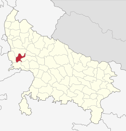 Location of Hathras district in Uttar Pradesh | |
| Country | India |
| State | Uttar Pradesh |
| Administrative division | Aligarh |
| Headquarters | Hathras |
| Government | |
| • Lok Sabha constituencies | Hathras |
| Area | |
| • Total | 1,840 km2 (710 sq mi) |
| Population (2011) | |
| • Total | 1,565,678 |
| • Density | 850/km2 (2,200/sq mi) |
| Demographics | |
| • Literacy | 73.1 per cent |
| • Sex ratio | 870 |
| Website | Official website |
Hathras district (हाथरस जनपद), was known during 1997-2012 as Mahamaya Nagar district (महामाया नगर जनपद), is a district of Uttar Pradesh state of india.[1] The town of Hathras is the district headquarters. Hathras district is a part of Aligarh Division. This district occupies an area of 1800.1 km². The district has a population of 1,565,678 (2011 census).
History
Hathras District was created on 3 May 1997 by incorporating parts of the Aligarh, Mathura, Khair and Agra districts. It was given the name Hathras District shortly after. In 1997, Hathras district was named after Mahamaya, mother of Gautama Buddha, by the state government after Mayawati became chief minister of Uttar Pradesh.[2] In 2012, the original ancient name was revived by the state government after Akhilesh Yadav became chief Minister.[1] so Hathras is also called Mahamaya Nagar.
Divisions
The district comprises four tehsils: Hathras, Sadabad, Sikandra Rao and Sasni, which are further divided into seven blocks: Sasni, Hathras, Mursan, Sadabad, Sahpau, Hasanpur Baru, Sikandra Rao and Hasayan.
There are four Vidhan Sabha constituencies in this district: Hathras, Sasni, Sadabad and Sikandra Rao. All of these are part of Hathras Lok Sabha constituency.
- Akbarpur is a village on the Sasni-Nanau Road. While Akbarpur and Seekur are separate, the revenue department counts them as one village. The Sasni-Nanau Road through this village links NH 93 to NH 91. According to the 1991 census, the population of the village was 2000 people. The village is a residential region for both Hindu and Muslim populations, including multiple Hindu castes. Brahmins, Jats, Jatav (Chamar) Khatiks, Harijans, and Telis, among other castes, reside or have resided there. The socio-economic status of the villagers is in line with the national average. Bauhre Chandan Singh Shiksha Mandir, a private school in the village, provides education up to the eighth grade and is accompanied by a primary school. Sushila Kaushik Academy of Education, covers grades nine to twelve. The school is run Bauhre Chandan Singh Shiksha Samiti.[3]
Demographics
According to the 2011 census Hathras district has a population of 1,565,678,[4] roughly equal to the nation of Gabon[5] This gives it a ranking of 318th in India (out of a total of 640).[4] The district has a population density of 851 inhabitants per square kilometre (2,200/sq mi).[4] Its population growth rate over the decade 2001–2011 was 17.19%.[4] Hathras has a sex ratio of 870 females for every 1,000 males,[4] and a literacy rate of 73.1%.[4]
Transport
Four railway stations serve Hathras - Hathras Junction railway station, Hathras Road railway station, Hathras City railway station, and Hathras Kila railway station.
References
- 1 2 "Important Cabinet Decisions". Information and Public Relations Department. Retrieved 17 January 2013.
- ↑ Bhushan, Ranjit (2 July 1997). "The Ambedkar Armada". Outlook. Retrieved 24 February 2012.
- ↑ "Villages of Sasni Sub District Hathras". Local Government Directory. Ministry of Panchayati Raj. Retrieved 28 August 2013.
- 1 2 3 4 5 6 "District Census 2011". Census2011.co.in. 2011. Retrieved 2011-09-30.
- ↑ US Directorate of Intelligence. "Country Comparison:Population". Retrieved 2011-10-01.
Gabon 1,576,665
 |
Khair | Aligarh district | Kanshiram Nagar district | |
| Mathura district | |
Etah district | ||
| ||||
| | ||||
| Agra district |
Coordinates: 27°36′N 78°03′E / 27.600°N 78.050°E