Raebareli district
| Raebareli district रायबरेली ज़िला | |
|---|---|
| District of Uttar Pradesh | |
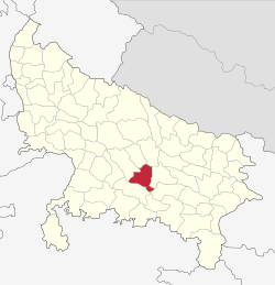 Location of Raebareli district in Uttar Pradesh | |
| Country | India |
| State | Uttar Pradesh |
| Administrative division | Lucknow |
| Headquarters | Raebareli |
| Tehsils | Raebareli |
| Government | |
| • Lok Sabha constituencies | Raebareli |
| Area | |
| • Total | 4,609 km2 (1,780 sq mi) |
| Population (2011) | |
| • Total | 3,404,004 |
| • Density | 740/km2 (1,900/sq mi) |
| Demographics | |
| • Literacy | 70% |
| • Sex ratio | 941 |
| Major highways | NH 24B, NH 231, NH31 |
| Website | Official website |
Raebareli (Hindi: रायबरेली ज़िला, Urdu: رائے بریلی ضلع) is a district of Uttar Pradesh state in northern India. The town of Raebareli is the district headquarters. The district is part of Lucknow Division.
History
Raebareli has always been a politically active district of Uttar Pradesh finding itself at the center of The Emergency. Raj Narain who opposed policies and practices of Indira Gandhi, contested against the Prime Minister in 1971 Lok Sabha elections from Rai Bareli, as a Janta Party candidate. Although he suffered a defeat, but he accused Indira Gandhi of corrupt electoral practices and filed an election petition against her. The Allahabad High Court on 12 June 1975 upheld the accusations and set aside the election of Indira Gandhi and also disqualified her to contest Lok Sabha election for next 6 years, which led to the imposition of Emergency in India.
Geography
The district had an area of 4,609 km2. The principal rivers of the district are the Ganges and the Sai: the former skirts it for 54 miles near Dalmau and is everywhere navigable for boats of 40 tons; the latter traverses it from N.W. to S.E. The principal crops are rice, pulse, wheat, barley, millet, and poppy. Rae Bareli town is connected with Lucknow by a branch of the Oudh & Rohilkhand railway, which in 1898 was extended to Benares.
Economy
In 2006 the Ministry of Panchayati Raj named Raebareli one of the country's 250 most backward districts (out of a total of 640).[1] It is one of the 34 districts in Uttar Pradesh currently receiving funds from the Backward Regions Grant Fund Programme (BRGF).[1]
Raebareli has also been nominated by the state government for receiving aid through central government's Smart Cities in India Programme.
Demographics
In 1901 the population was 1,033,760. According to the 2011 census Raebareli district has a population of 3,404,004,[2] roughly equal to the nation of Panama[3] or the US state of Connecticut.[4] This gives it a ranking of 97th in India (out of a total of 640).[2] The district has a population density of 739 inhabitants per square kilometre (1,910/sq mi) .[2] Its population growth rate over the decade 2001-2011 was 18.51%.[2] Rae Bareli has a sex ratio of 941 females for every 1000 males,[2] and a literacy rate of 69.04%.[2]
Languages
Languages spoken in the district include Awadhi, a vernacular in the Hindi continuum spoken by over 38 million people, mainly in the Awadh region.[5]
References
- 1 2 Ministry of Panchayati Raj (September 8, 2009). "A Note on the Backward Regions Grant Fund Programme" (PDF). National Institute of Rural Development. Retrieved September 27, 2011.
- 1 2 3 4 5 6 "District Census 2011". Census2011.co.in. 2011. Retrieved 2011-09-30.
- ↑ US Directorate of Intelligence. "Country Comparison:Population". Retrieved 2011-10-01.
Panama 3,460,462 July 2011 est.
- ↑ "2010 Resident Population Data". U. S. Census Bureau. Retrieved 2011-09-30.
Connecticut 3,574,097
- ↑ M. Paul Lewis, ed. (2009). "Awadhi: A language of India". Ethnologue: Languages of the World (16th ed.). Dallas, Texas: SIL International. Retrieved 2011-09-28.
 This article incorporates text from a publication now in the public domain: Chisholm, Hugh, ed. (1911). "article name needed". Encyclopædia Britannica (11th ed.). Cambridge University Press.
External links
 |
Lucknow district | Bara Banki district | | |
| Unnao district | |
Sultanpur district | ||
| ||||
| | ||||
| Fatehpur district | Kaushambi district | Pratapgarh district |
Coordinates: 26°13′48″N 81°14′24″E / 26.23000°N 81.24000°E