Chitrakoot district
| Chitrakoot district चित्रकूट | |
|---|---|
| District of Uttar Pradesh | |
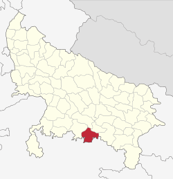 Location of Chitrakoot district in Uttar Pradesh | |
| Country | India |
| State | Uttar Pradesh |
| Administrative division | Chitrakoot |
| Headquarters | Chitrakoot Dham (Karwi) |
| Tehsils | 4 (Karwi, Mau, Manikpur and Rajapur) |
| Government | |
| • Lok Sabha constituencies | Banda Constituency |
| • Assembly seats | Chitrakoot, Mau & Manikpur |
| Area | |
| • Total | 3,216 km2 (1,242 sq mi) |
| Population (2011) | |
| • Total | 990,626 |
| • Density | 310/km2 (800/sq mi) |
| • Urban | 96,352 |
| Demographics | |
| • Literacy | 66.52 |
| • Sex ratio | 879 |
| Major highways | NH 76 |
| Average annual precipitation | Moderate mm |
| Website | Official website |
Chitrakoot district (Hindi: चित्रकूट जिला) is one of the districts of Uttar Pradesh state of India, and Chitrakoot town is the district headquarters. Chitrakoot district is a part of Chitrakoot Division. The district occupies an area of 3,45,291 km². The district has a population of 990,626 (2011 Census).[1] As of 2011 it is the second least populous district of Uttar Pradesh (out of 71), after Mahoba.[2]
History
On 6 May 1997, a new district was carved out from the erstwhile Banda district comprising its Karwi and Mau tehsils. The district was initially named as Chhatrapati Shahuji Nagar district. On 4 September 1998, it was renamed as Chitrakoot district.
Economy
In 2006 the Ministry of Panchayati Raj named Chitrakoot one of the country's 250 most backward districts (out of a total of 640).[3] It is one of the 34 districts in Uttar Pradesh currently receiving funds from the Backward Regions Grant Fund Programme (BRGF).[3] Successive governments have often ignored the district's development and hence has become one of the most remote and cut-off districts in India.
Demographics
According to the 2011 census Chitrakoot district has a population of 990,626,[2] roughly equal to the nation of Fiji[4] or the US state of Montana.[5] This gives it a ranking of 448th in India (out of a total of 640).[2] The district has a population density of 315 inhabitants per square kilometre (820/sq mi) .[2] Its population growth rate over the decade 2001-2011 was 29.29%.[2] Chitrakoot has a sex ratio of 879 females for every 1000 males,[2] and a literacy rate of 66.52%.[2]
Notes
- ↑ "Chitrakoot District Census 2011".
- 1 2 3 4 5 6 7 "District Census 2011". Census2011.co.in. 2011. Retrieved 2011-09-30.
- 1 2 Ministry of Panchayati Raj (8 September 2009). "A Note on the Backward Regions Grant Fund Programme" (PDF). National Institute of Rural Development. Archived from the original (PDF) on 5 April 2012. Retrieved 27 September 2011.
- ↑ US Directorate of Intelligence. "Country Comparison:Population". Retrieved 2011-10-01.
Fiji 883,125 July 2011 est.
- ↑ "2010 Resident Population Data". U. S. Census Bureau. Archived from the original on 19 October 2013. Retrieved 2011-09-30.
Montana 989,415
External links
- Chitrakoot District on Bundelkhanddarshan.com
- Official website
- Chitrakoot @ Bundelkhand's unofficial web site
- Chitrakoot Information Guide
 |
Fatehpur district | Kaushambi district | | |
| Banda district | |
Allahabad district | ||
| ||||
| | ||||
| Satna district, Madhya Pradesh | Rewa district, Madhya Pradesh |
Coordinates: 25°12′49″N 80°54′55″E / 25.21361°N 80.91528°E