Grade I listed buildings in Leicestershire

Leicestershire shown within England
There are over 6,000 Grade I listed buildings in England. This page is a list of these buildings in the county of Leicestershire, by district.
Blaby
| Name | Location | Type | Completed [note 1] | Date designated | Grid ref.[note 2] Geo-coordinates |
Entry number [note 3] | Image |
|---|---|---|---|---|---|---|---|
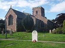
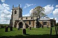
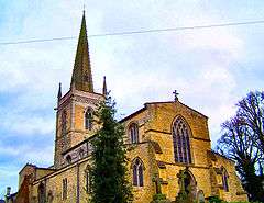
| Church of All Saints | Blaby | Parish Church | Late 13th century to early 14th century | 7 October 1957 | SP5703097857 52°34′32″N 1°09′36″W / 52.575549°N 1.159885°W |
1074757 |  |
| Kirby Muxloe Castle | Kirby Muxloe, Blaby | Castle | Begun 1480 | 23 February 1987 | SK5237904619 52°38′12″N 1°13′39″W / 52.636799°N 1.227441°W |
1177213 | 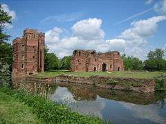 |
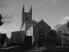
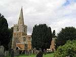
| Church of St Peter | Whetstone, Leicestershire | Parish Church | 13th century | 12 May 1997 | SP5576797526 52°34′22″N 1°10′43″W / 52.572705°N 1.178575°W |
1245457 | 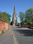 |
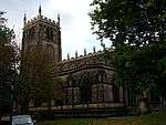
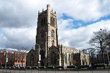
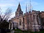
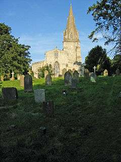
Charnwood

.jpg)


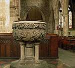
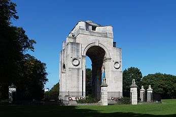
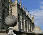
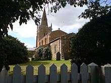
City of Leicester

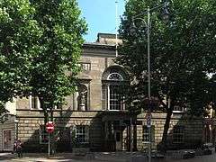


.jpg)


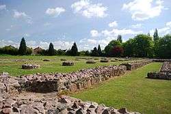
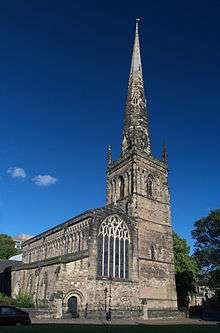
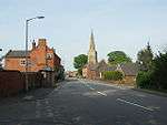
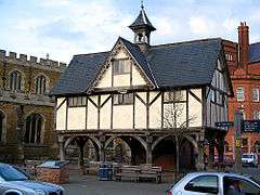
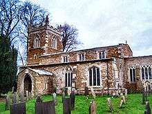
Harborough


.jpg)


Hinckley and Bosworth
| Name | Location | Type | Completed [note 1] | Date designated | Grid ref.[note 2] Geo-coordinates |
Entry number [note 3] | Image |
|---|---|---|---|---|---|---|---|
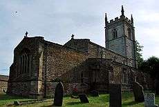
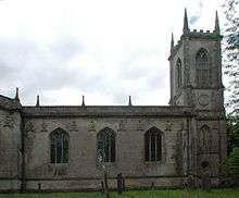
| Church of St Peter | Thornton, Bagworth & Thornton, Hinckley and Bosworth | Parish Church | C13-C16 | 7 November 1966 | SK4683107667 52°39′53″N 1°18′32″W / 52.664704°N 1.308984°W |
1074115 | 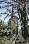 |
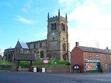
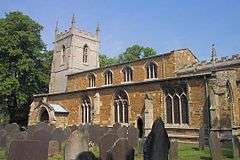
| Church of St Mary | Barwell, Hinckley and Bosworth | Parish Church | c1300-1500 | 8 March 1963 | SP4438096502 52°33′52″N 1°20′48″W / 52.564545°N 1.346717°W |
1074229 | 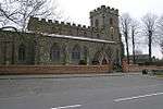 |
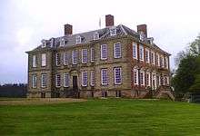
| Newbold Verdon Hall | Newbold Verdon, Hinckley and Bosworth | Country House | c. 1700 | 22 October 1952 | SK4421703817 52°37′49″N 1°20′53″W / 52.630315°N 1.348147°W |
1074089 | 
|
| Church of St Mary Magdelene | Peckleton, Hinckley and Bosworth | Parish Church | Early/Mid 14th century | 7 November 1966 | SK4701900837 52°36′12″N 1°18′26″W / 52.603292°N 1.307174°W |
1074235 |  |
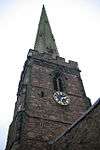
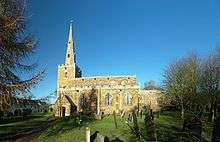
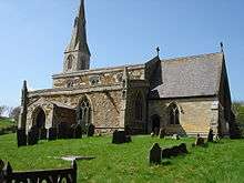
| Church of St Margaret | Stoke Golding, Hinckley and Bosworth | Parish Church | Early 13th century | 8 March 1963 | SP3977697265 52°34′18″N 1°24′52″W / 52.571759°N 1.414542°W |
1074214 |  |
| Church of St Edith | Orton on the Hill, Twycross, Hinckley and Bosworth | Parish Church | Later alterations | 7 November 1966 | SK3042303931 52°37′56″N 1°33′07″W / 52.632285°N 1.551928°W |
1188352 | 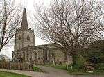 |
| Church of St James | Twycross, Hinckley and Bosworth | Parish Church | Early 14th century | 7 November 1966 | SK3387104906 52°38′27″N 1°30′03″W / 52.640846°N 1.500886°W |
1074217 | 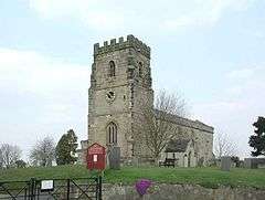 |
| Church of St Peter | Witherley, Hinckley and Bosworth | Parish Church | Early 14th century | 7 November 1966 | SP3251697339 52°34′22″N 1°31′18″W / 52.572906°N 1.521651°W |
1188486 | 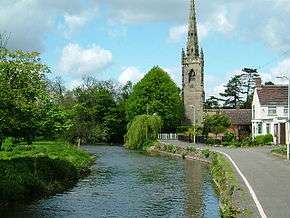 |
Melton


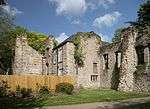
North West Leicestershire
| Name | Location | Type | Completed [note 1] | Date designated | Grid ref.[note 2] Geo-coordinates |
Entry number [note 3] | Image |
|---|---|---|---|---|---|---|---|
| The Sir John Moore Church of England Primary School |
Appleby Magna, North West Leicestershire | Wall | 1697 | 16 December 1952 | SK3137209146 52°40′45″N 1°32′15″W / 52.679111°N 1.537413°W |
1177850 | 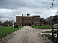 |
| Castle Ruins (including 2 Isolated Towers at South East and South West Angles of Outer Wall) |
Ashby-de-la-Zouch, North West Leicestershire | Castle | Late 15th century | 8 May 1950 | SK3612716674 52°44′47″N 1°27′59″W / 52.746486°N 1.46626°W |
1073591 | 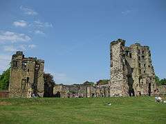 |
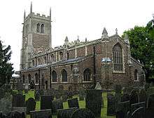
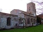
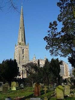
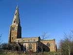
| Parish Church of St Helen | Ashby-de-la-Zouch, North West Leicestershire | Parish Church | 14th-century origins | 8 May 1950 | SK3608816767 52°44′50″N 1°28′01″W / 52.747325°N 1.466828°W |
1188344 | 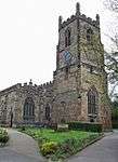 |
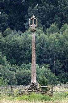
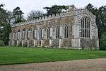
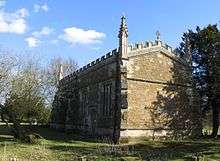
| Church of St Mary and St Hardulph | Breedon on the Hill, North West Leicestershire | Cross | C9 or 10th century | 7 December 1962 | SK4057723348 52°48′22″N 1°23′58″W / 52.806164°N 1.399518°W |
1361364 | 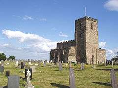 |
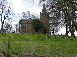
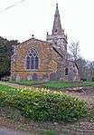
| Church of St Nicholas | Lockington, Lockington-Hemington, North West Leicestershire | Parish Church | c. 1200 | 7 December 1962 | SK4680127931 52°50′49″N 1°18′24″W / 52.846857°N 1.306542°W |
1074178 | 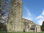 |
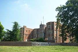
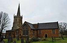
| Staunton Harold Church / Chapel of the Holy Trinity |
Staunton Harold, North West Leicestershire | Chapel | 1653-1665 | 24 November 1965 | SK3799120873 52°47′03″N 1°26′17″W / 52.784104°N 1.438163°W |
1074386 | 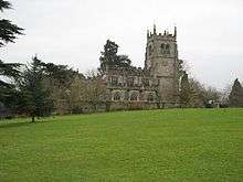 |
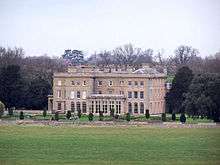
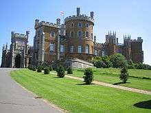
| Staunton Harold Hall | Staunton Harold, North West Leicestershire | Country House | c. 1700 | 1 March 1950 | SK3794220908 52°47′04″N 1°26′20″W / 52.784422°N 1.438886°W |
1177552 | 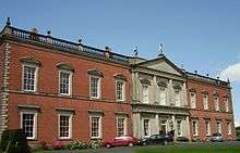 |
Oadby and Wigston
| Name | Location | Type | Completed [note 1] | Date designated | Grid ref.[note 2] Geo-coordinates |
Entry number [note 3] | Image |
|---|---|---|---|---|---|---|---|
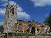
| Church of All Saints | Moat Street, Wigston, Oadby and Wigston | Parish Church | Early 14th century | 1 October 1953 | SP6040998648 52°34′56″N 1°06′36″W / 52.582295°N 1.109886°W |
1177393 | 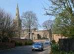 |
See also
References
English Heritage Images of England
Notes
- 1 2 3 4 5 6 7 8 The date given is the date used by Historic England as significant for the initial building or that of an important part in the structure's description.
- 1 2 3 4 5 6 7 8 Sometimes known as OSGB36, the grid reference is based on the British national grid reference system used by the Ordnance Survey.
- 1 2 3 4 5 6 7 8 The "List Entry Number" is a unique number assigned to each listed building and scheduled monument by Historic England.
External links
![]() Media related to Grade I listed buildings in Leicestershire at Wikimedia Commons
Media related to Grade I listed buildings in Leicestershire at Wikimedia Commons
This article is issued from Wikipedia - version of the 10/29/2016. The text is available under the Creative Commons Attribution/Share Alike but additional terms may apply for the media files.