Hamburg Bridge Historic District
|
Hamburg Bridge Historic District | |
 | |
  | |
| Location | Joshuatown Road and Old Hamburg Road, Lyme, Connecticut |
|---|---|
| Coordinates | 41°23′36″N 72°21′9″W / 41.39333°N 72.35250°WCoordinates: 41°23′36″N 72°21′9″W / 41.39333°N 72.35250°W |
| Area | 21 acres (8.5 ha) |
| Built | 1759 |
| Architect | Multiple |
| Architectural style | Greek Revival, Colonial, Queen Anne |
| NRHP Reference # | 83001288[1] |
| Added to NRHP | March 10, 1983 |
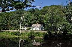
The Hamburg Bridge Historic District is located in Lyme, Connecticut. It encompasses a small village which was of economic importance until about 1824, as the site of a bridge across the Eight Mile River since 1759, and as the head of navigation of the river, which feeds the Connecticut River at Hamburg Cove. The district includes 10 houses, all of which are historically significant, as well as old stone wharves dating to the period.[2]
The district was added to the National Register of Historic Places on March 10, 1983.[1]
See also
| Wikimedia Commons has media related to Hamburg Bridge Historic District. |
References
- 1 2 National Park Service (2009-03-13). "National Register Information System". National Register of Historic Places. National Park Service.
- ↑ "NRHP nomination for Hamburg Bridge Historic District" (PDF). National Park Service. Retrieved 2015-01-25.
This article is issued from Wikipedia - version of the 11/28/2016. The text is available under the Creative Commons Attribution/Share Alike but additional terms may apply for the media files.