Herve
For other uses, see Herve (disambiguation).
| Herve | |||
|---|---|---|---|
| Municipality | |||
 | |||
| |||
 Herve Location in Belgium | |||
|
Location of Herve in the province of Liège 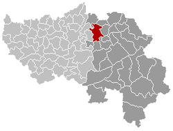 | |||
| Coordinates: 50°38′N 05°48′E / 50.633°N 5.800°ECoordinates: 50°38′N 05°48′E / 50.633°N 5.800°E | |||
| Country | Belgium | ||
| Community | French Community | ||
| Region | Wallonia | ||
| Province | Liège | ||
| Arrondissement | Verviers | ||
| Government | |||
| • Mayor | Pierre-Yves Jeholet (MR) | ||
| • Governing party/ies | HDM | ||
| Area | |||
| • Total | 56.84 km2 (21.95 sq mi) | ||
| Population (1 January 2016)[1] | |||
| • Total | 17,533 | ||
| • Density | 310/km2 (800/sq mi) | ||
| Postal codes | 4650-4654 | ||
| Area codes | 087 | ||
| Website | www.herve.be | ||


Herve is a Walloon municipality of Belgium in Province of Liège. On January 1, 2006 Herve had a total population of 16,772. The total area is 56.84 square kilometres (21.95 sq mi) which gives a population density of 295 inhabitants per km².
It is famed for its Herve cheese.
Municipal merger
On January 1, 1977, the municipality of Herve was merged with Battice, Bolland, Chaineux, Charneux, Grand-Rechain, Julémont and Xhendelesse under the name of "City of Herve" ("Ville de Herve" in French). Herve is currently constituted of 11 villages: Battice, Bolland, Bruyères, Chaineux, Charneux, Grand-Rechain, Herve, José, Julémont, Manaihant, Xhendelesse.
There are a number of smaller villages in the Herve region, such as Hacboister.
Architecture
- The church St Jean-Baptiste: built in the 17th century. The tower, with a height of 49 metres (161 ft), dates back to the 13th century. The bell tower is a distinctively crooked spire, in order to offer better resistance to the wind. The church was classed as a historic monument in 1934.
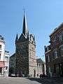 Church of St John Baptist and its bell tower
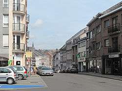
 Typical houses in Herve
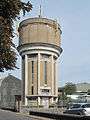 Herve, water tower
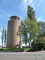 Battice, water tower
See also
References
- ↑ Population per municipality as of 1 January 2016 (XLS; 397 KB)
External links
-
 Media related to Herve at Wikimedia Commons
 - Ville de Herve - official site
 |
Dalhem | |
Aubel | |
| Blegny Soumagne |
|
Thimister-Clermont Dison | ||
| ||||
| | ||||
| Olne | Pepinster | Verviers |
Municipalities of the Province of Liège | ||
|---|---|---|
| Huy | 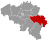 | |
| Liège | ||
| Verviers | ||
| Waremme | ||
This article is issued from Wikipedia - version of the 12/1/2016. The text is available under the Creative Commons Attribution/Share Alike but additional terms may apply for the media files.