Hillsborough Railroad Bridge
|
Hillsborough Railroad Bridge | |
|
Only bridge abutments survive today | |
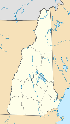  | |
| Location | Spans Contoocook River SW of NH 149, Hillsborough, New Hampshire |
|---|---|
| Coordinates | 43°6′48″N 71°53′44″W / 43.11333°N 71.89556°WCoordinates: 43°6′48″N 71°53′44″W / 43.11333°N 71.89556°W |
| Area | 0.2 acres (0.081 ha) |
| Built | 1903 |
| Architectural style | Town lattice truss |
| NRHP Reference # | 75000126[1] |
| Added to NRHP | June 10, 1975 |
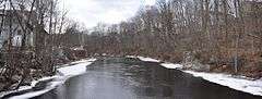
The Hillsborough Railroad Bridge was a historic covered railroad bridge spanning the Contoocook River in Hillsborough, New Hampshire. It was destroyed by arson in 1985.[2] The bridge was a two-span Town-Pratt lattice truss span, mounted on granite abutments and a central wooden pier, which replaced a granite pier washed away in 1938. It had a total length of 219 feet (67 m). It was built in 1903 by the Boston and Maine Railroad, and was at least the second bridge on the site.[3]
The bridge was listed on the National Register of Historic Places in 1975. At the time of its nomination it was one of six covered railroad bridges in the state;[1] it and at least one other (the Goffstown Covered Railroad Bridge) were destroyed by the actions of arsonists.
See also
- Contoocook Mills Industrial District, nearby
- List of New Hampshire covered bridges
- List of bridges on the National Register of Historic Places in New Hampshire
- National Register of Historic Places listings in Hillsborough County, New Hampshire
References
- 1 2 National Park Service (2010-07-09). "National Register Information System". National Register of Historic Places. National Park Service.
- ↑ "Hillsborough, NH: 2004 Draft Master Plan" (PDF). Town of Hillsborough. Retrieved 2012-08-16.
- ↑ "NRHP nomination for Hillsborough Railroad Bridge" (PDF). National Park Service. Retrieved 2014-05-23.
| Topics |  | |
|---|---|---|
| Lists by county | ||
| Other lists | ||
| ||