| [3] |
Name on the Register[4] |
Image |
Date listed[5] |
Location |
City or town |
Description |
|---|
| 1 |
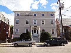
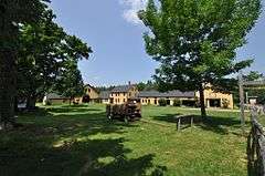
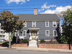
Back River Farm |
|
000000001984-06-22-0000June 22, 1984
(#84003236) |
Bay View Rd.
43°08′21″N 70°51′16″W / 43.139167°N 70.854444°W / 43.139167; -70.854444 (Back River Farm) |
Dover |
|
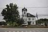
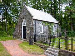
| 2 |
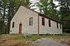
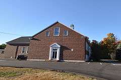
Canaan Chapel |
|
000000001982-03-11-0000March 11, 1982
(#82001877) |
Canaan Rd.
43°12′09″N 71°06′04″W / 43.2025°N 71.101111°W / 43.2025; -71.101111 (Canaan Chapel) |
Barrington |
|
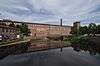
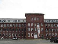
| 3 |
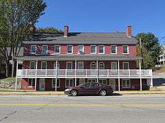
Cocheco Mills |
|
000000002014-03-26-0000March 26, 2014
(#14000081) |
Main & Washington Sts.
43°11′44″N 70°52′23″W / 43.195689°N 70.872933°W / 43.195689; -70.872933 (Cocheco Mills) |
Dover |
|
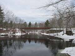
| 4 |
County Farm Bridge |
|
000000001975-05-21-0000May 21, 1975
(#75000237) |
Northwest of Dover on County Farm Rd.
43°13′14″N 70°56′38″W / 43.220556°N 70.943889°W / 43.220556; -70.943889 (County Farm Bridge) |
Dover |
Over Cocheco River
|
| 5 |
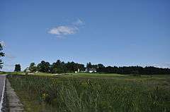
Durham Historic District |
|
000000001980-05-31-0000May 31, 1980
(#80000308) |
Main St. and Newmarket Rd.
43°07′47″N 70°55′10″W / 43.129722°N 70.919444°W / 43.129722; -70.919444 (Durham Historic District) |
Durham |
|
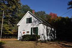
| 6 |
Farmington Town Pound |
|
000000001993-09-02-0000September 2, 1993
(#93000884) |
Northwestern side of Pound Rd. 300 ft (91 m) north of the junction of Ten Rod Rd.
43°21′33″N 71°04′49″W / 43.359167°N 71.080278°W / 43.359167; -71.080278 (Farmington Town Pound) |
Farmington |
The pound was built in 1823 by the town, replacing an earlier wooden structure built in 1802, and is one of a few well-preserved pounds in southeastern New Hampshire. It remained in use until late in the 19th century, and was sold into private hands in 1918. It was given back to the town, and is now maintained by the Farmington Historical Society.
|
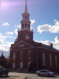
| 7 |
First Parish Church |
|
000000001982-03-11-0000March 11, 1982
(#82001696) |
218 Central Ave.
43°10′56″N 70°52′27″W / 43.182222°N 70.874167°W / 43.182222; -70.874167 (First Parish Church) |
Dover |
|
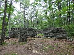
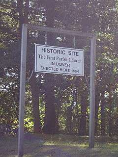
| 8 |
First Parish Church Site-Dover Point |
|
000000001983-05-27-0000May 27, 1983
(#83001153) |
Dover Point Rd.
43°08′26″N 70°50′21″W / 43.140556°N 70.839167°W / 43.140556; -70.839167 (First Parish Church Site-Dover Point) |
Dover |
|
| 9 |
Free Will Baptist Church |
|
000000001980-11-13-0000November 13, 1980
(#80000310) |
Ridge Top Road
43°23′59″N 71°09′33″W / 43.399722°N 71.159167°W / 43.399722; -71.159167 (Free Will Baptist Church) |
New Durham |
|
| 10 |
Garrison Hill Park and Tower |
|
000000001987-09-11-0000September 11, 1987
(#87001413) |
Abbie Sawyer Memorial Dr.
43°12′34″N 70°52′13″W / 43.209444°N 70.870278°W / 43.209444; -70.870278 (Garrison Hill Park and Tower) |
Dover |
|
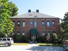
| 11 |
Green Street School |
|
000000001985-03-07-0000March 7, 1985
(#85000481) |
104 Green St.
43°15′23″N 70°51′50″W / 43.256389°N 70.863889°W / 43.256389; -70.863889 (Green Street School) |
Somersworth |
|
| 12 |
William Hale House |
|
000000001980-11-18-0000November 18, 1980
(#80000309) |
5 Hale St.
43°11′36″N 70°52′29″W / 43.193376°N 70.874858°W / 43.193376; -70.874858 (William Hale House) |
Dover |
|
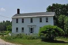
| 13 |
Richard Hayes House |
|
000000001986-02-27-0000February 27, 1986
(#86000283) |
184 Gonic Rd.
43°15′38″N 70°58′44″W / 43.260556°N 70.978889°W / 43.260556; -70.978889 (Richard Hayes House) |
Rochester |
|
| 14 |
Jenness Farm |
|
000000002001-03-02-0000March 2, 2001
(#01000206) |
626 Pickering Rd.
43°14′36″N 70°56′12″W / 43.243333°N 70.936667°W / 43.243333; -70.936667 (Jenness Farm) |
Rochester and Dover |
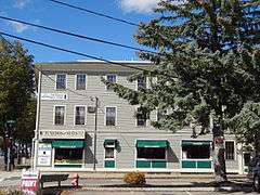
|
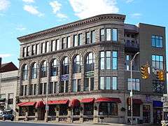
| 15 |
Lehoullier Building |
|
000000001979-12-26-0000December 26, 1979
(#79000211) |
161-169 Main St.
43°15′31″N 70°51′46″W / 43.258611°N 70.862778°W / 43.258611; -70.862778 (Lehoullier Building) |
Somersworth |
|
| 16 |
Milton Town House |
|
000000001980-11-26-0000November 26, 1980
(#80000311) |
NH 125 and Town House Rd.
43°26′27″N 70°59′05″W / 43.440833°N 70.984722°W / 43.440833; -70.984722 (Milton Town House) |
Milton |
|
| 17 |
New Durham Meetinghouse and Pound |
|
000000001980-12-08-0000December 8, 1980
(#80000312) |
Old Bay Rd.
43°25′25″N 71°07′42″W / 43.423611°N 71.128333°W / 43.423611; -71.128333 (New Durham Meetinghouse and Pound) |
New Durham |
|
| 18 |
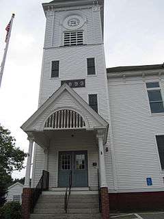
New Durham Town Hall |
|
000000001980-11-13-0000November 13, 1980
(#80000313) |
Main St. and Ridge Rd.
43°26′02″N 71°09′55″W / 43.433889°N 71.165278°W / 43.433889; -71.165278 (New Durham Town Hall) |
New Durham |
|
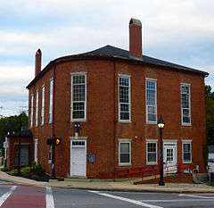
| 19 |
Plumer-Jones Farm |
|
000000001979-03-23-0000March 23, 1979
(#79000212) |
1305 White Mountain Highway (NH 125)
43°27′44″N 70°59′37″W / 43.462222°N 70.993611°W / 43.462222; -70.993611 (Plumer-Jones Farm) |
Milton |
Now the New Hampshire Farm Museum
|
| 20 |
Plummer Homestead |
|
000000002002-06-14-0000June 14, 2002
(#02000638) |
1273 White Mountain Highway (NH 125)
43°27′35″N 70°59′33″W / 43.459722°N 70.9925°W / 43.459722; -70.9925 (Plummer Homestead) |
Milton |
|
| 21 |
Public Market |
|
000000001985-03-07-0000March 7, 1985
(#85000541) |
93 Washington St.
43°11′43″N 70°52′31″W / 43.195278°N 70.875278°W / 43.195278; -70.875278 (Public Market) |
Dover |
|
| 22 |
Queensbury Mill |
|
000000001987-04-10-0000April 10, 1987
(#86003362) |
1 Market St.
43°15′54″N 70°51′58″W / 43.265°N 70.866111°W / 43.265; -70.866111 (Queensbury Mill) |
Somersworth |
|
| 23 |
Michael Reade House |
|
000000001980-02-12-0000February 12, 1980
(#80000314) |
43 Main St.
43°11′50″N 70°52′21″W / 43.197222°N 70.8725°W / 43.197222; -70.8725 (Michael Reade House) |
Dover |
|
| 24 |
Religious Society of Friends Meetinghouse |
|
000000001980-02-29-0000February 29, 1980
(#80000421) |
141 Central Ave.
43°11′12″N 70°52′25″W / 43.186667°N 70.873611°W / 43.186667; -70.873611 (Religious Society of Friends Meetinghouse) |
Dover |
|
| 25 |
Rochester Commercial and Industrial District |
|
000000001983-04-08-0000April 8, 1983
(#83001154) |
N. Main, Wakefield, Hanson, and S. Main Sts. and Central Square
43°18′11″N 70°58′34″W / 43.303056°N 70.976111°W / 43.303056; -70.976111 (Rochester Commercial and Industrial District) |
Rochester |
|
| 26 |
Rollinsford Grade School |
|
000000002015-09-29-0000September 29, 2015
(#15000670) |
487 Locust St.
43°13′55″N 70°49′24″W / 43.23187°N 70.82346°W / 43.23187; -70.82346 (Rollinsford Grade School) |
Rollinsford |
|
| 27 |
Rollinsford Town Hall |
|
000000001999-03-05-0000March 5, 1999
(#99000268) |
667 Main St.
43°14′08″N 70°49′17″W / 43.235556°N 70.821389°W / 43.235556; -70.821389 (Rollinsford Town Hall) |
Rollinsford |
|
| 28 |
St. Thomas Episcopal Church |
|
000000001984-06-07-0000June 7, 1984
(#84003241) |
5 Hale St.
43°11′37″N 70°52′30″W / 43.193611°N 70.875°W / 43.193611; -70.875 (St. Thomas Episcopal Church) |
Dover |
|
| 29 |
Salmon Falls Mill Historic District |
|
000000001980-02-29-0000February 29, 1980
(#80000315) |
Front St.
43°14′10″N 70°49′05″W / 43.236111°N 70.818056°W / 43.236111; -70.818056 (Salmon Falls Mill Historic District) |
Rollinsford |
|
| 30 |
Sawyer Building |
|
000000001980-05-23-0000May 23, 1980
(#80000316) |
4-6 Portland St.
43°11′48″N 70°52′21″W / 43.196667°N 70.8725°W / 43.196667; -70.8725 (Sawyer Building) |
Dover |
|
| 31 |
Sawyer Woolen Mills |
|
000000001989-09-13-0000September 13, 1989
(#89001208) |
1 Mill St.
43°10′44″N 70°52′35″W / 43.178889°N 70.876389°W / 43.178889; -70.876389 (Sawyer Woolen Mills) |
Dover |
|
| 32 |
Smith Chapel |
|
000000002013-02-13-0000February 13, 2013
(#13000009) |
45 Mill Pond Rd.
43°07′42″N 70°55′27″W / 43.128355°N 70.924292°W / 43.128355; -70.924292 (Smith Chapel) |
Durham |
|
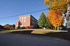
| 33 |
Somersworth High School |
|
000000002015-09-29-0000September 29, 2015
(#15000671) |
17 Grand St.
43°15′44″N 70°52′05″W / 43.26218°N 70.86794°W / 43.26218; -70.86794 (Somersworth High School) |
Somersworth |
Most recently was Hilltop Elementary School, which closed in 2012; misspelled "Somoresworth" on the National Register.
|
| 34 |
Strafford County Farm |
|
000000001981-02-25-0000February 25, 1981
(#81000100) |
County Farm Rd.
43°13′03″N 70°56′31″W / 43.2175°N 70.941944°W / 43.2175; -70.941944 (Strafford County Farm) |
Dover |
|
| 35 |
Strafford Union Academy |
|
000000001983-09-22-0000September 22, 1983
(#83001155) |
NH 126 and NH 202A
43°16′07″N 71°07′23″W / 43.268611°N 71.123056°W / 43.268611; -71.123056 (Strafford Union Academy) |
Strafford |
|
| 36 |
Gen. John Sullivan House |
|
000000001972-11-28-0000November 28, 1972
(#72000089) |
23 Newmarket Rd.
43°07′48″N 70°55′05″W / 43.13°N 70.918056°W / 43.13; -70.918056 (Gen. John Sullivan House) |
Durham |
Home of American Revolutionary War General John Sullivan, elected President of New Hampshire
|
| 37 |
Thompson Hall |
|
000000001996-12-06-0000December 6, 1996
(#96001468) |
Off Main St., University of New Hampshire campus
43°08′09″N 70°55′59″W / 43.135833°N 70.933056°W / 43.135833; -70.933056 (Thompson Hall) |
Durham |
|
| 38 |
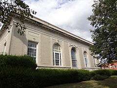
US Post Office-Dover Main |
|
000000001986-07-17-0000July 17, 1986
(#86002273) |
133-137 Washington St.
43°11′42″N 70°52′39″W / 43.195°N 70.8775°W / 43.195; -70.8775 (US Post Office-Dover Main) |
Dover |
|
| 39 |
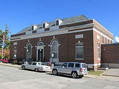
US Post Office-Somersworth Main |
|
000000001986-07-17-0000July 17, 1986
(#86002246) |
2 Government Way[6]
43°15′33″N 70°52′18″W / 43.259167°N 70.871667°W / 43.259167; -70.871667 (US Post Office-Somersworth Main) |
Somersworth |
|
| 40 |
Wiswall Falls Mills Site |
|
000000001988-03-18-0000March 18, 1988
(#88000184) |
John Hatch Park
South of Wiswall Road just east of the Lamprey River[7]
43°06′15″N 70°57′44″W / 43.1043°N 70.9621°W / 43.1043; -70.9621 (Wiswall Falls Mills Site) |
Durham |
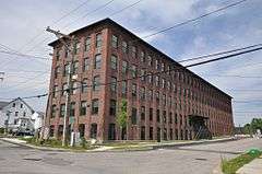
|
| 41 |
Woodbury Mill |
|
000000002013-03-25-0000March 25, 2013
(#13000156) |
1 Dover St.
43°12′07″N 70°52′29″W / 43.201985°N 70.874587°W / 43.201985; -70.874587 (Woodbury Mill) |
Dover |
|
| 42 |
Woodman Institute |
|
000000001980-07-24-0000July 24, 1980
(#80000317) |
182 Central Ave.
43°11′20″N 70°52′28″W / 43.188889°N 70.874444°W / 43.188889; -70.874444 (Woodman Institute) |
Dover |
|
| 43 |
Samuel Wyatt House |
|
000000001982-12-02-0000December 2, 1982
(#82000626) |
7 Church St.
43°11′30″N 70°52′31″W / 43.191667°N 70.875278°W / 43.191667; -70.875278 (Samuel Wyatt House) |
Dover |
|