| [3] |
Name on the Register[4] |
Image |
Date listed[5] |
Location |
City or town |
Description |
|---|
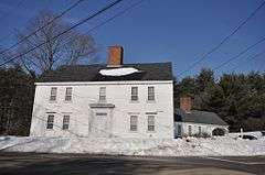
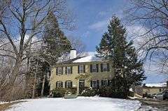
| 1 |
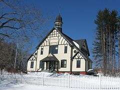
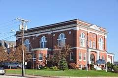
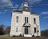
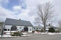
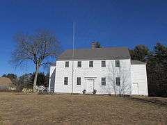
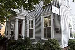
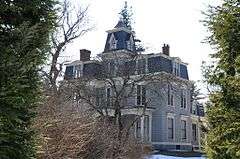
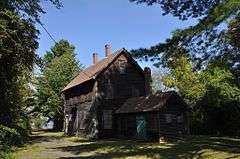
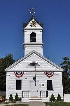
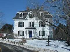
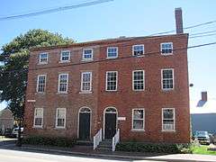
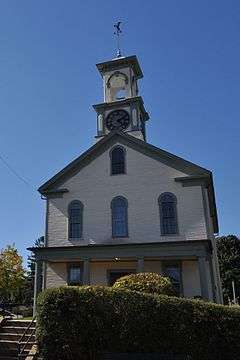
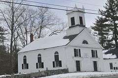
Adams Memorial Building |
|
000000001982-01-11-0000January 11, 1982
(#82001875) |
West Broadway
42°52′48″N 71°19′44″W / 42.88°N 71.3289°W / 42.88; -71.3289 (Adams Memorial Building) |
Derry |
|
| 2 |
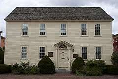
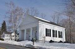
Atkinson Academy School |
|
000000001980-08-26-0000August 26, 1980
(#80000297) |
Academy Ave.
42°50′23″N 71°08′49″W / 42.8397°N 71.1469°W / 42.8397; -71.1469 (Atkinson Academy School) |
Atkinson |
|
| 3 |
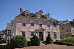
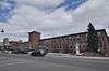
Atlantic Heights Development |
|
000000002006-09-20-0000September 20, 2006
(#06000869) |
Concord, Crescent, Falkland, Kearsarge, Porpoise, Preble, Raleigh, and Saratoga Ways
43°05′33″N 70°46′22″W / 43.0925°N 70.7728°W / 43.0925; -70.7728 (Atlantic Heights Development) |
Portsmouth |
|
| 4 |
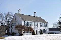
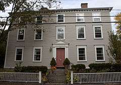
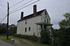
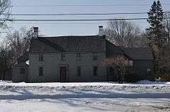
Josiah Bartlett House |
|
000000001971-11-11-0000November 11, 1971
(#71000050) |
Main St.
42°56′11″N 71°03′18″W / 42.9364°N 71.055°W / 42.9364; -71.055 (Josiah Bartlett House) |
Kingston |
|
| 5 |
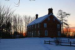
Bartlett-Cushman House |
|
000000002014-10-08-0000October 8, 2014
(#14000844) |
82 Portsmouth Ave.
43°00′44″N 70°55′02″W / 43.0122°N 70.9172°W / 43.0122; -70.9172 (Bartlett-Cushman House) |
Stratham |
|
| 6 |
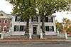
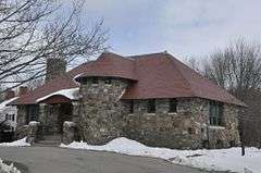
The Beach Club |
|
000000002013-12-24-0000December 24, 2013
(#13000974) |
2450 Ocean Blvd.
42°58′41″N 70°45′55″W / 42.977996°N 70.765204°W / 42.977996; -70.765204 (The Beach Club) |
Rye |
|
| 7 |
Samuel Beck House |
|
000000001973-04-03-0000April 3, 1973
(#73000167) |
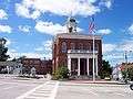
The Hill
43°04′44″N 70°45′36″W / 43.079°N 70.7599°W / 43.079; -70.7599 (Samuel Beck House) |
Portsmouth |
|
| 8 |
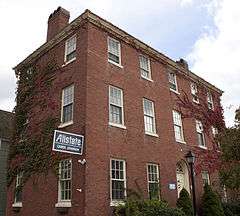
Benedict House |
|
000000001973-05-11-0000May 11, 1973
(#73000168) |
30 Middle St.
43°04′31″N 70°45′41″W / 43.0753°N 70.7614°W / 43.0753; -70.7614 (Benedict House) |
Portsmouth |
|
| 9 |
Centennial Hall |
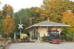
|
000000002016-04-05-0000April 5, 2016
(#16000144) |
105 Post Rd.
42°58′43″N 70°50′45″W / 42.978540°N 70.845892°W / 42.978540; -70.845892 (Centennial Hall) |
North Hampton |
|
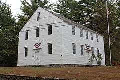
| 10 |
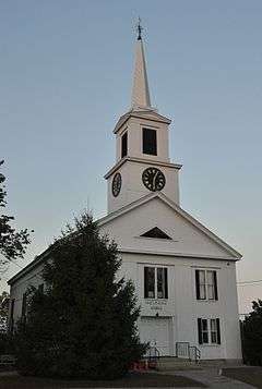
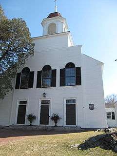
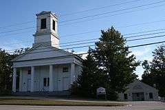
Chester Congregational Church |
|
000000001986-06-05-0000June 5, 1986
(#86001231) |
4 Chester St.
42°57′28″N 71°15′27″W / 42.9578°N 71.2575°W / 42.9578; -71.2575 (Chester Congregational Church) |
Chester |
|
| 11 |
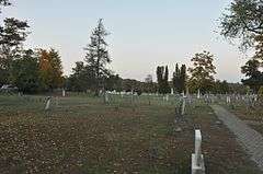
Chester Village Cemetery |
|
000000001979-11-29-0000November 29, 1979
(#79000203) |
NH 102 and NH 121
42°57′27″N 71°15′22″W / 42.9575°N 71.2561°W / 42.9575; -71.2561 (Chester Village Cemetery) |
Chester |
|
| 12 |
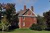
John Crockett House |
|
000000001983-03-24-0000March 24, 1983
(#83001144) |
245 Portsmouth Ave.
43°02′26″N 70°53′59″W / 43.0406°N 70.8997°W / 43.0406; -70.8997 (John Crockett House) |
Stratham |
|
| 13 |
Capt. Jonathan Currier House |
|
000000001983-04-11-0000April 11, 1983
(#83001145) |
Hilldale Ave.
42°52′34″N 71°00′08″W / 42.8761°N 71.0022°W / 42.8761; -71.0022 (Capt. Jonathan Currier House) |
South Hampton |
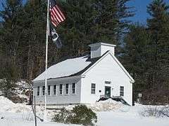
|
| 14 |
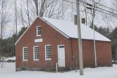
Dame School |
|
000000001980-10-30-0000October 30, 1980
(#80000298) |
NH 152
43°07′14″N 71°06′10″W / 43.1206°N 71.1028°W / 43.1206; -71.1028 (Dame School) |
Nottingham |
|
| 15 |
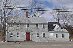
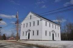
Danville Meetinghouse |
|
000000001982-04-19-0000April 19, 1982
(#82001876) |
N. Main St.
42°56′14″N 71°07′08″W / 42.937222°N 71.118889°W / 42.937222; -71.118889 (Danville Meetinghouse) |
Danville |
|
| 16 |
Danville Town House |
|
000000002000-12-01-0000December 1, 2000
(#00001465) |
210 Main St., NH 111A
42°54′54″N 71°07′24″W / 42.915°N 71.123333°W / 42.915; -71.123333 (Danville Town House) |
Danville |
|
| 17 |
Deerfield Center Historic District |
|
000000002002-09-14-0000September 14, 2002
(#02000958) |
1 Candia Rd., 1-14 Old Center Road South
43°08′00″N 71°14′37″W / 43.133333°N 71.243611°W / 43.133333; -71.243611 (Deerfield Center Historic District) |
Deerfield |
|
| 18 |
Drake Farm |
|
000000002016-09-20-0000September 20, 2016
(#16000645) |
148 Lafayette Rd.
42°59′22″N 70°49′20″W / 42.989321°N 70.822285°W / 42.989321; -70.822285 (Drake Farm) |
North Hampton |
|
| 19 |
Dudley House |
|
000000001971-06-21-0000June 21, 1971
(#71000051) |
14 Front St.
42°58′49″N 70°56′49″W / 42.980278°N 70.946944°W / 42.980278; -70.946944 (Dudley House) |
Exeter |
|
| 20 |
East Derry Historic District |
|
000000001982-08-10-0000August 10, 1982
(#82004991) |
Roughly bounded by Hampstead, Lane, and Cemetery Rds.
42°53′33″N 71°17′33″W / 42.8925°N 71.2925°W / 42.8925; -71.2925 (East Derry Historic District) |
East Derry |
|
| 21 |
John Elkins Farmstead |
|
000000001996-08-30-0000August 30, 1996
(#96000955) |
155 Beach Plain Rd.
42°56′39″N 71°06′07″W / 42.944167°N 71.101944°W / 42.944167; -71.101944 (John Elkins Farmstead) |
Danville |
Listed at 156 Beach Plain Rd.
|
| 22 |
Elm Farm |
|
000000001988-01-22-0000January 22, 1988
(#88000191) |
599 Main St.
42°56′58″N 71°08′00″W / 42.949444°N 71.133333°W / 42.949444; -71.133333 (Elm Farm) |
Danville |
|
| 23 |
Exeter Waterfront Commercial Historic District |
|
000000001980-12-03-0000December 3, 1980
(#80000299) |
Chestnut Hill Ave. and Water, Franklin, Pleasant, High, and Chestnut Sts.
42°58′57″N 70°56′49″W / 42.9825°N 70.946944°W / 42.9825; -70.946944 (Exeter Waterfront Commercial Historic District) |
Exeter |
Boundary Increase (added 1986-12-29): Chestnut St.
|
| 24 |
First Church |
|
000000001971-09-10-0000September 10, 1971
(#71000052) |
21 Front St.
42°58′50″N 70°56′51″W / 42.980556°N 70.9475°W / 42.980556; -70.9475 (First Church) |
Exeter |
|
| 25 |
First Universalist Church |
|
000000001979-12-26-0000December 26, 1979
(#79000204) |
Main St.
42°56′00″N 71°03′15″W / 42.933333°N 71.054167°W / 42.933333; -71.054167 (First Universalist Church) |
Kingston |
|
| 26 |
Fort Constitution |
|
000000001973-07-09-0000July 9, 1973
(#73000169) |
Walbach St.
43°04′17″N 70°42′37″W / 43.071389°N 70.710278°W / 43.071389; -70.710278 (Fort Constitution) |
New Castle |
|
| 27 |
Franklin Block |
|
000000001984-06-07-0000June 7, 1984
(#84003228) |
75 Congress St.
43°04′36″N 70°45′35″W / 43.076667°N 70.759722°W / 43.076667; -70.759722 (Franklin Block) |
Portsmouth |
|
| 28 |
Freewill Baptist Church-Peoples Baptist Church-New Hope Church |
|
000000002003-09-13-0000September 13, 2003
(#03000925) |
45 Pearl St.
43°04′32″N 70°45′49″W / 43.075556°N 70.763611°W / 43.075556; -70.763611 (Freewill Baptist Church-Peoples Baptist Church-New Hope Church) |
Portsmouth |
|
| 29 |
Fremont Meeting House |
|
000000001993-05-27-0000May 27, 1993
(#93000461) |
464 Main St.
42°58′59″N 71°07′44″W / 42.983056°N 71.128889°W / 42.983056; -71.128889 (Fremont Meeting House) |
Fremont |
|
| 30 |
Front Street Historic District |
|
000000001973-07-05-0000July 5, 1973
(#73000270) |
Front St. between its junctions with Spring and Water Sts.
42°58′45″N 70°57′04″W / 42.979167°N 70.951111°W / 42.979167; -70.951111 (Front Street Historic District) |
Exeter |
|
| 31 |
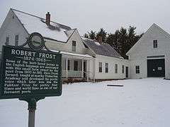
Robert Frost Homestead |
|
000000001968-05-23-0000May 23, 1968
(#68000008) |
2 mi (3.2 km) southeast of Derry
42°52′18″N 71°17′40″W / 42.871667°N 71.294444°W / 42.871667; -71.294444 (Robert Frost Homestead) |
Derry |
Home of poet Robert Frost
|
| 32 |
Gilman Garrison House |
|
000000001976-09-27-0000September 27, 1976
(#76000131) |
12 Water St.
42°58′50″N 70°56′42″W / 42.980556°N 70.945°W / 42.980556; -70.945 (Gilman Garrison House) |
Exeter |
|
| 33 |
Maj. John Gilman House |
|
000000001988-06-14-0000June 14, 1988
(#88000659) |
25 Cass St.
42°59′03″N 70°57′16″W / 42.984167°N 70.954444°W / 42.984167; -70.954444 (Maj. John Gilman House) |
Exeter |
|
| 34 |
Greeley House |
|
000000001980-06-16-0000June 16, 1980
(#80000300) |
East of East Kingston on NH 108
42°55′18″N 70°59′43″W / 42.921667°N 70.995278°W / 42.921667; -70.995278 (Greeley House) |
East Kingston |
|
| 35 |
Hampstead Meetinghouse |
|
000000001980-04-10-0000April 10, 1980
(#80000301) |
Emerson Ave.
42°52′32″N 71°10′48″W / 42.875556°N 71.18°W / 42.875556; -71.18 (Hampstead Meetinghouse) |
Hampstead |
|
| 36 |
Jeremiah Hart House |
|
000000001972-11-14-0000November 14, 1972
(#72000081) |
The Hill
43°04′44″N 70°45′41″W / 43.0788°N 70.7614°W / 43.0788; -70.7614 (Jeremiah Hart House) |
Portsmouth |
|
| 37 |
John Hart House |
|
000000001972-11-14-0000November 14, 1972
(#72000082) |
The Hill
43°04′43″N 70°45′41″W / 43.0787°N 70.7613°W / 43.0787; -70.7613 (John Hart House) |
Portsmouth |
|
| 38 |
Phoebe Hart House |
|
000000001973-04-02-0000April 2, 1973
(#73000170) |
The Hill
43°04′43″N 70°45′41″W / 43.0787°N 70.7614°W / 43.0787; -70.7614 (Phoebe Hart House) |
Portsmouth |
|
| 39 |
Hart-Rice House |
|
000000001972-08-07-0000August 7, 1972
(#72000083) |
The Hill
43°04′44″N 70°45′41″W / 43.0789°N 70.76145°W / 43.0789; -70.76145 (Hart-Rice House) |
Portsmouth |
|
| 40 |
Haven-White House |
|
000000001985-06-06-0000June 6, 1985
(#85001195) |
229 Pleasant St.
43°04′24″N 70°45′17″W / 43.073333°N 70.754722°W / 43.073333; -70.754722 (Haven-White House) |
Portsmouth |
|
| 41 |
Highland Road Historic District |
|
000000001983-04-11-0000April 11, 1983
(#83001146) |
Highland and Woodman Rds.
42°53′43″N 70°56′05″W / 42.895278°N 70.934722°W / 42.895278; -70.934722 (Highland Road Historic District) |
South Hampton |
|
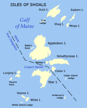
| 42 |
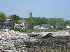
Isles of Shoals |
|
000000001980-12-10-0000December 10, 1980
(#80000419) |
Off the coast
42°58′34″N 70°37′14″W / 42.9760°N 70.6206°W / 42.9760; -70.6206 (Isles of Shoals) |
Rye |
Extends into Kittery, Maine
|
| 43 |
Richard Jackson House |
|
000000001968-11-24-0000November 24, 1968
(#68000009) |
Northwest St.
43°04′51″N 70°45′59″W / 43.080833°N 70.766389°W / 43.080833; -70.766389 (Richard Jackson House) |
Portsmouth |
Oldest surviving wooden house in New Hampshire, built 1664
|
| 44 |
Benjamin James House |
|
000000002002-03-13-0000March 13, 2002
(#02000168) |
186 Towle Farm Rd.
42°56′38″N 70°51′44″W / 42.943889°N 70.862222°W / 42.943889; -70.862222 (Benjamin James House) |
Hampton |
|
| 45 |
Jewell Town District |
|
000000001983-04-11-0000April 11, 1983
(#83001147) |
W. Whitehall Rd. and Jewell St.
42°52′22″N 70°58′08″W / 42.872778°N 70.968889°W / 42.872778; -70.968889 (Jewell Town District) |
South Hampton |
|
| 46 |
John Paul Jones House |
|
000000001972-11-28-0000November 28, 1972
(#72000084) |
Middle and State Sts.
43°04′31″N 70°45′39″W / 43.075278°N 70.760833°W / 43.075278; -70.760833 (John Paul Jones House) |
Portsmouth |
American Revolutionary War naval hero John Paul Jones boarded here in 1781-82, while supervising construction of a new battleship, the America.
|
| 47 |
Kensington Town House |
|
000000002013-04-09-0000April 9, 2013
(#13000155) |
95 Amesbury Rd.
42°55′54″N 70°56′43″W / 42.9316°N 70.9452°W / 42.9316; -70.9452 (Kensington Town House) |
Kensington |
|
| 48 |
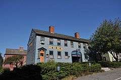
Ladd-Gilman House |
|
000000001974-12-02-0000December 2, 1974
(#74002055) |
Governors Lane and Water St.
42°58′54″N 70°56′57″W / 42.981667°N 70.949167°W / 42.981667; -70.949167 (Ladd-Gilman House) |
Exeter |
Now the American Independence Museum
|
| 49 |
Reuben Lamprey Homestead |
|
000000001982-11-09-0000November 9, 1982
(#82000624) |
416 Winnacunnet Rd.
42°55′51″N 70°48′46″W / 42.930833°N 70.812778°W / 42.930833; -70.812778 (Reuben Lamprey Homestead) |
Hampton |
|
| 50 |
Deacon Samuel and Jabez Lane Homestead |
|
000000001983-04-08-0000April 8, 1983
(#83001148) |
Portsmouth Ave.
43°01′22″N 70°55′00″W / 43.022778°N 70.916667°W / 43.022778; -70.916667 (Deacon Samuel and Jabez Lane Homestead) |
Stratham |
|
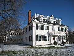
| 51 |
Gov. John Langdon Mansion |
|
000000001974-12-02-0000December 2, 1974
(#74000197) |
143 Pleasant St.
43°04′31″N 70°45′23″W / 43.075278°N 70.756389°W / 43.075278; -70.756389 (Gov. John Langdon Mansion) |
Portsmouth |
Great Georgian house built in 1784, home of John Langdon
|
| 52 |
Larkin-Rice House |
|
000000001979-11-29-0000November 29, 1979
(#79000205) |
180 Middle St.
43°04′24″N 70°45′43″W / 43.073333°N 70.761944°W / 43.073333; -70.761944 (Larkin-Rice House) |
Portsmouth |
|
| 53 |
Little Boar's Head Historic District |
|
000000001999-06-03-0000June 3, 1999
(#99000668) |
Parts of Atlantic Ave., Chapel Rd., Ocean Blvd., Sea Rd., and Willow Ave.
42°57′36″N 70°46′45″W / 42.96°N 70.779167°W / 42.96; -70.779167 (Little Boar's Head Historic District) |
North Hampton |
|
| 54 |
Elijah Locke House |
|
000000001979-12-19-0000December 19, 1979
(#79000206) |
5 Grove Rd.
42°59′33″N 70°46′19″W / 42.9925°N 70.771944°W / 42.9925; -70.771944 (Elijah Locke House) |
Rye |
|
| 55 |
MacPheadris-Warner House |
|
000000001966-10-15-0000October 15, 1966
(#66000028) |
Chapel and Daniel Sts.
43°04′41″N 70°45′18″W / 43.078056°N 70.755°W / 43.078056; -70.755 (MacPheadris-Warner House) |
Portsmouth |
|
| 56 |
Richman Margeson Estate |
|
000000001990-06-21-0000June 21, 1990
(#90000873) |
Long Point Rd. near Great Bay shore
43°04′45″N 70°51′29″W / 43.079167°N 70.858056°W / 43.079167; -70.858056 (Richman Margeson Estate) |
Newington |
Now in the Great Bay National Wildlife Refuge; no public access as of 2012
|
| 57 |
Moffatt-Ladd House |
|
000000001968-11-24-0000November 24, 1968
(#68000010) |
154 Market St.
43°04′44″N 70°45′32″W / 43.078889°N 70.758889°W / 43.078889; -70.758889 (Moffatt-Ladd House) |
Portsmouth |
|
| 58 |
Moses-Kent House |
|
000000001985-09-12-0000September 12, 1985
(#85002184) |
1 Pine St.
42°58′36″N 70°57′18″W / 42.976667°N 70.955°W / 42.976667; -70.955 (Moses-Kent House) |
Exeter |
|
| 59 |
James Neal House |
|
000000001972-08-07-0000August 7, 1972
(#72000112) |
74 Deer St.
43°04′44″N 70°45′41″W / 43.07885°N 70.7614°W / 43.07885; -70.7614 (James Neal House) |
Portsmouth |
|
| 60 |
New Castle Congregational Church |
|
000000002015-02-02-0000February 2, 2015
(#14001241) |
65 Main St.
43°04′16″N 70°42′59″W / 43.071152°N 70.716398°W / 43.071152; -70.716398 (New Castle Congregational Church) |
New Castle |
|
| 61 |
New Hampshire Bank Building |
|
000000001979-09-10-0000September 10, 1979
(#79000207) |
22-26 Market Sq.
43°04′37″N 70°45′27″W / 43.076944°N 70.7575°W / 43.076944; -70.7575 (New Hampshire Bank Building) |
Portsmouth |
|
| 62 |
Newington Center Historic District |
|
000000001987-11-30-0000November 30, 1987
(#87002106) |
272-336, 305-353 Nimble Hill Rd.; also Merrimac Drive, north of Short St.
43°05′58″N 70°50′00″W / 43.099444°N 70.833333°W / 43.099444; -70.833333 (Newington Center Historic District) |
Newington |
Second set of addresses represents a boundary increase
|
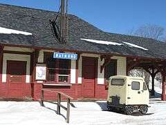
| 63 |
Newington Railroad Depot |
|
000000002010-04-19-0000April 19, 2010
(#10000187) |
Bloody Point Rd.
43°07′00″N 70°49′15″W / 43.116667°N 70.820833°W / 43.116667; -70.820833 (Newington Railroad Depot) |
Newington |
|
| 64 |
Newmarket Industrial and Commercial Historic District |
|
000000001980-12-01-0000December 1, 1980
(#80000302) |
NH 108
43°04′47″N 70°56′14″W / 43.079722°N 70.937222°W / 43.079722; -70.937222 (Newmarket Industrial and Commercial Historic District) |
Newmarket |
|
| 65 |
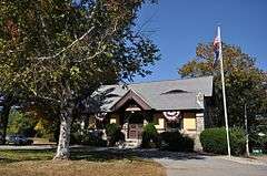
Nichols Memorial Library |
|
000000001981-01-28-0000January 28, 1981
(#81000076) |
Main St.
42°56′12″N 71°03′12″W / 42.936667°N 71.053333°W / 42.936667; -71.053333 (Nichols Memorial Library) |
Kingston |
|
| 66 |
North Hampton Library |
|
000000002014-02-05-0000February 5, 2014
(#13001149) |
237 Atlantic Ave.
42°58′24″N 70°49′50″W / 42.9734°N 70.830419°W / 42.9734; -70.830419 (North Hampton Library) |
North Hampton |
|
| 67 |
North Hampton Town Hall |
|
000000002013-02-13-0000February 13, 2013
(#13000006) |
231 Atlantic Ave.
42°58′25″N 70°49′50″W / 42.973546°N 70.830619°W / 42.973546; -70.830619 (North Hampton Town Hall) |
North Hampton |
|
| 68 |
North School |
|
000000002013-02-13-0000February 13, 2013
(#13000007) |
63 Amesbury Rd.
42°56′22″N 70°56′58″W / 42.939554°N 70.949408°W / 42.939554; -70.949408 (North School) |
Kensington |
|
| 69 |
Northwood Congregational Church |
|
000000001979-11-30-0000November 30, 1979
(#79000208) |
U.S. Route 4
43°13′02″N 71°12′32″W / 43.217222°N 71.208889°W / 43.217222; -71.208889 (Northwood Congregational Church) |
Northwood |
|
| 70 |
Nutter-Rymes House |
|
000000001972-11-03-0000November 3, 1972
(#72000085) |
48 School St.
43°04′44″N 70°45′41″W / 43.078889°N 70.761389°W / 43.078889; -70.761389 (Nutter-Rymes House) |
Portsmouth |
|
| 71 |
Old North Cemetery |
|
000000001978-03-08-0000March 8, 1978
(#78000218) |
Maplewood Ave.
43°04′41″N 70°45′48″W / 43.078056°N 70.763333°W / 43.078056; -70.763333 (Old North Cemetery) |
Portsmouth |
|
| 72 |
Parsons Homestead |
|
000000001980-12-05-0000December 5, 1980
(#80000420) |
520 Washington Rd.
43°00′49″N 70°46′14″W / 43.013611°N 70.770556°W / 43.013611; -70.770556 (Parsons Homestead) |
Rye |
|
| 73 |
Daniel Pinkham House |
|
000000001972-11-03-0000November 3, 1972
(#72000086) |
The Hill
43°04′44″N 70°45′41″W / 43.07878°N 70.761389°W / 43.07878; -70.761389 (Daniel Pinkham House) |
Portsmouth |
|
| 74 |
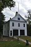
Plaistow Carhouse |
|
000000001980-12-10-0000December 10, 1980
(#80000303) |
27 Elm St.
42°50′21″N 71°05′33″W / 42.839167°N 71.0925°W / 42.839167; -71.0925 (Plaistow Carhouse) |
Plaistow |
Now houses Plaistow police and fire services
|
| 75 |
General Porter House |
|
000000001985-10-11-0000October 11, 1985
(#85003359) |
32-34 Livermore St.
43°04′24″N 70°45′16″W / 43.073333°N 70.754444°W / 43.073333; -70.754444 (General Porter House) |
Portsmouth |
|
| 76 |
Portsmouth Athenaeum |
|
000000001973-05-24-0000May 24, 1973
(#73000171) |
9 Market Sq.
43°04′37″N 70°45′29″W / 43.076944°N 70.758056°W / 43.076944; -70.758056 (Portsmouth Athenaeum) |
Portsmouth |
|
| 77 |
Portsmouth Cottage Hospital |
|
000000001996-09-13-0000September 13, 1996
(#96000954) |
Junkins Ave., southern side of South Mill Pond
43°04′14″N 70°45′17″W / 43.070556°N 70.754722°W / 43.070556; -70.754722 (Portsmouth Cottage Hospital) |
Portsmouth |
|
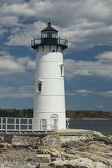
| 78 |
Portsmouth Harbor Light |
|
000000002009-10-08-0000October 8, 2009
(#09000816) |
0.3 miles (0.48 km) east of the Route 1B junction with Wentworth Rd., at the southeastern corner of Fort Constitution
43°04′16″N 70°42′31″W / 43.071036°N 70.708594°W / 43.071036; -70.708594 (Portsmouth Harbor Light) |
New Castle |
|
| 79 |
Portsmouth Public Library |
|
000000001973-03-20-0000March 20, 1973
(#73000172) |
8 Islington St.
43°04′31″N 70°45′41″W / 43.075278°N 70.761389°W / 43.075278; -70.761389 (Portsmouth Public Library) |
Portsmouth |
Listing is for old library building, formerly the Portsmouth Academy, now Discover Portsmouth
|
| 80 |
Benjamin Franklin Prescott House |
|
000000001987-12-03-0000December 3, 1987
(#87002069) |
Prescott Rd.
43°03′02″N 71°05′55″W / 43.050556°N 71.098611°W / 43.050556; -71.098611 (Benjamin Franklin Prescott House) |
Epping |
|
| 81 |
Pulpit Rock Base-End Station (N. 142) |
|
000000002010-04-16-0000April 16, 2010
(#10000188) |
9 Davis Rd.
43°02′00″N 70°43′10″W / 43.033333°N 70.719444°W / 43.033333; -70.719444 (Pulpit Rock Base-End Station (N. 142)) |
Rye |
|
| 82 |
Raymond Boston and Maine Railroad Depot |
|
000000001979-05-16-0000May 16, 1979
(#79000209) |
Main St.
43°02′09″N 71°10′53″W / 43.035833°N 71.181389°W / 43.035833; -71.181389 (Raymond Boston and Maine Railroad Depot) |
Raymond |
|
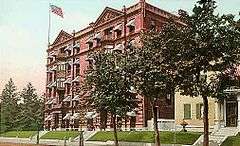
| 83 |
Rockingham Hotel |
|
000000001982-03-11-0000March 11, 1982
(#82001693) |
401 State St.
43°04′32″N 70°45′38″W / 43.075556°N 70.760556°W / 43.075556; -70.760556 (Rockingham Hotel) |
Portsmouth |
|
| 84 |
George Rogers House |
|
000000001976-06-07-0000June 7, 1976
(#76000132) |
76 Northwest St.
43°04′53″N 70°46′00″W / 43.081389°N 70.766667°W / 43.081389; -70.766667 (George Rogers House) |
Portsmouth |
|
| 85 |
Rundlet-May House |
|
000000001976-06-07-0000June 7, 1976
(#76000133) |
364 Middle St.
43°04′16″N 70°45′47″W / 43.071111°N 70.763056°W / 43.071111; -70.763056 (Rundlet-May House) |
Portsmouth |
|
| 86 |
St. Andrew's-by-the-Sea |
|
000000002001-12-13-0000December 13, 2001
(#01001352) |
Church Rd., 0.2 mi (0.32 km) southwest of its junction with South Rd. and NH 1A
42°58′27″N 70°46′02″W / 42.974167°N 70.767222°W / 42.974167; -70.767222 (St. Andrew's-by-the-Sea) |
Rye |
|
| 87 |
St. John's Church |
|
000000001978-01-31-0000January 31, 1978
(#78000417) |
105 Chapel St.
43°04′42″N 70°45′20″W / 43.078333°N 70.755556°W / 43.078333; -70.755556 (St. John's Church) |
Portsmouth |
|
| 88 |
Salem Common Historic District |
|
000000002011-04-15-0000April 15, 2011
(#11000190) |
304, 310, 312 Main St.
42°47′22″N 71°12′01″W / 42.7894°N 71.2003°W / 42.7894; -71.2003 (Salem Common Historic District) |
Salem |
|
| 89 |
Sanborn Seminary |
|
000000001984-03-15-0000March 15, 1984
(#84003233) |
178 Main St.
42°56′21″N 71°03′16″W / 42.9392°N 71.0544°W / 42.9392; -71.0544 (Sanborn Seminary) |
Kingston |
|
| 90 |
Sandown Depot, Boston and Maine Railroad |
|
000000001986-09-04-0000September 4, 1986
(#86002167) |
Depot Rd.
42°55′46″N 71°11′08″W / 42.9294°N 71.1856°W / 42.9294; -71.1856 (Sandown Depot, Boston and Maine Railroad) |
Sandown |
|
| 91 |
Sandown Old Meetinghouse |
|
000000001978-08-09-0000August 9, 1978
(#78000219) |
Fremont Rd.
42°55′58″N 71°11′10″W / 42.9328°N 71.1861°W / 42.9328; -71.1861 (Sandown Old Meetinghouse) |
Sandown |
|
| 92 |
Searles School and Chapel |
|
000000001982-01-11-0000January 11, 1982
(#82001694) |
Range and Searles Rds.
42°48′31″N 71°15′27″W / 42.808611°N 71.2575°W / 42.808611; -71.2575 (Searles School and Chapel) |
Windham |
|
| 93 |
Edward Sewall Garrison |
|
000000001980-01-11-0000January 11, 1980
(#80000304) |
16 Epping Rd.
42°59′36″N 70°57′41″W / 42.993333°N 70.961389°W / 42.993333; -70.961389 (Edward Sewall Garrison) |
Exeter |
|
| 94 |
Shapley Town House |
|
000000001973-02-28-0000February 28, 1973
(#73000173) |
454-456 Court St.
43°04′37″N 70°45′14″W / 43.076944°N 70.753889°W / 43.076944; -70.753889 (Shapley Town House) |
Portsmouth |
|
| 95 |
Henry Sherburne House |
|
000000001972-08-07-0000August 7, 1972
(#72000087) |
62 Deer St., The Hill
43°04′44″N 70°45′41″W / 43.0789°N 70.7614°W / 43.0789; -70.7614 (Henry Sherburne House) |
Portsmouth |
|
| 96 |
Smith's Corner Historic District |
|
000000001983-04-11-0000April 11, 1983
(#83001149) |
Main Ave., South, Stagecoach, and Chase Rds.
42°53′28″N 70°59′30″W / 42.891111°N 70.991667°W / 42.891111; -70.991667 (Smith's Corner Historic District) |
South Hampton |
|
| 97 |
Simeon P. Smith House |
|
000000001972-11-14-0000November 14, 1972
(#72000088) |
The Hill
43°04′44″N 70°45′41″W / 43.07887°N 70.761389°W / 43.07887; -70.761389 (Simeon P. Smith House) |
Portsmouth |
|
| 98 |
Smyth Public Library |
|
000000002007-09-13-0000September 13, 2007
(#07000948) |
194 High St.
43°03′47″N 71°18′10″W / 43.063056°N 71.302778°W / 43.063056; -71.302778 (Smyth Public Library) |
Candia |
|
| 99 |
South Meetinghouse |
|
000000001982-04-19-0000April 19, 1982
(#82001695) |
Marcy St. and Meeting House Hill
43°04′29″N 70°45′10″W / 43.074722°N 70.752778°W / 43.074722; -70.752778 (South Meetinghouse) |
Portsmouth |
|
| 100 |
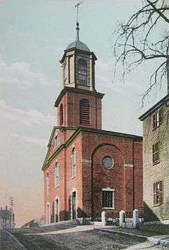
South Parish |
|
000000001979-08-21-0000August 21, 1979
(#79000210) |
292 State St.
43°04′32″N 70°45′29″W / 43.075556°N 70.758056°W / 43.075556; -70.758056 (South Parish) |
Portsmouth |
|
| 101 |
Square Schoolhouse |
|
000000001980-04-17-0000April 17, 1980
(#80000305) |
NH 156 and Ledge Farm Rd.
43°06′11″N 71°06′34″W / 43.103056°N 71.109444°W / 43.103056; -71.109444 (Square Schoolhouse) |
Nottingham |
|
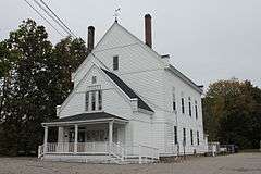
| 102 |
Stevens Memorial Hall |
|
000000002004-09-10-0000September 10, 2004
(#04000963) |
Junction of NH 102 and NH 121
42°57′25″N 71°15′29″W / 42.9569°N 71.2581°W / 42.9569; -71.2581 (Stevens Memorial Hall) |
Chester |
|
| 103 |
Stone School |
|
000000001978-07-12-0000July 12, 1978
(#78000418) |
Granite St.
43°04′44″N 70°56′18″W / 43.078889°N 70.938333°W / 43.078889; -70.938333 (Stone School) |
Newmarket |
Now houses the local historical society museum
|
| 104 |
Strawbery Banke Historic District |
|
000000001975-06-20-0000June 20, 1975
(#75000236) |
Bounded by Court and Marcy Sts. and both sides of Hancock and Washington Sts.
43°04′33″N 70°45′14″W / 43.075833°N 70.753889°W / 43.075833; -70.753889 (Strawbery Banke Historic District) |
Portsmouth |
|
| 105 |
Samuel Tenney House |
|
000000001980-11-25-0000November 25, 1980
(#80000306) |
65 High St.
42°58′49″N 70°56′23″W / 42.980278°N 70.939722°W / 42.980278; -70.939722 (Samuel Tenney House) |
Exeter |
|
| 106 |
Matthew Thornton House |
|
000000001971-11-11-0000November 11, 1971
(#71000053) |
2 Thornton St.
42°53′38″N 71°18′46″W / 42.893889°N 71.312778°W / 42.893889; -71.312778 (Matthew Thornton House) |
Derry Village |
|
| 107 |
Town Center Historic District |
|
000000001983-04-11-0000April 11, 1983
(#83001150) |
Main and Hilldale Aves. and Jewell St.
42°52′52″N 70°57′47″W / 42.881111°N 70.963056°W / 42.881111; -70.963056 (Town Center Historic District) |
South Hampton |
|
| 108 |
Town House |
|
000000001980-04-17-0000April 17, 1980
(#80000307) |
Old Centre Rd.
43°07′59″N 71°14′37″W / 43.133056°N 71.243611°W / 43.133056; -71.243611 (Town House) |
Deerfield |
|
| 109 |
Union Meetinghouse-Universalist Church |
|
000000002013-02-13-0000February 13, 2013
(#13000008) |
97 Amesbury Rd.
42°55′53″N 70°56′43″W / 42.931306°N 70.945299°W / 42.931306; -70.945299 (Union Meetinghouse-Universalist Church) |
Kensington |
|
| 110 |
Unitarian Church |
|
000000001984-12-13-0000December 13, 1984
(#84000558) |
Exeter Rd.
42°56′00″N 70°53′23″W / 42.933333°N 70.889722°W / 42.933333; -70.889722 (Unitarian Church) |
Hampton Falls |
|
| 111 |
USS ALBACORE |
|
000000001989-04-11-0000April 11, 1989
(#89001077) |
Portsmouth Maritime Museum
43°04′58″N 70°46′00″W / 43.082778°N 70.766667°W / 43.082778; -70.766667 (USS ALBACORE) |
Portsmouth |
|
| 112 |
Watson Academy |
|
000000001982-11-09-0000November 9, 1982
(#82000625) |
Academy St.
43°02′36″N 71°04′33″W / 43.0433°N 71.0758°W / 43.0433; -71.0758 (Watson Academy) |
Epping |
|
| 113 |
Gov. Meshech Weare House |
|
000000001973-06-29-0000June 29, 1973
(#73000174) |
Exeter Rd. (NH 88)
42°55′02″N 70°52′00″W / 42.9172°N 70.8667°W / 42.9172; -70.8667 (Gov. Meshech Weare House) |
Hampton Falls |
|
| 114 |
Weeks House |
|
000000001975-06-20-0000June 20, 1975
(#75000131) |
Weeks Ave. off NH 33
43°02′16″N 70°50′26″W / 43.0378°N 70.8406°W / 43.0378; -70.8406 (Weeks House) |
Greenland |
|
| 115 |
Gov. John Wentworth House |
|
000000001973-06-29-0000June 29, 1973
(#73000175) |
346 Pleasant St.
43°04′25″N 70°45′14″W / 43.0736°N 70.7539°W / 43.0736; -70.7539 (Gov. John Wentworth House) |
Portsmouth |
Also known as the Mark Wentworth House
|
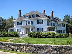
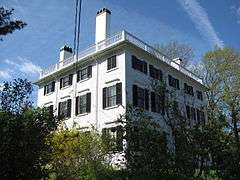
| 116 |
Wentworth-Coolidge Mansion |
|
000000001968-11-24-0000November 24, 1968
(#68000011) |
2 mi (3.2 km) south of Portsmouth, off NH 1A
43°03′42″N 70°44′20″W / 43.0617°N 70.7389°W / 43.0617; -70.7389 (Wentworth-Coolidge Mansion) |
Portsmouth |
|
| 117 |
Wentworth-Gardner and Tobias Lear Houses |
|
000000001979-10-30-0000October 30, 1979
(#79000319) |
Mechanic and Gardner Sts.
43°04′28″N 70°45′02″W / 43.0744°N 70.7506°W / 43.0744; -70.7506 (Wentworth-Gardner and Tobias Lear Houses) |
Portsmouth |
|
| 118 |
Wentworth-Gardner House |
|
000000001968-11-24-0000November 24, 1968
(#68000012) |
140 Mechanic St.
43°04′28″N 70°45′02″W / 43.0744°N 70.7506°W / 43.0744; -70.7506 (Wentworth-Gardner House) |
Portsmouth |
|
| 119 |
Whidden-Ward House |
|
000000001971-11-05-0000November 5, 1971
(#71000077) |
The Hill
43°04′43″N 70°45′41″W / 43.0786°N 70.7614°W / 43.0786; -70.7614 (Whidden-Ward House) |
Portsmouth |
|
| 120 |
Wiggin Memorial Library |
|
000000001993-12-10-0000December 10, 1993
(#93001381) |
158 Portsmouth Ave.
43°01′30″N 70°54′42″W / 43.025°N 70.9117°W / 43.025; -70.9117 (Wiggin Memorial Library) |
Stratham |
Now houses the Stratham Historical Society
|
| 121 |
Cornet Thomas Wiggin House |
|
000000001983-03-24-0000March 24, 1983
(#83001151) |
249 Portsmouth Ave.
43°02′27″N 70°53′56″W / 43.0408°N 70.8989°W / 43.0408; -70.8989 (Cornet Thomas Wiggin House) |
Stratham |
|
| 122 |
Woodman Road Historic District |
|
000000001983-04-11-0000April 11, 1983
(#83001152) |
Woodman Rd.
42°53′11″N 70°56′21″W / 42.8864°N 70.9392°W / 42.8864; -70.9392 (Woodman Road Historic District) |
South Hampton |
|
| 123 |
Gen. Mason J. Young House |
|
000000001986-02-27-0000February 27, 1986
(#86000281) |
4 Young Rd.
42°50′41″N 71°21′56″W / 42.8447°N 71.3656°W / 42.8447; -71.3656 (Gen. Mason J. Young House) |
Londonderry |
|


.JPG)

.jpg)


%2C_launching_1953.jpg)