| [3] |
Name on the Register[4] |
Image |
Date listed[5] |
Location |
City or town |
Description |
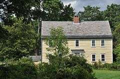
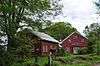
|---|
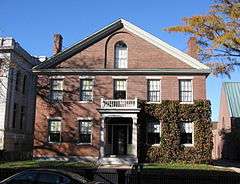
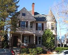
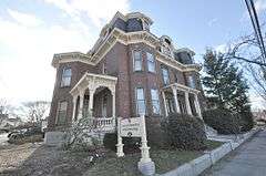
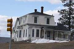
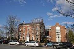
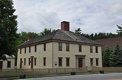
| 1 |
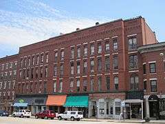
2½ Beacon Street |
|
000000001984-12-17-0000December 17, 1984
(#84000500) |
2½ Beacon St.
43°12′42″N 71°32′33″W / 43.2117°N 71.5425°W / 43.2117; -71.5425 (2½ Beacon Street) |
Concord |
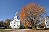
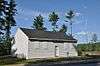
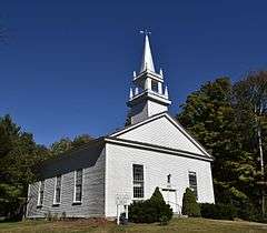
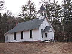
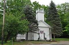
|
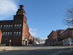
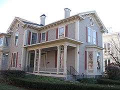
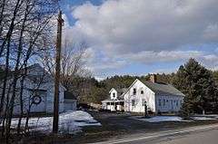
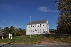
| 2 |
Allenstown Meeting House |
|
000000002004-12-06-0000December 6, 2004
(#04001327) |
Deerfield Rd.
43°09′37″N 71°22′53″W / 43.1603°N 71.3814°W / 43.1603; -71.3814 (Allenstown Meeting House) |
Allenstown |
|
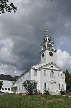
| 3 |
Baptist New Meeting House |
|
000000002005-12-22-0000December 22, 2005
(#05001446) |
461 Main St.
43°24′53″N 71°58′48″W / 43.4147°N 71.98°W / 43.4147; -71.98 (Baptist New Meeting House) |
New London |
|
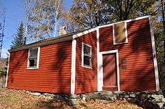
| 4 |
Bear Brook State Park Civilian Conservation Corps (CCC) Camp Historic District |
|
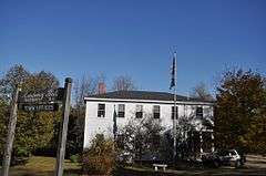
000000001992-06-11-0000June 11, 1992
(#92000632) |
½ mile from park entrance, 160 yd (150 m) south of Allenstown-Deerfield Rd., in Bear Brook State Park
43°09′29″N 71°22′44″W / 43.1581°N 71.3789°W / 43.1581; -71.3789 (Bear Brook State Park Civilian Conservation Corps (CCC) Camp Historic District) |
Allenstown |
|
| 5 |
Beaver Meadow Brook Archeological Site (27MR3) |
|
000000001989-06-02-0000June 2, 1989
(#89000434) |
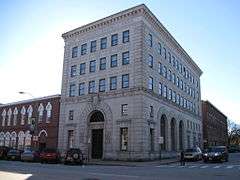
West side of the Merrimack River near Sewall's Falls[6]
|
Concord |
Major Native American archeological site[6]
|
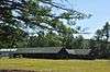
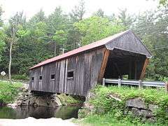
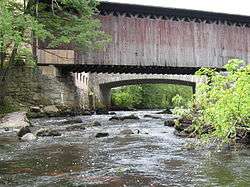
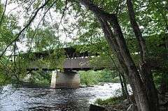
| 6 |
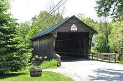
Bement Covered Bridge |
|
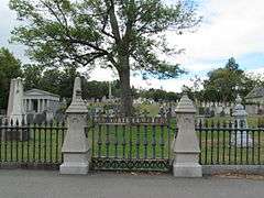
000000001976-11-21-0000November 21, 1976
(#76000128) |
Center Rd.
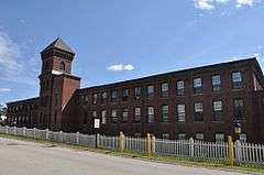
43°15′51″N 71°57′13″W / 43.2642°N 71.9536°W / 43.2642; -71.9536 (Bement Covered Bridge) |
Bradford |
Over the Warner River
|
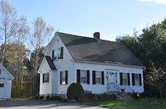
| 7 |
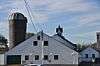
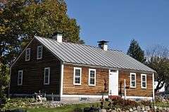
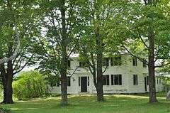
Bennett Farm |
|
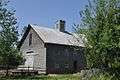
000000002002-09-14-0000September 14, 2002
(#02000960) |
11 Bennett Rd.
43°10′14″N 71°47′33″W / 43.1706°N 71.7925°W / 43.1706; -71.7925 (Bennett Farm) |
Henniker |
|
| 8 |
Blossom Hill and Calvary Cemeteries |
|
000000002010-12-15-0000December 15, 2010
(#10000891) |
N. State St.
43°13′19″N 71°33′13″W / 43.2219°N 71.5536°W / 43.2219; -71.5536 (Blossom Hill and Calvary Cemeteries) |
Concord |
|
| 9 |
Bog Bridge |
|
000000001989-03-16-0000March 16, 1989
(#89000192) |
Off NH 11 over Pleasant Brook
43°25′49″N 71°52′11″W / 43.4303°N 71.8697°W / 43.4303; -71.8697 (Bog Bridge) |
Andover |
|
| 10 |
Boscawen Academy and Much-I-Do-Hose House |
|
000000001980-12-08-0000December 8, 1980
(#80000292) |
King St.
43°19′03″N 71°37′20″W / 43.3175°N 71.6222°W / 43.3175; -71.6222 (Boscawen Academy and Much-I-Do-Hose House) |
Boscawen |
|
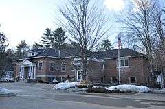
| 11 |
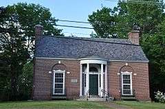
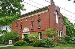
Boscawen Public Library |
|
000000001981-05-28-0000May 28, 1981
(#81000073) |
King St.
43°19′09″N 71°37′31″W / 43.3192°N 71.6253°W / 43.3192; -71.6253 (Boscawen Public Library) |
Boscawen |
|
| 12 |
Bradford Center Meetinghouse |
|
000000002013-06-14-0000June 14, 2013
(#13000384) |
18 Rowe Mountain Rd.
43°14′10″N 71°58′08″W / 43.2361°N 71.9690°W / 43.2361; -71.9690 (Bradford Center Meetinghouse) |
Bradford |
|
| 13 |
Bradford Town Hall |
|
000000001980-11-13-0000November 13, 1980
(#80000293) |
W. Main St.
43°16′09″N 71°57′42″W / 43.2692°N 71.9617°W / 43.2692; -71.9617 (Bradford Town Hall) |
Bradford |
|
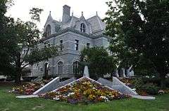
| 14 |
H. Styles Bridges House |
|
000000002005-12-22-0000December 22, 2005
(#05001444) |
21 Mountain Rd.
43°14′23″N 71°32′20″W / 43.2397°N 71.5389°W / 43.2397; -71.5389 (H. Styles Bridges House) |
Concord |
The official residence of the governor
|
| 15 |
Canterbury Shaker Village |
|
000000001975-06-17-0000June 17, 1975
(#75000129) |
4 mi (6.4 km) east of Canterbury on Shaker Rd.
43°21′32″N 71°29′24″W / 43.3589°N 71.49°W / 43.3589; -71.49 (Canterbury Shaker Village) |
Canterbury |
One of the best-preserved Shaker villages
|
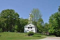
| 16 |
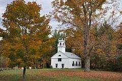
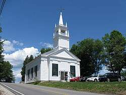
Center Meetinghouse |
|
000000001979-12-19-0000December 19, 1979
(#79000201) |
NH 103
43°19′16″N 72°02′08″W / 43.3211°N 72.0356°W / 43.3211; -72.0356 (Center Meetinghouse) |
Newbury |
|
| 17 |
Chamberlin House |
|
000000001982-08-16-0000August 16, 1982
(#82001688) |
44 Pleasant St.
43°12′12″N 71°32′19″W / 43.2033°N 71.5386°W / 43.2033; -71.5386 (Chamberlin House) |
Concord |
|
| 18 |
Concord Civic District |
|
000000001983-12-22-0000December 22, 1983
(#83004203) |
107 N. Main St., 25 Capitol St., 39-45 Green St., 20-30 Park St., and 33 N. State St.
43°12′24″N 71°32′22″W / 43.2067°N 71.5394°W / 43.2067; -71.5394 (Concord Civic District) |
Concord |
|
| 19 |
Concord Historic District |
|
000000001975-06-11-0000June 11, 1975
(#75000234) |
Roughly bounded by N. State St., Horse Shoe Pond, Boston and Maine railroad tracks, Sen. Styles Bridges Highway, and Church St.
43°12′57″N 71°32′30″W / 43.2158°N 71.5417°W / 43.2158; -71.5417 (Concord Historic District) |
Concord |
|
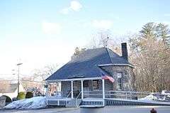
| 20 |
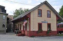
Contoocook Railroad Depot |
|
000000002006-03-16-0000March 16, 2006
(#06000131) |
896 Main St. in the village of Contoocook
43°13′21″N 71°42′47″W / 43.2225°N 71.7131°W / 43.2225; -71.7131 (Contoocook Railroad Depot) |
Hopkinton |
|
| 21 |
Henry J. Crippen House |
|
000000001983-12-22-0000December 22, 1983
(#83004204) |
189-191 N. Main St.
43°12′45″N 71°32′26″W / 43.2125°N 71.5406°W / 43.2125; -71.5406 (Henry J. Crippen House) |
Concord |
|
| 22 |
Dalton Covered Bridge |
|
000000001976-11-21-0000November 21, 1976
(#76000221) |
Joppa Rd.
43°16′36″N 71°48′43″W / 43.2767°N 71.8119°W / 43.2767; -71.8119 (Dalton Covered Bridge) |
Warner |
Over the Warner River
|
| 23 |
Dimond Hill Farm |
|
000000002007-03-15-0000March 15, 2007
(#07000155) |
314 Hopkinton Rd.
43°11′28″N 71°37′03″W / 43.1911°N 71.6175°W / 43.1911; -71.6175 (Dimond Hill Farm) |
Concord |
|
| 24 |
Lewis Downing, Jr., House |
|
000000001987-09-11-0000September 11, 1987
(#87001425) |
33 Pleasant St.
43°12′10″N 71°32′18″W / 43.2028°N 71.5383°W / 43.2028; -71.5383 (Lewis Downing, Jr., House) |
Concord |
|
| 25 |
Downtown Concord Historic District |
|
000000002000-06-09-0000June 9, 2000
(#00000652) |
Roughly bounded by Center St., Loudon Rd., Storrs St., Hills Ave., and S. State, Green, School, Capitol, and Park Sts.
43°12′19″N 71°32′15″W / 43.2053°N 71.5375°W / 43.2053; -71.5375 (Downtown Concord Historic District) |
Concord |
|
| 26 |
Gershom Durgin House |
|
000000002000-12-01-0000December 1, 2000
(#00001463) |
391 Franklin Highway
43°26′34″N 71°46′14″W / 43.4428°N 71.7706°W / 43.4428; -71.7706 (Gershom Durgin House) |
Andover |
|
| 27 |
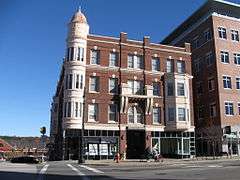
Eagle Hotel |
|
000000001978-09-20-0000September 20, 1978
(#78000216) |
110 N. Main St.
43°12′25″N 71°32′12″W / 43.2069°N 71.5367°W / 43.2069; -71.5367 (Eagle Hotel) |
Concord |
|
| 28 |
East Andover Village Center Historic District |
|
000000001989-03-16-0000March 16, 1989
(#89000191) |
Village of East Andover, junction of NH 11 and Chase Hill Rd.
43°27′34″N 71°44′51″W / 43.4594°N 71.7475°W / 43.4594; -71.7475 (East Andover Village Center Historic District) |
Andover |
|
| 29 |
Endicott Hotel |
|
000000001987-05-29-0000May 29, 1987
(#87000818) |
1-3 S. Main St.
43°12′14″N 71°32′09″W / 43.2039°N 71.5358°W / 43.2039; -71.5358 (Endicott Hotel) |
Concord |
|
| 30 |
Farrington House |
|
000000001982-03-09-0000March 9, 1982
(#82001858) |
30 S. Main St.
43°12′11″N 71°32′09″W / 43.2031°N 71.5358°W / 43.2031; -71.5358 (Farrington House) |
Concord |
|
| 31 |
First Congregational Church of Boscawen |
|
000000001982-04-19-0000April 19, 1982
(#82001689) |
King St.
43°19′19″N 71°37′45″W / 43.3219°N 71.6292°W / 43.3219; -71.6292 (First Congregational Church of Boscawen) |
Boscawen |
|
| 32 |
Reuben Foster House and Perley Cleaves House |
|
000000001982-03-15-0000March 15, 1982
(#82001690) |
64 and 62 N. State St.
43°12′35″N 71°32′27″W / 43.2097°N 71.5408°W / 43.2097; -71.5408 (Reuben Foster House and Perley Cleaves House) |
Concord |
|
| 33 |
Franklin Falls Historic District |
|
000000001982-08-19-0000August 19, 1982
(#82001691) |
Roughly bounded by Bow, River, and School Sts., Ayles Ct., and the Winnipesaukee River
43°26′39″N 71°38′57″W / 43.4442°N 71.6492°W / 43.4442; -71.6492 (Franklin Falls Historic District) |
Franklin |
Encompasses most of downtown Franklin
|
| 34 |
Hall Memorial Library |
|
000000001978-10-04-0000October 4, 1978
(#78000217) |
Park St.
43°26′30″N 71°35′36″W / 43.4417°N 71.5933°W / 43.4417; -71.5933 (Hall Memorial Library) |
Northfield |
|
| 35 |
Charles S. Hall House |
|
000000002002-06-13-0000June 13, 2002
(#02000640) |
1740 Dover Rd.
43°13′32″N 71°20′48″W / 43.2256°N 71.3467°W / 43.2256; -71.3467 (Charles S. Hall House) |
Epsom |
|
| 36 |
Matthew Harvey House |
|
000000001992-09-04-0000September 4, 1992
(#92001082) |
Western side of Harvey Rd., 0.25 mi (0.40 km) north of its junction with Keyser St.
43°22′22″N 71°57′22″W / 43.3728°N 71.9561°W / 43.3728; -71.9561 (Matthew Harvey House) |
Sutton |
|
| 37 |
Hay Estate |
|
000000002000-11-02-0000November 2, 2000
(#00001288) |
NH 103A, 2.2 mi (3.5 km) north of its junction with NH 103
43°21′00″N 72°02′43″W / 43.35°N 72.0453°W / 43.35; -72.0453 (Hay Estate) |
Newbury |
Former summer home of American statesman John Hay
|
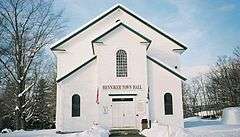
| 38 |
Henniker Town Hall |
|
000000001981-02-24-0000February 24, 1981
(#81000074) |
Depot Hill Rd.
43°10′32″N 71°49′23″W / 43.1756°N 71.8231°W / 43.1756; -71.8231 (Henniker Town Hall) |
Henniker |
|
| 39 |
Hersey Farms Historic District |
|
000000002008-06-30-0000June 30, 2008
(#08000512) |
1057 and 1088 Franklin Highway
43°28′16″N 71°43′51″W / 43.4711°N 71.7308°W / 43.4711; -71.7308 (Hersey Farms Historic District) |
Andover |
|
| 40 |
Hill Center Church |
|
000000001985-09-12-0000September 12, 1985
(#85002186) |
Murray Hill Rd.[7]
43°31′26″N 71°44′26″W / 43.523778°N 71.740682°W / 43.523778; -71.740682 (Hill Center Church) |
Hill |
|
| 41 |
Hopkinton Railroad Covered Bridge |
|
000000001980-01-11-0000January 11, 1980
(#80000294) |
Off NH 103 and NH 127
43°13′23″N 71°42′51″W / 43.2231°N 71.7142°W / 43.2231; -71.7142 (Hopkinton Railroad Covered Bridge) |
Hopkinton |
Over Contoocook River in village of Contoocook
|
| 42 |
Howe-Quimby House |
|
000000001980-06-27-0000June 27, 1980
(#80000295) |
Southwest of Hopkinton on Sugar Hill Rd.
43°09′29″N 71°42′03″W / 43.1581°N 71.7008°W / 43.1581; -71.7008 (Howe-Quimby House) |
Hopkinton |
|
| 43 |
Keniston Bridge |
|
000000001989-03-16-0000March 16, 1989
(#89000190) |
Bridge Rd. over the Blackwater River
43°26′06″N 71°50′12″W / 43.435°N 71.8367°W / 43.435; -71.8367 (Keniston Bridge) |
Andover |
|
| 44 |
Leavitt Farm |
|
000000001982-03-11-0000March 11, 1982
(#82001692) |
103 Old Loudon Rd.
43°13′56″N 71°28′52″W / 43.2322°N 71.4811°W / 43.2322; -71.4811 (Leavitt Farm) |
Concord |
|
| 45 |
William H. Long Memorial |
|
000000001977-07-15-0000July 15, 1977
(#77000092) |
Main St.
43°11′27″N 71°40′19″W / 43.1908°N 71.6719°W / 43.1908; -71.6719 (William H. Long Memorial) |
Hopkinton |
Now houses the Hopkinton Historical Society
|
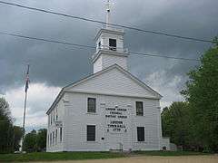
| 46 |
Loudon Town Hall |
|
000000001990-09-05-0000September 5, 1990
(#90001351) |
Junction of Clough Hill and Youngs Hill Rds.
43°19′57″N 71°25′51″W / 43.3325°N 71.4308°W / 43.3325; -71.4308 (Loudon Town Hall) |
Loudon |
|
| 47 |
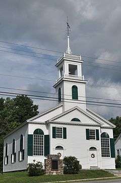
Lower Warner Meetinghouse |
|
000000001989-05-25-0000May 25, 1989
(#89000450) |
NH 103
43°16′28″N 71°47′57″W / 43.2744°N 71.7992°W / 43.2744; -71.7992 (Lower Warner Meetinghouse) |
Warner |
|
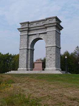
| 48 |
Memorial Arch of Tilton |
|
000000001980-05-19-0000May 19, 1980
(#80000296) |
Elm St.
43°26′23″N 71°35′17″W / 43.4397°N 71.5881°W / 43.4397; -71.5881 (Memorial Arch of Tilton) |
Northfield |
|
| 49 |
Merrimack County Bank |
|
000000001980-02-28-0000February 28, 1980
(#80000415) |
214 N. Main St.
43°12′41″N 71°32′20″W / 43.2114°N 71.5389°W / 43.2114; -71.5389 (Merrimack County Bank) |
Concord |
|
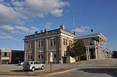
| 50 |
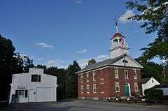
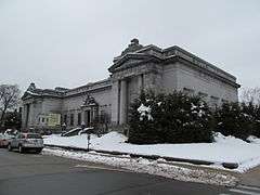
Merrimack County Courthouse |
|
000000001979-11-27-0000November 27, 1979
(#79000202) |
163 N. Main St.
43°12′35″N 71°32′20″W / 43.2097°N 71.5389°W / 43.2097; -71.5389 (Merrimack County Courthouse) |
Concord |
|
| 51 |
Millville School |
|
000000001985-11-07-0000November 7, 1985
(#85002781) |
2 Fisk Rd.
43°11′50″N 71°34′28″W / 43.1972°N 71.5744°W / 43.1972; -71.5744 (Millville School) |
Concord |
|
| 52 |
Morrill-Lassonde House |
|
000000001984-03-15-0000March 15, 1984
(#84003216) |
East of King St.
43°18′26″N 71°36′49″W / 43.3072°N 71.6136°W / 43.3072; -71.6136 (Morrill-Lassonde House) |
Boscawen |
|
| 53 |
Murray Hill Summer Home District |
|
000000001988-03-17-0000March 17, 1988
(#88000179) |
Murray Hill Rd. roughly between Cass Mill and Lynch Rds.
43°32′24″N 71°47′46″W / 43.54°N 71.7961°W / 43.54; -71.7961 (Murray Hill Summer Home District) |
Hill |
|
| 54 |
New Hampshire Savings Bank Building |
|
000000001988-06-14-0000June 14, 1988
(#88000658) |
97 N. Main St.
43°12′24″N 71°32′14″W / 43.2067°N 71.5372°W / 43.2067; -71.5372 (New Hampshire Savings Bank Building) |
Concord |
|
| 55 |
Northfield Union Church |
|
000000001984-03-15-0000March 15, 1984
(#84003219) |
Sondogardy Pond Rd.
43°22′14″N 71°36′58″W / 43.3706°N 71.6161°W / 43.3706; -71.6161 (Northfield Union Church) |
Northfield |
|
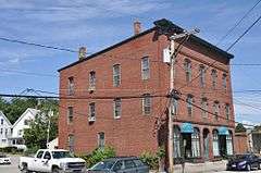
| 56 |
Jacob Noyes Block |
|
000000001986-02-27-0000February 27, 1986
(#86000278) |
48 Glass St.
43°07′50″N 71°27′06″W / 43.1306°N 71.4517°W / 43.1306; -71.4517 (Jacob Noyes Block) |
Suncook |
|
| 57 |
Old North Cemetery |
|
000000002008-11-09-0000November 9, 2008
(#08001031) |
North State St.
43°12′53″N 71°32′40″W / 43.2148°N 71.5444°W / 43.2148; -71.5444 (Old North Cemetery) |
Concord |
|
| 58 |
Old Post Office |
|
000000001973-08-13-0000August 13, 1973
(#73000269) |
N. State St., between Capitol and Park St.
43°12′23″N 71°32′24″W / 43.2064°N 71.54°W / 43.2064; -71.54 (Old Post Office) |
Concord |
|
| 59 |
Old Webster Meeting House |
|
000000001985-03-07-0000March 7, 1985
(#85000479) |
1220 Battle Street (NH 127).
43°19′47″N 71°43′03″W / 43.3297°N 71.7175°W / 43.3297; -71.7175 (Old Webster Meeting House) |
Webster |
|
| 60 |
Page Belting Company Mills |
|
000000002002-06-14-0000June 14, 2002
(#02000641) |
26 Commercial St.
43°13′01″N 71°32′21″W / 43.2169°N 71.5392°W / 43.2169; -71.5392 (Page Belting Company Mills) |
Concord |
|
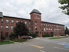
| 61 |
Pembroke Mill |
|
000000001985-09-12-0000September 12, 1985
(#85002188) |
100 Main St.
43°07′49″N 71°27′18″W / 43.1303°N 71.455°W / 43.1303; -71.455 (Pembroke Mill) |
Pembroke |
|
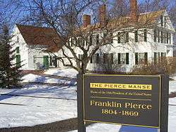
| 62 |
Franklin Pierce House |
|
000000001979-10-15-0000October 15, 1979
(#79000318) |
52 S. Main St.
43°12′01″N 71°32′03″W / 43.2003°N 71.5342°W / 43.2003; -71.5342 (Franklin Pierce House) |
Concord |
Site of home of President Franklin Pierce, 1856-1869, and place where he died. Not to be confused with Pierce Manse at 14 Horseshoe Pond Lane, Pierce's home from 1842-1848. NOTE: Burned down in 1981[8]
|
| 63 |
Pillsbury Memorial Hall |
|
000000001993-03-04-0000March 4, 1993
(#93000147) |
93 Main St.
43°20′02″N 71°57′13″W / 43.3339°N 71.9536°W / 43.3339; -71.9536 (Pillsbury Memorial Hall) |
Sutton |
|
| 64 |
Pineground Bridge |
|
000000002004-03-10-0000March 10, 2004
(#04000149) |
0.15 mi (0.24 km) east of NH 28 on Depot Rd.
43°15′26″N 71°22′12″W / 43.2572°N 71.37°W / 43.2572; -71.37 (Pineground Bridge) |
Chichester |
Over Suncook River
|
| 65 |
Pittsfield Center Historic District |
|
000000001980-12-12-0000December 12, 1980
(#80000416) |
Main Street and town center side streets
43°18′18″N 71°19′34″W / 43.305°N 71.3261°W / 43.305; -71.3261 (Pittsfield Center Historic District) |
Pittsfield |
|
| 66 |
Pleasant View Home |
|
000000001984-09-19-0000September 19, 1984
(#84003222) |
227 Pleasant St.
43°11′42″N 71°33′31″W / 43.195°N 71.5586°W / 43.195; -71.5586 (Pleasant View Home) |
Concord |
|
| 67 |
Potter Place Railroad Station |
|
000000001989-03-16-0000March 16, 1989
(#89000189) |
Depot St.
43°26′18″N 71°51′22″W / 43.4383°N 71.8561°W / 43.4383; -71.8561 (Potter Place Railroad Station) |
Andover |
Houses the Andover Historical Society Museum
|
| 68 |
Robie's Country Store |
|
000000002000-08-31-0000August 31, 2000
(#00001038) |
8 Riverside St.
43°05′52″N 71°27′59″W / 43.0978°N 71.4664°W / 43.0978; -71.4664 (Robie's Country Store) |
Hooksett |
|
| 69 |
Rolfe Barn |
|
000000002007-03-15-0000March 15, 2007
(#07000154) |
16 Penacook St.
43°17′00″N 71°35′23″W / 43.2833°N 71.5897°W / 43.2833; -71.5897 (Rolfe Barn) |
Concord |
Owned by the Penacook Historical Society
|
| 70 |
Gov. Frank West Rollins House |
|
000000001984-03-15-0000March 15, 1984
(#84003225) |
135 N. State St.
43°12′54″N 71°32′36″W / 43.215°N 71.5433°W / 43.215; -71.5433 (Gov. Frank West Rollins House) |
Concord |
|
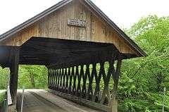
| 71 |
Rowell's Covered Bridge |
|
000000001976-11-21-0000November 21, 1976
(#76000129) |
Clement Hill Rd.
43°11′33″N 71°44′54″W / 43.1925°N 71.7483°W / 43.1925; -71.7483 (Rowell's Covered Bridge) |
West Hopkinton |
Over Contoocook River
|
| 72 |
Salisbury Academy Building |
|
000000001975-05-30-0000May 30, 1975
(#75000235) |
Junction of NH 127 and U.S. Route 4
43°22′47″N 71°42′52″W / 43.3797°N 71.7144°W / 43.3797; -71.7144 (Salisbury Academy Building) |
Salisbury |
Now houses the town offices
|
| 73 |
South Danbury Christian Church |
|
000000001985-06-06-0000June 6, 1985
(#85001191) |
U.S. Route 4
43°28′58″N 71°53′12″W / 43.4828°N 71.8867°W / 43.4828; -71.8867 (South Danbury Christian Church) |
Danbury |
|
| 74 |
South Sutton Meeting House |
|
000000001993-05-27-0000May 27, 1993
(#93000462) |
17 Meeting House Hill Rd.
43°19′14″N 71°56′07″W / 43.3206°N 71.9353°W / 43.3206; -71.9353 (South Sutton Meeting House) |
South Sutton |
|
| 75 |
Stanley Tavern |
|
000000002005-09-07-0000September 7, 2005
(#05000970) |
371 Main St.
43°11′29″N 71°40′27″W / 43.1914°N 71.6742°W / 43.1914; -71.6742 (Stanley Tavern) |
Hopkinton |
|
| 76 |
Sulphite Railroad Bridge |
|
000000001975-06-11-0000June 11, 1975
(#75000130) |
Off US 3 over the Winnipesaukee River
43°26′43″N 71°38′10″W / 43.4453°N 71.6361°W / 43.4453; -71.6361 (Sulphite Railroad Bridge) |
Franklin |
|
| 77 |
Suncook Village Commercial-Civic Historic District |
|
000000002005-03-15-0000March 15, 2005
(#05000174) |
1 and 9-15 Glass St., 116-161 Main St., 19 Mill Falls, and 4 Union St. in the village of Suncook
43°07′52″N 71°27′12″W / 43.1311°N 71.4533°W / 43.1311; -71.4533 (Suncook Village Commercial-Civic Historic District) |
Pembroke |
|
| 78 |
Tucker Mountain Schoolhouse |
|
000000002005-03-18-0000March 18, 2005
(#05000175) |
Tucker Mountain Road
43°29′01″N 71°45′42″W / 43.4836°N 71.7617°W / 43.4836; -71.7617 (Tucker Mountain Schoolhouse) |
Andover |
Former schoolhouse open as a local museum on weekends; operated by the Andover Historical Society
|
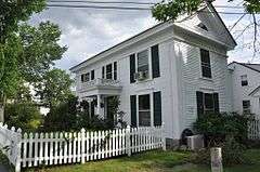
| 79 |
Donald D. Tuttle House |
|
000000001995-08-31-0000August 31, 1995
(#95001052) |
12 Gabby Lane
43°10′34″N 71°32′13″W / 43.1761°N 71.5369°W / 43.1761; -71.5369 (Donald D. Tuttle House) |
Concord |
Listed at 257 Pleasant St; moved to Gabby Lane in Concord in 2009 to make way for the Langley Parkway[9]
|
| 80 |
Upham-Walker House |
|
000000001980-05-15-0000May 15, 1980
(#80000418) |
18 Park St.
43°12′26″N 71°32′20″W / 43.2072°N 71.5389°W / 43.2072; -71.5389 (Upham-Walker House) |
Concord |
|
| 81 |
Waterloo Covered Bridge |
|
000000001976-11-21-0000November 21, 1976
(#76000130) |
Newmarket Rd.
43°17′16″N 71°51′27″W / 43.2878°N 71.8575°W / 43.2878; -71.8575 (Waterloo Covered Bridge) |
Waterloo |
Over the Warner River
|
| 82 |
Waterloo Historic District |
|
000000002003-09-13-0000September 13, 2003
(#03000926) |
78-183 Waterloo St., 12 and 68 Newmarket Rd., 4 Willoughby-Colby Rd., Bean Road Cemetery
43°17′19″N 71°51′15″W / 43.2886°N 71.8542°W / 43.2886; -71.8542 (Waterloo Historic District) |
Warner |
|
| 83 |
Webster Congregational Church |
|
000000001985-03-07-0000March 7, 1985
(#85000480) |
Off NH 127 on Long St.
43°19′48″N 71°43′00″W / 43.33°N 71.7167°W / 43.33; -71.7167 (Webster Congregational Church) |
Webster |
|
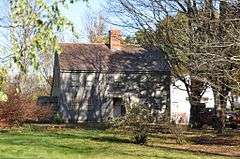
| 84 |
Daniel Webster Family Home |
|
000000001974-05-30-0000May 30, 1974
(#74000196) |
S. Main St.
43°24′24″N 71°39′06″W / 43.4067°N 71.6517°W / 43.4067; -71.6517 (Daniel Webster Family Home) |
West Franklin |
Farm owned by family of Daniel Webster; it is sometimes confused with the nearby Daniel Webster Birthplace state historic site.
|
| 85 |
Dr. Solomon M. Whipple House |
|
000000001985-09-12-0000September 12, 1985
(#85002187) |
Main St.
43°24′48″N 71°59′05″W / 43.4133°N 71.9847°W / 43.4133; -71.9847 (Dr. Solomon M. Whipple House) |
New London |
|
| 86 |
White Farm |
|
000000001981-05-15-0000May 15, 1981
(#81000075) |
144 Clinton St.
43°11′19″N 71°33′37″W / 43.1886°N 71.5603°W / 43.1886; -71.5603 (White Farm) |
Concord |
|
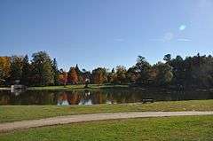
| 87 |
White Park |
|
000000001982-11-09-0000November 9, 1982
(#82000623) |
Bounded by Washington, Centre, High, Beacon, and White Sts.
43°12′23″N 71°32′53″W / 43.2064°N 71.5481°W / 43.2064; -71.5481 (White Park) |
Concord |
|


.jpg)