| [3] |
Name on the Register[4] |
Image |
Date listed[5] |
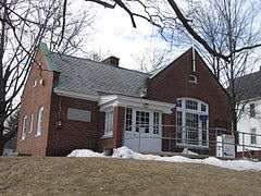
Location |
City or town |
Description |
|---|
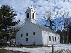
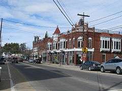
| 1 |
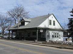
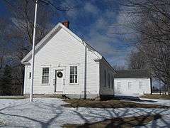
Alton Bay Railroad Station |
|
000000001983-09-22-0000September 22, 1983
(#83001124) |
NH 11
43°28′24″N 71°14′17″W / 43.473333°N 71.238056°W / 43.473333; -71.238056 (Alton Bay Railroad Station) |
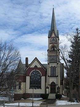
Alton |
|
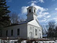
| 2 |
Bay Meeting House and Vestry |
|
000000001984-06-07-0000June 7, 1984
(#84002508) |
Upper Bay and Steele Rds.
43°32′17″N 71°32′12″W / 43.538056°N 71.536667°W / 43.538056; -71.536667 (Bay Meeting House and Vestry) |
Sanbornton |
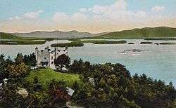
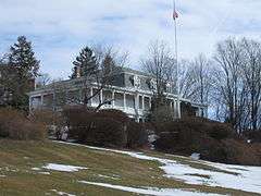
|
| 3 |
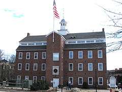
Belknap-Sulloway Mill |
|
000000001971-01-25-0000January 25, 1971
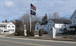
(#71000046) |
25 Beacon Street East
43°31′39″N 71°28′07″W / 43.527617°N 71.468602°W / 43.527617; -71.468602 (Belknap-Sulloway Mill) |
Laconia |
Now the Belknap Mill Museum;[6] listed as being on "Mill Street".
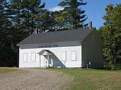
|
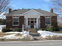
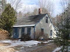
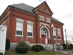
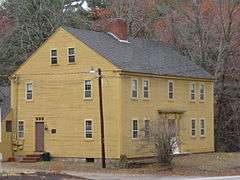
| 4 |
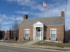
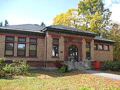
Belmont Public Library |
|
000000001985-09-12-0000September 12, 1985
(#85002191) |
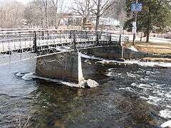
Main St.
43°26′37″N 71°28′57″W / 43.443611°N 71.4825°W / 43.443611; -71.4825 (Belmont Public Library) |
Belmont |
|
| 5 |
John W. Busiel House |
|
000000001994-09-19-0000September 19, 1994
(#94001094) |
30 Church St.
43°31′48″N 71°28′16″W / 43.53°N 71.471111°W / 43.53; -71.471111 (John W. Busiel House) |
Laconia |
|
| 6 |
Busiel-Seeburg Mill |
|
000000001971-01-25-0000January 25, 1971
(#71000047) |
1 Mill Plaza
43°31′41″N 71°28′05″W / 43.527947°N 71.468184°W / 43.527947; -71.468184 (Busiel-Seeburg Mill) |
Laconia |
Listed as being on "Mill Street"
|
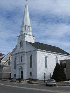
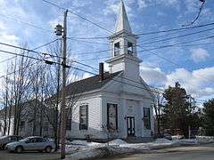
| 7 |
Centre Congregational Church |
|
000000001983-09-08-0000September 8, 1983
(#83001125) |
Province Rd.
43°25′31″N 71°24′51″W / 43.425278°N 71.414167°W / 43.425278; -71.414167 (Centre Congregational Church) |
Gilmanton |
|
| 8 |
Centre Harbor Village Historic District |
|
000000001983-09-08-0000September 8, 1983
(#83001126) |
Main and Plymouth Sts.
43°42′32″N 71°27′46″W / 43.708889°N 71.462778°W / 43.708889; -71.462778 (Centre Harbor Village Historic District) |
Center Harbor |
|
| 9 |
Dana Meeting House |
|
000000001984-12-13-0000December 13, 1984
(#84000516) |
Dana Hill Rd.
43°38′34″N 71°38′00″W / 43.642778°N 71.633333°W / 43.642778; -71.633333 (Dana Meeting House) |
New Hampton |
|
| 10 |
District No. 9 Schoolhouse |
|
000000002000-03-15-0000March 15, 2000
(#00000198) |
358 Hoyt Rd.
43°31′48″N 71°23′48″W / 43.53°N 71.396667°W / 43.53; -71.396667 (District No. 9 Schoolhouse) |
Gilford |
|
| 11 |
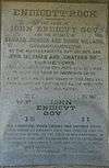
Endicott Rock |
|
000000001980-05-28-0000May 28, 1980
(#80000264) |
Weirs Channel
43°36′20″N 71°27′22″W / 43.605556°N 71.456111°W / 43.605556; -71.456111 (Endicott Rock) |
Laconia (Weirs Beach) |
|
| 12 |
Evangelical Baptist Church |
|
000000001985-09-12-0000September 12, 1985
(#85002189) |
Veterans Sq.
43°31′45″N 71°28′20″W / 43.529167°N 71.472222°W / 43.529167; -71.472222 (Evangelical Baptist Church) |
Laconia |
|
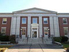
| 13 |
Federal Building |
|
000000002011-10-25-0000October 25, 2011
(#11000766) |
719 Main St.
43°31′50″N 71°28′17″W / 43.530556°N 71.471389°W / 43.530556; -71.471389 (Federal Building) |
Laconia |
|
| 14 |
First Baptist Church of Gilmanton |
|
000000001989-12-01-0000December 1, 1989
(#89002059) |
Province Rd./NH 107, 0.25 miles north of Stage Rd.
43°22′51″N 71°21′14″W / 43.380833°N 71.353889°W / 43.380833; -71.353889 (First Baptist Church of Gilmanton) |
Gilmanton |
|
| 15 |
First Congregational Church |
|
000000001990-03-09-0000March 9, 1990
(#90000386) |
Church St, west of Main St.
43°27′17″N 71°13′20″W / 43.454722°N 71.222222°W / 43.454722; -71.222222 (First Congregational Church) |
Alton |
|
| 16 |
First Free Will Baptist Church in Meredith |
|
000000001986-12-01-0000December 1, 1986
(#86003368) |
Winona Rd.
43°38′48″N 71°32′15″W / 43.646667°N 71.5375°W / 43.646667; -71.5375 (First Free Will Baptist Church in Meredith) |
Meredith |
|
| 17 |
First Freewill Baptist Church |
|
000000001978-08-02-0000August 2, 1978
(#78000209) |
North of Lovelock
43°31′09″N 71°12′00″W / 43.519167°N 71.2°W / 43.519167; -71.2 (First Freewill Baptist Church) |
East Alton |
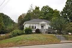
|
| 18 |
Oscar Foss Memorial Library |
|
000000001985-11-07-0000November 7, 1985
(#85002779) |
Main St.
43°20′21″N 71°15′38″W / 43.339167°N 71.260556°W / 43.339167; -71.260556 (Oscar Foss Memorial Library) |
Barnstead |
|
| 19 |
Gale Memorial Library |
|
000000001985-09-12-0000September 12, 1985
(#85002185) |
695 Main St.
43°31′47″N 71°28′17″W / 43.529722°N 71.471389°W / 43.529722; -71.471389 (Gale Memorial Library) |
Laconia |
|
| 20 |
Gilmanton Academy |
|
000000001983-09-08-0000September 8, 1983
(#83001127) |
Province Rd.
43°25′30″N 71°24′50″W / 43.425°N 71.413889°W / 43.425; -71.413889 (Gilmanton Academy) |
Gilmanton |
|
| 21 |
Gilmanton Ironworks Library |
|
000000001989-03-16-0000March 16, 1989
(#89000188) |
Elm St.
43°25′03″N 71°17′47″W / 43.4175°N 71.2965°W / 43.4175; -71.2965 (Gilmanton Ironworks Library) |
Gilmanton |
|
| 22 |
Gordon-Nash Library |
|
000000001988-09-15-0000September 15, 1988
(#88001437) |
Main St.
43°36′19″N 71°39′09″W / 43.605278°N 71.6525°W / 43.605278; -71.6525 (Gordon-Nash Library) |
New Hampton |
|
| 23 |
Ossian Wilbur Goss Reading Room |
|
000000001986-09-04-0000September 4, 1986
(#86002165) |
188 Elm St.
43°32′57″N 71°27′59″W / 43.549167°N 71.466389°W / 43.549167; -71.466389 (Ossian Wilbur Goss Reading Room) |
Laconia (Lakeport) |
|
| 24 |
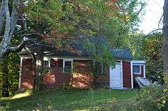
House by the Side of the Road |
|
000000001980-11-26-0000November 26, 1980
(#80000265) |
61 School St.
43°26′51″N 71°35′24″W / 43.4475°N 71.59°W / 43.4475; -71.59 (House by the Side of the Road) |
Tilton |
|
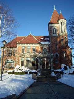
| 25 |
Kimball Castle |
|
000000001982-08-16-0000August 16, 1982
(#82001666) |
Locke's Hill Rd.
43°35′01″N 71°22′46″W / 43.5835°N 71.3794°W / 43.5835; -71.3794 (Kimball Castle) |
Gilford |
|
| 26 |
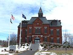
Laconia District Court |
|
000000001982-11-09-0000November 9, 1982
(#82004990) |
Academy Sq.
43°31′25″N 71°28′11″W / 43.523611°N 71.469722°W / 43.523611; -71.469722 (Laconia District Court) |
Laconia |
|
| 27 |
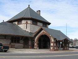
Laconia Passenger Station |
|
000000001982-01-11-0000January 11, 1982
(#82001667) |
Veterans Sq.
43°31′45″N 71°28′21″W / 43.529167°N 71.4725°W / 43.529167; -71.4725 (Laconia Passenger Station) |
Laconia |
|
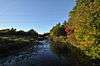
| 28 |
Lochmere Archeological District |
|
000000001982-11-01-0000November 1, 1982
(#82000615) |
West bank of the Winnipesaukee River[7]
|
Tilton |
A large area containing numerous Native American artifacts; sites in the district are partially compromised by construction.[7]
|
| 29 |
Meredith Public Library |
|
000000001984-12-13-0000December 13, 1984
(#84000514) |
50 Main St.
43°39′15″N 71°29′59″W / 43.654167°N 71.499722°W / 43.654167; -71.499722 (Meredith Public Library) |
Meredith |
|
| 30 |
Monument Square Historic District |
|
000000001984-03-15-0000March 15, 1984
(#84002512) |
Main, Factory, Church, and Depot Sts.
43°27′19″N 71°13′11″W / 43.455278°N 71.219722°W / 43.455278; -71.219722 (Monument Square Historic District) |
Alton |
|
| 31 |
Washington Mooney House |
|
000000001997-09-04-0000September 4, 1997
(#97001102) |
Junction of NH 104 and Interstate 93
43°36′52″N 71°38′29″W / 43.614444°N 71.641389°W / 43.614444; -71.641389 (Washington Mooney House) |
New Hampton |
|
| 32 |
John J. Morrill Store |
|
000000001980-08-29-0000August 29, 1980
(#80000266) |
Belknap Mountain Rd.
43°32′52″N 71°24′23″W / 43.547778°N 71.406389°W / 43.547778; -71.406389 (John J. Morrill Store) |
Gilford |
|
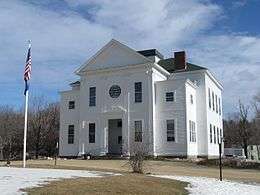
| 33 |
New Hampshire Veterans' Association Historic District |
|
000000001980-05-22-0000May 22, 1980
(#80000267) |
North of Laconia on Lakeside Ave.
43°36′21″N 71°27′43″W / 43.605833°N 71.461944°W / 43.605833; -71.461944 (New Hampshire Veterans' Association Historic District) |
Laconia (Weirs Beach) |
|
| 34 |
New Hampton Community Church |
|
000000001985-03-07-0000March 7, 1985
(#85000474) |
Main St.
43°36′23″N 71°38′55″W / 43.606389°N 71.648611°W / 43.606389; -71.648611 (New Hampton Community Church) |
New Hampton |
|
| 35 |
New Hampton Town House |
|
000000001998-03-23-0000March 23, 1998
(#98000198) |
Junction of Dana Hill and Town House Roads
43°37′27″N 71°37′43″W / 43.624167°N 71.628611°W / 43.624167; -71.628611 (New Hampton Town House) |
New Hampton |
|
| 36 |
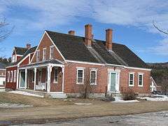
Benjamin Rowe House |
|
000000002008-04-30-0000April 30, 2008
(#07000552) |
88 Belknap Mountain Rd.
43°32′37″N 71°24′10″W / 43.543611°N 71.402778°W / 43.543611; -71.402778 (Benjamin Rowe House) |
Gilford |
|
| 37 |
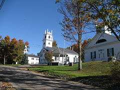
Sanbornton Square Historic District |
|
000000001980-12-08-0000December 8, 1980
(#80000417) |
Sanbornton Square
43°29′33″N 71°35′01″W / 43.4925°N 71.5835°W / 43.4925; -71.5835 (Sanbornton Square Historic District) |
Sanbornton |
|
| 38 |
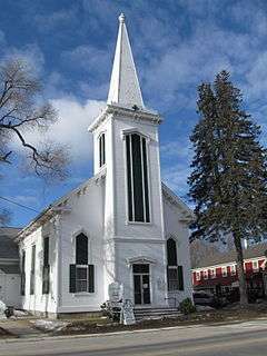
Second Free Baptist Church |
|
000000001990-03-09-0000March 9, 1990
(#90000387) |
Main St., south of Church St.
43°27′18″N 71°13′14″W / 43.455°N 71.220556°W / 43.455; -71.220556 (Second Free Baptist Church) |
Alton |
|
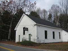
| 39 |
Smith Meeting House |
|
000000001998-03-23-0000March 23, 1998
(#98000196) |
Junction of Smith Meetinghouse, Parsonage Hill, and Joe Jones Rds.
43°24′57″N 71°21′48″W / 43.415833°N 71.363333°W / 43.415833; -71.363333 (Smith Meeting House) |
Gilmanton |
|
| 40 |
Tilton Downtown Historic District |
|
000000001983-07-07-0000July 7, 1983
(#83001128) |
Roughly Main St. between Central and Bridge Sts.
43°26′34″N 71°35′25″W / 43.442778°N 71.590278°W / 43.442778; -71.590278 (Tilton Downtown Historic District) |
Tilton |
|
| 41 |
Tilton Island Park Bridge |
|
000000001980-03-21-0000March 21, 1980
(#80000268) |
Tilton Island Park
43°26′32″N 71°35′13″W / 43.442222°N 71.586944°W / 43.442222; -71.586944 (Tilton Island Park Bridge) |
Tilton |
Over the Winnipesaukee River
|
| 42 |
Charles E. Tilton Mansion |
|
000000001982-08-10-0000August 10, 1982
(#82004995) |
School St.
43°26′38″N 71°35′28″W / 43.443889°N 71.591111°W / 43.443889; -71.591111 (Charles E. Tilton Mansion) |
Tilton |
|
| 43 |
United Baptist Church of Lakeport |
|
000000001985-06-06-0000June 6, 1985
(#85001198) |
23 Park St.
43°32′56″N 71°27′48″W / 43.548889°N 71.463333°W / 43.548889; -71.463333 (United Baptist Church of Lakeport) |
Laconia (Lakeport) |
|
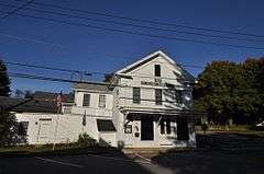
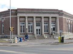
| 44 |
US Post Office-Laconia Main |
|
000000001986-07-18-0000July 18, 1986
(#86002252) |
33 Church St.
43°31′36″N 71°28′28″W / 43.526667°N 71.474444°W / 43.526667; -71.474444 (US Post Office-Laconia Main) |
Laconia |
|
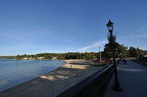
| 45 |
The Weirs |
|
000000001975-05-12-0000May 12, 1975
(#75000120) |
Near outlet of Lake Winnipesaukee[8]
|
Laconia (Weirs Beach) |
Major Native American archeological site.[8] |