| [3] |
Name on the Register[4] |
Image |
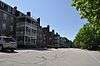
Date listed[5] |
Location |
City or town |
Description |
|---|
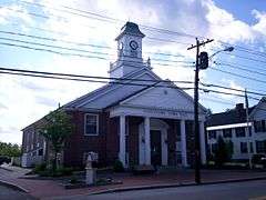
| 1 |
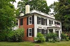
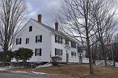
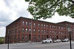
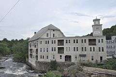
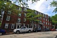
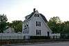
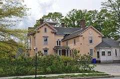
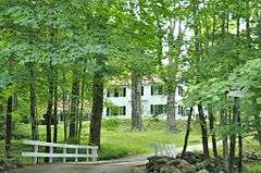
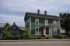
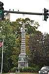
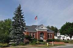
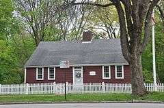
Abbot House |
|
000000001980-04-17-0000April 17, 1980
(#80000289) |
1 Abbott Sq.
42°45′57″N 71°28′08″W / 42.7658°N 71.4689°W / 42.7658; -71.4689 (Abbot House) |
Nashua |
|
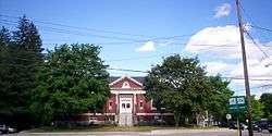
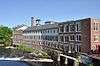
| 2 |
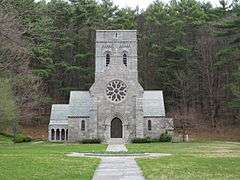
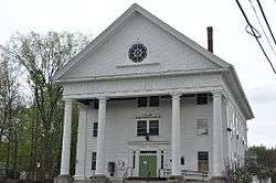
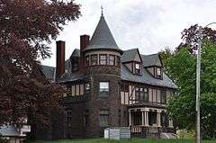
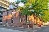
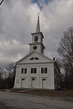
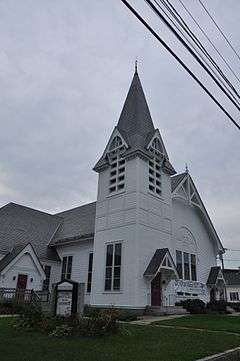
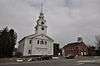
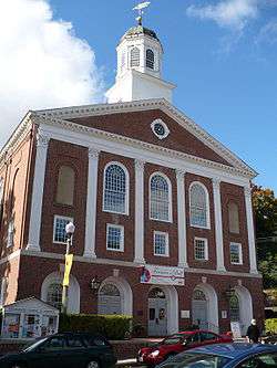
All Saints' Church |
|
000000001980-12-01-0000December 1, 1980
(#80000290) |
51 Concord St.
42°52′50″N 71°56′48″W / 42.8806°N 71.9467°W / 42.8806; -71.9467 (All Saints' Church) |
Peterborough |
|
| 3 |
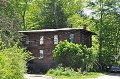
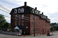
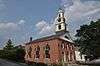
Amherst Village Historic District |
|
000000001982-08-18-0000August 18, 1982
(#82001679) |
NH 101 and NH 122
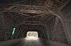
42°51′46″N 71°37′37″W / 42.8628°N 71.6269°W / 42.8628; -71.6269 (Amherst Village Historic District) |
Amherst |
|
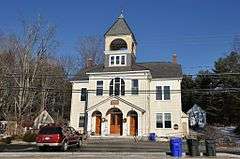
| 4 |
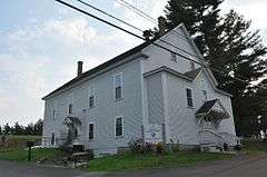
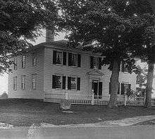
Ash Street School |
|
000000001975-05-30-0000May 30, 1975
(#75000232) |
Bounded by Ash, Bridge, Maple, and Pearl Sts.
42°59′46″N 71°27′17″W / 42.9961°N 71.4547°W / 42.9961; -71.4547 (Ash Street School) |
Manchester |
|
| 5 |
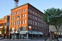
Athens Building |
|
000000001975-05-30-0000May 30, 1975
(#75000123) |
76-96 Hanover St.
42°59′29″N 71°27′43″W / 42.9914°N 71.4619°W / 42.9914; -71.4619 (Athens Building) |
Manchester |
|
| 6 |
Jonathan Barnes House |
|
000000001982-03-01-0000March 1, 1982
(#82001680) |
North Rd.
43°08′51″N 71°56′02″W / 43.1475°N 71.9339°W / 43.1475; -71.9339 (Jonathan Barnes House) |
Hillsborough Center |
|
| 7 |
Bedford Presbyterian Church |
|
000000002007-06-12-0000June 12, 2007
(#07000554) |
4 Church Rd.
42°56′42″N 71°31′12″W / 42.945°N 71.52°W / 42.945; -71.52 (Bedford Presbyterian Church) |
Bedford |
|
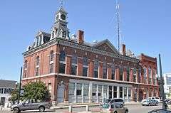
| 8 |
Bedford Town Hall |
|
000000001984-12-13-0000December 13, 1984
(#84000530) |
70 Bedford Center Rd.
42°56′47″N 71°30′57″W / 42.9464°N 71.5158°W / 42.9464; -71.5158 (Bedford Town Hall) |
Bedford |
|
| 9 |
Bennington Village Historic District |
|
000000002010-04-19-0000April 19, 2010
(#10000185) |
Antrim Rd, Main St, School St, Cross St, Francestown Rd, South Bennington Rd, Acre St, Old Stagecoach Rd, Starrett Rd.
43°00′11″N 71°55′28″W / 43.0031°N 71.9244°W / 43.0031; -71.9244 (Bennington Village Historic District) |
Bennington |
|
| 10 |
Birchwood Inn |
|
000000001985-06-06-0000June 6, 1985
(#85001194) |
NH 45
42°49′12″N 71°51′04″W / 42.82°N 71.8511°W / 42.82; -71.8511 (Birchwood Inn) |
Temple |
|
| 11 |
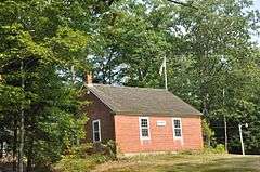
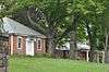
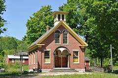
Brick Schoolhouse |
|
000000002002-09-14-0000September 14, 2002
(#02000957) |
432 NH 123
42°48′52″N 71°55′00″W / 42.8144°N 71.9167°W / 42.8144; -71.9167 (Brick Schoolhouse) |
Sharon |
|
| 12 |
Building at 418-420 Notre Dame Ave. |
|
000000001996-12-20-0000December 20, 1996
(#96001467) |
418-420 Notre Dame Ave.
42°59′35″N 71°28′34″W / 42.9931°N 71.4761°W / 42.9931; -71.4761 (Building at 418-420 Notre Dame Ave.) |
Manchester |
Houses the America's Credit Union Museum, site of the first credit union
|
| 13 |
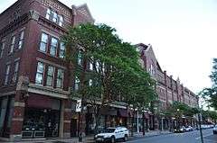
Carpenter and Bean Block |
|
000000002002-12-13-0000December 13, 2002
(#02001548) |
1382-1414 Elm St.
42°59′52″N 71°27′53″W / 42.9978°N 71.4647°W / 42.9978; -71.4647 (Carpenter and Bean Block) |
Manchester |
|
| 14 |
Frank Pierce Carpenter House |
|
000000001994-03-17-0000March 17, 1994
(#94000168) |
1800 Elm St.
43°00′17″N 71°27′57″W / 43.0047°N 71.4658°W / 43.0047; -71.4658 (Frank Pierce Carpenter House) |
Manchester |
|
| 15 |
Amos Chase House and Mill |
|
000000001992-03-12-0000March 12, 1992
(#92000155) |
Western side of NH 114, 1/8 mile south of its junction with NH 77
43°06′32″N 71°45′01″W / 43.1089°N 71.7503°W / 43.1089; -71.7503 (Amos Chase House and Mill) |
Weare |
|
| 16 |
Citizens' Hall |
|
000000001999-12-09-0000December 9, 1999
(#99001482) |
13-12 Citizens' Hall Rd.
42°52′44″N 71°47′05″W / 42.8789°N 71.7847°W / 42.8789; -71.7847 (Citizens' Hall) |
Lyndeborough |
|
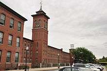
| 17 |
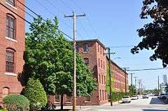
Contoocook Mills Industrial District |
|
000000001975-06-10-0000June 10, 1975
(#75000124) |
Between Mill St. and the Contoocook River; also Mill St.
43°06′48″N 71°53′40″W / 43.1133°N 71.8944°W / 43.1133; -71.8944 (Contoocook Mills Industrial District) |
Hillsborough |
Mill St. represents a boundary increase.
|
| 18 |
County Farm Bridge |
|
000000001981-05-14-0000May 14, 1981
(#81000070) |
Northwest of Wilton on Old County Farm Rd.
42°51′25″N 71°49′03″W / 42.8569°N 71.8175°W / 42.8569; -71.8175 (County Farm Bridge) |
Wilton |
|
| 19 |
Daniel Cragin Mill |
|
000000001982-03-23-0000March 23, 1982
(#82001681) |
West of Wilton at the junction of Davisville Rd. and the Burton Highway
42°51′22″N 71°47′20″W / 42.8561°N 71.7889°W / 42.8561; -71.7889 (Daniel Cragin Mill) |
Wilton |
Also known as Frye's Measure Mill
|
| 20 |
Currier Gallery of Art |
|
000000001979-12-19-0000December 19, 1979
(#79000199) |
192 Orange St.
42°59′52″N 71°27′21″W / 42.9978°N 71.4558°W / 42.9978; -71.4558 (Currier Gallery of Art) |
Manchester |
|
| 21 |
District A |
|
000000001982-11-12-0000November 12, 1982
(#82000618) |
Bounded by Pleasant, State, Granite, and Bedford Sts.
42°59′14″N 71°28′05″W / 42.9872°N 71.4681°W / 42.9872; -71.4681 (District A) |
Manchester |
Worker housing district located near the Amoskeag Millyard
|
| 22 |
District B |
|
000000001982-11-12-0000November 12, 1982
(#82000619) |
Roughly bounded by Canal, Mechanic, Franklin, and Pleasant Sts.
42°59′25″N 71°27′57″W / 42.9903°N 71.4658°W / 42.9903; -71.4658 (District B) |
Manchester |
Worker housing district located near the Amoskeag Millyard
|
| 23 |
District C |
|
000000001982-11-12-0000November 12, 1982
(#82000620) |
Roughly bounded by N. Hampshire Lane, Hollis, Canal, and Bridge Sts.
42°59′43″N 71°27′55″W / 42.9953°N 71.4653°W / 42.9953; -71.4653 (District C) |
Manchester |
Worker housing district located near the Amoskeag Millyard
|
| 24 |
District D |
|
000000001982-11-12-0000November 12, 1982
(#82000621) |
Roughly bounded by Canal, Langdon, Elm, and W. Brook Sts.
42°59′57″N 71°27′59″W / 42.9992°N 71.4664°W / 42.9992; -71.4664 (District D) |
Manchester |
Worker housing district located near the Amoskeag Millyard
|
| 25 |
District E |
|
000000001982-11-12-0000November 12, 1982
(#82000622) |
258-322 McGregor St.
42°59′40″N 71°28′27″W / 42.9944°N 71.4742°W / 42.9944; -71.4742 (District E) |
Manchester |
Worker housing district located near the Amoskeag Millyard
|
| 26 |
Dunlap Building |
|
000000002004-06-09-0000June 9, 2004
(#04000587) |
967 Elm St.
42°59′30″N 71°27′48″W / 42.9917°N 71.4633°W / 42.9917; -71.4633 (Dunlap Building) |
Manchester |
|
| 27 |
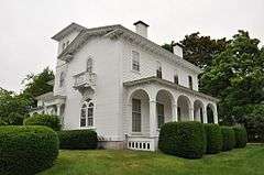
The Flint Estate |
|
000000001984-12-13-0000December 13, 1984
(#84000525) |
Old Keene and Old Center Rd.
43°05′04″N 71°58′40″W / 43.0844°N 71.9778°W / 43.0844; -71.9778 (The Flint Estate) |
Antrim |
|
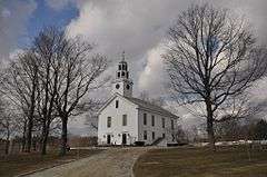
| 28 |
Francestown Meetinghouse |
|
000000001999-06-14-0000June 14, 1999
(#99000667) |
NH 136
42°59′14″N 71°48′46″W / 42.9872°N 71.8128°W / 42.9872; -71.8128 (Francestown Meetinghouse) |
Francestown |
|
| 29 |
Francestown Town Hall and Academy and Town Common Historic District |
Upload image |
000000002016-04-05-0000April 5, 2016
(#16000143) |
2 New Boston Rd.
42°59′13″N 71°48′44″W / 42.987033°N 71.812186°W / 42.987033; -71.812186 (Francestown Town Hall and Academy and Town Common Historic District) |
Francestown |
|
| 30 |
Alpheus Gay House |
|
000000001982-03-09-0000March 9, 1982
(#82001682) |
184 Myrtle St.
42°59′53″N 71°27′25″W / 42.9981°N 71.4569°W / 42.9981; -71.4569 (Alpheus Gay House) |
Manchester |
|
| 31 |
Goffstown Congregational Church |
|
000000001996-03-01-0000March 1, 1996
(#96000193) |
10 Main St.
43°01′10″N 71°36′03″W / 43.0194°N 71.6008°W / 43.0194; -71.6008 (Goffstown Congregational Church) |
Goffstown |
|
| 32 |
Goffstown Covered Railroad Bridge |
|
000000001975-06-18-0000June 18, 1975
(#75000125) |
NH 114 (Main St.) over the Piscataquog River
43°01′04″N 71°35′58″W / 43.0178°N 71.5994°W / 43.0178; -71.5994 (Goffstown Covered Railroad Bridge) |
Goffstown |
Destroyed by fire on August 16, 1976[6] (Bridge abutments are visible in the photo.)
|
| 33 |
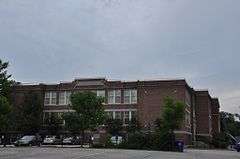
Goffstown High School |
|
000000001997-12-19-0000December 19, 1997
(#97001524) |
12 Reed St.
43°01′10″N 71°35′54″W / 43.0194°N 71.5983°W / 43.0194; -71.5983 (Goffstown High School) |
Goffstown |
Former high school building is now senior housing.
|
| 34 |
Goffstown Main Street Historic District |
|
000000002007-03-15-0000March 15, 2007
(#07000153) |
Selected buildings on Church St., Depot St., High St., Main St., and N. Mast St.
43°01′09″N 71°36′00″W / 43.0191°N 71.5999°W / 43.0191; -71.5999 (Goffstown Main Street Historic District) |
Goffstown |
|
| 35 |
Goffstown Public Library |
|
000000001995-12-07-0000December 7, 1995
(#95001426) |
2 High St.
43°01′14″N 71°36′01″W / 43.0206°N 71.6003°W / 43.0206; -71.6003 (Goffstown Public Library) |
Goffstown |
|
| 36 |
Grasmere Schoolhouse #9 and Town Hall |
|
000000001990-09-05-0000September 5, 1990
(#90001350) |
87 Center St.
43°01′18″N 71°32′46″W / 43.0217°N 71.5461°W / 43.0217; -71.5461 (Grasmere Schoolhouse #9 and Town Hall) |
Goffstown |
In village of Grasmere
|
| 37 |
Greenfield Meeting House |
|
000000001983-12-08-0000December 8, 1983
(#83004090) |
Forest Rd.
42°57′03″N 71°52′21″W / 42.9508°N 71.8725°W / 42.9508; -71.8725 (Greenfield Meeting House) |
Greenfield |
|
| 38 |
Hamblet-Putnam-Frye House |
|
000000002000-06-22-0000June 22, 2000
(#00000651) |
293 Burton Highway
42°51′23″N 71°47′28″W / 42.8564°N 71.7911°W / 42.8564; -71.7911 (Hamblet-Putnam-Frye House) |
Wilton |
|
| 39 |
Hancock Village Historic District |
|
000000001988-03-08-0000March 8, 1988
(#88000178) |
Main St. roughly between Norway Pond La. and Old Dublin Rd., and Bennington and Norway Hill Rds.
42°58′22″N 71°58′59″W / 42.9728°N 71.9831°W / 42.9728; -71.9831 (Hancock Village Historic District) |
Hancock |
|
| 40 |
Hancock-Greenfield Bridge |
|
000000001981-05-05-0000May 5, 1981
(#81000071) |
Forest Rd.
42°57′25″N 71°56′08″W / 42.9569°N 71.9356°W / 42.9569; -71.9356 (Hancock-Greenfield Bridge) |
Hancock |
Over Contoocook River
|
| 41 |
Harrington-Smith Block |
|
000000001987-01-28-0000January 28, 1987
(#86003367) |
18-52 Hanover St.
42°59′28″N 71°27′44″W / 42.9911°N 71.4622°W / 42.9911; -71.4622 (Harrington-Smith Block) |
Manchester |
|
| 42 |
Hill-Lassonde House |
|
000000001985-12-02-0000December 2, 1985
(#85003033) |
269 Hanover St.
42°59′27″N 71°27′21″W / 42.9908°N 71.4558°W / 42.9908; -71.4558 (Hill-Lassonde House) |
Manchester |
|
| 43 |
Hills House |
|
000000001983-04-08-0000April 8, 1983
(#83001141) |
211 Derry Rd.
42°47′46″N 71°26′05″W / 42.7961°N 71.4347°W / 42.7961; -71.4347 (Hills House) |
Hudson |
Architect Hubert G. Ripley
|
| 44 |
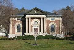
Hills Memorial Library |
|
000000001984-06-07-0000June 7, 1984
(#84002812) |
16 Library St.
42°45′54″N 71°26′19″W / 42.765°N 71.4386°W / 42.765; -71.4386 (Hills Memorial Library) |
Hudson |
|
| 45 |
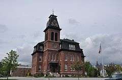
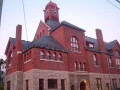
Hillsborough County Courthouse |
|
000000001985-06-06-0000June 6, 1985
(#85001196) |
19 Temple St.
42°45′41″N 71°27′54″W / 42.7614°N 71.465°W / 42.7614; -71.465 (Hillsborough County Courthouse) |
Nashua |
|
| 46 |
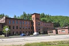
Hillsborough Mills |
|
000000002013-06-14-0000June 14, 2013
(#13000383) |
37 Wilton Rd.
42°50′28″N 71°43′18″W / 42.8411°N 71.7216°W / 42.8411; -71.7216 (Hillsborough Mills) |
Milford |
|
| 47 |
Hillsborough Railroad Bridge |
|
000000001975-06-10-0000June 10, 1975
(#75000126) |
Spans the Contoocook River southwest of NH 149
43°06′48″N 71°53′44″W / 43.1133°N 71.8956°W / 43.1133; -71.8956 (Hillsborough Railroad Bridge) |
Hillsborough |
Destroyed by arson in 1985.[7] (Bridge abutments are visible in the photo.)
|
| 48 |
Hollis Village Historic District |
|
000000002001-03-02-0000March 2, 2001
(#01000204) |
Roughly parts of Ash St., Broad St., Cleasby Ln., Depot Rd., Main St., Monument Sq. and Silver Lake Rd.
42°44′17″N 71°35′05″W / 42.7381°N 71.5847°W / 42.7381; -71.5847 (Hollis Village Historic District) |
Hollis |
|
| 49 |
Hoyt Shoe Factory |
|
000000001985-11-07-0000November 7, 1985
(#85002777) |
477 Silver and 170 Lincoln Sts.
42°58′38″N 71°27′05″W / 42.9772°N 71.4514°W / 42.9772; -71.4514 (Hoyt Shoe Factory) |
Manchester |
|
| 50 |
Thomas Russell Hubbard House |
|
000000001988-03-08-0000March 8, 1988
(#88000177) |
220 Myrtle St.
42°59′54″N 71°27′17″W / 42.9983°N 71.4547°W / 42.9983; -71.4547 (Thomas Russell Hubbard House) |
Manchester |
|
| 51 |
Hunt Memorial Library |
|
000000001971-06-28-0000June 28, 1971
(#71000049) |
6 Main St.
42°45′23″N 71°27′50″W / 42.7564°N 71.4639°W / 42.7564; -71.4639 (Hunt Memorial Library) |
Nashua |
|
| 52 |
Kennedy Hill Farm |
|
000000001984-06-07-0000June 7, 1984
(#84002813) |
Kennedy Hill Rd.
42°59′47″N 71°32′21″W / 42.9964°N 71.5392°W / 42.9964; -71.5392 (Kennedy Hill Farm) |
Goffstown |
|
| 53 |
Killicut-Way House |
|
000000001989-12-01-0000December 1, 1989
(#89002056) |
2 Old House Ln.
42°43′55″N 71°28′15″W / 42.7319°N 71.4708°W / 42.7319; -71.4708 (Killicut-Way House) |
Nashua |
|
| 54 |
Kimball Brothers Shoe Factory |
|
000000001985-11-07-0000November 7, 1985
(#85002776) |
335 Cypress St.
42°58′55″N 71°26′22″W / 42.9819°N 71.4394°W / 42.9819; -71.4394 (Kimball Brothers Shoe Factory) |
Manchester |
|
| 55 |
Lamson Farm |
|
000000001981-02-24-0000February 24, 1981
(#81000072) |
Lamson Rd.
42°55′17″N 71°41′07″W / 42.9214°N 71.6853°W / 42.9214; -71.6853 (Lamson Farm) |
Mont Vernon |
|
| 56 |
Lyndeborough Center Historic District |
|
000000001984-06-07-0000June 7, 1984
(#84002814) |
Center Rd.
42°54′24″N 71°46′02″W / 42.9067°N 71.7672°W / 42.9067; -71.7672 (Lyndeborough Center Historic District) |
Lyndeborough Center |
|
| 57 |
MacDowell Colony |
|
000000001966-10-15-0000October 15, 1966
(#66000026) |
West of U.S. Route 202
42°53′27″N 71°57′39″W / 42.8908°N 71.9608°W / 42.8908; -71.9608 (MacDowell Colony) |
Peterborough |
An artists' colony
|
| 58 |
Manchester City Hall |
|
000000001975-06-13-0000June 13, 1975
(#75000233) |
908 Elm St.
42°59′28″N 71°27′50″W / 42.9911°N 71.4639°W / 42.9911; -71.4639 (Manchester City Hall) |
Manchester |
|
| 59 |
McClure-Hilton House |
|
000000001989-12-01-0000December 1, 1989
(#89002058) |
16 Tinker Rd.
42°48′40″N 71°31′45″W / 42.8111°N 71.5292°W / 42.8111; -71.5292 (McClure-Hilton House) |
Merrimack |
|
| 60 |
The Meetinghouse |
|
000000001982-03-11-0000March 11, 1982
(#82001683) |
Monument Sq.
42°44′22″N 71°35′18″W / 42.7394°N 71.5883°W / 42.7394; -71.5883 (The Meetinghouse) |
Hollis |
|
| 61 |
Milford Cotton and Woolen Manufacturing Company |
|
000000001982-08-18-0000August 18, 1982
(#82001684) |
2 Bridge St.
42°50′11″N 71°38′57″W / 42.8364°N 71.6492°W / 42.8364; -71.6492 (Milford Cotton and Woolen Manufacturing Company) |
Milford |
|
| 62 |
Milford Town House and Library Annex |
|
000000001988-12-01-0000December 1, 1988
(#88001436) |
Nashua St.
42°50′08″N 71°38′58″W / 42.8356°N 71.6494°W / 42.8356; -71.6494 (Milford Town House and Library Annex) |
Milford |
|
| 63 |
Nashua Gummed and Coated Paper Company Historic District |
|
000000002015-12-22-0000December 22, 2015
(#15000919) |
34, 44, 55 Franklin & 21, 25 30 Front Sts.
42°45′46″N 71°28′13″W / 42.762729°N 71.470336°W / 42.762729; -71.470336 (Nashua Gummed and Coated Paper Company Historic District) |
Nashua |
|
| 64 |
Nashua Manufacturing Company Historic District |
|
000000001987-09-11-0000September 11, 1987
(#87001460) |
Factory and Pine Sts.
42°45′35″N 71°28′22″W / 42.7597°N 71.4728°W / 42.7597; -71.4728 (Nashua Manufacturing Company Historic District) |
Nashua |
|
| 65 |
Nashville Historic District |
|
000000001984-12-13-0000December 13, 1984
(#84000574) |
Roughly centered on junction of Main, Amherst, and Concord Streets
42°46′08″N 71°27′59″W / 42.7689°N 71.4664°W / 42.7689; -71.4664 (Nashville Historic District) |
Nashua |
|
| 66 |
New England Glassworks Site |
Upload image |
000000001975-06-10-0000June 10, 1975
(#75000127) |
near Kidder Mountain
|
Temple |
Site of a 1780s glassworks, one of the first in the nation[8]
|
| 67 |
New Hampshire State Union Armory |
|
000000001982-08-10-0000August 10, 1982
(#82004993) |
60 Pleasant St.
42°59′18″N 71°27′57″W / 42.9883°N 71.4658°W / 42.9883; -71.4658 (New Hampshire State Union Armory) |
Manchester |
|
| 68 |
New Ipswich Center Village Historic District |
|
000000001991-09-03-0000September 3, 1991
(#91001173) |
Roughly bounded by Turnpike Rd., Porter Hill Rd., Main St., NH 123A, Preston Hill, Manley, and King Rds.
42°45′10″N 71°51′22″W / 42.7528°N 71.8561°W / 42.7528; -71.8561 (New Ipswich Center Village Historic District) |
New Ipswich |
|
| 69 |
New Ipswich Town Hall |
|
000000001984-12-13-0000December 13, 1984
(#84000555) |
Main St.
42°44′53″N 71°51′17″W / 42.7481°N 71.8547°W / 42.7481; -71.8547 (New Ipswich Town Hall) |
New Ipswich |
|
| 70 |
Marion Nichols Summer Home |
|
000000002003-12-10-0000December 10, 2003
(#03001283) |
56 Love Lane
42°44′04″N 71°36′02″W / 42.7344°N 71.6006°W / 42.7344; -71.6006 (Marion Nichols Summer Home) |
Hollis |
Now known as the Beaver Brook Association's Lodge
|
| 71 |
North Weare Schoolhouse |
|
000000001995-09-06-0000September 6, 1995
(#95001051) |
Northern side of Old Concord Stage Rd. east of its junction with NH 114
43°06′40″N 71°44′56″W / 43.1111°N 71.7489°W / 43.1111; -71.7489 (North Weare Schoolhouse) |
Weare |
|
| 72 |
Old County Road South Historic District |
|
000000001980-05-15-0000May 15, 1980
(#80000413) |
South of Francestown off NH 136
42°58′27″N 71°48′22″W / 42.9742°N 71.8061°W / 42.9742; -71.8061 (Old County Road South Historic District) |
Francestown |
|
| 73 |
Old Post Office Block |
|
000000001986-12-01-0000December 1, 1986
(#86003364) |
54-72 Hanover St.
42°59′28″N 71°27′44″W / 42.9911°N 71.4622°W / 42.9911; -71.4622 (Old Post Office Block) |
Manchester |
|
| 74 |
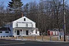
Parker's Store |
|
000000001980-05-14-0000May 14, 1980
(#80000414) |
West of Goffstown on NH 114
43°01′34″N 71°37′42″W / 43.0261°N 71.6283°W / 43.0261; -71.6283 (Parker's Store) |
Goffstown |
|
| 75 |
William Peabody House |
|
000000001979-11-30-0000November 30, 1979
(#79000200) |
N. River Rd.
42°50′38″N 71°39′56″W / 42.8439°N 71.6656°W / 42.8439; -71.6656 (William Peabody House) |
Milford |
|
| 76 |
Pelham Library and Memorial Building |
|
000000002011-04-15-0000April 15, 2011
(#11000191) |
5 Main St.
42°44′02″N 71°19′19″W / 42.7339°N 71.3219°W / 42.7339; -71.3219 (Pelham Library and Memorial Building) |
Pelham |
|
| 77 |
Peterborough Town House |
|
000000001996-02-29-0000February 29, 1996
(#96000194) |
1 Grove St.
42°52′38″N 71°57′04″W / 42.8772°N 71.9511°W / 42.8772; -71.9511 (Peterborough Town House) |
Peterborough |
|
| 78 |
Peterborough Unitarian Church |
|
000000001973-04-23-0000April 23, 1973
(#73000165) |
Main and Summer Sts.
42°52′40″N 71°57′00″W / 42.8778°N 71.95°W / 42.8778; -71.95 (Peterborough Unitarian Church) |
Peterborough |
|
| 79 |
Franklin Pierce Homestead |
|
000000001966-10-15-0000October 15, 1966
(#66000027) |
3 mi (4.8 km) west of Hillsborough on NH 31
43°06′58″N 71°57′03″W / 43.1161°N 71.9508°W / 43.1161; -71.9508 (Franklin Pierce Homestead) |
Hillsborough |
Childhood home of U.S. President Franklin Pierce
|
| 80 |
St. George's School and Convent |
|
000000001985-09-12-0000September 12, 1985
(#85002192) |
12 Orange St.
42°59′49″N 71°27′36″W / 42.9969°N 71.46°W / 42.9969; -71.46 (St. George's School and Convent) |
Manchester |
|
| 81 |
G.O. Sanders House |
|
000000001986-02-27-0000February 27, 1986
(#86000277) |
10 Derry St.
42°45′57″N 71°26′26″W / 42.7658°N 71.4406°W / 42.7658; -71.4406 (G.O. Sanders House) |
Hudson |
|
| 82 |
Signer's House and Matthew Thornton Cemetery |
|
000000001978-12-22-0000December 22, 1978
(#78000214) |
South of Merrimack on U.S. Route 3
42°50′23″N 71°29′30″W / 42.8397°N 71.4917°W / 42.8397; -71.4917 (Signer's House and Matthew Thornton Cemetery) |
Merrimack |
|
| 83 |
Smith and Dow Block |
|
000000002002-12-13-0000December 13, 2002
(#02001549) |
1426-1470 Elm St.
42°59′54″N 71°27′54″W / 42.9983°N 71.465°W / 42.9983; -71.465 (Smith and Dow Block) |
Manchester |
|
| 84 |
Gov. John Butler Smith House |
|
000000002002-09-14-0000September 14, 2002
(#02000959) |
62 School St.
43°06′59″N 71°53′47″W / 43.1164°N 71.8964°W / 43.1164; -71.8964 (Gov. John Butler Smith House) |
Hillsborough |
Houses the local library and town offices
|
| 85 |
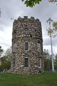
Smyth Tower |
|
000000001978-07-24-0000July 24, 1978
(#78000215) |
718 Smyth Rd.
43°00′44″N 71°26′35″W / 43.0122°N 71.4431°W / 43.0122; -71.4431 (Smyth Tower) |
Manchester |
On the grounds of the Manchester VA Hospital
|
| 86 |
Stark Park |
|
000000002006-06-14-0000June 14, 2006
(#06000505) |
Bounded by N. River Rd., Park Ave., and the Merrimack River
43°00′52″N 71°28′17″W / 43.0144°N 71.4714°W / 43.0144; -71.4714 (Stark Park) |
Manchester |
|
| 87 |
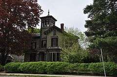
Gen. George Stark House |
|
000000001980-11-25-0000November 25, 1980
(#80000291) |
22 Concord St.
42°46′05″N 71°28′04″W / 42.7681°N 71.4678°W / 42.7681; -71.4678 (Gen. George Stark House) |
Nashua |
|
| 88 |
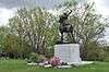
Gen. John Stark House |
|
000000001973-06-29-0000June 29, 1973
(#73000166) |
2000 Elm St.
43°00′30″N 71°28′00″W / 43.0083°N 71.4667°W / 43.0083; -71.4667 (Gen. John Stark House) |
Manchester |
|
| 89 |
Stonyfield Farm |
|
000000001983-08-03-0000August 3, 1983
(#83001142) |
Northwest of Wilton on Foster Rd.
42°52′00″N 71°47′24″W / 42.8667°N 71.79°W / 42.8667; -71.79 (Stonyfield Farm) |
Wilton |
Farm (dating to the 19th century) where yogurt-maker Stonyfield Farm was founded
|
| 90 |
William Parker Straw House |
|
000000001987-12-08-0000December 8, 1987
(#87002068) |
282 N. River Rd.
43°00′26″N 71°28′09″W / 43.0072°N 71.4692°W / 43.0072; -71.4692 (William Parker Straw House) |
Manchester |
|
| 91 |
Roger Sullivan House |
|
000000002004-03-10-0000March 10, 2004
(#04000150) |
168 Walnut St.
42°59′54″N 71°27′30″W / 42.9983°N 71.4583°W / 42.9983; -71.4583 (Roger Sullivan House) |
Manchester |
|
| 92 |
Temple Town Hall |
|
000000002007-06-12-0000June 12, 2007
(#07000551) |
Main St., junction of NH 45 and the Gen. Miller Highway
42°49′12″N 71°51′08″W / 42.82°N 71.8522°W / 42.82; -71.8522 (Temple Town Hall) |
Temple |
|
| 93 |
Union Chapel |
|
000000002009-02-03-0000February 3, 2009
(#08001411) |
220 Sawmill Rd.
43°06′46″N 71°56′37″W / 43.1128°N 71.9437°W / 43.1128; -71.9437 (Union Chapel) |
Hillsborough |
|
| 94 |
US Post Office-Peterborough Main |
|
000000001986-07-17-0000July 17, 1986
(#86002253) |
23 Grove St.
42°52′36″N 71°57′04″W / 42.8767°N 71.9511°W / 42.8767; -71.9511 (US Post Office-Peterborough Main) |
Peterborough |
|
| 95 |
Valley Cemetery |
|
000000002004-09-10-0000September 10, 2004
(#04000964) |
Pine and Auburn Sts.
42°58′59″N 71°27′40″W / 42.9831°N 71.4611°W / 42.9831; -71.4611 (Valley Cemetery) |
Manchester |
|
| 96 |
Varney School |
|
000000001982-01-11-0000January 11, 1982
(#82001685) |
84 Varney St.
42°58′49″N 71°28′43″W / 42.9803°N 71.4786°W / 42.9803; -71.4786 (Varney School) |
Manchester |
|
| 97 |
Victory Park Historic District |
|
000000001996-06-03-0000June 3, 1996
(#96000615) |
405 Pine, 148 Concord, and 111 and 129 Amherst Sts.
42°59′32″N 71°27′37″W / 42.9922°N 71.4603°W / 42.9922; -71.4603 (Victory Park Historic District) |
Manchester |
|
| 98 |
Weare Town House |
|
000000001985-12-02-0000December 2, 1985
(#85003034) |
NH 114
43°05′45″N 71°43′51″W / 43.0958°N 71.7308°W / 43.0958; -71.7308 (Weare Town House) |
Weare |
|
| 99 |
Weston Observatory |
|
000000001975-05-28-0000May 28, 1975
(#75000128) |
Oak Hill, Derryfield Park
43°00′04″N 71°26′21″W / 43.0011°N 71.4392°W / 43.0011; -71.4392 (Weston Observatory) |
Manchester |
|
| 100 |
Oliver Whiting Homestead |
|
000000001982-03-09-0000March 9, 1982
(#82001686) |
Old County Farm Rd.
42°51′18″N 71°49′21″W / 42.855°N 71.8225°W / 42.855; -71.8225 (Oliver Whiting Homestead) |
Wilton |
|
| 101 |
Caleb Whittaker Place |
|
000000001983-08-03-0000August 3, 1983
(#83001143) |
Perkins Pond Rd.
43°02′46″N 71°44′29″W / 43.0461°N 71.7414°W / 43.0461; -71.7414 (Caleb Whittaker Place) |
Weare |
|
| 102 |
Wilton Public and Gregg Free Library |
|
000000001982-01-11-0000January 11, 1982
(#82001687) |
Forest St.
42°50′43″N 71°44′20″W / 42.8453°N 71.7389°W / 42.8453; -71.7389 (Wilton Public and Gregg Free Library) |
Wilton |
|
| 103 |
Wilton Town Hall |
|
000000002009-04-20-0000April 20, 2009
(#09000254) |
42 Main St.
42°50′37″N 71°44′15″W / 42.8435°N 71.7376°W / 42.8435; -71.7376 (Wilton Town Hall) |
Wilton |
|
| 104 |
Levi Woodbury Homestead |
|
000000002007-03-15-0000March 15, 2007
(#07000152) |
1 Main St.
42°59′14″N 71°48′48″W / 42.9872°N 71.8133°W / 42.9872; -71.8133 (Levi Woodbury Homestead) |
Francestown |
|
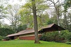
| 105 |
Zimmerman House |
|
000000001979-10-18-0000October 18, 1979
(#79003790) |
223 Heather St.
43°01′18″N 71°27′47″W / 43.0217°N 71.4631°W / 43.0217; -71.4631 (Zimmerman House) |
Manchester |
House designed by Frank Lloyd Wright; tours operated by the Currier Museum of Art. |


_AND_EAST_ELEVATION_(SIDE)_-_T._L._Thorpe_Building%2C_19_Traction_Street%2C_Manchester%2C_Hillsborough_County%2C_NH_HABS_NH%2C6-MANCH%2C10-1.tif.jpg)
