Holy Cross Township, Clay County, Minnesota
| Holy Cross Township, Minnesota | |
|---|---|
| Township | |
 Holy Cross Township, Minnesota Location within the state of Minnesota | |
| Coordinates: 46°40′40″N 96°43′55″W / 46.67778°N 96.73194°WCoordinates: 46°40′40″N 96°43′55″W / 46.67778°N 96.73194°W | |
| Country | United States |
| State | Minnesota |
| County | Clay |
| Area | |
| • Total | 33.3 sq mi (86.1 km2) |
| • Land | 33.3 sq mi (86.1 km2) |
| • Water | 0.0 sq mi (0.0 km2) |
| Elevation | 915 ft (279 m) |
| Population (2000) | |
| • Total | 129 |
| • Density | 3.9/sq mi (1.5/km2) |
| Time zone | Central (CST) (UTC-6) |
| • Summer (DST) | CDT (UTC-5) |
| FIPS code | 27-29906[1] |
| GNIS feature ID | 0664509[2] |
Holy Cross Township is a township in Clay County, Minnesota, United States. The population was 129 at the 2000 census.
Holy Cross Township was named for a tall Christian cross which stood at a local cemetery.[3]
Geography
According to the United States Census Bureau, the township has a total area of 33.2 square miles (86 km2), all land.
Demographics
As of the census[1] of 2000, there were 129 people, 47 households, and 43 families residing in the township. The population density was 3.9 people per square mile (1.5/km²). There were 59 housing units at an average density of 1.8/sq mi (0.7/km²). The racial makeup of the township was 100.00% White.
There were 47 households out of which 36.2% had children under the age of 18 living with them, 87.2% were married couples living together, and 6.4% were non-families. 6.4% of all households were made up of individuals and 4.3% had someone living alone who was 65 years of age or older. The average household size was 2.74 and the average family size was 2.82.
In the township the population was spread out with 27.1% under the age of 18, 2.3% from 18 to 24, 26.4% from 25 to 44, 29.5% from 45 to 64, and 14.7% who were 65 years of age or older. The median age was 43 years. For every 100 females there were 115.0 males. For every 100 females age 18 and over, there were 108.9 males.
The median income for a household in the township was $45,313, and the median income for a family was $45,313. Males had a median income of $33,125 versus $21,563 for females. The per capita income for the township was $15,863. There were 4.9% of families and 7.5% of the population living below the poverty line, including 13.2% of under eighteens and none of those over 64.
References
- 1 2 "American FactFinder". United States Census Bureau. Retrieved 2008-01-31.
- ↑ "US Board on Geographic Names". United States Geological Survey. 2007-10-25. Retrieved 2008-01-31.
- ↑ Upham, Warren (1920). Minnesota Geographic Names: Their Origin and Historic Significance. Minnesota Historical Society. p. 117.
Municipalities and communities of Clay County, Minnesota, United States | ||
|---|---|---|
| Cities | 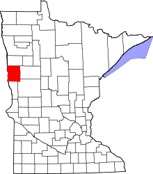 | |
| Townships | ||
| CDPs | ||
| Unincorporated communities | ||
| Ghost towns | ||