Glyndon, Minnesota
| Glyndon, Minnesota | |
|---|---|
| City | |
| Nickname(s): G-town | |
| Motto: City Living in a Rural Setting | |
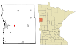 Location of Glyndon, Minnesota | |
| Coordinates: 46°52′25″N 96°34′47″W / 46.87361°N 96.57972°W | |
| Country | United States |
| State | Minnesota |
| County | Clay |
| Area[1] | |
| • Total | 1.51 sq mi (3.91 km2) |
| • Land | 1.51 sq mi (3.91 km2) |
| • Water | 0 sq mi (0 km2) |
| Elevation | 925 ft (282 m) |
| Population (2010)[2] | |
| • Total | 1,394 |
| • Estimate (2013[3]) | 1,397 |
| • Density | 923.2/sq mi (356.4/km2) |
| Time zone | Central (CST) (UTC-6) |
| • Summer (DST) | CDT (UTC-5) |
| ZIP code | 56547 |
| Area code(s) | 218 |
| FIPS code | 27-24182 |
| GNIS feature ID | 0644192[4] |
| Website | http://glyndonmn.com |
Glyndon is a city in Clay County, Minnesota, United States. The population was 1,394 as of the 2010 census.[5]
History
Glyndon was platted in 1872 when the railroad was extended to that point.[6] A post office has been in operation in Glyndon since 1872.[7]
Geography
According to the United States Census Bureau, the city has a total area of 1.51 square miles (3.91 km2), all land.[1] The city was named after Howard Glyndon, the pen name of poet Laura C. Redden Searing.
U.S. Route 10 serves as a main route in the city.
Demographics
| Historical population | |||
|---|---|---|---|
| Census | Pop. | %± | |
| 1880 | 406 | — | |
| 1890 | 275 | −32.3% | |
| 1900 | 250 | −9.1% | |
| 1910 | 295 | 18.0% | |
| 1920 | 382 | 29.5% | |
| 1930 | 388 | 1.6% | |
| 1940 | 405 | 4.4% | |
| 1950 | 411 | 1.5% | |
| 1960 | 489 | 19.0% | |
| 1970 | 674 | 37.8% | |
| 1980 | 882 | 30.9% | |
| 1990 | 862 | −2.3% | |
| 2000 | 1,049 | 21.7% | |
| 2010 | 1,394 | 32.9% | |
| Est. 2015 | 1,380 | [8] | −1.0% |
| U.S. Decennial Census[9] 2013 Estimate[10] | |||
2010 census
As of the census[2] of 2010, there were 1,394 people, 464 households, and 360 families residing in the city. The population density was 923.2 inhabitants per square mile (356.4/km2). There were 487 housing units at an average density of 322.5 per square mile (124.5/km2). The racial makeup of the city was 92.3% White, 1.2% African American, 2.8% Native American, 1.9% from other races, and 1.8% from two or more races. Hispanic or Latino of any race were 6.0% of the population.
There were 464 households of which 50.9% had children under the age of 18 living with them, 65.5% were married couples living together, 6.7% had a female householder with no husband present, 5.4% had a male householder with no wife present, and 22.4% were non-families. 18.5% of all households were made up of individuals and 5.1% had someone living alone who was 65 years of age or older. The average household size was 3.00 and the average family size was 3.45.
The median age in the city was 29.5 years. 35.4% of residents were under the age of 18; 6.9% were between the ages of 18 and 24; 32.4% were from 25 to 44; 18.2% were from 45 to 64; and 6.9% were 65 years of age or older. The gender makeup of the city was 50.9% male and 49.1% female.
2000 census
As of the census of 2000, there were 1,049 people, 359 households, and 283 families residing in the city. The population density was 693.5 people per square mile (268.2/km²). There were 403 housing units at an average density of 266.4 per square mile (103.0/km²). The racial makeup of the city was 95.71% White, 0.10% African American, 0.29% Native American, 0.10% Asian, 1.91% from other races, and 1.91% from two or more races. Hispanic or Latino of any race were 7.53% of the population.
There were 359 households out of which 44.6% had children under the age of 18 living with them, 65.2% were married couples living together, 10.3% had a female householder with no husband present, and 20.9% were non-families. 18.7% of all households were made up of individuals and 4.7% had someone living alone who was 65 years of age or older. The average household size was 2.92 and the average family size was 3.33.
In the city the population was spread out with 34.2% under the age of 18, 8.0% from 18 to 24, 31.0% from 25 to 44, 19.4% from 45 to 64, and 7.4% who were 65 years of age or older. The median age was 30 years. For every 100 females there were 102.1 males. For every 100 females age 18 and over, there were 96.6 males.
The median income for a household in the city was $44,028, and the median income for a family was $50,000. Males had a median income of $35,259 versus $22,303 for females. The per capita income for the city was $17,922. About 7.3% of families and 9.7% of the population were below the poverty line, including 12.8% of those under age 18 and 5.1% of those age 65 or over.
References
- 1 2 "US Gazetteer files 2010". United States Census Bureau. Archived from the original on January 24, 2012. Retrieved 2012-11-13.
- 1 2 "American FactFinder". United States Census Bureau. Retrieved 2012-11-13.
- ↑ "Population Estimates". United States Census Bureau. Retrieved 2014-06-09.
- ↑ "US Board on Geographic Names". United States Geological Survey. 2007-10-25. Retrieved 2008-01-31.
- ↑ "2010 Census Redistricting Data (Public Law 94-171) Summary File". American FactFinder. U.S. Census Bureau, 2010 Census. Archived from the original on July 21, 2011. Retrieved 23 April 2011.
- ↑ Upham, Warren (1920). Minnesota Geographic Names: Their Origin and Historic Significance. Minnesota Historical Society. p. 116.
- ↑ "Clay County". Jim Forte Postal History. Retrieved 3 April 2015.
- ↑ "Annual Estimates of the Resident Population for Incorporated Places: April 1, 2010 to July 1, 2015". Retrieved July 2, 2016.
- ↑ United States Census Bureau. "Census of Population and Housing". Archived from the original on May 11, 2015. Retrieved September 11, 2013.
- ↑ "Annual Estimates of the Resident Population: April 1, 2010 to July 1, 2013". Retrieved June 9, 2014.
Municipalities and communities of Clay County, Minnesota, United States | ||
|---|---|---|
| Cities | 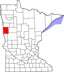 | |
| Townships | ||
| CDPs | ||
| Unincorporated communities | ||
| Ghost towns | ||
| Counties | ||
|---|---|---|
| Main cities | ||
| Surrounding areas |
| |
‡ - county seat | ||
Coordinates: 46°52′31″N 96°34′44″W / 46.87528°N 96.57889°W