Hawley, Minnesota
| Hawley, Minnesota | |
|---|---|
| City | |
|
Logo for the City of Hawley, Minnesota | |
| Motto: A Family Friendly Community | |
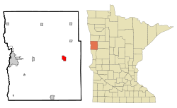 Location of Hawley, Minnesota | |
| Coordinates: 46°52′49″N 96°19′5″W / 46.88028°N 96.31806°W | |
| Country | United States |
| State | Minnesota |
| County | Clay |
| Government | |
| • Mayor | James Joy |
| Area[1] | |
| • Total | 2.53 sq mi (6.55 km2) |
| • Land | 2.53 sq mi (6.55 km2) |
| • Water | 0 sq mi (0 km2) |
| Elevation | 1,152 ft (351 m) |
| Population (2010)[2] | |
| • Total | 2,067 |
| • Estimate (2013[3]) | 2,083 |
| • Density | 817.0/sq mi (315.4/km2) |
| Time zone | Central (CST) (UTC-6) |
| • Summer (DST) | CDT (UTC-5) |
| ZIP code | 56549 |
| Area code(s) | 218 |
| FIPS code | 27-27746 |
| GNIS feature ID | 0644744[4] |
| Website | http://www.hawley.govoffice.com/ |
Hawley is a town in Clay County, Minnesota, United States, along the Buffalo River. The population was 2,067 at the 2010 census.[5] The town went through six quick name changes after 1871 until, in 1872, it was finally named after Thomas Hawley Canfield, an officer in the Northern Pacific Railway, which laid out the town.[6] General Custer visited the town in 1876. In 2007, the town started an ad campaign called "Hawley Would" (a homophonic play on words of "Hollywood"). The campaign focuses on both the small-town atmosphere of Hawley and its proximity to the Fargo-Moorhead metropolitan area; Hawley is 22 miles from downtown Fargo.
Geography

Hawley is east of Moorhead, at the intersection of the Buffalo River, U.S. Route 10, and the Burlington Northern Railroad. According to the United States Census Bureau, the city has a total area of 2.53 square miles (6.55 km2), all of it land.[1] It is located in Vikingland of Minnesota, and has a number of pasture and farmlands nearby.
The land is flat (mostly treeless) farmland west of the city, and more hilly-forested land to the east. There is much wildlife including deer, moose, waterfowl, raccoon, skunk, wolf, fox, and many other indigenous animal species. The indigenous trees in the forests are mostly leafy, with very few natural evergreens.
Demographics
| Historical population | |||
|---|---|---|---|
| Census | Pop. | %± | |
| 1880 | 77 | — | |
| 1890 | 270 | 250.6% | |
| 1900 | 526 | 94.8% | |
| 1910 | 800 | 52.1% | |
| 1920 | 939 | 17.4% | |
| 1930 | 958 | 2.0% | |
| 1940 | 1,122 | 17.1% | |
| 1950 | 1,196 | 6.6% | |
| 1960 | 1,270 | 6.2% | |
| 1970 | 1,371 | 8.0% | |
| 1980 | 1,634 | 19.2% | |
| 1990 | 1,655 | 1.3% | |
| 2000 | 1,882 | 13.7% | |
| 2010 | 2,067 | 9.8% | |
| Est. 2015 | 2,179 | [7] | 5.4% |
| U.S. Decennial Census[8] 2013 Estimate[9] | |||
2010 census
As of the census[2] of 2010, there were 2,067 people, 854 households, and 553 families residing in the city. The population density was 817.0 inhabitants per square mile (315.4/km2). There were 891 housing units at an average density of 352.2 per square mile (136.0/km2). The racial makeup of the city was 96.3% White, 0.3% African American, 1.0% Native American, 0.7% Asian, and 1.6% from two or more races. Hispanic or Latino of any race were 0.9% of the population.
There were 854 households of which 37.2% had children under the age of 18 living with them, 50.2% were married couples living together, 10.9% had a female householder with no husband present, 3.6% had a male householder with no wife present, and 35.2% were non-families. 32.1% of all households were made up of individuals and 17.8% had someone living alone who was 65 years of age or older. The average household size was 2.42 and the average family size was 3.03.
The median age in the city was 34.9 years. 29.2% of residents were under the age of 18; 5.6% were between the ages of 18 and 24; 28.5% were from 25 to 44; 21.1% were from 45 to 64; and 15.6% were 65 years of age or older. The gender makeup of the city was 48.5% male and 51.5% female.
2000 census
As of the census of 2000, there were 1,882 individuals, 744 households, and 514 families residing in the city. The population density was 764.8 people per square mile (295.4/km²). There were 787 housing units at an average density of 319.8 per square mile (123.5/km²). The racial makeup of the city was 98.46% White, 0.11% African American, 0.37% Native American, 0.21% Asian, and 0.85% from two or more races. 0.43% of the population were Hispanic or Latino of any race.
There were 744 households out of which 34.3% had children under the age of 18 living with them, 56.9% were married couples living together, 8.7% had a female householder with no husband present, and 30.8% were non-families. 28.0% of all households were made up of individuals and 15.7% had someone living alone who was 65 years of age or older. The average household size was 2.45 and the average family size was 3.02.
In the city the population was spread out with 26.5% under the age of 18, 7.3% from 18 to 24, 26.8% from 25 to 44, 19.3% from 45 to 64, and 20.0% who were 65 years of age or older. The median age was 38 years. For every 100 females there were 95.6 males. For every 100 females age 18 and over, there were 94.5 males.
The median income for a household in the city was $35,652, and the median income for a family was $47,188. Males had a median income of $33,333 versus $21,284 for females. The per capita income for the city was $17,178. About 7.2% of families and 8.5% of the population were below the poverty line, including 10.6% of those under the age of 18 and 12.2% of those 65 and older.
Hawley School District
The Hawley School District has a grades K-6 school building and a separate 7-12 school building. Both schools are noted for high test scores. Sports are fairly popular in Hawley, with the team name being the Golden Nuggets for Football, Basketball, Wrestling, Baseball, Volleyball, Softball, Golf, and Dance. Hawley combines with Ulen-Hitterdal for Track and Cross Country, and they are called the Fighting Walleye. Outside of sports the Hawley School District offers many opportunities in the field of arts. Students may participate in Band, Choir, Jazz Band, Blues (R&B) Band, Pop Singers, Speech, Drama, Spring Musical, FFA and other art related events. The Jazz Band and Pop Singers also have a good track record when it comes to getting "Superior" ratings at the local and state contest levels. The Band and Choir also make a trip every four years to the Walt Disney World Resort in central Florida to participate in Disney's Magic Music Days Program. The school's colors are maroon and gold, and the school's song is an adaptation of On Wisconsin.[10]
Hawley culture

Annual events in the Hawley area include the Hawley Rodeo (and Rodeo Parade), Western Minnesota Steam Threshers Reunion (WMSTR), and Hawley High School’s Homecoming.
The Hjemkomst The small town of Hawley might be best known for its Hjemkomst Viking Ship. The building of this ship began in November 1973 by Robert Asp. It was modeled after a Norwegian ship found south of Oslo that dated back from about 950 A.D. called the “Gokstad.” The Hjemkomst ship sailed from Duluth, Minnesota to Bergen, Norway in 1982. The event is considered one of Hawley’s finest. The ship is now located at the Hjemkomst Center museum in nearby Moorhead, Minnesota.
Hawley Golf Course An 18-hole course located on the eastern edge of the city. Built in 1923, it features Bent grass greens, and blue grass fairways. Hawley Golf and Country Club amenities include snack bar, practice green, driving range, and practice area.
Hawley Public Schools' first graduation was in 1904. The school building was devastated by fire in 1897. The school was rebuilt and has continued growing since then, and is now made up of an Elementary building and a High School building. There is also a school in the Spring Prairie Hutterite colony that works in a joint effort with the Hawley Public School system.
Hawley’s Man of the Century was Rev. G Hellwarth (1963- ). He was the pastor of the Hawley Lutheran Parish. (Other area churches include Gran Lutheran Church, Hawley Alliance Church, Hawley Lutheran Church, Hawley United Methodist Church, Hegland Lutheran Church, Lysne Lutheran Church, Our Savior’s Lutheran Church, Rollag Lutheran Church, Solem Lutheran Church, and St. Andrew’s Catholic Church).
Hawley’s newspaper, The Hawley Herald, was involved in the production of the books Journey Back to Hawley (1972) and The Journey Continues…(1997) to signify the town’s anniversaries. These two books contain information concerning Hawley’s History.
References
- 1 2 "US Gazetteer files 2010". United States Census Bureau. Retrieved 2012-11-13.
- 1 2 "American FactFinder". United States Census Bureau. Retrieved 2012-11-13.
- ↑ "Population Estimates". United States Census Bureau. Retrieved 2014-06-09.
- ↑ "US Board on Geographic Names". United States Geological Survey. 2007-10-25. Retrieved 2008-01-31.
- ↑ "2010 Census Redistricting Data (Public Law 94-171) Summary File". American FactFinder. U.S. Census Bureau, 2010 Census. Retrieved 23 April 2011.
- ↑ Gilman, Rhonda R. (1989). The Story of Minnesota's Past. Saint Paul, Minnesota: Minnesota Historical Society Press. pp. 23–33. ISBN 0-87351-267-7.
- ↑ "Annual Estimates of the Resident Population for Incorporated Places: April 1, 2010 to July 1, 2015". Retrieved July 2, 2016.
- ↑ United States Census Bureau. "Census of Population and Housing". Retrieved September 11, 2013.
- ↑ "Annual Estimates of the Resident Population: April 1, 2010 to July 1, 2013". Retrieved June 9, 2014.
- ↑ http://www.mshsl.org/mshsl/schoolpage2.asp?school=201
External links
- http://www.hawley.k12.mn.us/html Hawley's School Site
- http://www.hawley.govoffice.com/ Hawley's Official Site
- Hjemkomst Center Site
- http://www.HawleyWould.com Hawley's Economic Development Site
Municipalities and communities of Clay County, Minnesota, United States | ||
|---|---|---|
| Cities | 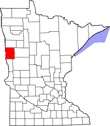 | |
| Townships | ||
| CDPs | ||
| Unincorporated communities | ||
| Ghost towns | ||
| Counties | ||
|---|---|---|
| Main cities | ||
| Surrounding areas |
| |
‡ - county seat | ||
Coordinates: 46°52′51″N 96°19′00″W / 46.88083°N 96.31667°W