Hitterdal, Minnesota
| Hitterdal, Minnesota | |
|---|---|
| City | |
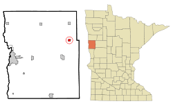 Location of Hitterdal, Minnesota | |
| Coordinates: 46°58′37″N 96°15′22″W / 46.97694°N 96.25611°W | |
| Country | United States |
| State | Minnesota |
| County | Clay |
| Area[1] | |
| • Total | 0.94 sq mi (2.43 km2) |
| • Land | 0.86 sq mi (2.23 km2) |
| • Water | 0.08 sq mi (0.21 km2) |
| Elevation | 1,250 ft (381 m) |
| Population (2010)[2] | |
| • Total | 201 |
| • Estimate (2013[3]) | 203 |
| • Density | 233.7/sq mi (90.2/km2) |
| Time zone | Central (CST) (UTC-6) |
| • Summer (DST) | CDT (UTC-5) |
| ZIP code | 56552 |
| Area code(s) | 218 |
| FIPS code | 27-29402 |
| GNIS feature ID | 0645032[4] |
Hitterdal is a city in Clay County, Minnesota, United States. The population was 201 at the 2010 census.[5]
History
A post office called Hitterdal has been in operation since 1887.[6] The city was named after Hitterdal, in Norway.[7]
Geography
According to the United States Census Bureau, the city has a total area of 0.94 square miles (2.43 km2), of which, 0.86 square miles (2.23 km2) is land and 0.08 square miles (0.21 km2) is water.[1]
Demographics
| Historical population | |||
|---|---|---|---|
| Census | Pop. | %± | |
| 1920 | 204 | — | |
| 1930 | 198 | −2.9% | |
| 1940 | 268 | 35.4% | |
| 1950 | 262 | −2.2% | |
| 1960 | 235 | −10.3% | |
| 1970 | 201 | −14.5% | |
| 1980 | 253 | 25.9% | |
| 1990 | 242 | −4.3% | |
| 2000 | 201 | −16.9% | |
| 2010 | 201 | 0.0% | |
| Est. 2015 | 201 | [8] | 0.0% |
| U.S. Decennial Census[9] 2013 Estimate[10] | |||
2010 census
As of the census[2] of 2010, there were 201 people, 89 households, and 58 families residing in the city. The population density was 233.7 inhabitants per square mile (90.2/km2). There were 100 housing units at an average density of 116.3 per square mile (44.9/km2). The racial makeup of the city was 96.5% White, 1.5% African American, 0.5% Asian, and 1.5% from two or more races. Hispanic or Latino of any race were 1.0% of the population.
There were 89 households of which 27.0% had children under the age of 18 living with them, 56.2% were married couples living together, 5.6% had a female householder with no husband present, 3.4% had a male householder with no wife present, and 34.8% were non-families. 30.3% of all households were made up of individuals and 14.6% had someone living alone who was 65 years of age or older. The average household size was 2.26 and the average family size was 2.81.
The median age in the city was 44.5 years. 21.9% of residents were under the age of 18; 9.1% were between the ages of 18 and 24; 20% were from 25 to 44; 27.5% were from 45 to 64; and 21.9% were 65 years of age or older. The gender makeup of the city was 55.7% male and 44.3% female.
2000 census
As of the census of 2000, there were 201 people, 86 households, and 570 families residing in the city. The population density was 249.3 people per square mile (95.8/km²). There were 102 housing units at an average density of 126.5 per square mile (48.6/km²). The racial makeup of the city was 97.01% White, 1.49% Asian, 1.00% from other races, and 0.50% from two or more races. Hispanic or Latino of any race were 1.49% of the population.
There were 86 households out of which 29.1% had children under the age of 18 living with them, 55.8% were married couples living together, 3.5% had a female householder with no husband present, and 33.7% were non-families. 30.2% of all households were made up of individuals and 17.4% had someone living alone who was 65 years of age or older. The average household size was 2.34 and the average family size was 2.89.
In the city the population was spread out with 25.4% under the age of 18, 8.5% from 18 to 24, 21.9% from 25 to 44, 26.4% from 45 to 64, and 17.9% who were 65 years of age or older. The median age was 42 years. For every 100 females there were 118.5 males. For every 100 females age 18 and over, there were 105.5 males.
The median income for a household in the city was $32,500, and the median income for a family was $35,625. Males had a median income of $33,125 versus $19,375 for females. The per capita income for the city was $13,737. About 17.2% of families and 12.3% of the population were below the poverty line, including 18.8% of those under the age of eighteen and none of those sixty five or over.
Government
The current mayor is Gayle Holte.
References
- 1 2 "US Gazetteer files 2010". United States Census Bureau. Retrieved 2012-11-13.
- 1 2 "American FactFinder". United States Census Bureau. Retrieved 2012-11-13.
- ↑ "Population Estimates". United States Census Bureau. Retrieved 2014-06-09.
- ↑ "US Board on Geographic Names". United States Geological Survey. 2007-10-25. Retrieved 2008-01-31.
- ↑ "2010 Census Redistricting Data (Public Law 94-171) Summary File". American FactFinder. U.S. Census Bureau, 2010 Census. Retrieved 23 April 2011.
- ↑ "Clay County". Jim Forte Postal History. Retrieved 3 April 2015.
- ↑ Upham, Warren (1920). Minnesota Geographic Names: Their Origin and Historic Significance. Minnesota Historical Society. p. 117.
- ↑ "Annual Estimates of the Resident Population for Incorporated Places: April 1, 2010 to July 1, 2015". Retrieved July 2, 2016.
- ↑ United States Census Bureau. "Census of Population and Housing". Retrieved September 11, 2013.
- ↑ "Annual Estimates of the Resident Population: April 1, 2010 to July 1, 2013". Retrieved June 9, 2014.
Municipalities and communities of Clay County, Minnesota, United States | ||
|---|---|---|
| Cities | 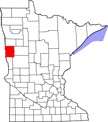 | |
| Townships | ||
| CDPs | ||
| Unincorporated communities | ||
| Ghost towns | ||
| Counties | ||
|---|---|---|
| Main cities | ||
| Surrounding areas |
| |
‡ - county seat | ||
Coordinates: 46°58′39″N 96°15′33″W / 46.97750°N 96.25917°W