Hutsonville Township, Crawford County, Illinois
| Hutsonville Township | |
|---|---|
| Township | |
 Location in Crawford County | |
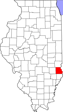 Crawford County's location in Illinois | |
| Coordinates: 39°07′04″N 87°41′03″W / 39.11778°N 87.68417°WCoordinates: 39°07′04″N 87°41′03″W / 39.11778°N 87.68417°W | |
| Country | United States |
| State | Illinois |
| County | Crawford |
| Established | November 5, 1867 |
| Area | |
| • Total | 37.51 sq mi (97.2 km2) |
| • Land | 36.81 sq mi (95.3 km2) |
| • Water | 0.69 sq mi (1.8 km2) 1.84% |
| Elevation | 486 ft (148 m) |
| Population (2010) | |
| • Total | 1,177 |
| • Density | 32/sq mi (12/km2) |
| Time zone | CST (UTC-6) |
| • Summer (DST) | CDT (UTC-5) |
| ZIP codes | 62433, 62451, 62454, 62478 |
| GNIS feature ID | 0429160 |
Hutsonville Township is one of ten townships in Crawford County, Illinois, USA. As of the 2010 census, its population was 1,177 and it contained 550 housing units.[1]
Geography
According to the 2010 census, the township has a total area of 37.51 square miles (97.2 km2), of which 36.81 square miles (95.3 km2) (or 98.13%) is land and 0.69 square miles (1.8 km2) (or 1.84%) is water.[1] The Wabash River defines its eastern border.
Cities, towns, villages
Unincorporated towns
Cemeteries
The township contains these eight cemeteries: Ball, Bradbury, Draper, Guyer, Hutson Old, Hutsonville New, Lindley and Musgrave.
Major highways
School districts
- Hutsonville Community Unit School District 1
- Palestine Community Unit School District 3
- Robinson Community Unit School District 2
Political districts
- Illinois' 15th congressional district
- State House District 109
- State Senate District 55
References
- "Hutsonville Township, Crawford County, Illinois". Geographic Names Information System. United States Geological Survey. Retrieved 2010-01-10.
- United States Census Bureau 2007 TIGER/Line Shapefiles
- United States National Atlas
- 1 2 "Population, Housing Units, Area, and Density: 2010 - County -- County Subdivision and Place -- 2010 Census Summary File 1". United States Census. Retrieved 2013-05-28.
External links

Municipalities and communities of Crawford County, Illinois, United States | ||
|---|---|---|
| City | ||
| Town | ||
| Villages | ||
| Townships | ||
| CDPs | ||
| Other unincorporated communities | ||
| Ghost town | ||
| Footnotes | ‡This populated place also has portions in an adjacent county or counties | |
This article is issued from Wikipedia - version of the 12/3/2013. The text is available under the Creative Commons Attribution/Share Alike but additional terms may apply for the media files.