Montgomery Township, Crawford County, Illinois
| Montgomery Township | |
|---|---|
| Township | |
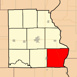 Location in Crawford County | |
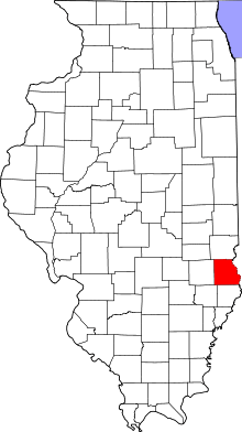 Crawford County's location in Illinois | |
| Coordinates: 38°54′35″N 87°35′55″W / 38.90972°N 87.59861°WCoordinates: 38°54′35″N 87°35′55″W / 38.90972°N 87.59861°W | |
| Country | United States |
| State | Illinois |
| County | Crawford |
| Established | June 21, 1869 |
| Area | |
| • Total | 54.5 sq mi (141 km2) |
| • Land | 54.04 sq mi (140.0 km2) |
| • Water | 0.45 sq mi (1.2 km2) 0.83% |
| Elevation | 558 ft (170 m) |
| Population (2010) | |
| • Total | 672 |
| • Density | 12.4/sq mi (4.8/km2) |
| Time zone | CST (UTC-6) |
| • Summer (DST) | CDT (UTC-5) |
| ZIP codes | 62427, 62451, 62454 |
| GNIS feature ID | 0429388 |
Montgomery Township is one of ten townships in Crawford County, Illinois, USA. As of the 2010 census, its population was 672 and it contained 301 housing units.[1]
Geography
According to the 2010 census, the township has a total area of 54.5 square miles (141 km2), of which 54.04 square miles (140.0 km2) (or 99.16%) is land and 0.45 square miles (1.2 km2) (or 0.83%) is water.[1] The Wabash River defines its eastern border.
Cities, towns, villages
- Flat Rock (east quarter)
Unincorporated towns
(This list is based on USGS data and may include former settlements.)
Cemeteries
The township contains these twenty-three cemeteries: Allen, Baker, Bartmess, Bennett, Dickerson, Ferrell, Ford, Fuller, Ganies, Green, Green Hill, Hale, Higgins, Johnson, Lackey, Maddox, Morea, Norton, Pleasant View, Seaney, Shaw, Tobey and Wesley Chapel.
Major highways
School districts
- Lawrence County Community Unit District 20
- Palestine Community Unit School District 3
- Robinson Community Unit School District 2
Political districts
- Illinois' 15th congressional district
- State House District 109
- State Senate District 55
References
- "Montgomery Township, Crawford County, Illinois". Geographic Names Information System. United States Geological Survey. Retrieved 2010-01-10.
- United States Census Bureau 2007 TIGER/Line Shapefiles
- United States National Atlas
- 1 2 "Population, Housing Units, Area, and Density: 2010 - County -- County Subdivision and Place -- 2010 Census Summary File 1". United States Census. Retrieved 2013-05-28.
External links

Municipalities and communities of Crawford County, Illinois, United States | ||
|---|---|---|
| City | ||
| Town | ||
| Villages | ||
| Townships | ||
| CDPs | ||
| Other unincorporated communities | ||
| Ghost town | ||
| Footnotes | ‡This populated place also has portions in an adjacent county or counties | |
This article is issued from Wikipedia - version of the 12/5/2013. The text is available under the Creative Commons Attribution/Share Alike but additional terms may apply for the media files.